Long Island Motor Parkway Bridge Series: #9 The Creedmoor Bridge in Queens Updated: 10/22/16
When the 48 miles of the Motor Parkway were completed in 1926, a total of 60 bridges were built by William K. Vanderbilt Jr. and his associates over and under the parkway. Going west to east, the ninth bridge from the Western Terminus at Nassau Boulevard (Horace Harding Boulevard) was a highway bridge connecting the properties belonging to the State Hospital at Creedmoor. It is unclear whether the bridge was used as a pedestrian walkway and/or also for automobiles.
Background
In 1872, the newly formed National Rifle Association (NRA) purchased a 70-acre property in Queens owned by the Central and North Side Railroad of Long Island to be used as a range for shooting practice. The farmland had previously been owned by the Creed family. In 1908 Creedmoor State Hospital acquired the property and in 1912 the Farm Colony of Brooklyn State Hospital opened with 32 patients.
Motor Parkway Atlas- Queens
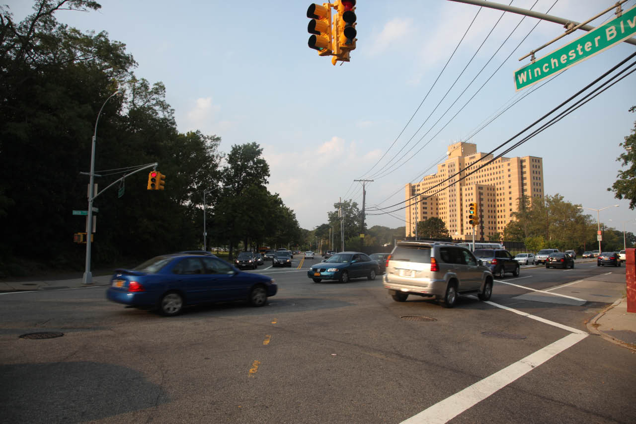
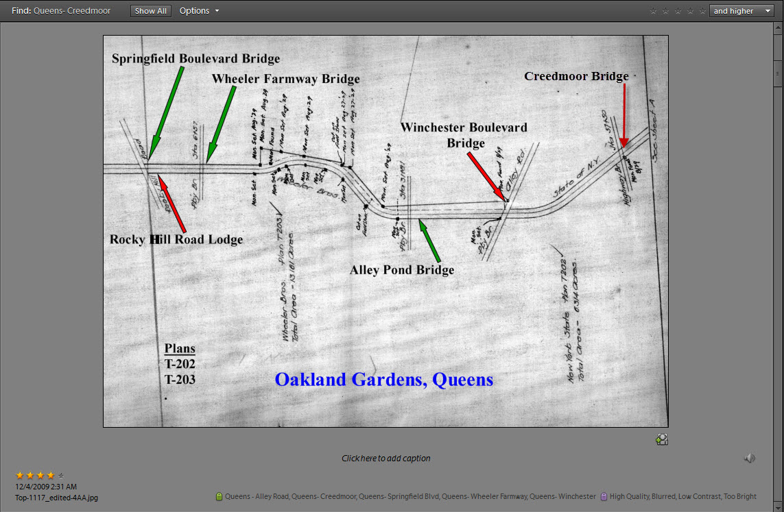 The bridge was located about 1,100 feet east of Winchester Boulevard. As noted in the Atlas, the bridge was classified as a "highway bridge" because the Motor Parkway went underneath the bridge. The 6.314 acres surrounding the bridge were purchased by the Motor Parkway from New York State.
1924 Aerial- Queens
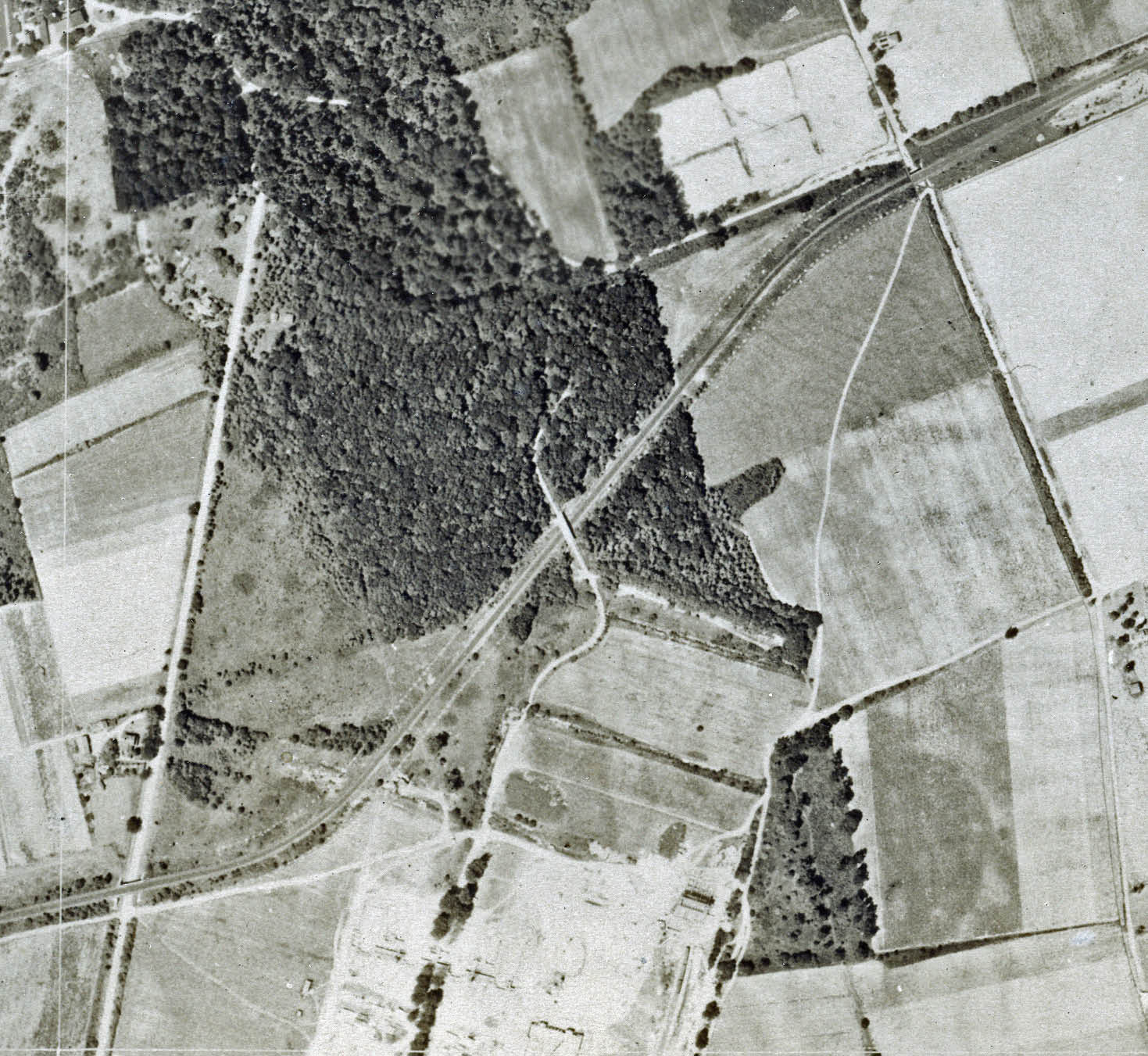
This aerial shows the section of the Motor Parkway from Winchester Boulevard (bottom left) to Commonwealth Boulevard(top right). The Creedmoor Bridge can be seen in the middle of the aerial.
1930
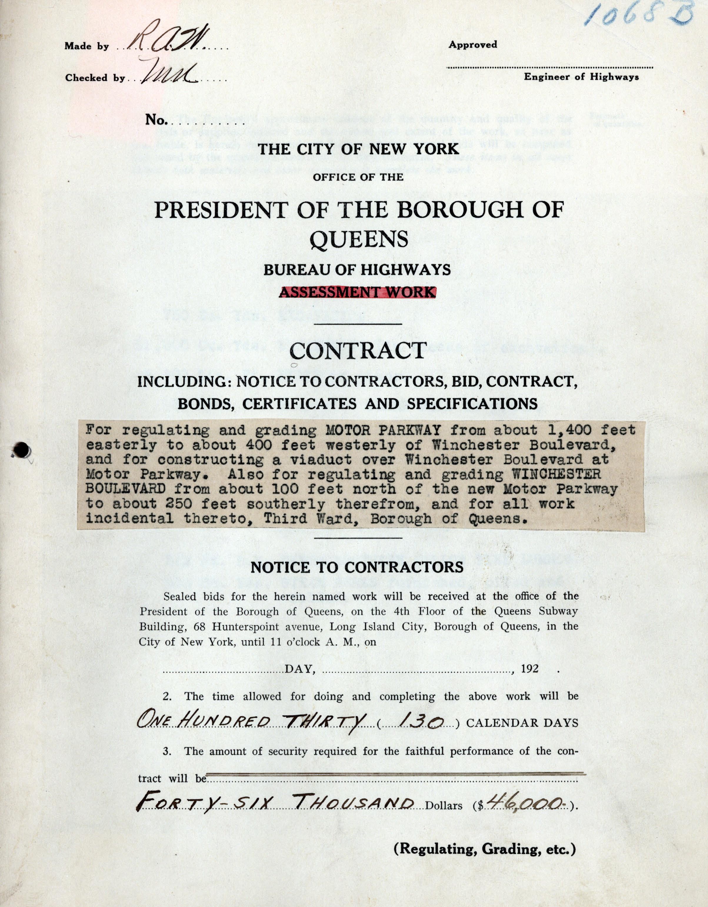
In the late 1920s, New York City decided to widen Union Turnpike to make it a major east-west road through Queens. However, the Motor Parkway in the area of Winchester Boulevard was in the path of the expansion. By an agreement among the city, the owners of the Motor Parkway and nearby State Hospital at Creedmoor, New York City planned to move a section of the Motor Parkway further north of the original location. This agreement was described in a New York Times article on June 22, 1930. The project was awarded to contractor Kennedy & Smith for $46,000.
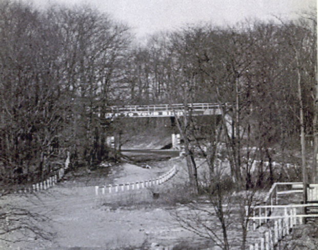
March 3, 1932 Photo (Courtesy of Queens Borough President's Collection)

For a period of time in 1931 and 1932, there were two Motor Parkway bridges over Winchester Boulevard, the railroad-type original built in 1912 and the new concrete bridge further north as seen in this photo. The Creedmoor Bridge can be seen beyond the new concrete bridge on the left.
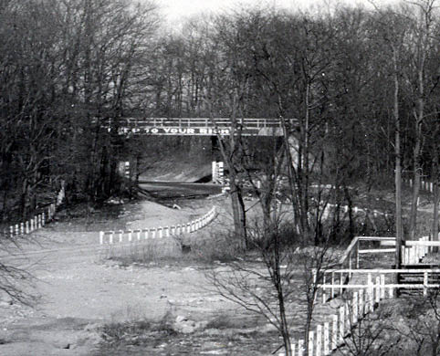
A close-up of the Creedmoor Bridge. The sign reads: "Stay to Your Right". Note: The unique two-pillar design of the bridge.
November 23, 1937 Aerial- Winchester Boulevard, Queens
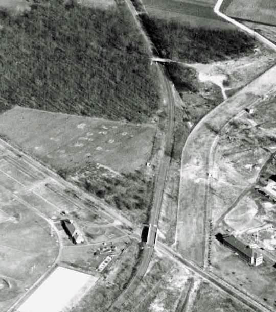
This wonderful aerial shows the new Winchester Boulevard Bridge on the bottom and the Creedmoor Bridge towards the top. After five years, the Union Turnpike to the south was still being built.
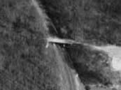
A close-up of the bridge.
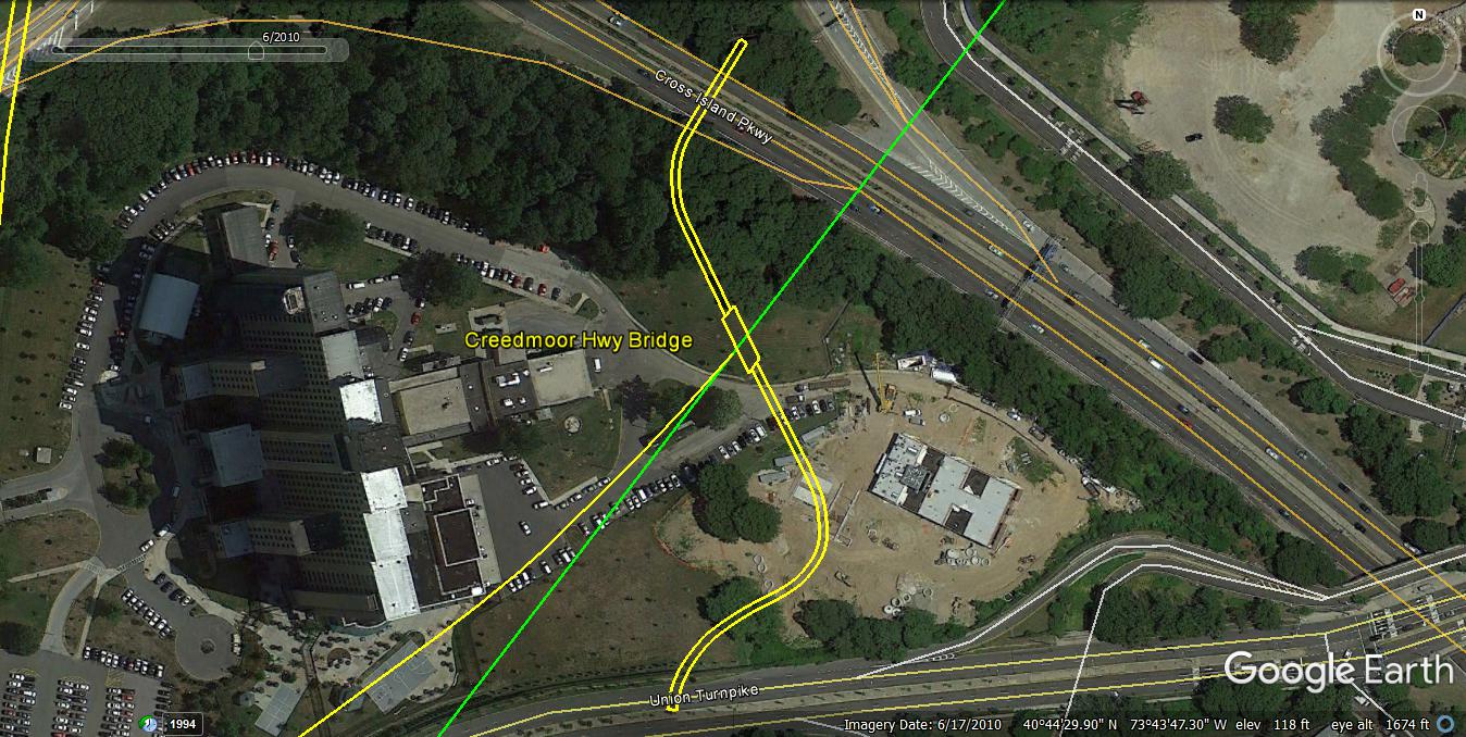
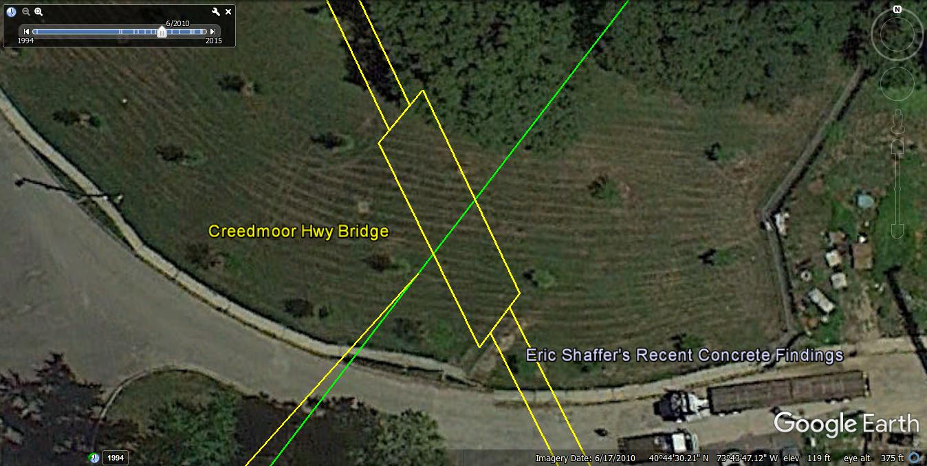
Current Views-2011
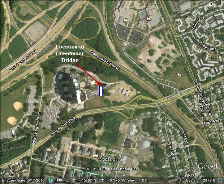 This is the approximate location of the Creedmoor Bridge.
 There are no remnants remaining of the bridges on the property of the Creedmoor Psychiatric Center.


Comments
Hi Howard. I went to Historical Aerials to view this area, but the aerial map for this location only goes back to 1966. Maybe there’s a path left? Too hard to tell. I’ve been checking out Historic Map works (website). They have decent road maps of Long Island, etc.
Brian, due to the construction of the hospital, all remants of the Motor Parkway are long gone.
The path or road that continued N/O the Creedmoor Highway Bridge meandered thru quite a bit of forest. I read that they used to have the patients tend to the farm fields. Just being outdoors and doing some yard work can be quite therapeutic.
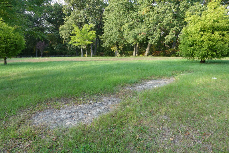
Although photos can be misleading, Eric’s photo does not look like the materials used in bridge construction (but does look a lot like crumbly pavement childhood). I investigated further using the 1951 aerial NYCityMap that can be found at on.nyc.gov/2frfpIU and comparing that image to the 2010 NYC aerial overlay and to Howard’s November 23, 1937, and October 1941 aerials of same area.
I conclude that Eric’s “concrete findings” are associated with an access road seen in the 1941 and 1951 aerials that trends NNW and is connected to the NE end of this truncated LIMP segment. In 1951, there is a long diagram light-colored slash that may be a debris mound or an informal barrier and seems to be associated with Eric’s “finding.” In both aerials, the bridge is further to the SW, so Frank may have drawn the Creedmoor Bridge slightly too far to the NE and the bridge probably would cross through in the triangular junction, at a spot where a dark car is shown in the NYC 2006 aerial.
I’ve discovered that others have referenced the 1951 aerial. You can clearly see many LIMP highlights coexisting/overlaid with modern landmarks including the concrete abutments of the Commonwealth Blvd. bridge, the North Hempstead Tpke. and Hollis Ct. Blvd. Bridges, and the LIMP segment destroyed when the CVE was built.