Long Island Motor Parkway Bridge Series #58: Little East Neck Road Motor Parkway Bridge

The 58th bridge in the series documenting the 65 bridges built by the Long Island Motor Parkway is the Little East Neck Road Motor Parkway Bridge in Melville and Wyandanch.
The bridge was built around 1910 over Little East Neck Road, just south of East Neck Road (now Colonial Springs Road). Although there ares no known ground images of this bridge, the bridge was documented in 1928-1930 aerials.
Enjoy,
Howard Kroplick
June 1907 Survey
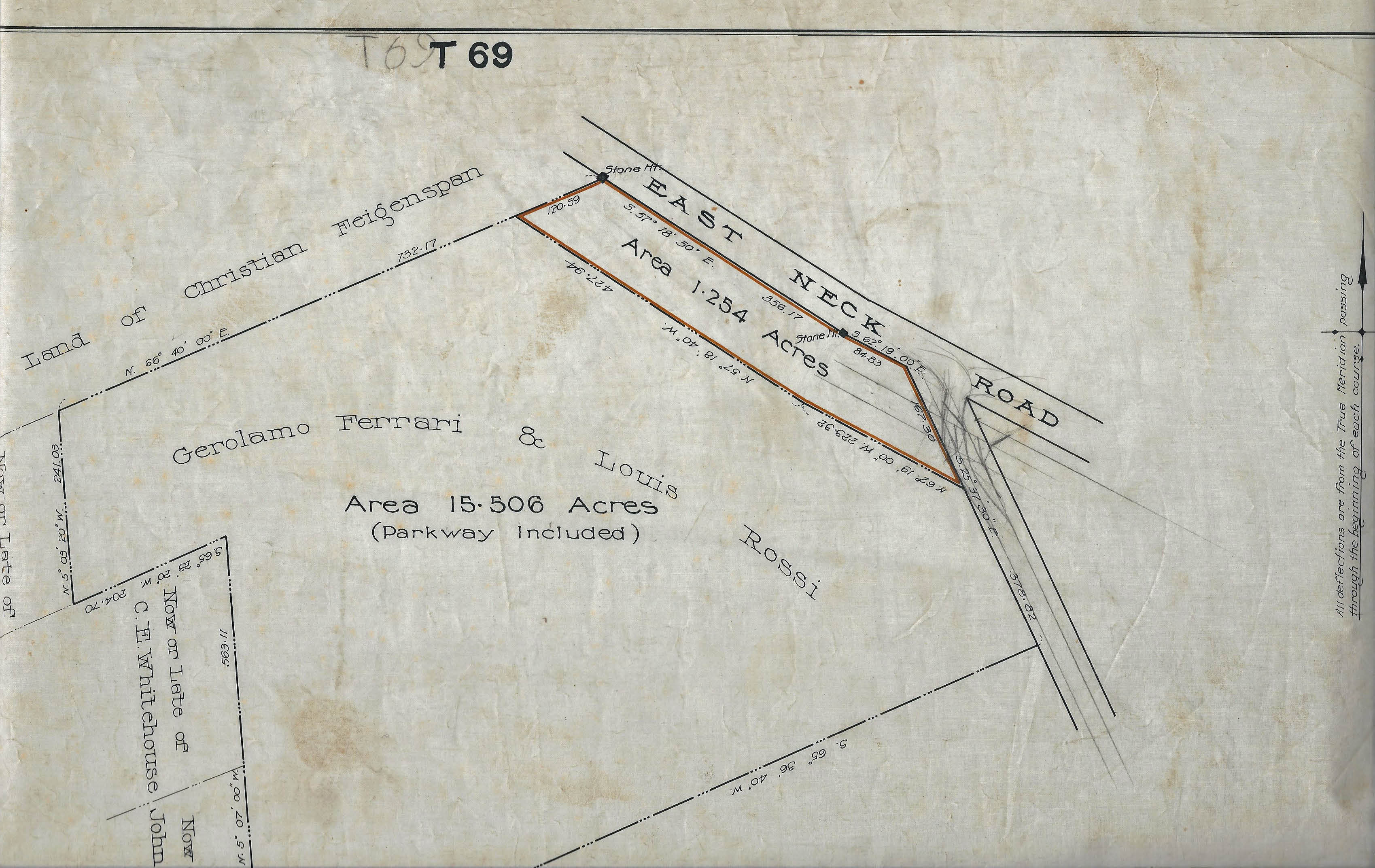
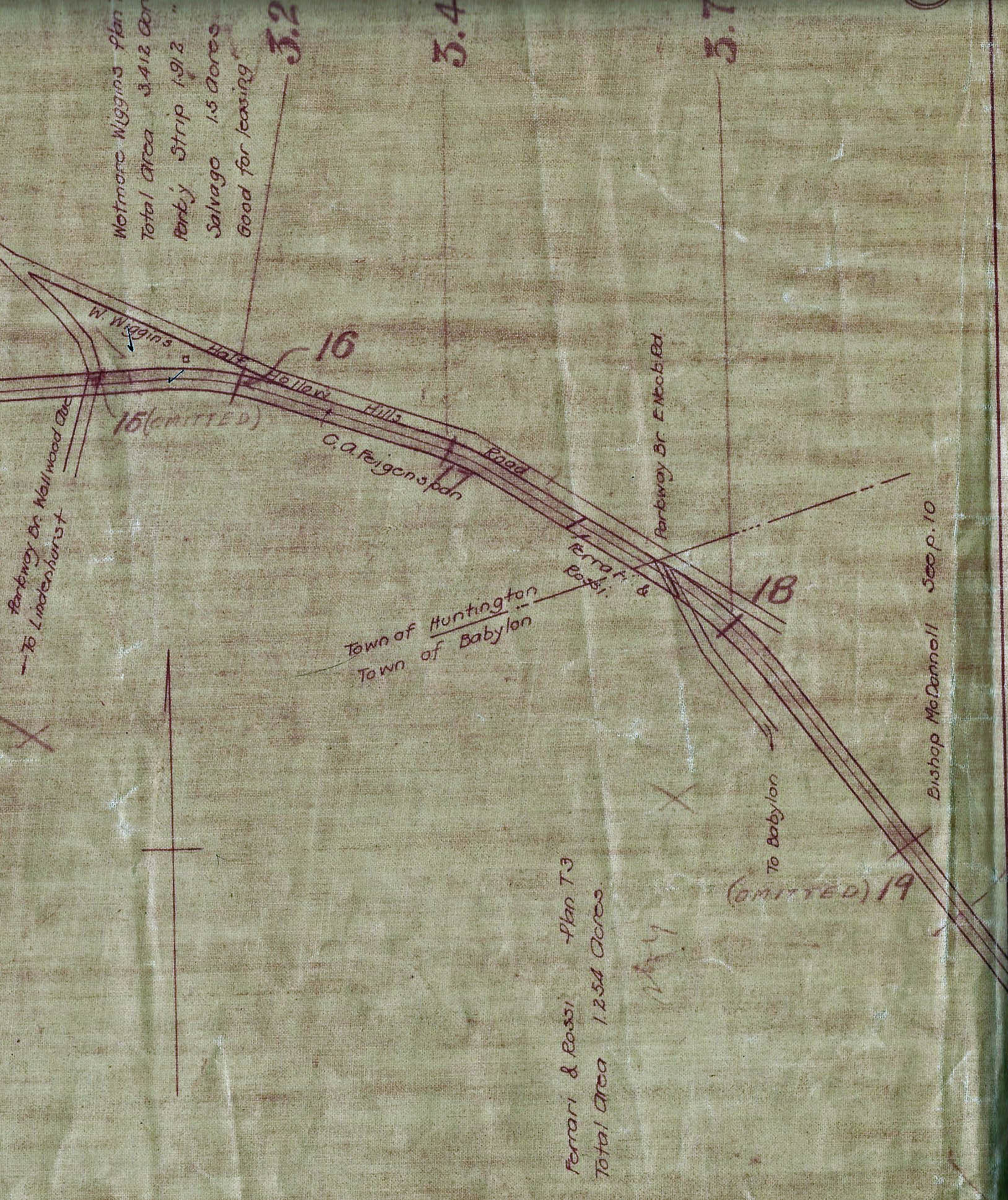
This survey documents that the Motor Parkway was south of East Neck Road (now Colonial Springs Road) just before going over Little East Neck Road. To obtain the right-of-way in this section, the Long Island Motor Parkway Inc. purchased 15.506 acres from Gerolamo Ferrari and Louis Rossi. Only 1.254 acres of the purchase was used for the road.
October 1907 Survey
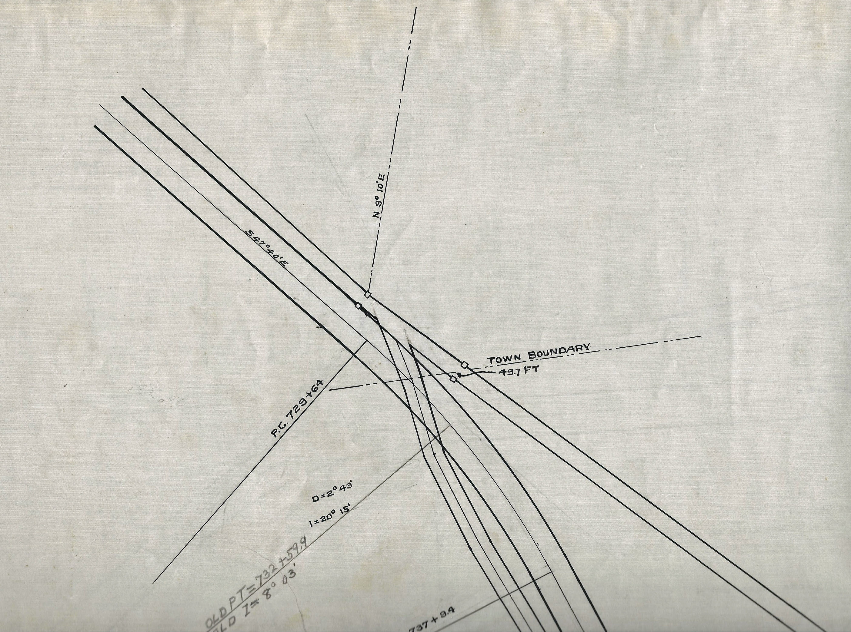
This survey indicated that the Huntington/Babylon Town border was in the middle of the bridge. Accordingly, the bridge could be considered in both Melville and Wyandanch.
1928 Motor Parkway Atlas
1928 Aerial
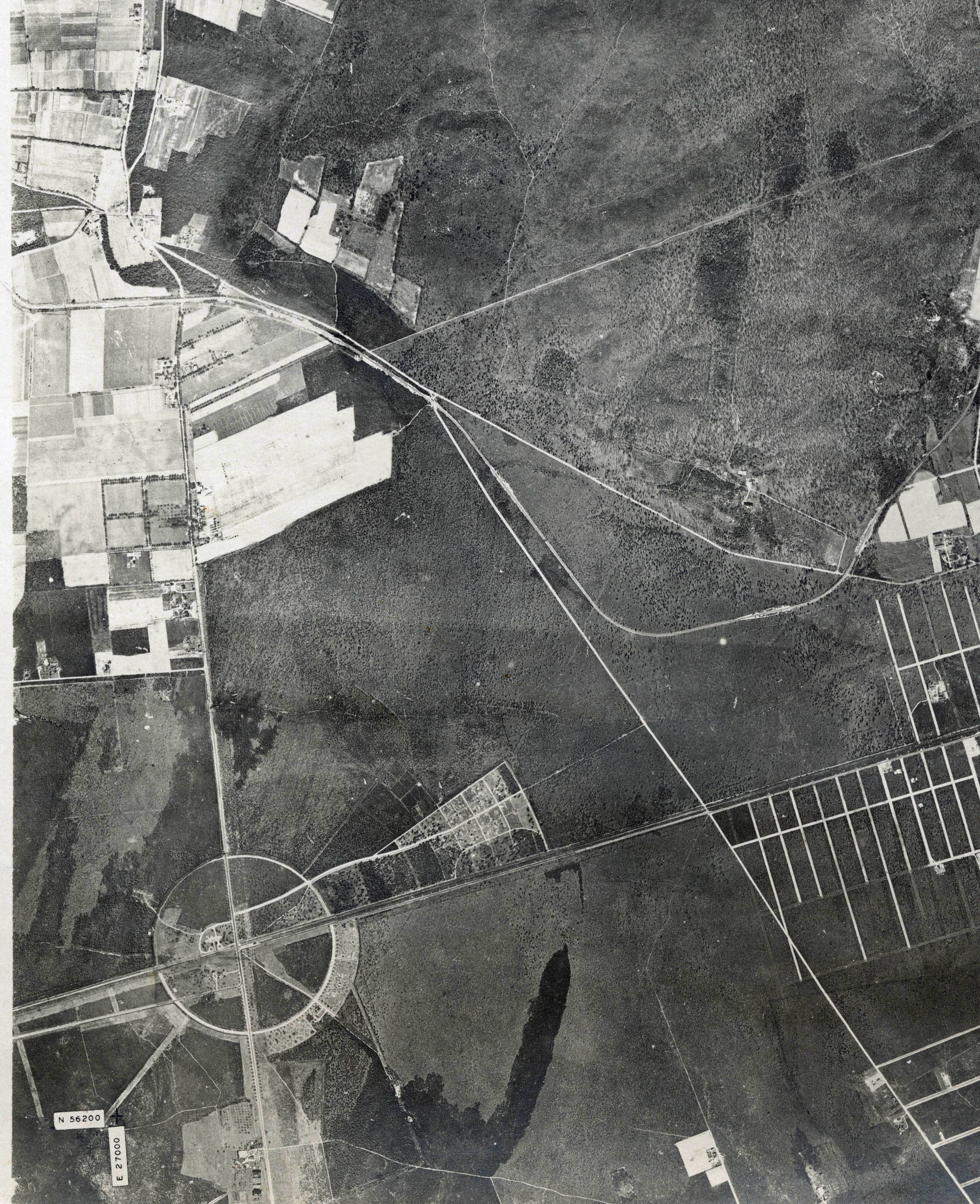
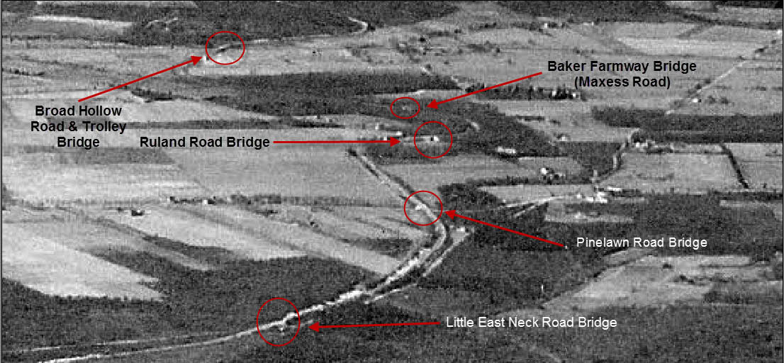
A spectacular aerial showing the Motor Parkway loop in Wyandanch. Note the circular road of the Pinelawn Cemetery. In 1936 this section became the Long Island National Cemetery.
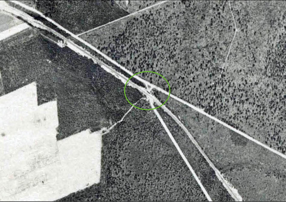
A closeup of the aerial provides the best photo of the Little East Neck Road Motor Parkway Bridge.
February 3, 1930
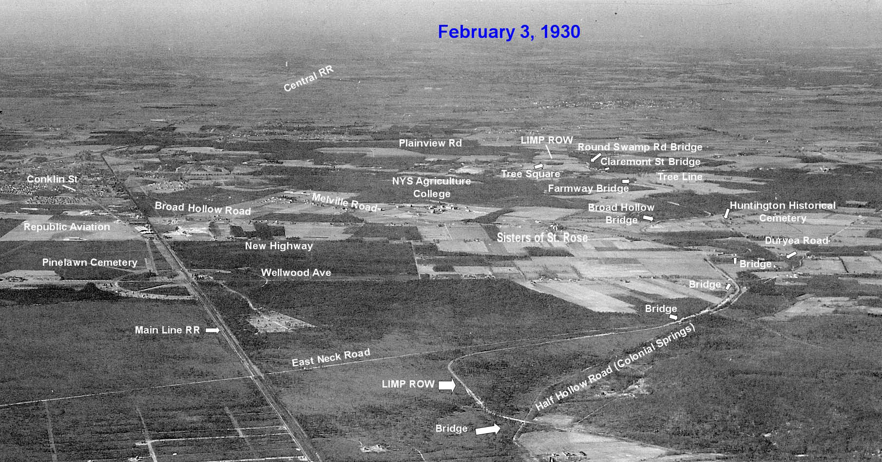
Another revealing aerial shows the route of the Motor Parkway east of Little East Neck Road and south of Colonial Springs Road in Wyandanch.
A blurry view of the bridge.
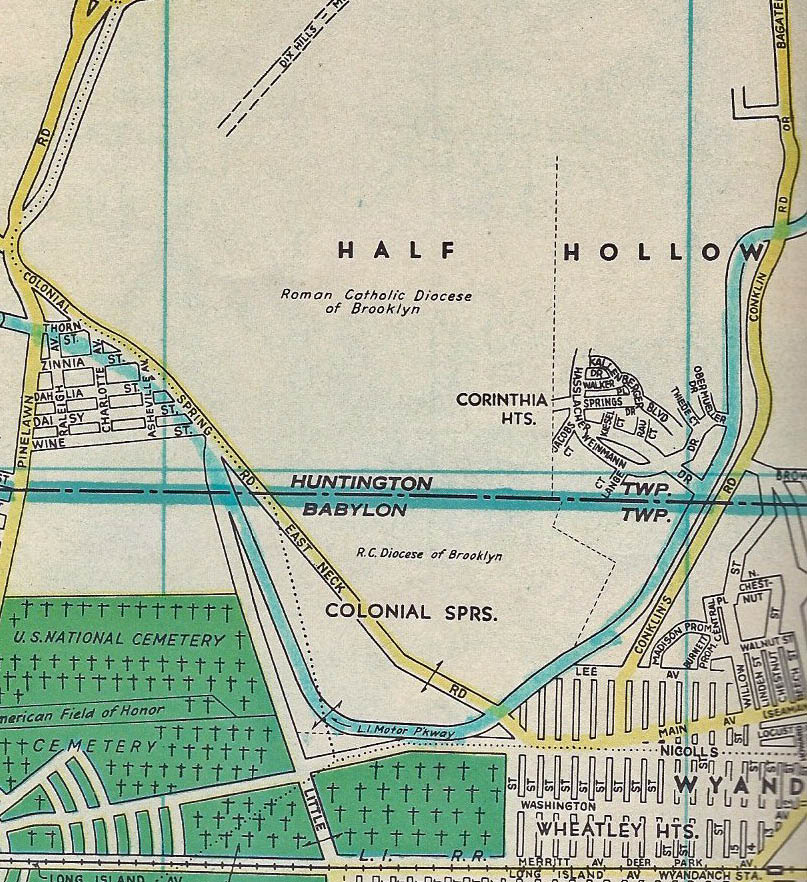
1952 Map
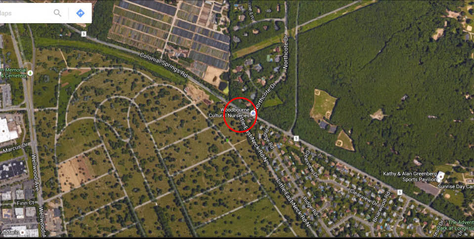
Current Views
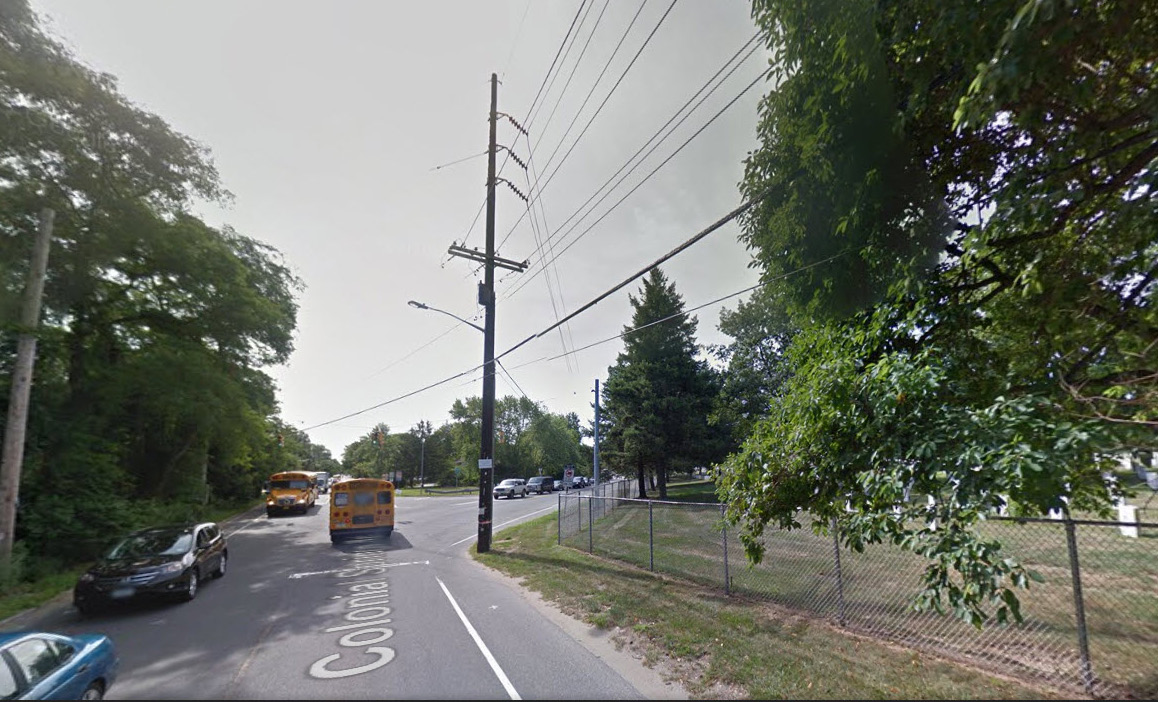
The intersection of Colonial Springs Road and Little East Neck Road. The bridge was located to just to the right over Little East Neck Road.
Check out Wayne Consolla's online Motor Parkway map to find the location of the Little East Neck Road Motor Parkway Bridge.


Comments
Perhaps the street pattern within the cemetery property on the 1952 map is the current paths in the cemetery?
Howard…I know you are not there yet, but here is something I’m curious about n/o the Colonial Springs Rd bridge. According to a 1945 or earlier topo map on the HistoricAerials website, a RR siding ran n/o the mainline; pretty much following present day 23rd St. It continued north over Main, and looks to intersect with the LIMP. I came upon this while comparing a 1947 topo with a 1945 or earlier topo map. Perhaps with the construction of the LIMP in this area, this RR siding was encountered?
Hello all. My last comment here pertained to a RR spur that appeared to intersect with the LIMP let’s say N/O the overpass of Colonial Springs Rd. According to Wikipedia, there was a brickyard named Wyandance Brick and Terra Corp. They utilized this RR siding to transport the bricks to the mainline. It also states their was a forest fire that destroyed the plant in 1893. A 1941 map of this area shows this brickyards property just N/W of the LIMP. If this siding was in operation during the construction of the LIMP, perhaps some accommodation was worked out at the time.