Long Island Motor Parkway Bridge Series #39: Newbridge Road Bridge in Hempstead Plains
The 39th bridge in the series documenting the 60 bridges built by the Long Island Motor Parkway is the Newbridge Road Bridge in the Hempstead Plains (now Levittown). It is classified as a "parkway" bridge since the Motor Parkway went over Newbridge Road (often confused with Newbridge Avenue in East Meadow).
One of the original 16 bridges built for the 1908 Vanderbilt Cup Race and used for the 1908 to 1910 races, this unusual curved bridge is probably one of the best documented Motor Parkway bridges.
Enjoy,
Howard Kroplick
Motor Parkway Survey- August 1909
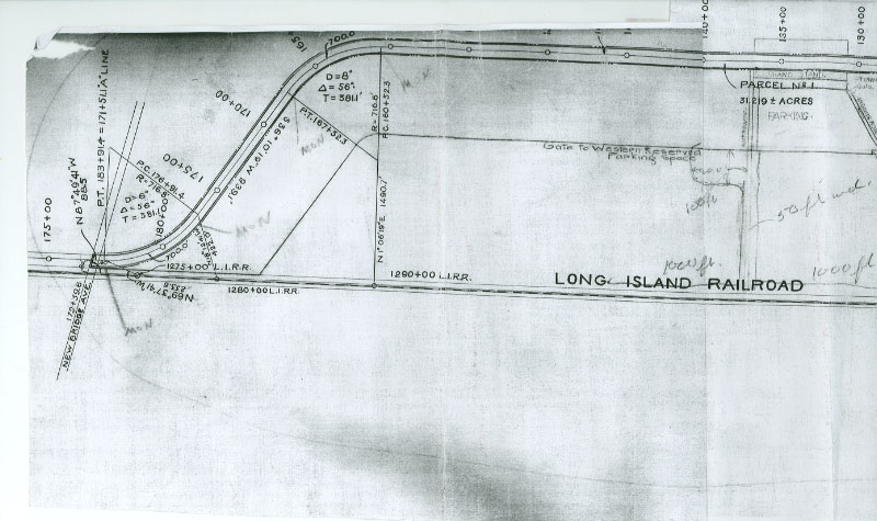
The Newbridge Road Bridge was the last bridge for the racers of the 1908, 1909, and 1910 Vanderbilt Cup Races before reaching the grandstands.
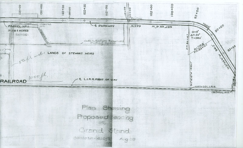
The property around the bridge and the grandstands were purchased from the "heirs of A.T. Stewart" also known as the "Merrillon Estate".
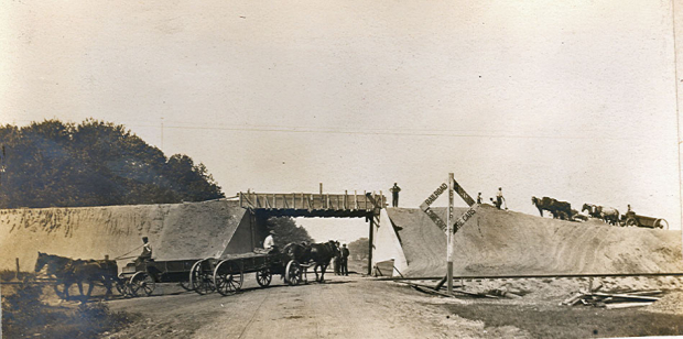
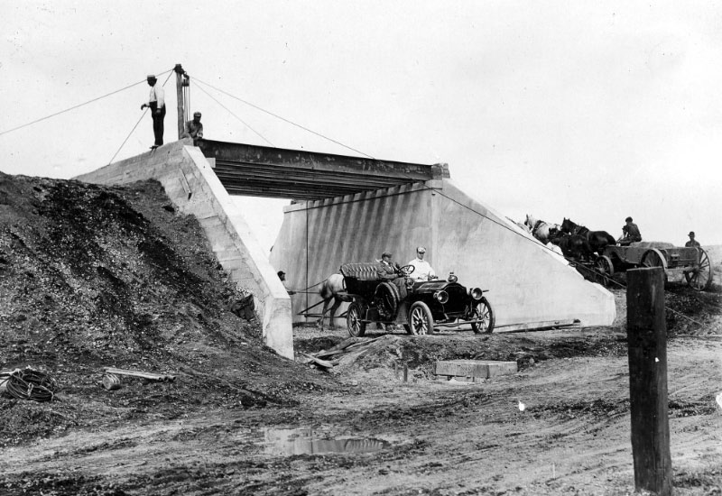
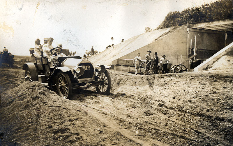
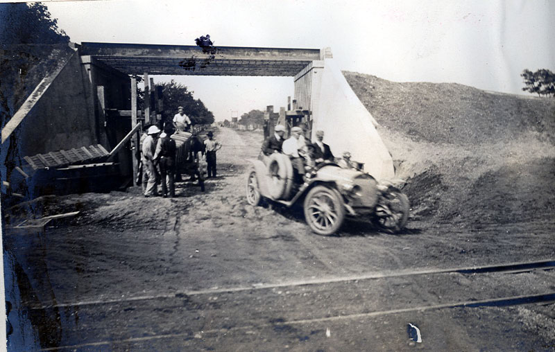
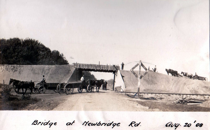
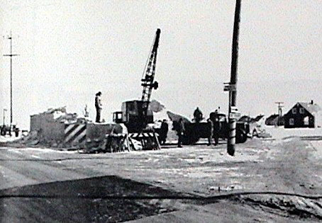
Construction Photos-1908
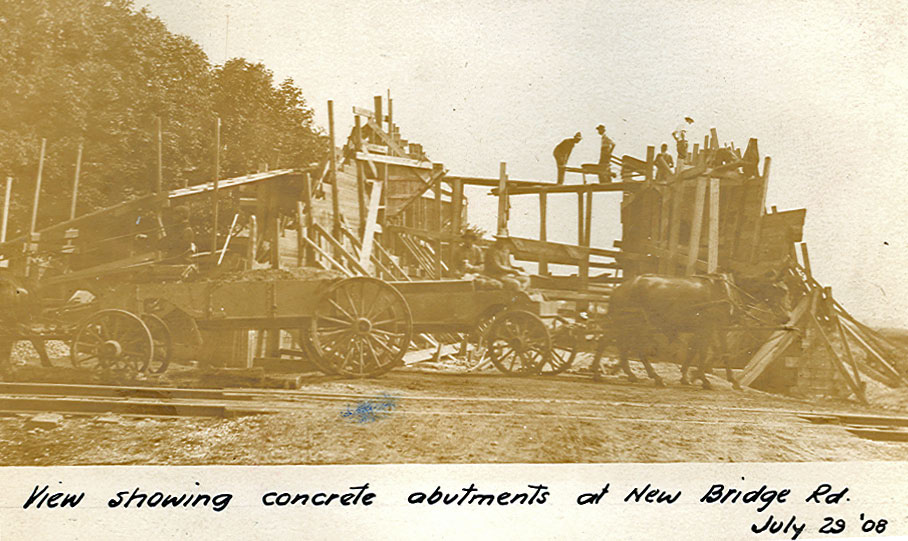
The bridge went up quickly over a four-month period July-September).
This photo reinforces the need for the Motor Parkway!
The tracks of the Central Branch of the Long Island Rairroad were just south of the bridge.
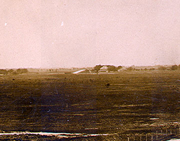
1908 Vanderbilt Cup Race- October 24, 1908
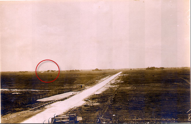
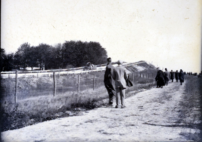
This photo was taken from the Press BBox/Officials Stand. The bridge can be seen in the background on the left. Easy to understand why this was the "Hempstead Plains".
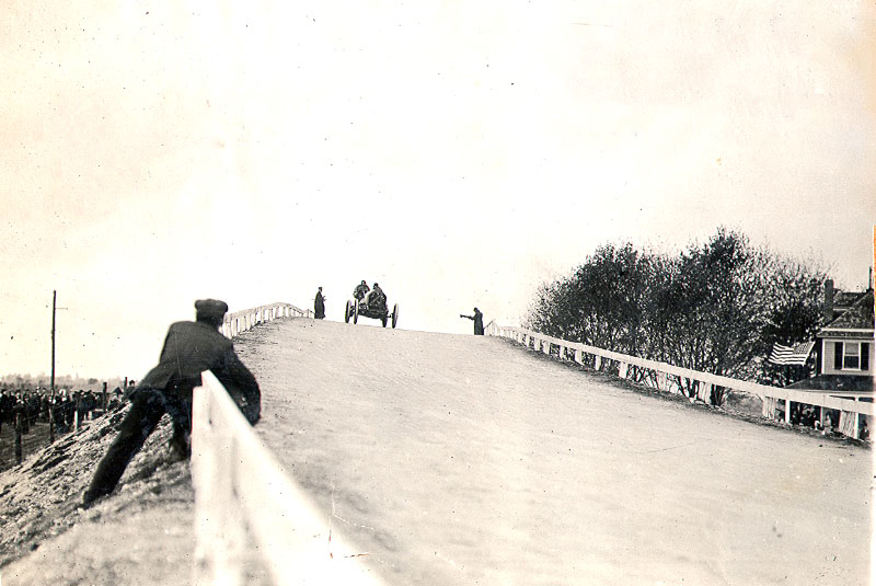
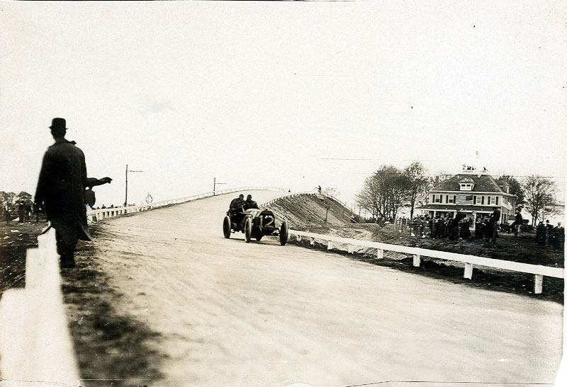
The #4 Chadwick driven by Willie Haupt. The Newbridge Hotel is on the right. Note how the bridge began to curve to the north.
The Chadwick leaving the bridge.
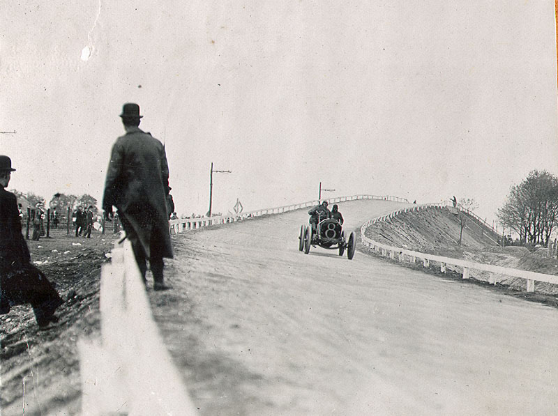
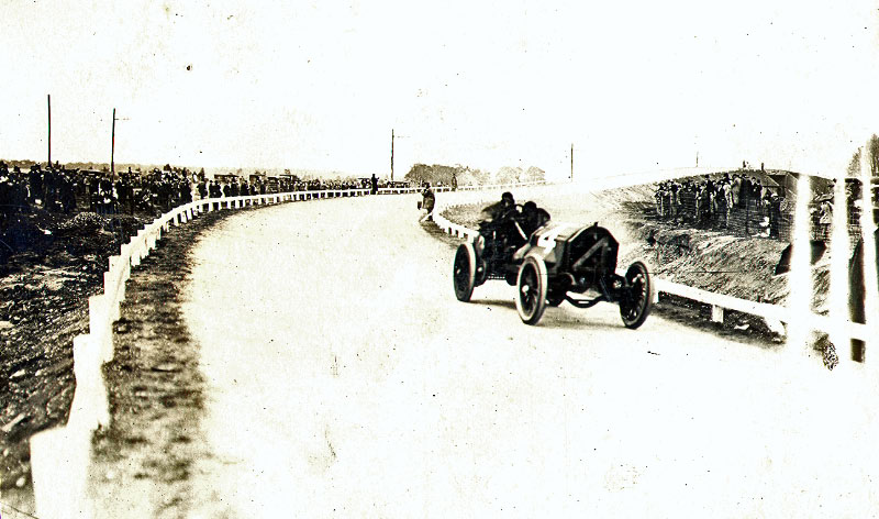
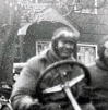
The #8 Thomas driven by Joe Seymour.
The #12 Thomas driven by George Saltzman.

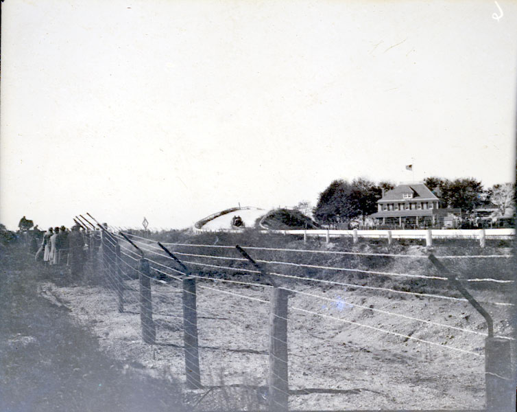
The roof and patio of the Newbridge Hotel was a popular location for spectators.
1909 Vanderbilt Cup Race- October 30, 1909
A rainy and cold October day reduced the size of the crowds.
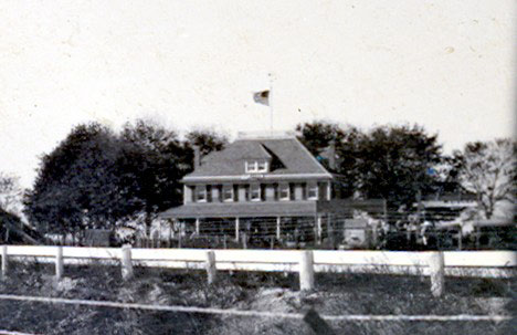
No one braved the Newbridge Hotel roof in 1909.
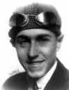
The #16 Mercedes driven by Spencer Wishart.
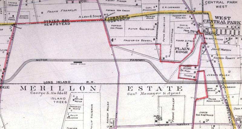
Belcher-Hyde Map-1927
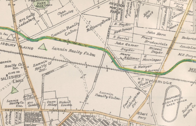
This 1927 map indicated the location for the "Proposed Acqueduct Race Track".
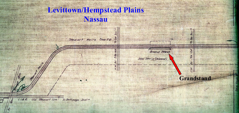
Motor Parkway Atlas- 1928
Aerial- May 27, 1947
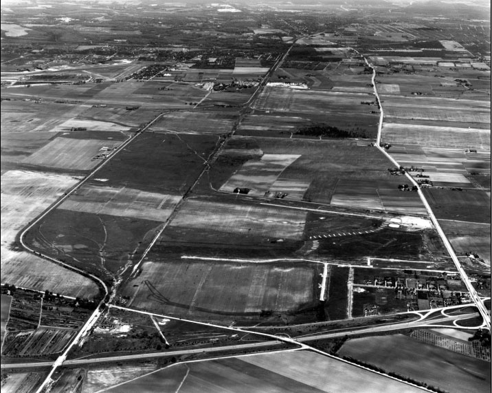
The bridge was still standing when Levitt & Sons began to build Levittown.
Aerial- Late 1947
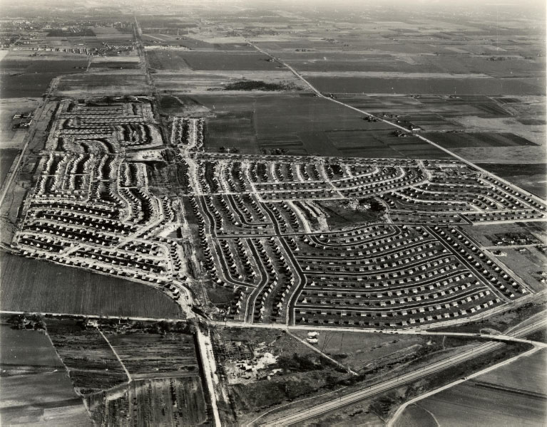
After only six months, hundreds of homes had been built.
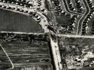
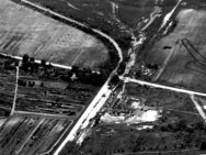
This aerial actually captured the bridge being dismantled.
The remains of the Newbridge Road Bridge.
Now- Goggle Earth
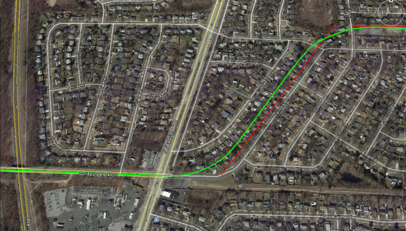
Check out Wayne Consolla's online Motor Parkway map, to find the location of the Newbridge Road Bridge.


Comments
Thanks for these fabulous photos Howard! I grew up no more than 1/4 mile from the site of this bridge. I can still remember in the 1960s seeing railroad ties from the Central Branch near where the bridge was located. My guess is that the bridge came down around 1949-1950.
I believe is was taken down 1948