Long Island Motor Parkway Bridge Series #33: The “Roosevelt Field” Motor Parkway Bridge in Westbury
The 33rd bridge in the series documenting the 60 bridges built by the Long Island Motor Parkway is the highway bridge that eventually connected Stewart Avenue to Roosevelt Field. The bridge was located then in Westbury, now called East Garden City with a Garden City post office.
We are now half-way home to documenting all the Motor Parkway bridges.
Enjoy,
Howard Kroplick
1908 Survey
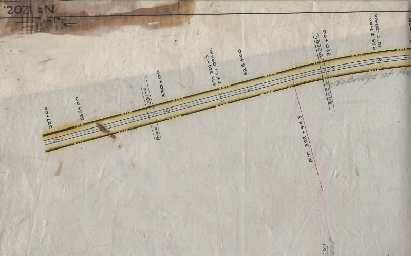
This 1908 survey shows the Motor Parkway crossing a road at station #331. The bridge was considered a "highway" bridge since the Motor Parkway went through it.
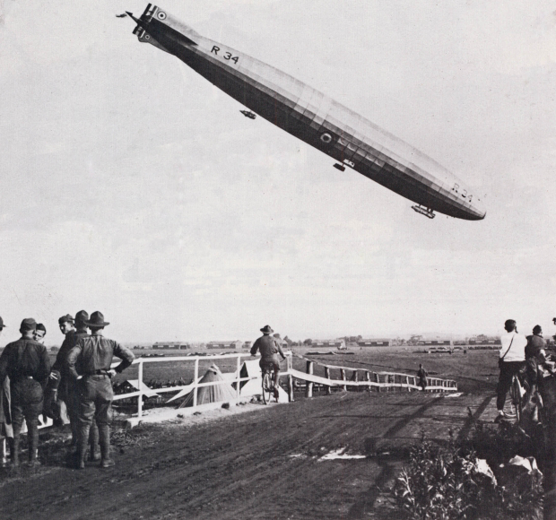
1918 Landing of R-34
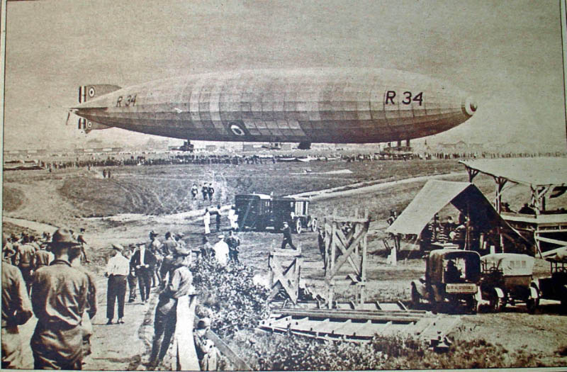
In July 1919, Long Island became part of aviation history when an airship crossed the Atlantic Ocean for the very first time and ended its voyage at Roosevelt Field.
In this photo, the British Army's 643-foot dirigible R-34 can be seen just before landing. The men on the left were standing on the Motor Parkway Bridge.
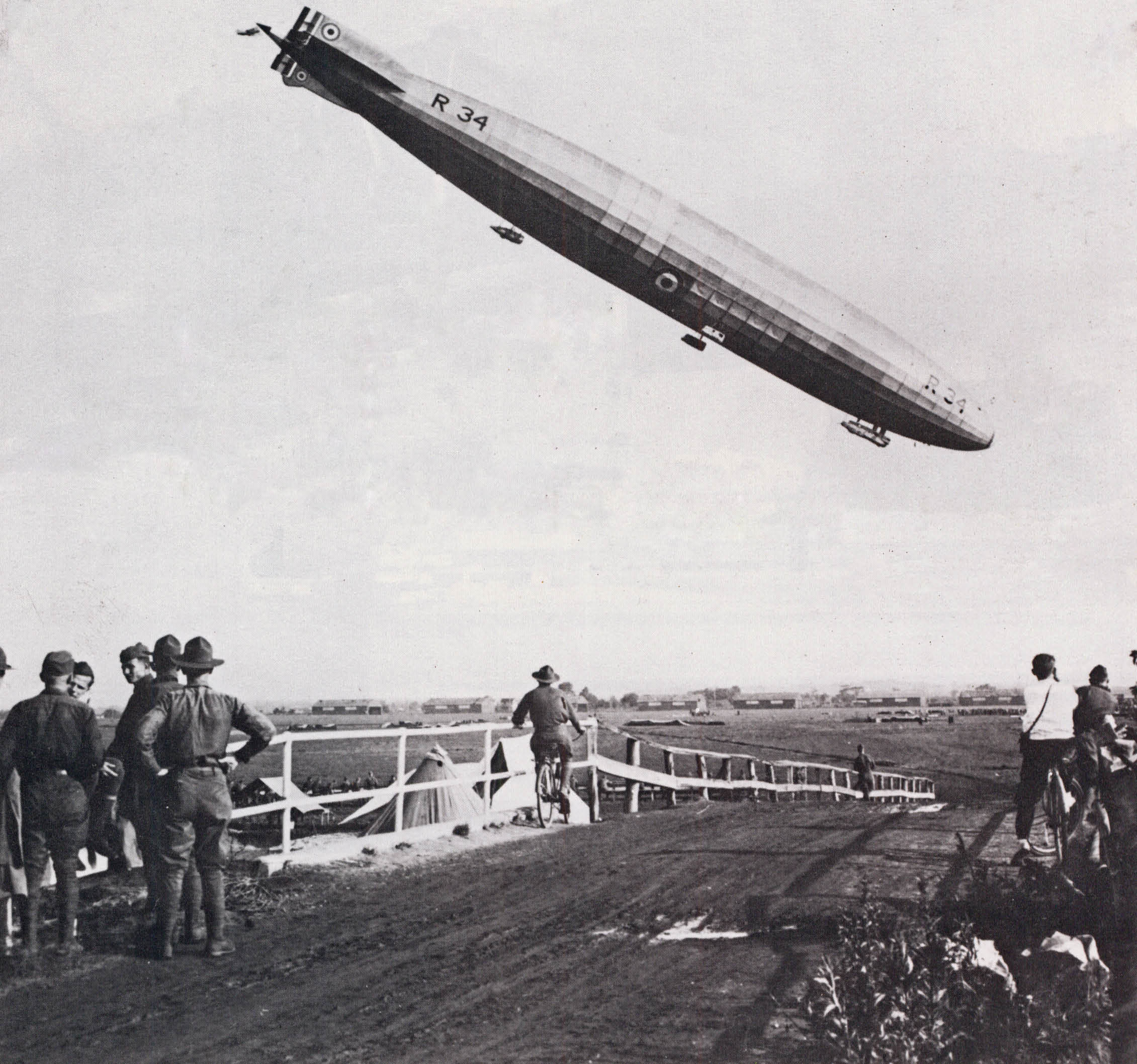
Another view of R-34 from atop the bridge.
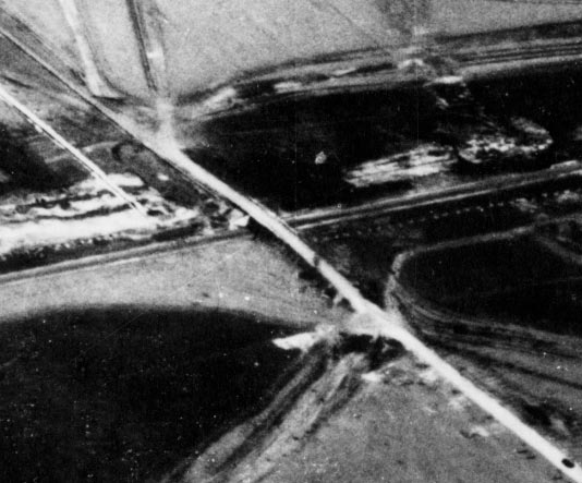
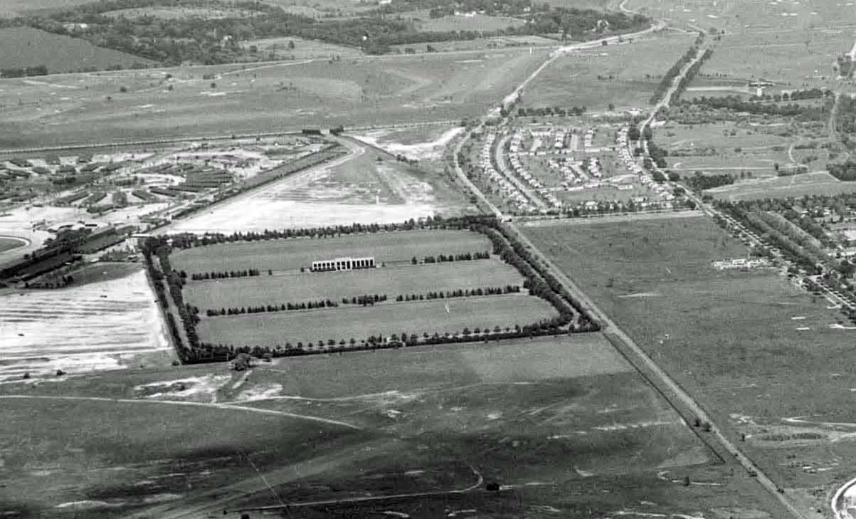
1924 Aerial
June 16, 1927 Lindbergh Reception
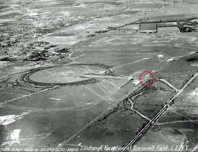
One of the busiest days on the Motor Parkway was June 16, 1927, when Charles Lindbergh returned to Roosevelt Field to celebrate his successful solo flight to Paris. Lindbergh had taken off from the Roosevelt Field eastern runway 27 days earlier. The Motor Parkway is the road in the middle of the image running parallel to Stewart Avenue on the right. The circle in the photo was formed by rows and rows of automobiles surrounding the dedication area. Stewart Avenue was a major access point that day with traffic using the bridge over the Motor Parkway to reach the ceremonies.
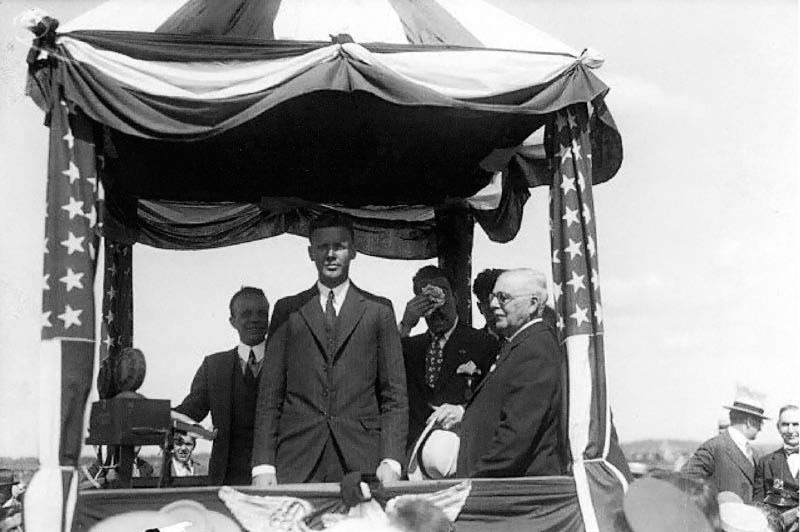
At the homecoming celebration in the center of the circle, Colonel Charles Lindbergh addressed an estimated crowd of 25,000 people and promoted the development of Roosevelt Field as a major aviation center. Lindbergh had landed his Spirit of St. Louis plane at Roosevelt Field earlier in the morning.
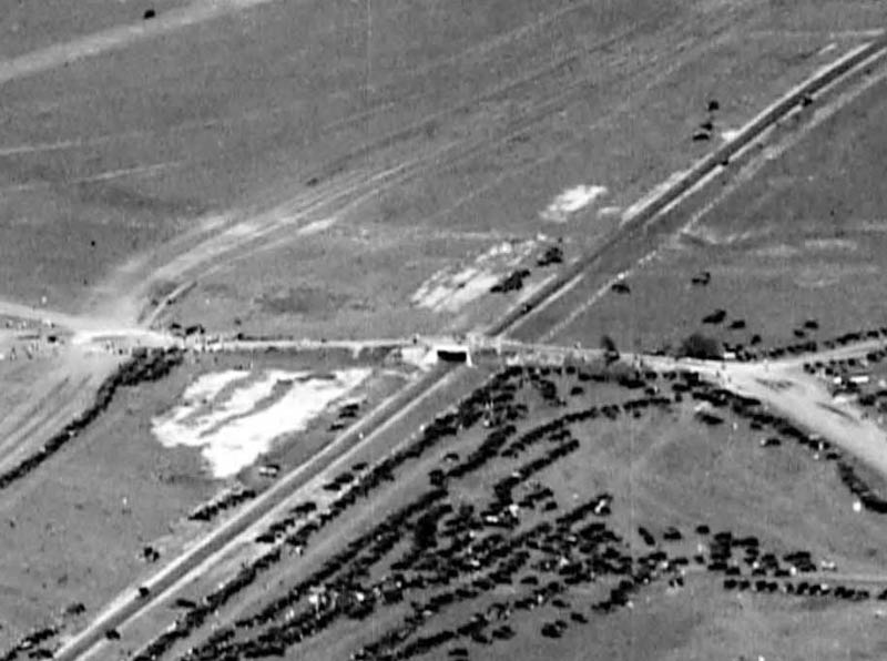
The bridge with cars parked south of the Motor Parkway
1928 Motor Parkway Atlas
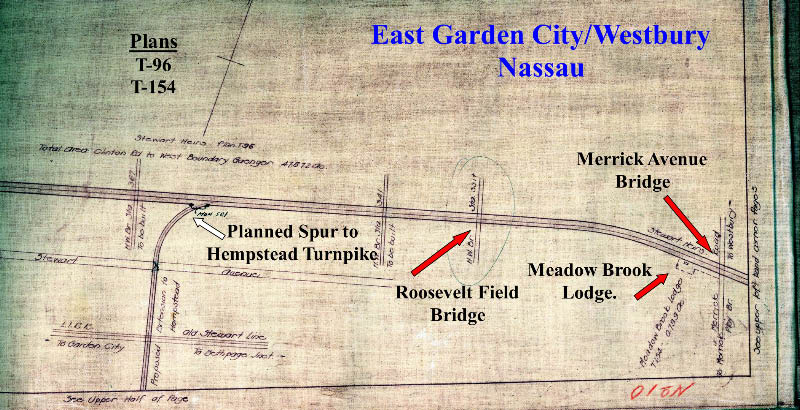
The bridge was the last bridge prior to the Meadow Brook Lodge.
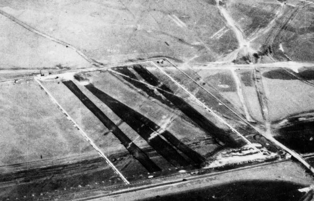
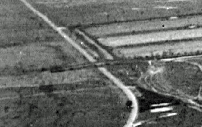
May 5, 1928 Aerial
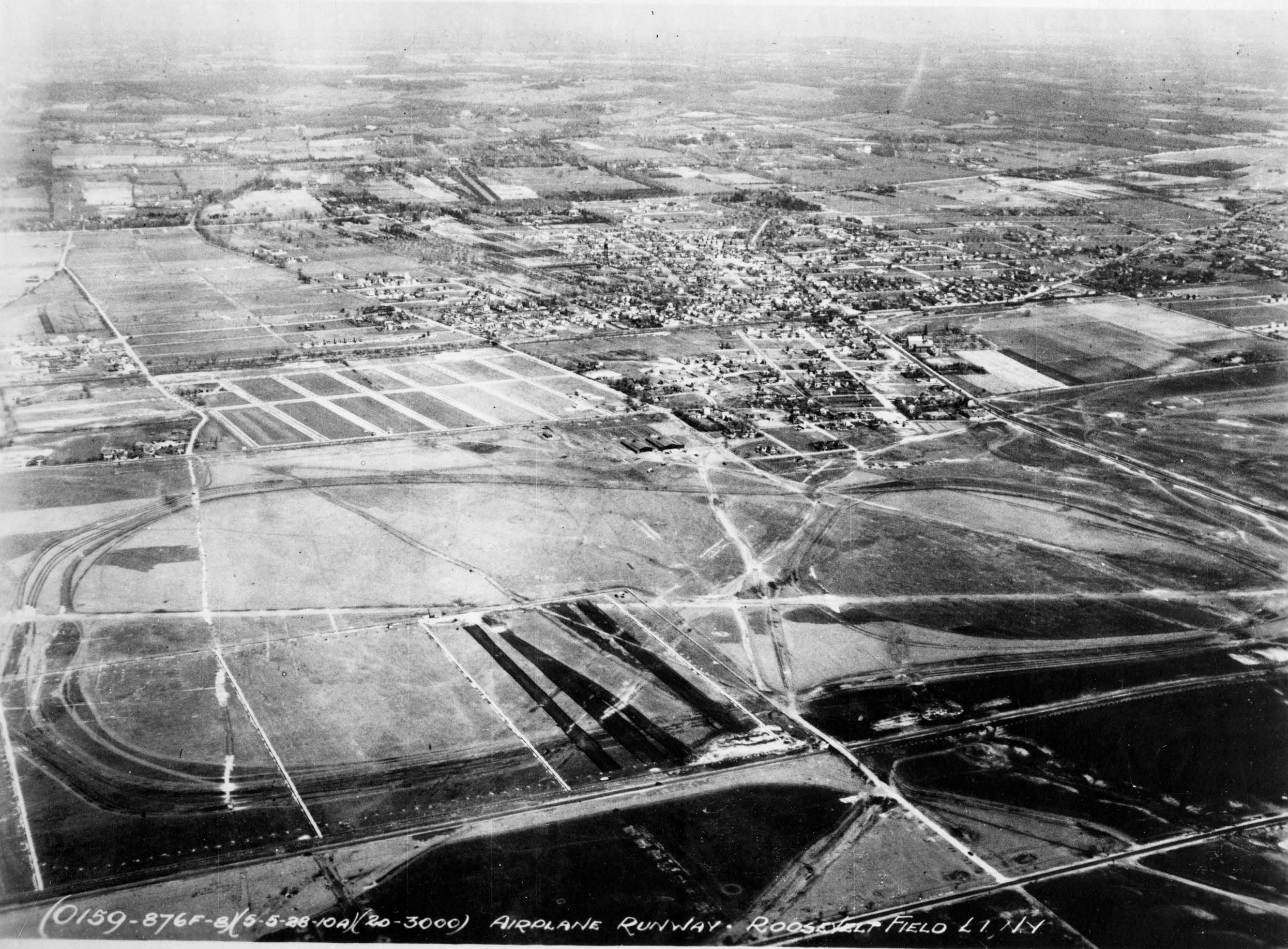
This aerial of Roosevelt Field appears to show the Meadowbrook Polo Club field being built.
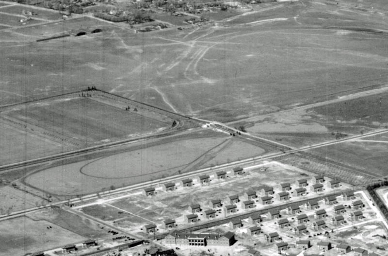
1931 Aerial
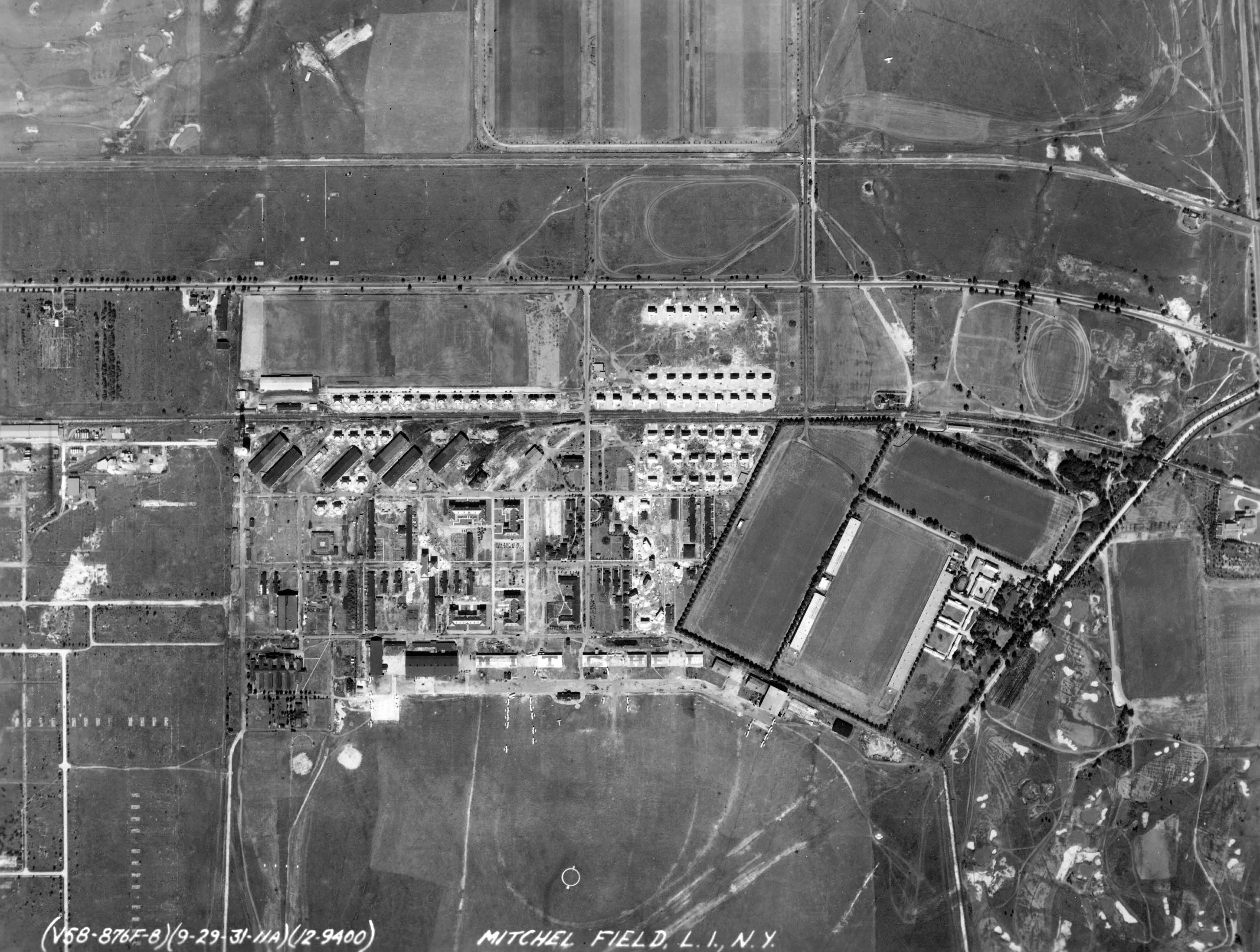
In the late 1920s, the Meadow Brook Club purchased property north of the Motor Parkway and built another polo field (see top-middle).
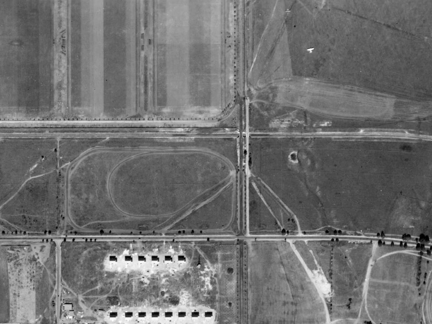
The club built their own bridge to the field parallel to the Motor Parkway bridge.
1936 Vanderbilt Cup Race, Roosevelt Raceway
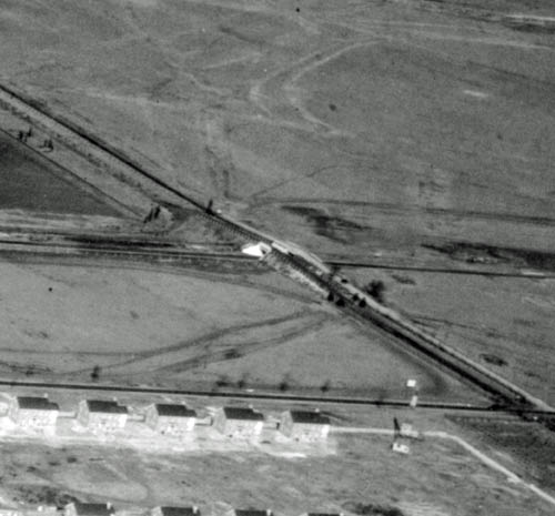
Aerials (1938-1939)
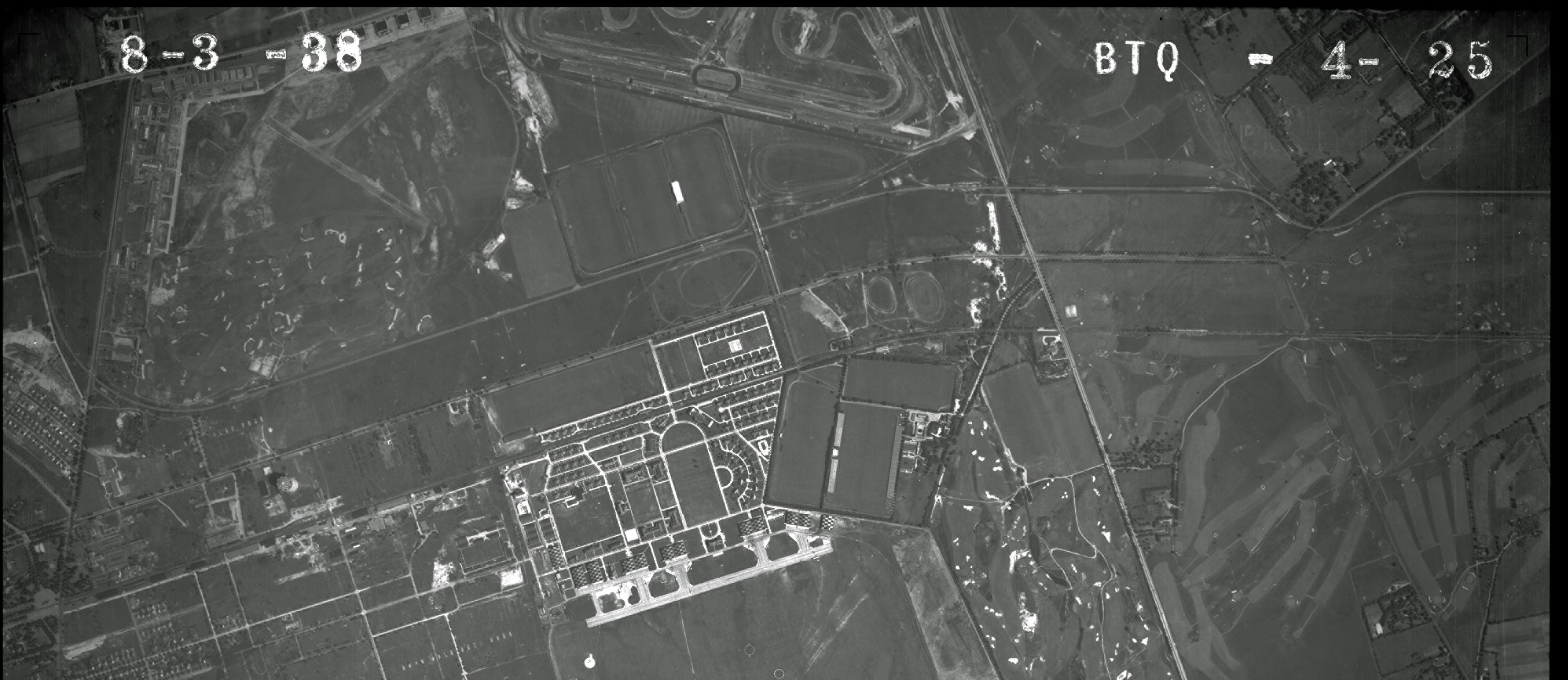
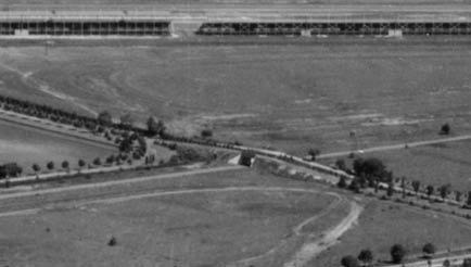
The twin bridges.
Looking north east.
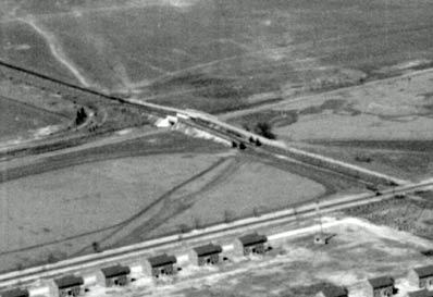
1940s Aerial
1954 Map
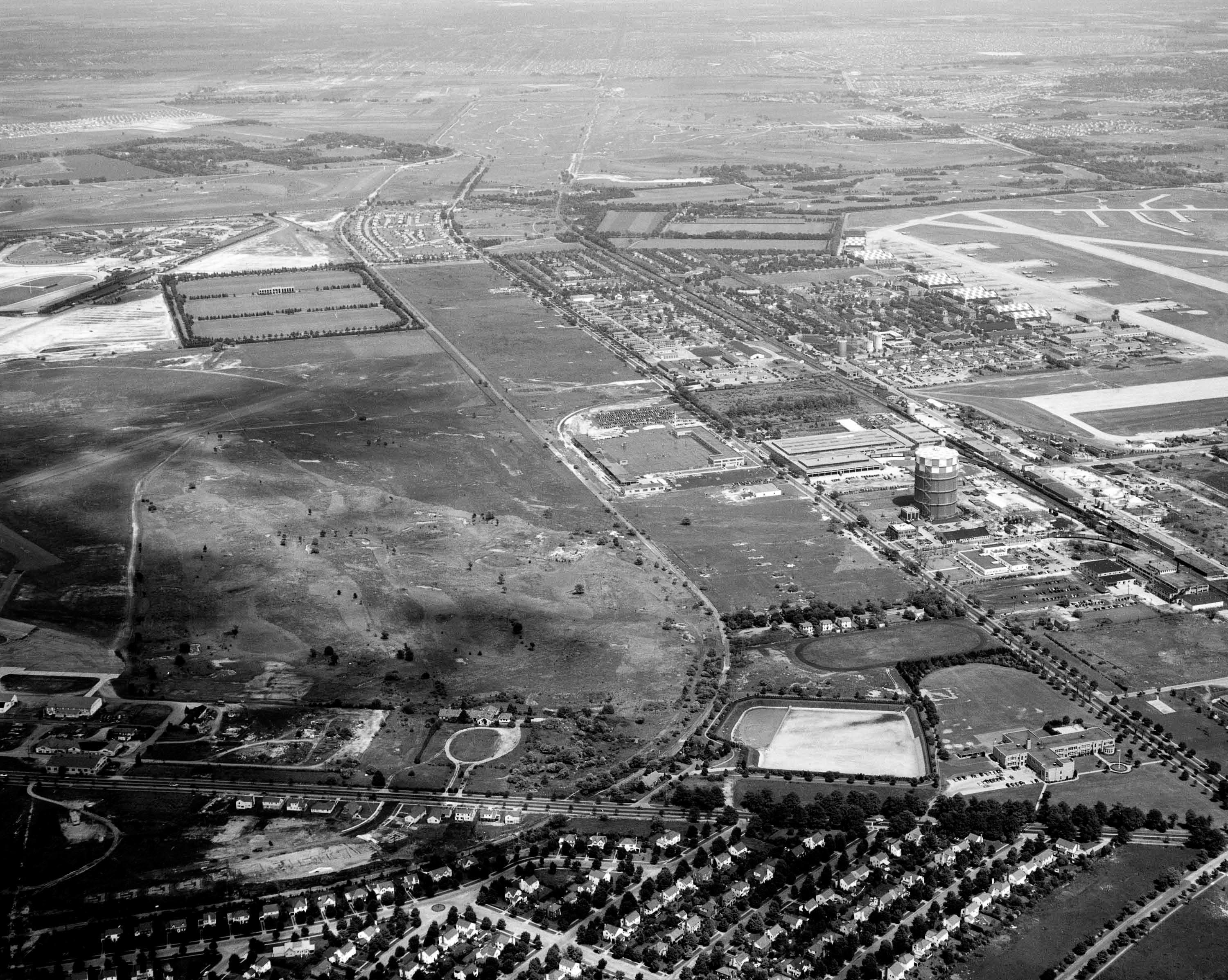
1956 Aerial
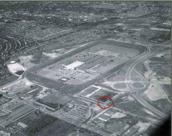
This spectacular aerial taken on October 3, 1956 shows the open-air Roosevelt Field Shopping Center.
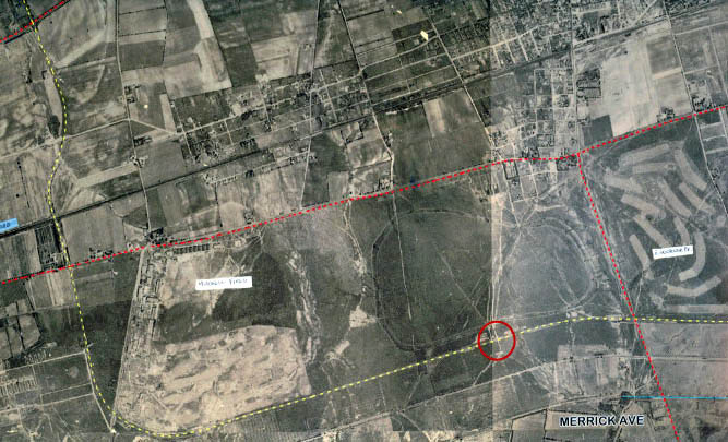
2013 Google Earth Aerial
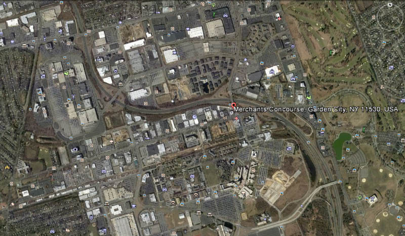
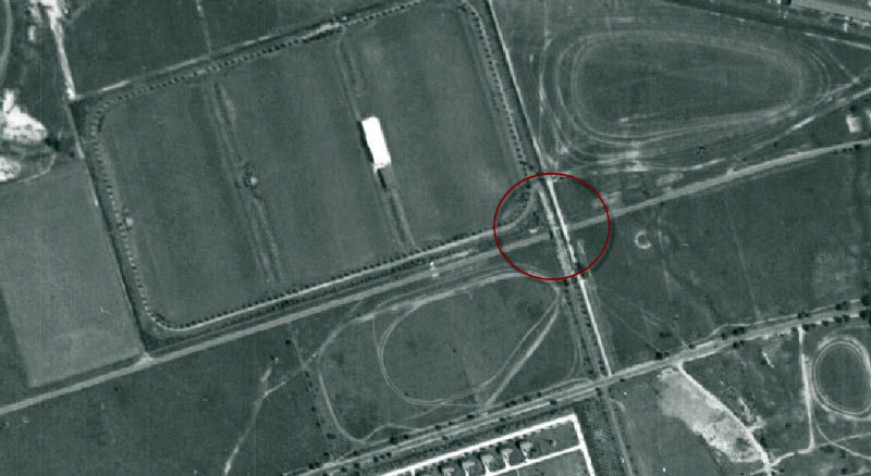
The location of the Motor Parkway bridge is approximately the Merchant's Concourse bridge over Meadowbrook Parkway.
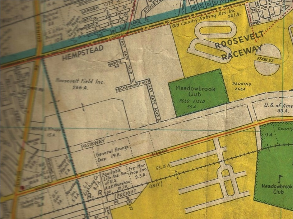
As shown on Wayne Consolla's online map, most people do not realize that the Meadowbrook Parkway in this area parallels the Motor Parkway right-of-way.


Comments
I never knew of this overpass, thanks Howard. I was always curious of the area E/O South St, and just S/O of the Meadowbrook. It just looks tough to get back there. When I’m feeling better, my goal is to walk the LIMP path in Queens.
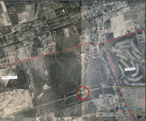
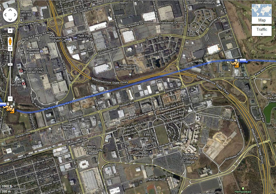
I don’t think the location is the Merchant’s Concourse bridge over Meadowbrook Parkway. I think it is more West of that perhaps in line with South Street. See my map.
I base this on the 1956 aerial shown above. I the top photo you can see Roosevelt field and the Northern entrance from Old Country Rd. Just South of this entrance is another clover leaf (Zeckendorf Dr )on the curve and the LIMP bridge is just south of this clover leaf. South Street lines up with this so that is my best guess.
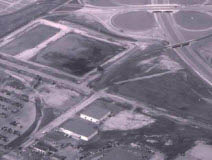
Based on Aerials (1938-1939) the 3rd one down: I now agree with the Merchant’s Concourse bridge location. I think the 1956 aerial is marked wrong.
Thanks Howard. Amazing coverage of this difficult to access area! I know there was a bridge in here somewhere but thanks to all to help pinpoint it! ( I’ve seen pics of it somewhere ) And the twin bridge was a surprising revelation and very cool. There must’ve been a certain feeling driving under those double bridges, making a location reference point of some sort for LIMP go’ers. Sort of like a race track reference point. Never would have known they existed. Brian is right about tough access. Everything barbwired and locked down. I often wonder what could have caused this high security. Also incredible is the amount of work progressing into the MSP. Robert Moses definately had a plan!
Wayne, I believe you are correct. Looking at the current Google Earth view shows that the the Meadow Brook Club’s property is still there, and amazingly for that area, is still undeveloped. At the lower East corner of the property where South street turns 90 degrees South, is where I also think the LIMP bridge was.
At that exact spot also is an abondoned Central RR spur that I assume was only used for a short time. The fairly new for that time RR testle bridge over the Meadowbrook Pkwy is clearly seen in the ‘56 aerial. Part of the tracks are also still visible in between the RR bridge and Stewart Ave in current Google views. Driving East on South Street, there is actually still a RR crossing sign just as you come to the curve in the road even though the tracks have been paved over years ago. To see that sign drive down the road in Google Street View. I’m a little puzzled since it looks like a new sign on a modern light post.
Howard,
Correct me if I’m wrong, but in the June 16, 1927 Lindbergh Reception aerial photo, it looks like you can see the faint ROW line where the Meadowbrook is going to be. Had construction or surveying already started taking place at that time?
Greg
I think I need to revise my earlier comments. I based my comments on the ‘56 aerial, but now looking at the 1938 aerial, it does indeed look like the bridge would be near where the Merchant’s Concourse bridge is currently, (judging by where Mitchell Field’s central lawn is located-now the Quad for NCC) It looks like I was also wrong about the Meadow Brook Club property location.
Could the red circle placed on the 1956 aerial be in the wrong location?
I think the red circle is in the wrong place - the 56 aerial looks like the south drive of roosevelt field’s south eastern corner and what appears to look like the polo fields is really a huge storm drain and Akbar Indian rest. is right there - the red circle would be west of the polo fields and the Merchant Concourse closer to the mall. Good puzzle !! Mike
One original motor parkway post remains between where Stewart Ave. and the Meadowbrook Parkway run parallel - as documented here:
http://www.freewebs.com/limparkway/stewartavenuegardencity.htm. I haven’t been back there in a few years so I’m hoping its still there.
The red circle is definitely in the wrong place in the ‘56 aerial . . . that is South Street NOT the Merchants Concourse (just came back from lunch there)
amazing stuff…where’s my time-machine?!