Long Island Motor Parkway Bridge Series:#19 I.U. Willets Road Motor Parkway Bridge in Searingtown
Going west to east, the 19th bridge of the Long Island Motor Parkway bridge series was built to allow access to I.U. Willets Road in Searingtown. As seen below, it is one of the best documented Motor Parkway bridges.
Enjoy,
Howard Kroplick
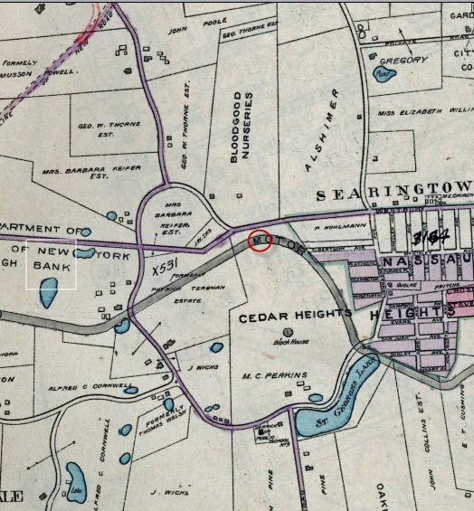
1906 Belcher-Hyde Map
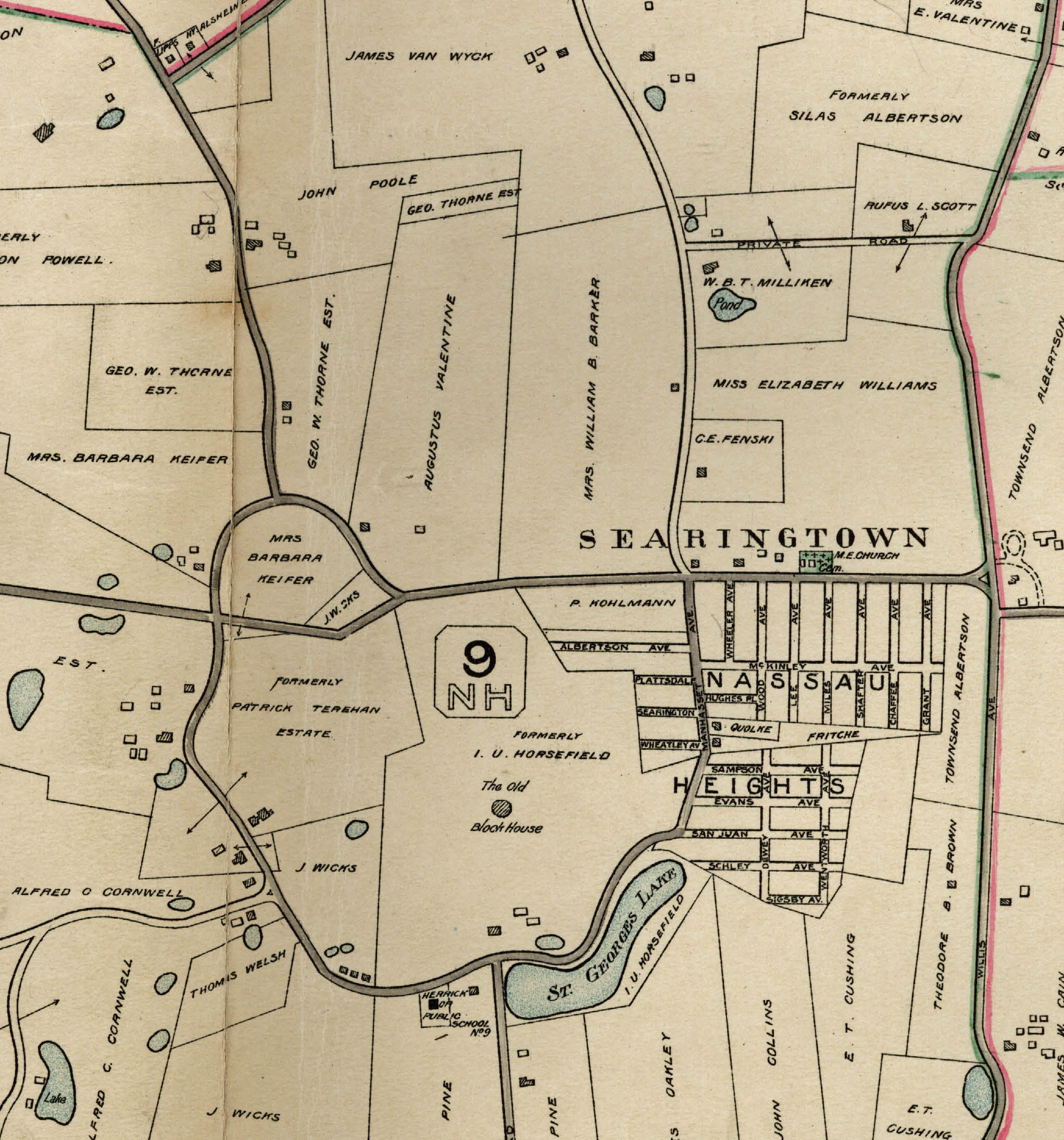
Around 1900, the property south of I.U. Willets Road was owned by the I.U. Horsefield (Horsfield) family.
1909 Surveys
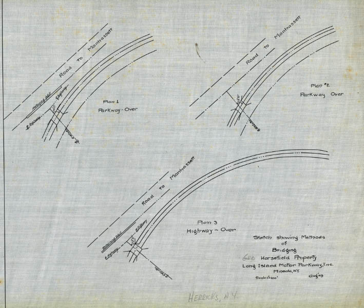
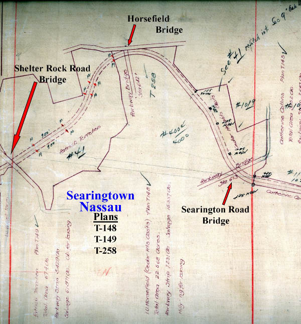
The Motor Parkway purchased 22.56 acres in the area for the Motor Parkway right-of-way. As part of the purchase agreement, the Motor Parkway was required to build a bridge that would allow access to I.U. Willets Road ("Road to Manhassett"). In this survey, three different plans were shown for "bridging Horsefield Property".
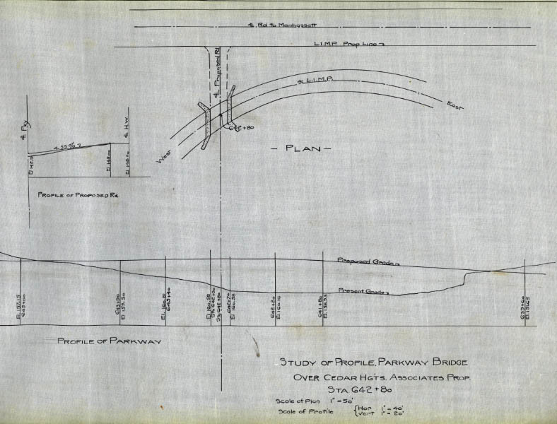
By 1909, the Horsefield (Horsfield) property had been sold to developer Cedar Heights Associates. As seen in this bridge plan, the Motor Parkway property line in this area bordered on I.U. Willets Road.
1914 Belcher-Hyde Map
The location of the bridge in relation to I.U. Willets Road and the Motor Parkway.
1926 Aerial
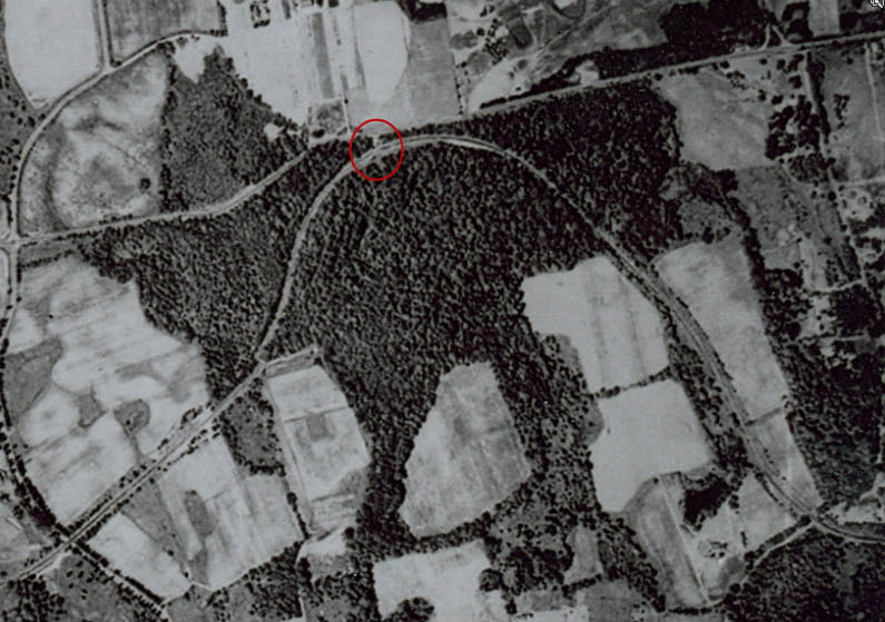
This aerial view showed how little of this area was developed by 1924.
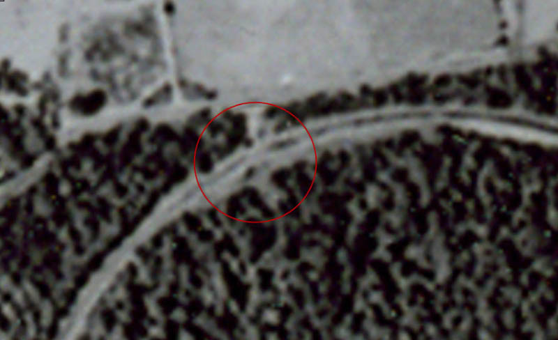
A close-up shows the bridge and the dirt road that connected to I.U. Willets Road.
1928 Motor Parkway Atlas
The "Parkway Bridge" was designated Station 642 in the Motor Parkway Atlas.
1942 Survey
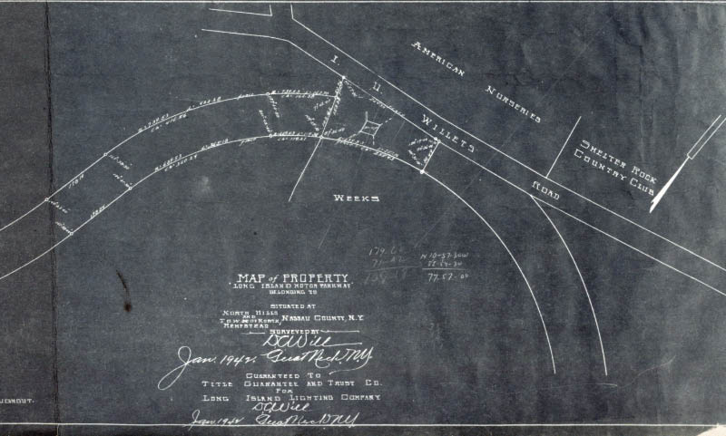
This blueprint shows the bridge and "American Nurseries" north of I.U Willets Road.
1950
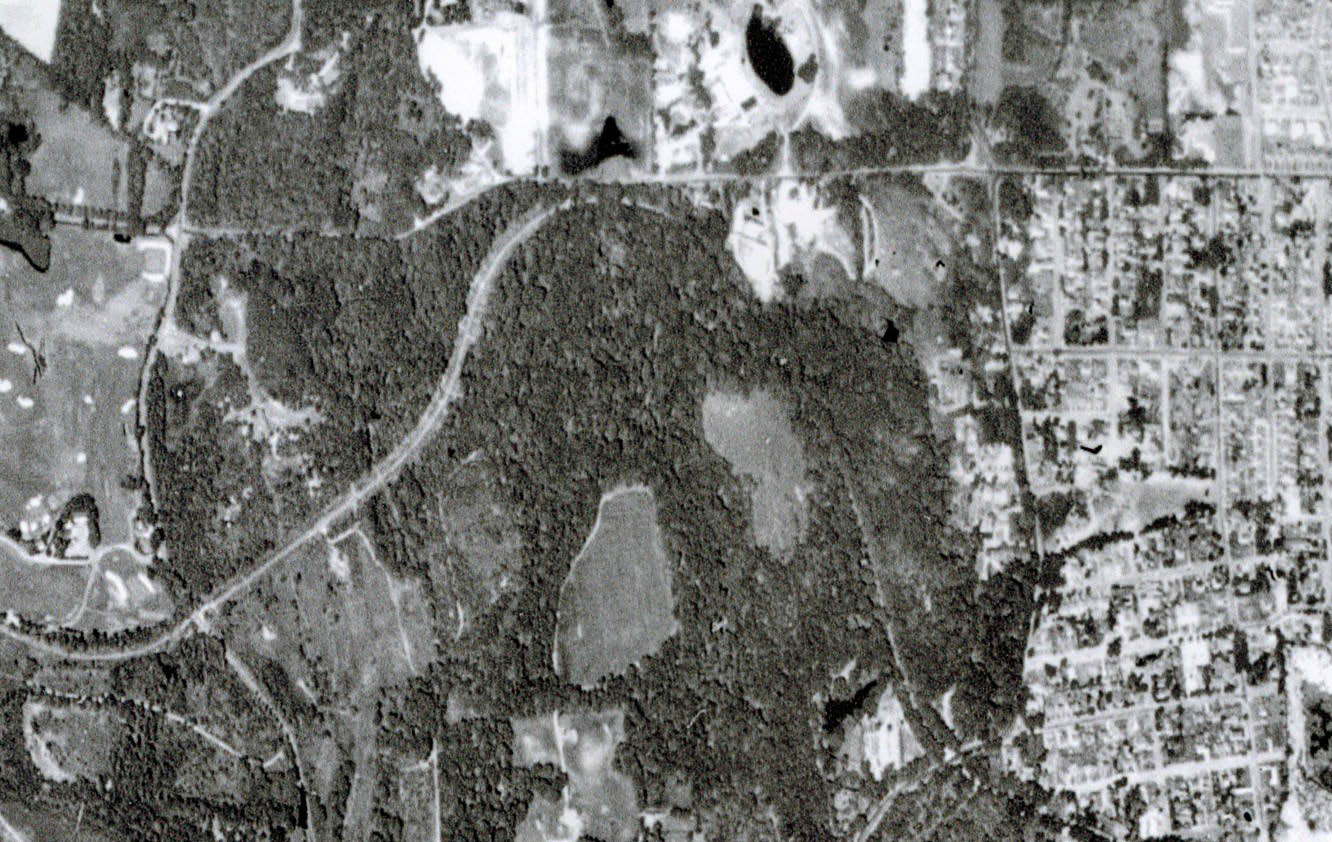
Compare this aerial with the above 1924 aerial... Long Island was quickly being developed for suburban living.
1960
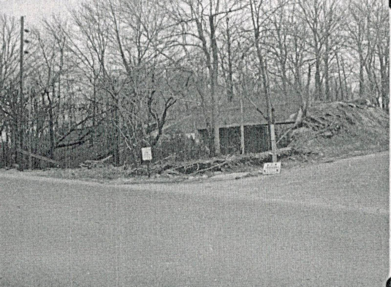
A ground-level photo of the bridge looking south from I.U. Willets Road. Note the utility pole on the left.
2012- Current View
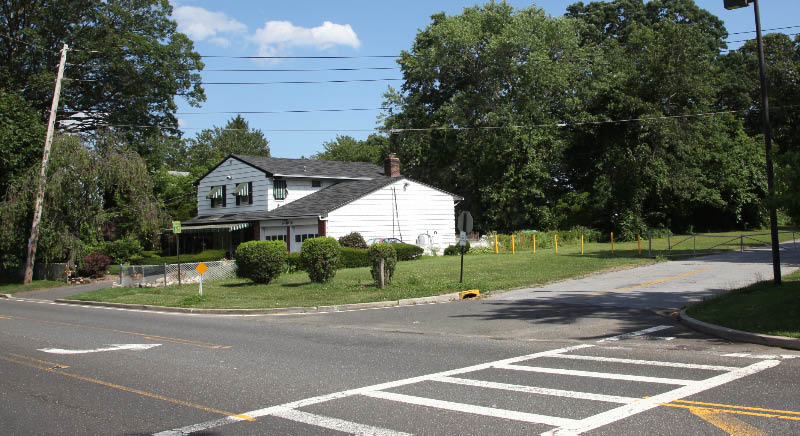
Same view 52 years later... a utility pole is still in the same spot.
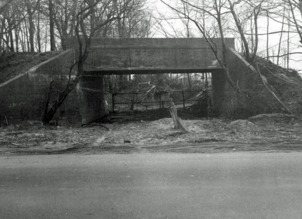
1960

The best photo of the bridge...again looking south from I.U.Willets Road.
2012- Current View
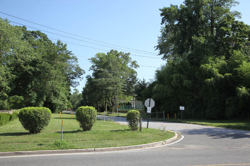
Same view today...the west embankment is hidden by bamboo trees on the right.
1981
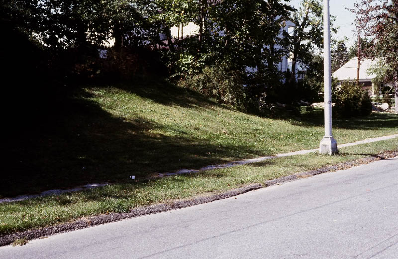
Ron Ridolph documented the west embankment over 30 years ago.
2012- Current Views
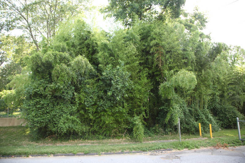
The well-hidden west embankment.
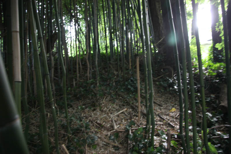
Without fear of poison ivy and ticks, a view of the embankment...Okay a little fear.
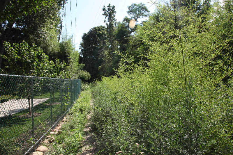
Looking south, the Motor Parkway has been taken over by Mother Nature.
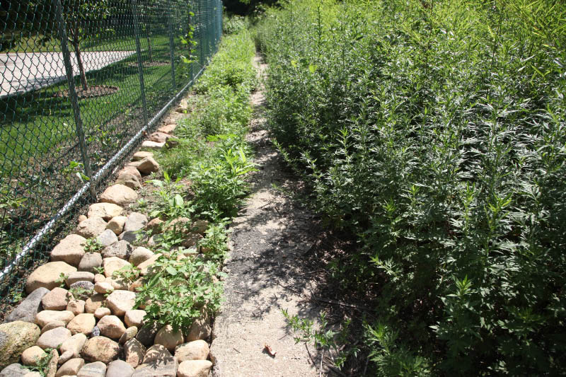
The 3-foot concrete extension of the Motor Parkway is still visible.
2012- Bing Map
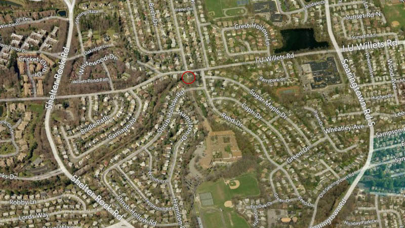
A Bing "bird's eye" view still shows the path of the Motor Parkway to the west. The homes on Sugar Maple Drive to the east were built directly of the Motor Parkway right-of-way. Note how both Shrug Hollow Road and Sugar Maple Drive follow the path of the Motor Parkway.
2012 Current Views
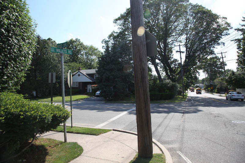
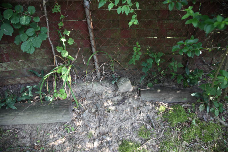
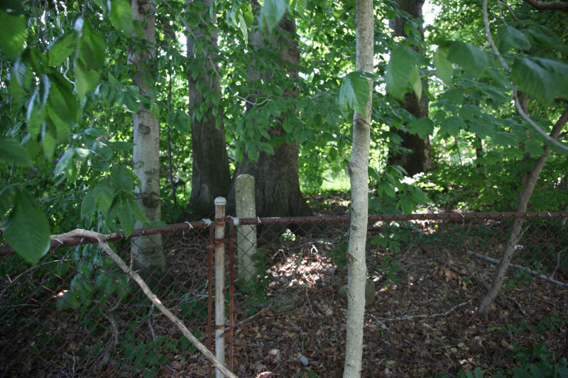
My favorite co-author Al Velocci noted in his Motor Parkway Toll Lodge book; " Another location the Parkway considered gracing with a lodge was at Searingtown with an entrance off today's I.U.Willets Road at Reed Drive. The right-of-way.. was acquired from the Cedar Heights Association. The purchase consisted of 23 plus acres at a cost of $1,500 per acre; the Cedar Heights group in a letter dated June 6, 1909, was willing to reduce the price to $1,250 per acre if the Parkway would open an entrance and build a lodge at that point...The Searingtown Lodge idea was never more than a passing thought."
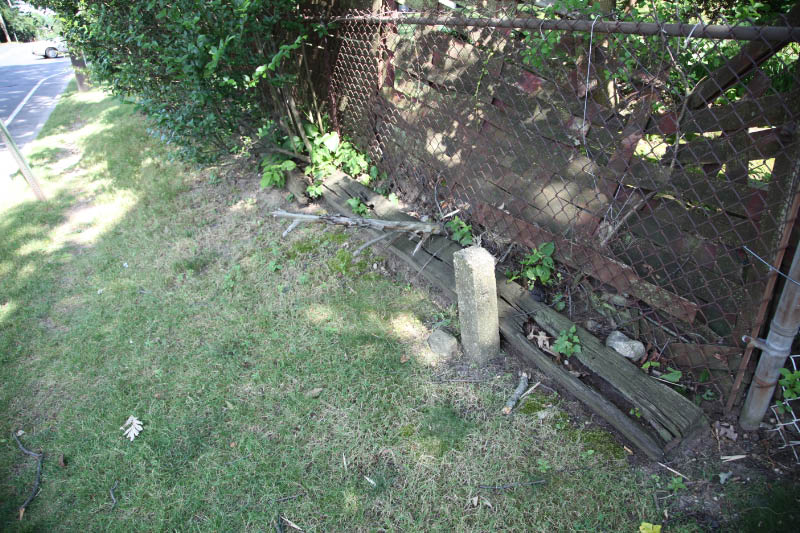
Based on Al's research, I decided to explore the area around Reed Drive. Surprise, I discovered three Motor Parkway concrete posts!


Comments
Amazing stuff. I cannot tell you how much I appreciate your work. Along IU Willets road the old cement posts used to stick out of the ground quite a bit higher. They were buried, and some completely buried when they repaved the area about 20 years ago. They added a couple of feet of dirt there. My neighbor was just telling me how he used to walk the parkway up there all the time. That would be in the late 1950’s, and the only thing in that whole area was the brick house on IU Willets Road east of this bridge, and just east of the cement post that you found up on the hill.
There used to be a whole row of posts in the backyard of 39 Piiper Drive, but they are all gone. They ran right accross the lawn.
Thank you again.
-joe
Hi Howard. Thanks as always for running a great site about the LIMP. I always had a notion that there must have been an overpass in this location. The ground level is high at the end of this LIPA ROW, compared to the entrance road from IU Willets into the school south of this location. So the LIMP continued on this overpass, and so not to interfere with the path underneath to IU Willets Rd?
Thanks for the info. Howard and the pics of the posts - I need to check them out!
NICE WORK HOWARD, THE THREE FOOT CONCRETE EXTENSION PICTURED ABOVE STILL EXISTING IN THIS AREA, IS ON THE EAST END OF THE MOTOR PARKWAY RIGHT RIGHT OF WAY THAT LILCO ACQUIRED IN 1941 FROM NASSAU COUNTY FOR TWENTY FIVE THOUSAND DOLLARS. THE WESTERN END OF ONE HUNDRED FOOT WIDE PURCHASE WAS AT NEW HYDE PARK ROAD.. THE REASON FOR THE ACQUISITION WAS LILCO’S NEED FOR A RIGHT OF WAY TO RUN NEW ELECTRIC POWER LINES FROM THE GLENWOOD LANDING POWER PLANT TO THE 2 MILLION SQUARE FEET BUILDING THE SPERRY CORPORATION WAS CONSTRUCTING IN LAKE SUCCESS FOR THE WAR EFFORT. THIS SECTION OF THE PARKWAY’S RIGHT OF WAY, ENDING AT THE REAR OF THE SUB-STATION ON SHELTER ROCK ROAD, CAN BE ACCESSED AT THE I.U.WILLETS ROAD ENTRANCE TO HERRICKS HIGH SCHOOL. KEEP UP THE GOOD WORK, AL.
I think bridge 19 on the map should be placed a little bit to the west over the herricks high school driveway, next to the west embankment.
Sometimes as we’ve seen you can’t believe everything you read. Unless I’m mistaken you would be hard pressed to find Lou Willetts Road (I.U. Willets) on Long Island. From “The Automobile” of August 23, 1906