Long Island Motor Parkway Bridge Series:#16 New Hyde Park Road Motor Parkway Bridge in Searingtown
Leaving Lake Success and skipping Robert Moses' second Motor Parkway bridge over Northern State Parkway, the next target for our series is the Hyde Park Avenue Motor Parkway Bridge in Searingtown. The road was later renamed New Hyde Park Road. Remember to click on the image to enlarge it.
This is the first Motor Parkway bridge where there is no known ground image or clear aerial. Does anyone have other images of this elusive bridge?
Enjoy,
Howard Kroplick
June 1909 Survey
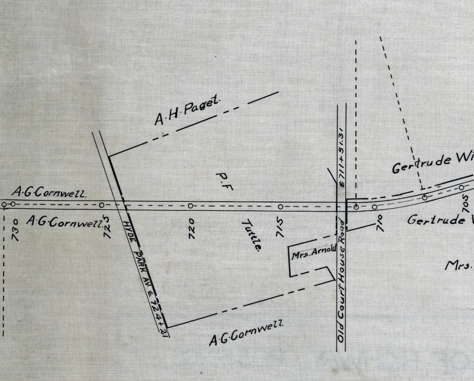 The Hyde Park Avenue Motor Parkway Bridge was surrounded by the properties belonging to A.G.Cornwell and P.F. Tuttle. The bridge was designated as #724+21.
August 1920 Survey
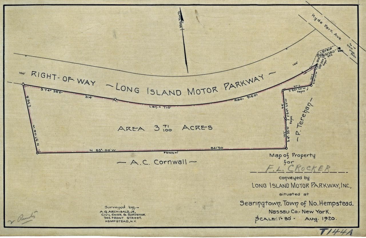 This is a survey of the property just west of Hyde Park Avenue. A total of 3.71 acres were purchased from F.L. Crocker. Given the proximity of the Great Neck Lodge, it is doubtful that a lodge was planned here. Calling Al Velocci !!! Update: See Al's comment below. This survey was the property near Shelter Rock Road not New Hyde Park Road.
1924 Aerial
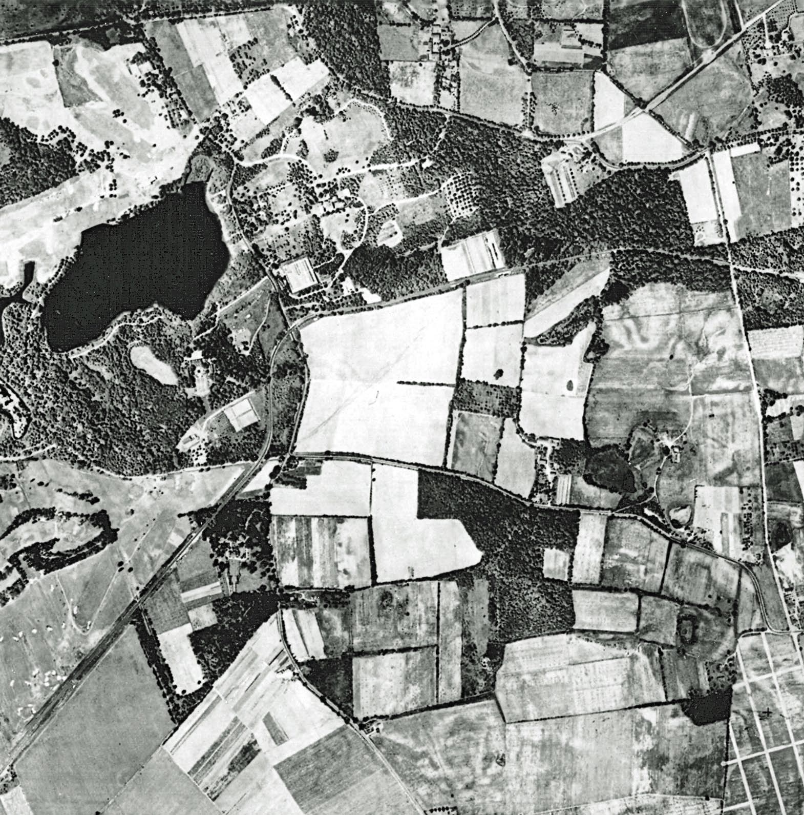 One of my favorite aerials from a 1924 survey of Long Island showed the Motor Parkway from Queens (Lower left corner) to New Hyde Park Road (far right).
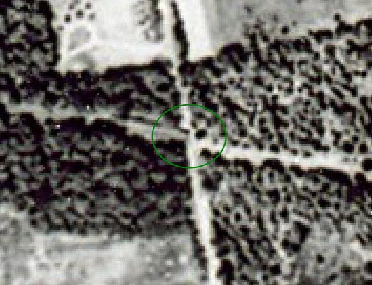 It is very fuzzy but the New Hyde Park Road Motor Parkway Bridge was within the marked circle.
1928 Motor Parkway Atlas
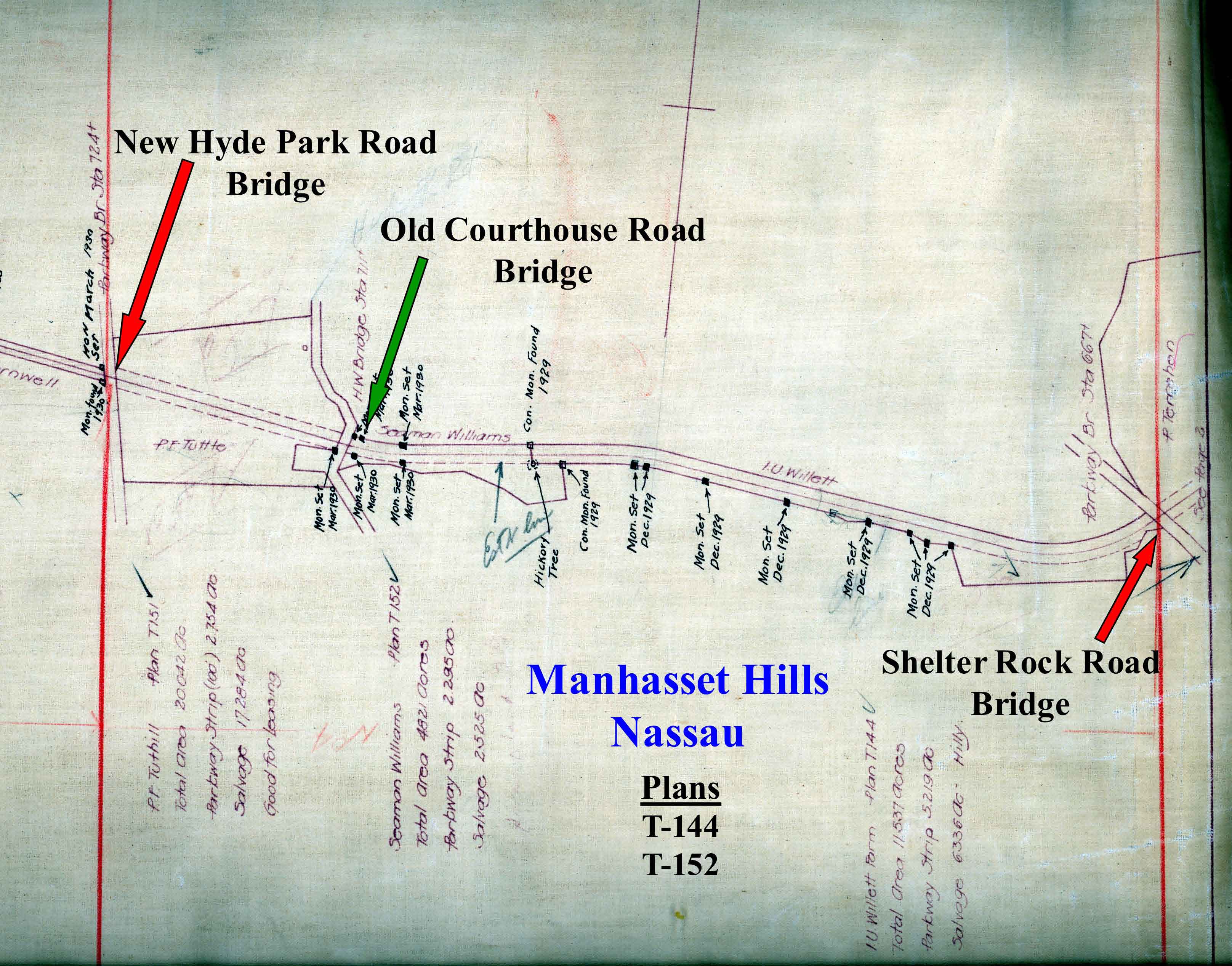 This Atlas map section between Hyde Park Avenue and Shelter Rock Road shows three Motor Parkway bridges
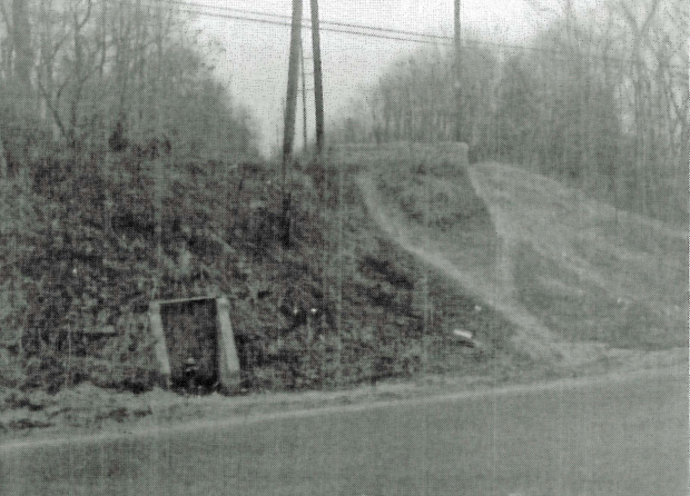
1960s Ground-Level Photo
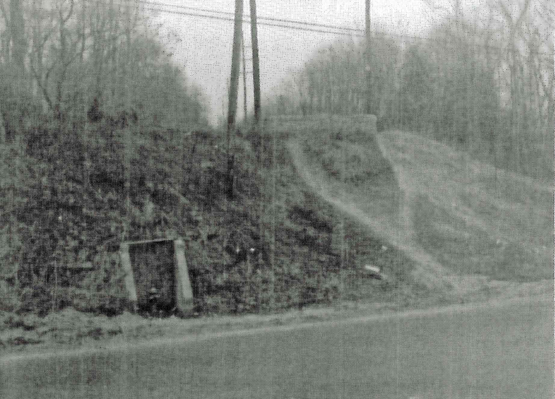 This is a rarely seen photo of the bridge showing the high east embankment. Click on the image and see the pavement still in place on the top of the embankment.
Current Views
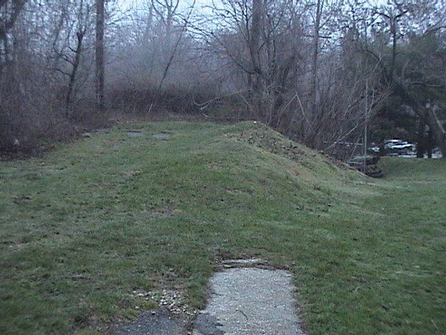 This is a view of the east embankment looking west to New Hyde Park Road. Note the remnants of the pavement and the three-foot concrete extension.
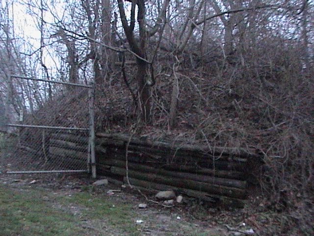
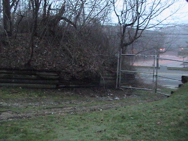 Side views of the embankment held in place by wooden support beams
Update: January 28, 2012
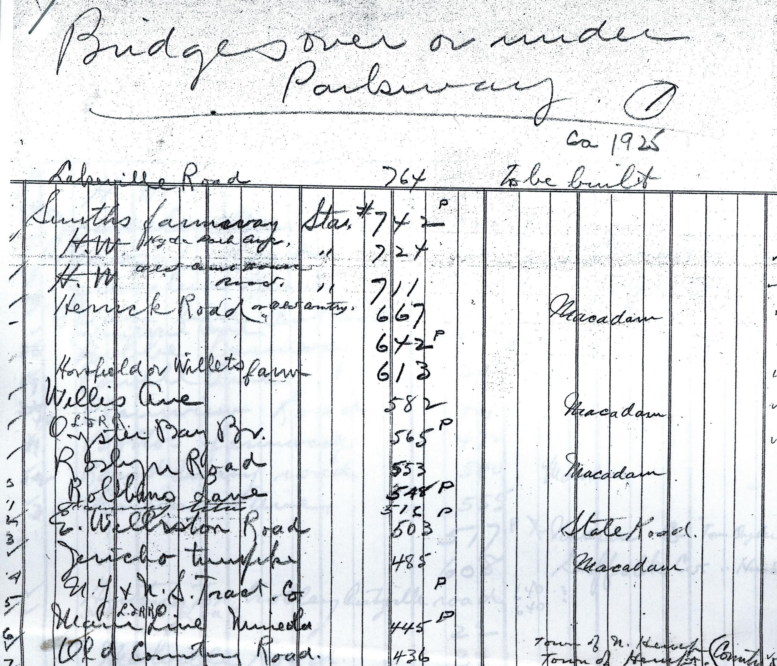 This Long Island Motor Parkway Inc. document provided a 1910 listing of all "Bridges over or under Parkway". It was updated "ca. 1925". Most of the bridges were designated as "P" (parkway bridges that carried the Motor Parkway over main roads), "H.W."(highway bridges where the Motor Parkway went under the main roads) or a "Farmway Bridge". The Hyde Park Avenue Bridge, also designated as station 724, was originally listed as "H.W." indicating the first bridge located at his location went under the main road similar to Old Country Road (which does not have a "P" mark). (Courtesy of the Suffolk County Vanderbilt Museum).
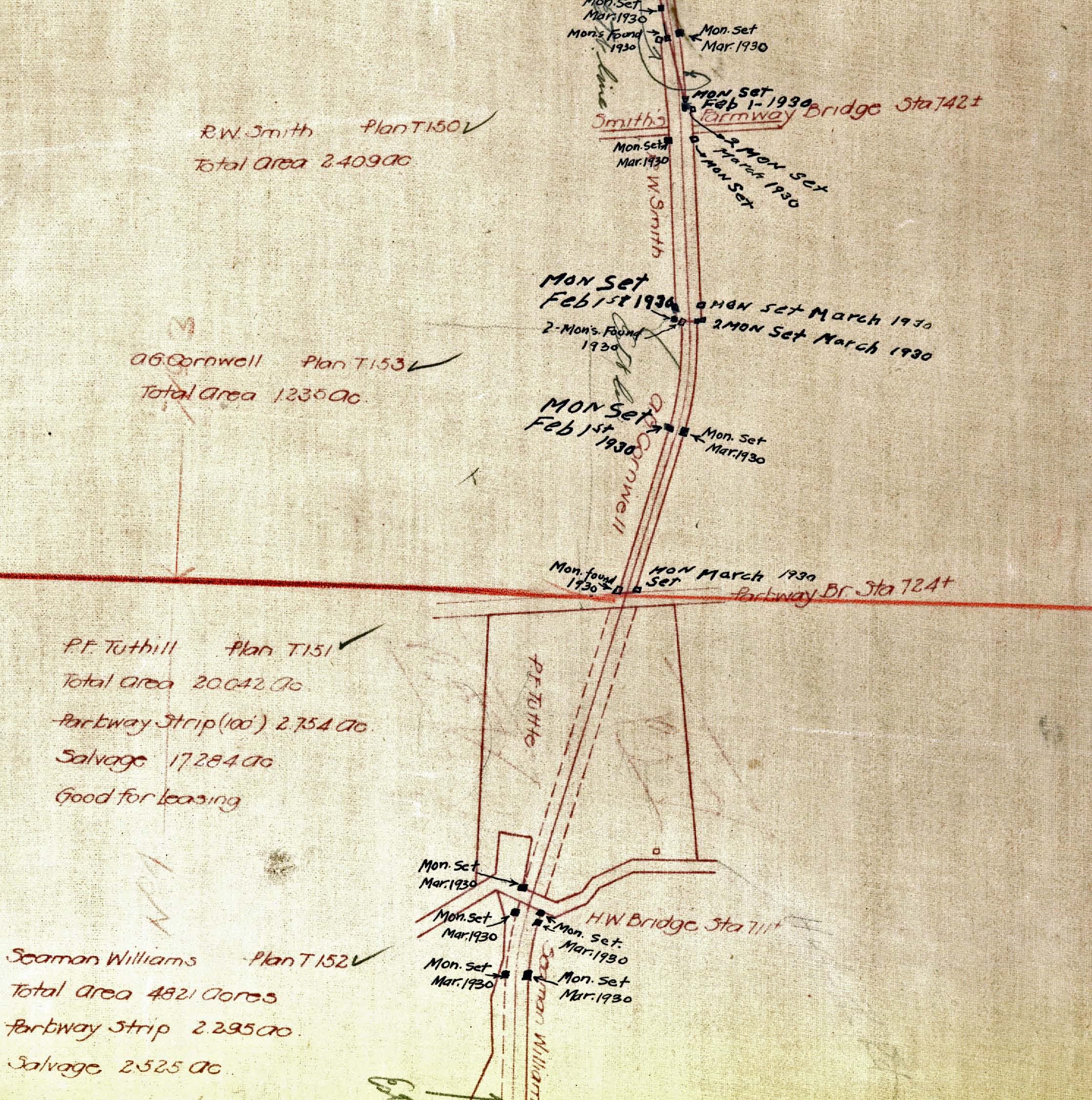 This section of the 1928 Motor Parkway Atlas shows three Motor Parkway bridges from Smith's Farmway Bridge to the Old Courthouse Road Highway Bridge. Note the designation for Hyde Park Avenue Bridge was "Parkway Br Sta 724)". Conclusion: As indicated by the 1924 aerial, the original bridge at this location may have gone under New Hyde Park Road (H.W.) and by 1928 rebuilt as a "parkway" bridge that went over the road. Was the adjoining land shown in the 1920 survey purchased as a bypass while the new bridge was being constructed?


Comments
These photos once again raise the question of whether the LIMP originally crossed UNDER NHP Road - changing to OVER NHP Road when Moses built the LIMP bridges over NSP.
Hi Mitch:
Not sure why the building of the Northern State Parkway would impact the new Hyde Park Road Bridge. Clearly, the photos indicate there was a Motor Parkway bridge that went over NHP Road. However, I do not have any images that documents the bridge prior to 1932. Can any LIMPers help?
Howard
Howard
Looking at the June ‘09 survey - there’s no difference between the NHP and Old Courthouse Rd intersections (and we obviously know the LIMP passes under OCR). The ‘24 aerial clearly shows the LIMP crossing OVER Marcus Ave & Lakeville Rd yet the NHP Rd intersection is vague (actually favoring the LIMP crossing beneath NHP Rd).
Mitch
Hi Mitch:
I have updated the New Hyde Park Road Bridge post that may support your theory.
Howard
Hi Howard,
Love the new site and the new “zoom” feature. One question: in the 1928 atlas, there are notations like “mon. set. Mar. 1930” and “Mon found 1930”. Do you know what those mean?
Hi Mitch:
Those notations indicate the location of monuments (markers) placed or found by survey markers. I have found several while walking the Long Island Motor Parkway trail.
Howard, Crocker was the purchaser, the Parkway was the seller. Also, the transaction was for a piece of property on the west side of Shelter Rock Rd. ,not off of New Hyde Park Rd. I know the survey says Hyde Park Rd., (Marcus Ave. was also refered as Hyde Park Rd. at the time) Adding to the confusion, Shelter Rock Rd. in the 1914 Belcher Hyde Atlas is also called Old Court House Rd. By the way, Marcus Ave. was given that designation by North Hempstead’s Supervisor Christ who named it after his son, Marcus around 1918. Hope this helps. Al Velocci
Hi Al:
Thanks! You are still my favorite co-author!
Howard
The other possibility is that the 1909 NHP Rd bridge was so narrow it can’t be distinguished in the aerials.
Subsequent research (in particular, page 1 of the Brooklyn Eagle of July 2, 1938) has me rethinking my replacement bridge theory. The NHP bridge must have been so narrow in width and short in length that it just doesn’t register on the ‘24 Fairchild aerial.