Kleiner’s Kolumn: The Long Island Motor Parkway in Maps (Part III)
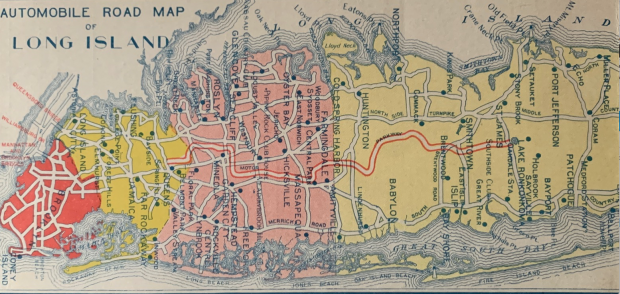
Part III of the map series provides a further look at the Motor Parkway as depicted on various types of maps. The undated map above was compiled and printed by The M.B. Printing & Binding Co. of NY and included a space for an address and stamp.
Art Kleiner
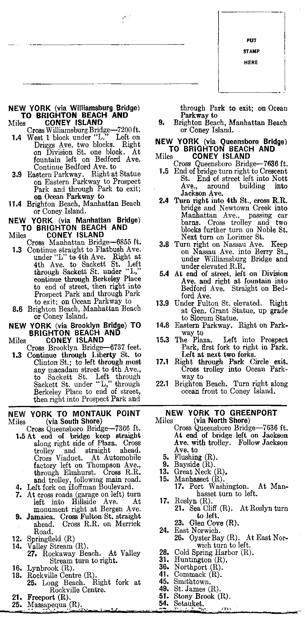
The mailer provides directions and mileage to various points across Long Island as well as Repair and Gasoline Stations (R).
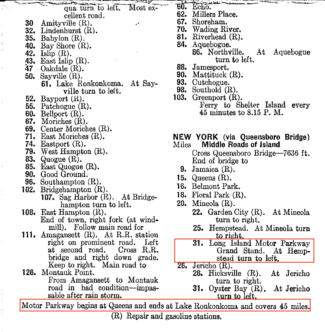
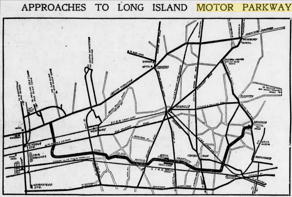
From the Queensboro Bridge to the Long Island Motor Parkway the map shows a distance of 31 miles. Total mileage for the Motor Parkway is 45 miles.
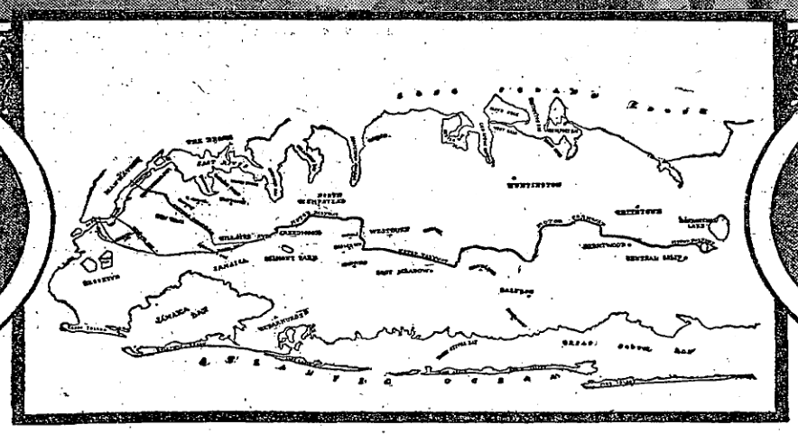
Early 1909 map from the Brooklyn Daily Eagle showing the Parkway going between Jericho Turnpike near Mineola and the Bethpage Toll Lodge.
1911 map from The New York Times.
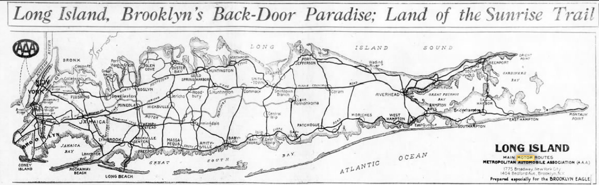
Prepared by the Metropolitan Automobile Association (anagram of AAA however) in 1925. (Brooklyn Daily Eagle)
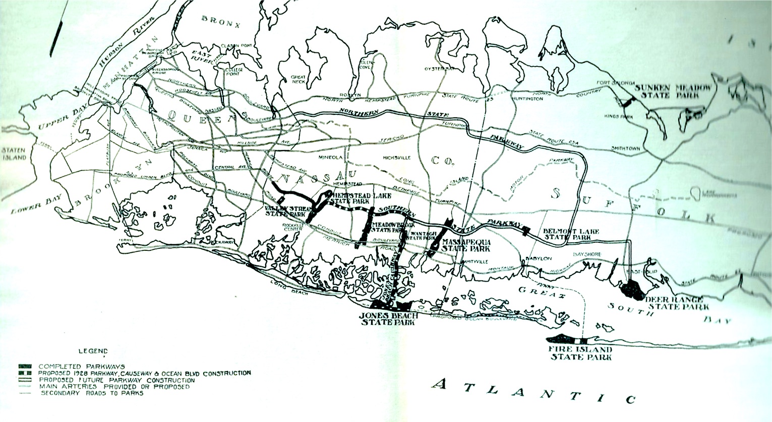
Published by the Long Island State Park Commission in 1927 as part of a 116 page tourist book highlighting the Northern and Southern State Parkways as proposed future construction. Commission members included Robert Moses and Franklin D. Roosevelt. Notice Deer Range State Park which was renamed Hecksher (e.g., August) State Park.
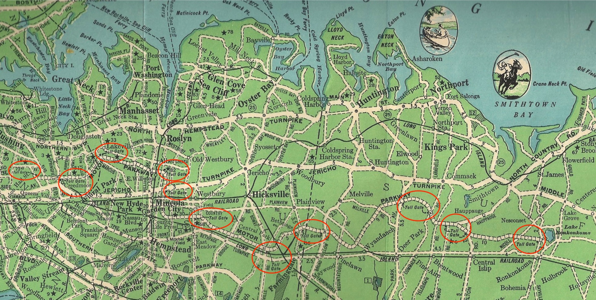
1928 Sunrise Trails map published by the LI Chamber of Commerce showing Toll Lodges, golf clubs, auto ferries, etc.
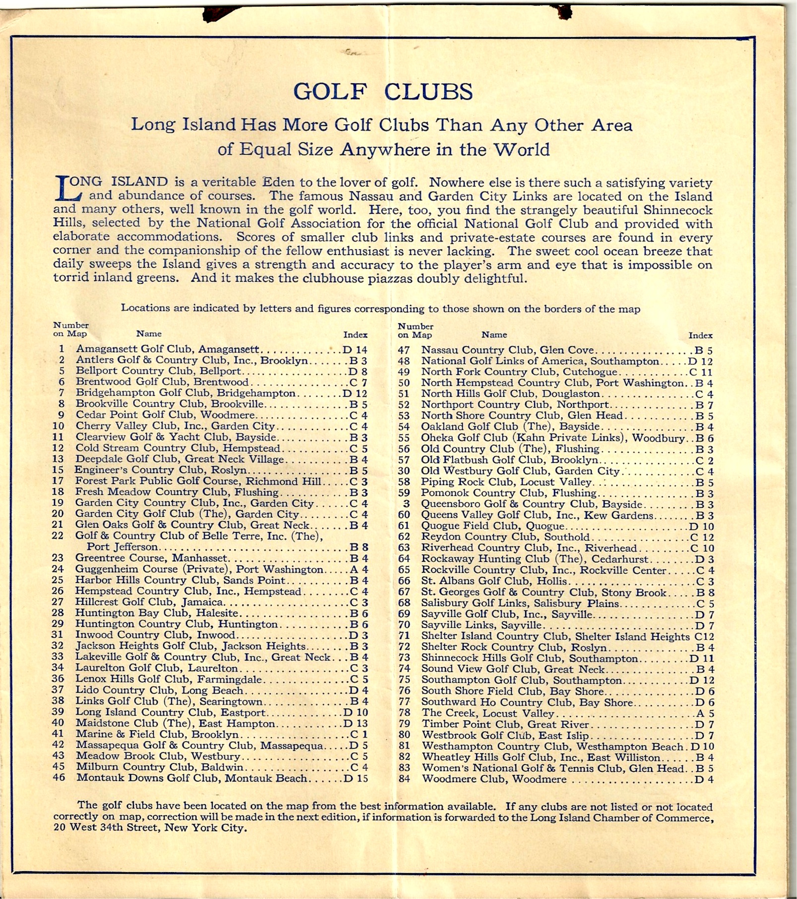
Interestingly one would think there were 84 golf clubs as shown, but not all numbers are on the list (e.g., 4 and 16).
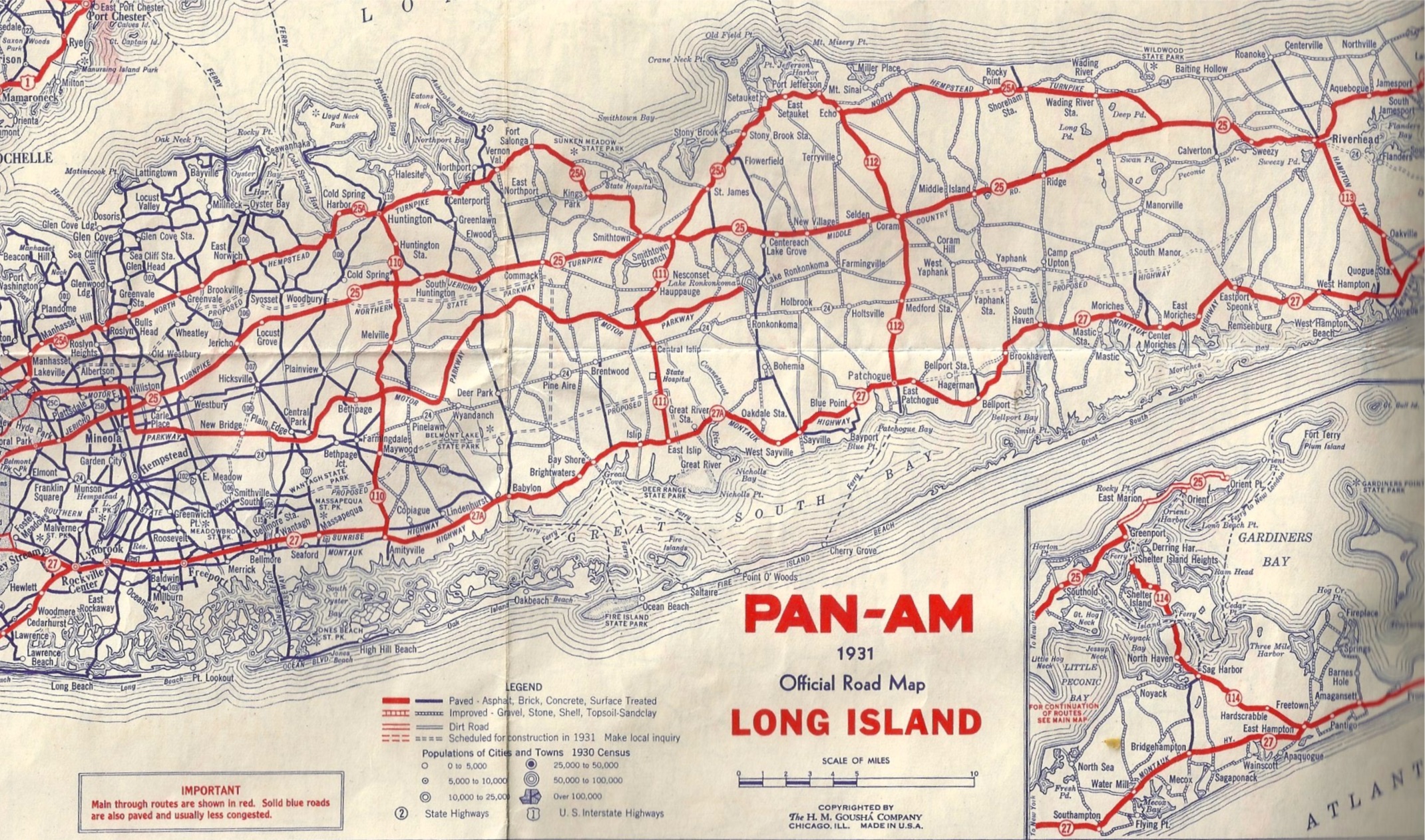
No, not Pan-Am airlines, but Pan-Am Motor Oil. The state parkways are still proposed. 1931 The H.M. Gousha Company
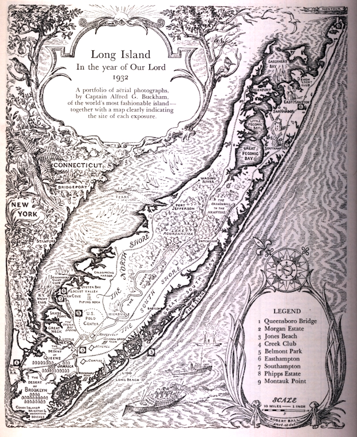
Love this one from Fortune Magazine of 1932.
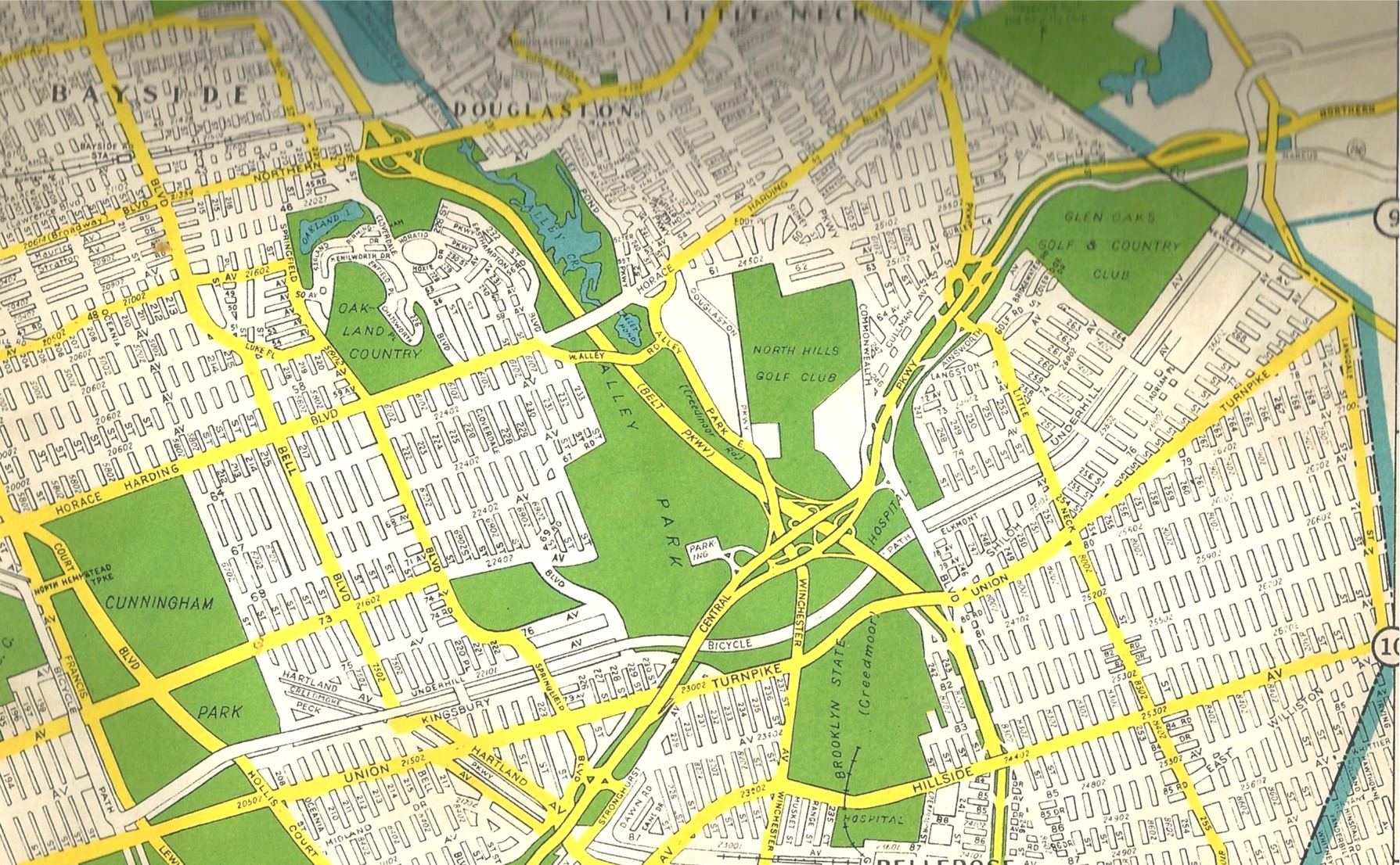
Hagstrom map of 1944 showing the Motor Parkway as a bicycle path through Queens.


Comments
I blew up the 1911 NYT map but it’s too blurry to read; the eastern terminus and Lake Ronkonkoma seem oddly displaced, relatively. Thanks again, Art, for this fab. thread. Sam, III
Sam, The location of the Parkway ROW on the 1911 NYT map is pretty accurate. Prior to the determination to end the Parkway at Lake Ronkonkoma, the ROW to Riverhead was south of the lake with a spur to the Inn. The Parkway had already acquired several parcels of land just south and east of the Lake prior to that decision.
Wonderful research, Art. I sure do wish the maps were larger and readable in many cases. Is this possible? Regards, Steve
Thanks Steven. Some maps are taken from newspaper archives which sometimes aren’t digitized clearly at the source. I have a few more map posts coming up in which I’ll try to increase the resolution.
Howard and Art, I ran across this map, https://en.wikipedia.org/wiki/Long_Island#/map/0, on which it is amazingly easy to trace virtually the entire length of the LIMP RoW. One more resource. Sam, III
I didn’t realize I grew up in the “Desert of Queens”! It’s funny that the most desert-like part of Nassau Co. (formerly the eastern half of Queens, pre-consolidation) was the Hempstead Plains, central-to-south. The north sides of current Queens and Brooklyn were the rich farmland and woodlands of the townships of old Newtown and Flushing (including Bayside) where I grew up and where my ancestors farmed.
Attached is a hand drawn map previously featured in August, 2013 from a Sept. 1907 issue of Automobile Topics. Interesting caricatures depicting how politics and economic issues impacted the route of the Motor Parkway. And a rare view of the never to be built route between Lake Ronkonkoma and Riverhead.
http://www.vanderbiltcupraces.com/blog/article/anatomy_of_a_1907_cartoon_how_the_motor_parkway_becam_kinky
Don’t forget, folks, that the Wheeler Road and Ronk. exits led south to WKV (Sr.)‘s Idle Hour and Frederick Bourne’s Indian Neck Hall, among many other South Shore mansions. There’s still a Vanderbilt Wharf Marina in Oakdale, just east of the Grand Canal. Al V. - what happened to the land purchased SOUTH and EAST of Ronk. (again - please)? Sam, III
Sam - yes about the exits leading to Idle Hour from Ronkonoma - and the realtors used that as a selling point - see pics. 1909 and 1910 ads from The Brooklyn Daily Eagle.
From Art Keiner:
I found this picture in a publication named “The Wireless Age”, July, 1920 in a story about the New York Radio Central Station, which was to be a powerful transmitting station located near Rocky Point. While the Motor Parkway was not named on the map, it is very easily noticeable.
My father drove me all over the place, especially LI, and I remember one of the marvels of my world was an overseas antenna system (zillions of phone poles all wired together). As recall it was on the flat land of Hauppauge between the curve of the LIMP and Old Willetts Path and No. St. Pkwy./New Hwy. Those poles remained there until the Marcus Blvd. area (where I twice worked) was built up. I can’t find any reference to this array - anyone? Sam, III
From Art Kleiner
Hi Sam, you might be referring to the Mackay Radio and Telegraph Co. location as shown on the 1941 Hagstrom map here. I also have a 1952 Hagstrom which also shows it. The other two are from historicaerials.com and are from 1953 (still showing the building) and 1980 (showing the building’s footprint). The street named Wireless Blvd. is a reminder of the Mackay company. Send me an e-mail apart from the blog is you have any other questions about Mackay. An internet search produced a lot of hits pertaining to a lawsuit it was in back in the late 30s with the National Labor Relations Board and RCA among others.
Sam, Regarding the fate of properties the Parkway purchased east of Inn…. Almost all of the properties for the ROW east of the Petit Trianon were purchased in 1907 with just a few in early 1908. They were not an easy sell because most of those acquired parcels were only 100 feet wide and not all has road frontage. Some of the properties were returned to the sellers because they had covenants that required that the Parkway had to be built by a certain date. Some of the larger tracts were broken up and sold piecemeal but many of the properties were sold by Suffolk County at tax lien sales in 1939 because the Parkway had stopped paying the real estate taxes in the early 1930’s. Those properties not sold when the Parkway was dissolved were turned over to Vanderbilt personally who walked away from those in the tax lien sales.
Art, you’re a gem! Forgot all about Wireless Blvd.; used to use it. Since the polefield was on the left outbound and the right inbound, that kinda proves that we were on the LIMP (and, knowing Dad, that was probably the weekend it closed - I was all of FOUR). See, folks, I *TOLD* you so! That would have been in Dad’s new 1939 Dodge, with me standing in the back holding on the the rug rail for dear life. Al - minor detail, but just how were the unsold lots conveyed to Willie personally when they had been bought by the LIMP corporately; was he the guarantor? Sam, III