Kleiner’s Kolumn: Removal of the Roosevelt Field Motor Parkway Bridge
This installment of the series exploring the removal of Motor Parkway bridges documents plans from the Nassau County Department of Public Works pertaining to the Roosevelt Field Motor Parkway Bridge which connected Stewart Avenue and Roosevelt Field.
Location
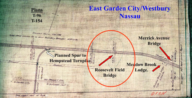
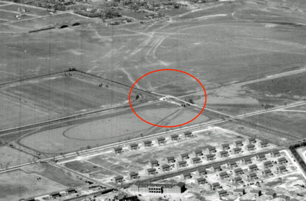
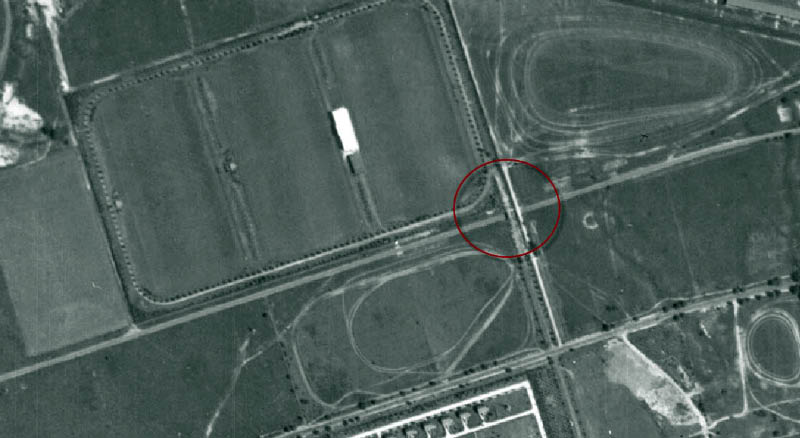
The bridge was located west of the Meadow Brook Lodge and the Merrick Avenue Bridge and was used to access Roosevelt Field from Stewart Avenue.
In Use
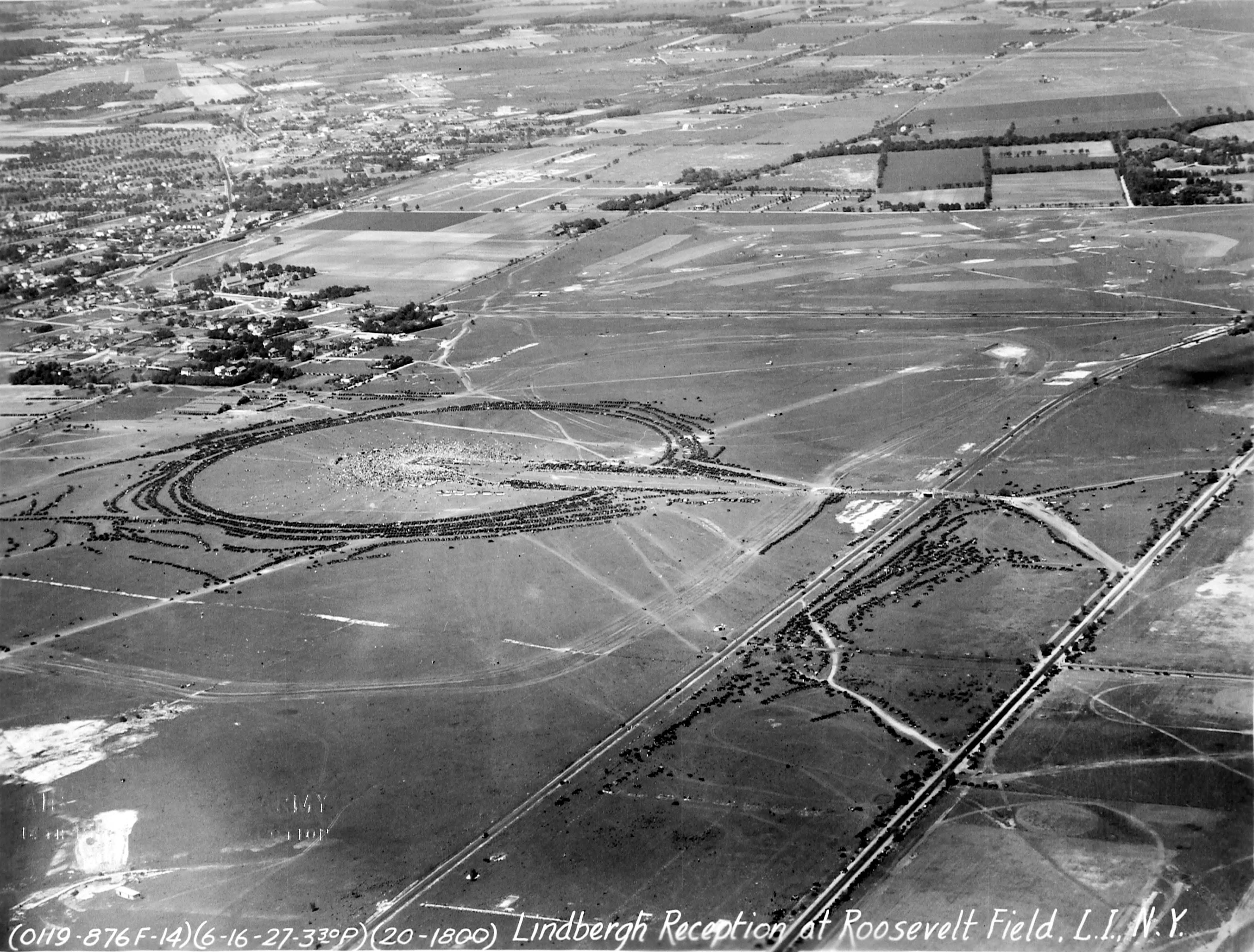
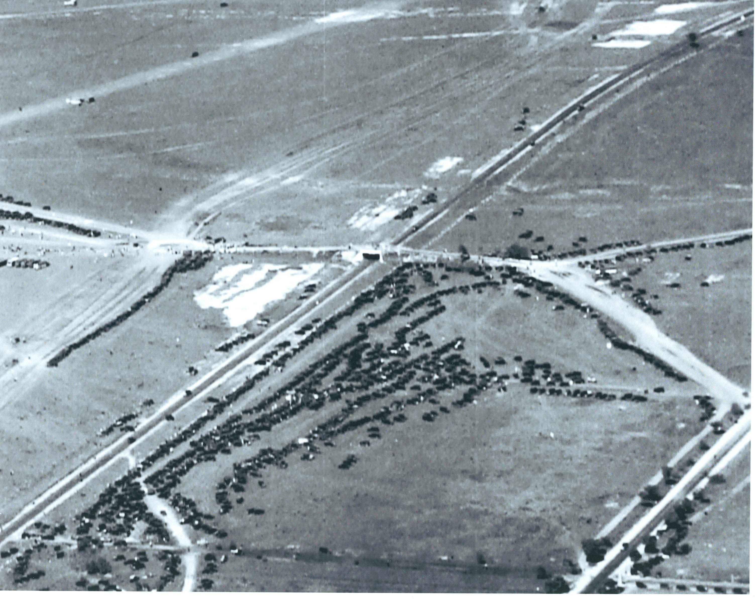
In 1927, motorists coming to view Charles Lindbergh used the bridge. The circular formation in the photo are cars lined up around the festivities.
Original Bridge Removal Plans
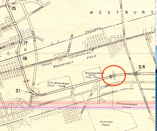
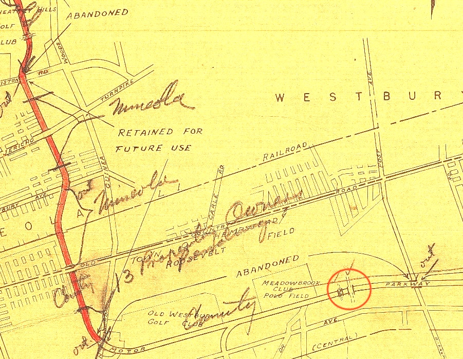
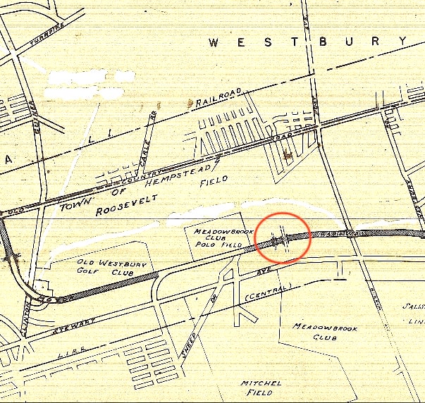
The bridge was not slated to be demolished in the initial round of removals according to Nassau County's original plans in 1938. Bridges 15, 21 and 24 were to be removed, while 17 and 18 were to be repainted. The unmarked bridge immediately to the west of the Roosevelt Field Motor Parkway bridge is the Meadow Brook Club Bridge that club built in the 1920s. (Nassau County Publish Works).
Courtesy of the Preservation Long Island.
Removal Plans
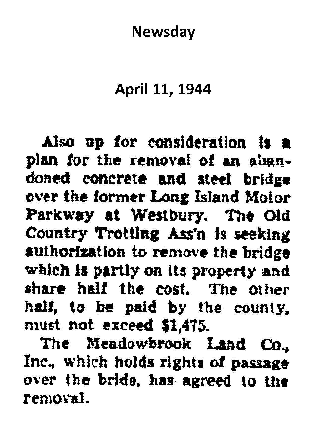
Discussions were held between Nassau County, the Old Country Trotting Association and the Meadowbrook Land Co., Inc. to remove the bridge. (Newsday, April 11, 1944)
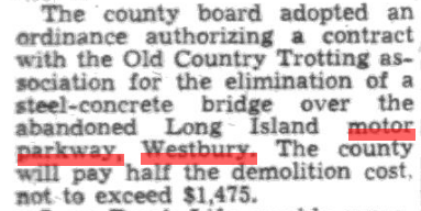
Resulting in a County ordinance being enacted the following week. (Nassau Daily Review-Star, April 18, 1944)
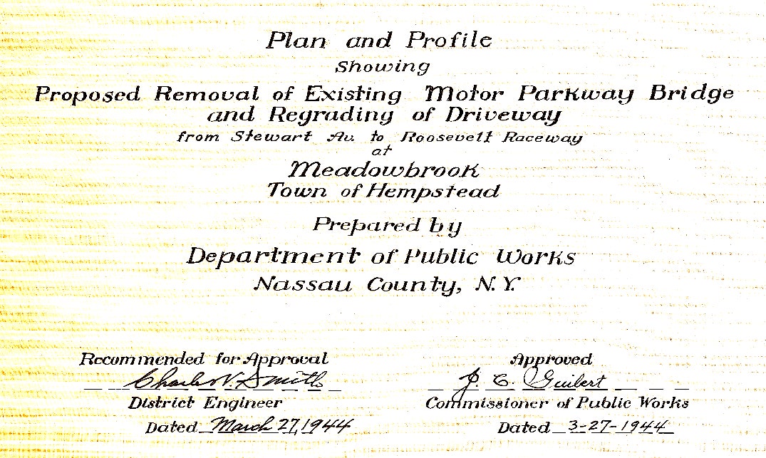
Plans were created for the removal and regrading of the bridge and its driveway in March of that year, even before the ordinance was enacted. (Nassau County Public Works)
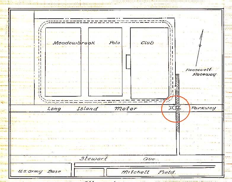
The bridge was on the south east border of the Meadowbrook Polo Club and north of Mitchell Field.
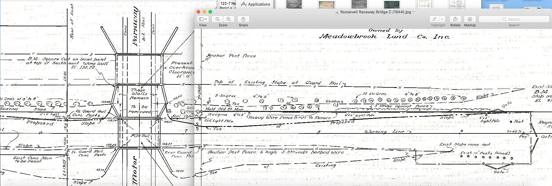
Details included existing placement of bushes, guard rails, concrete posts, light posts, barbed wire and which walls and fences were to remain.
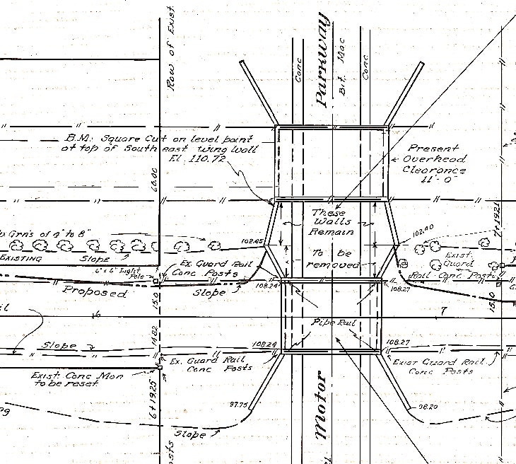
Close up of main part of bridge
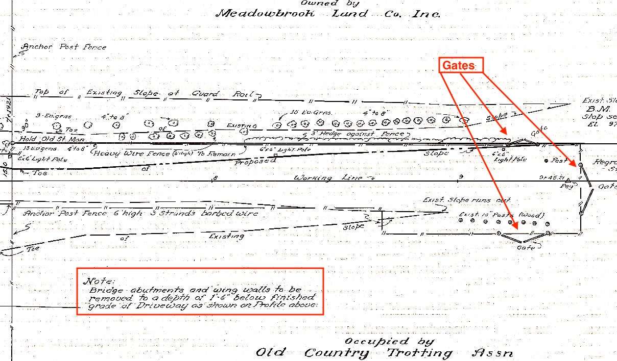
Close up showing plans for the east side of the bridge. Note that the bridge abutments were to be removed to a depth of 1'6" below the grade of the driveway. Interestingly, there is a set of gates on the north and south sides of the location along with a gate on the edge.


Comments
Very interesting maps and documents. I note that it appears that the Trotting Association must have purchased some property near the bridge from Nassau County between the 1938 closing of the LIMP and 1944. Makes me wonder how many parcels both Nassau and Suffolk sold within 10 years of taking title. Who were the buyers? That could be the subject of future investigations and blog posts. Thanks for the good work Art?
The twin bridges! They weren’t so ‘twin’ after all. Great details here Art. The original LIMP bridge to the east (1909-1940’s) was slightly longer than the latter Meadow Brook Polo Club bridge (1920’s-1940’s). If I read this correctly it looks like the shorter Polo bridge was first to go in ~1944. It appears there was a slight grade uphill as you headed east, but flat under the Polo bridge. and the height clearance of the LIMP bridge was only 11’0”, restricting travel for most modern day tractor trailer heights of 13’6”. As noted, the abutment walls were saved under the dirt below but I doubt they survived the MSP onslaught.
I stand corrected! These two bridges were swapped on the online LIMP map. Correction updated.
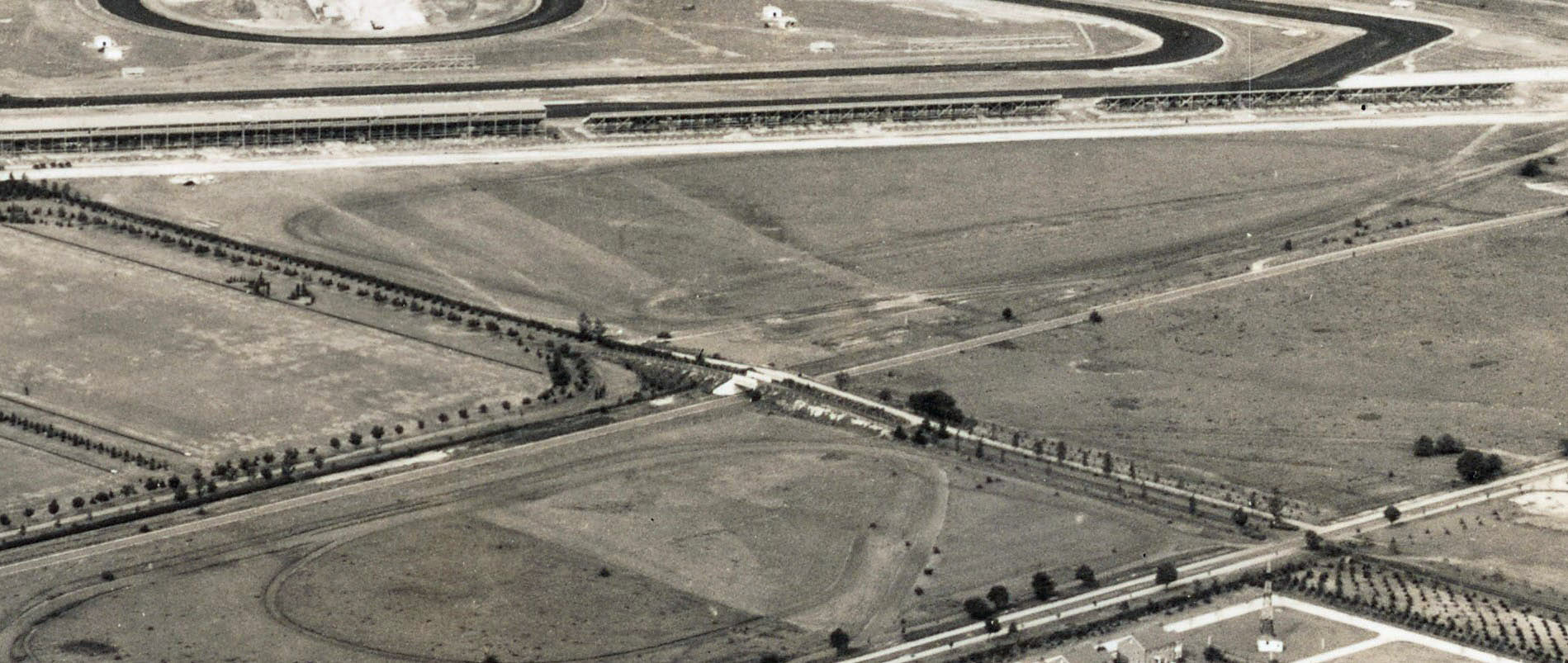
Here I am in my ‘think tank’ again : ). Upon viewing a closeup aerial ( below ), the wing walls of these bridges were literally touching each other like the sketch shows. Thought both bridges were demolished at the same time, but the 1950 aerial below shows the Meadowbrook Club Bridge still in use. The gates on the east ( sketch ), may be associated with the Mitchell Gardens Complex.
Did anyone notice that all three “Original Bridge Removal Plans” show the Mitchel/Hempstead Spur as reality? See the 14 Sep and 29 Oct 2013 blog posts. Sam, III
Good catch Brian. It now appears the LIMP Roosevelt Field bridge was the first to be removed as seen in the 1950 aerial below, sometime between 1944-1950, possibly after 1945, after the end of WWII. The bottom 1951 Newsday photo was taken from the Polo bridge, with the car parked where the LIMP bridge once stood.
Sam- I too noticed the proposed tail of the Hemp Spur. I’m not entirely sure where exactly it was planned to be built but I believe the spur was to be further west and closer to the Clinton Rd bridge curve. But that finding doesn’t jive with the Motor Pkwy Atlas. Another interesting subject.
I became ‘lost’ with my sense of direction with the 7th image under ‘Removal Plans’. Thinking East was to the right, but South is right ( 5th image under ‘Removal Plans’ ). The South Gate is at the entrance road north from Stewart Ave, leading to The Meadowbrook Club Bridge. Feel free to correct me if wrong.
Yes Sam III, I noticed this. LIMP Corporation must of donated these maps to Nassau County. I only noticed what was Sheep Dr on older Topo Maps. Must of been a livestock route : )
As a point of reference, the proposed Mitchel/ Hempstead Spur would have run north / south along the approximate route of West Road on Mitchel Field (notice the misspelling of Mitchel with two ‘L’s’ on some maps), about a block east of and running parallel with Oak Street (known as ‘Ave. E’ on Camp Mills).
West Road runs on, or ridiculously close to, what may have been Ave. F or G on Camp Mills, very close to the easternmost border of the Camp, necessitating the spur to cross Army property (not to mention crossing the LIRR right of way on the Central Line). One wonders, might that have been a factor in it never being built if the Federal Government refused to part company with it at the time?
In any event, the spur would have continued southward, skirting the property of Hofstra and rendezvousing with Hempstead Turnpike just east of the college, lining up with a proposed extension of Uniondale Ave. as seen in this map of February, 1908.
My above comment, Nov 8th, is wrong. The 3 gates on the NORTH are likely meant for the Trotting Association.