The Long Island Motor Parkway Survey Bookmap: Fresh Meadows- The Western Terminus
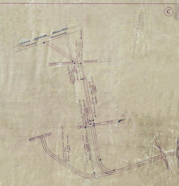
One of the treasures of my original Motor Parkway survey collection and a key to to the survey maps is a 22-page 1910 "Bookmap" documenting the right-of way, the original property owners, and the corresponding survey plan #s.The Atlas includes the entire 44-mile right-of-way with surveyor notes added in 1929 and 1930. Starting from west (Fresh Meadows) going east (Lake Ronkonkoma), here is the first page of the Atlas with an accompanying aerial and photos (click to enlarge).
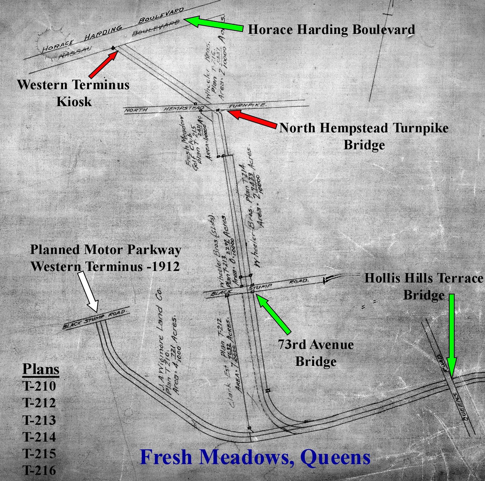
This is the Fresh Meadows page of the Bookmap. I have added captions for the key Motor Parkway structures including the Nassau Boulevard terminus and kiosk, the North Hempstead Turnpike Bridge and the 73rd Avenue Bridge (then called Black Stump Road). Note the two Motor Parkway curves at the bottom of the page. The first curve was the planned original western terminus that was to end at 73rd Avenue.
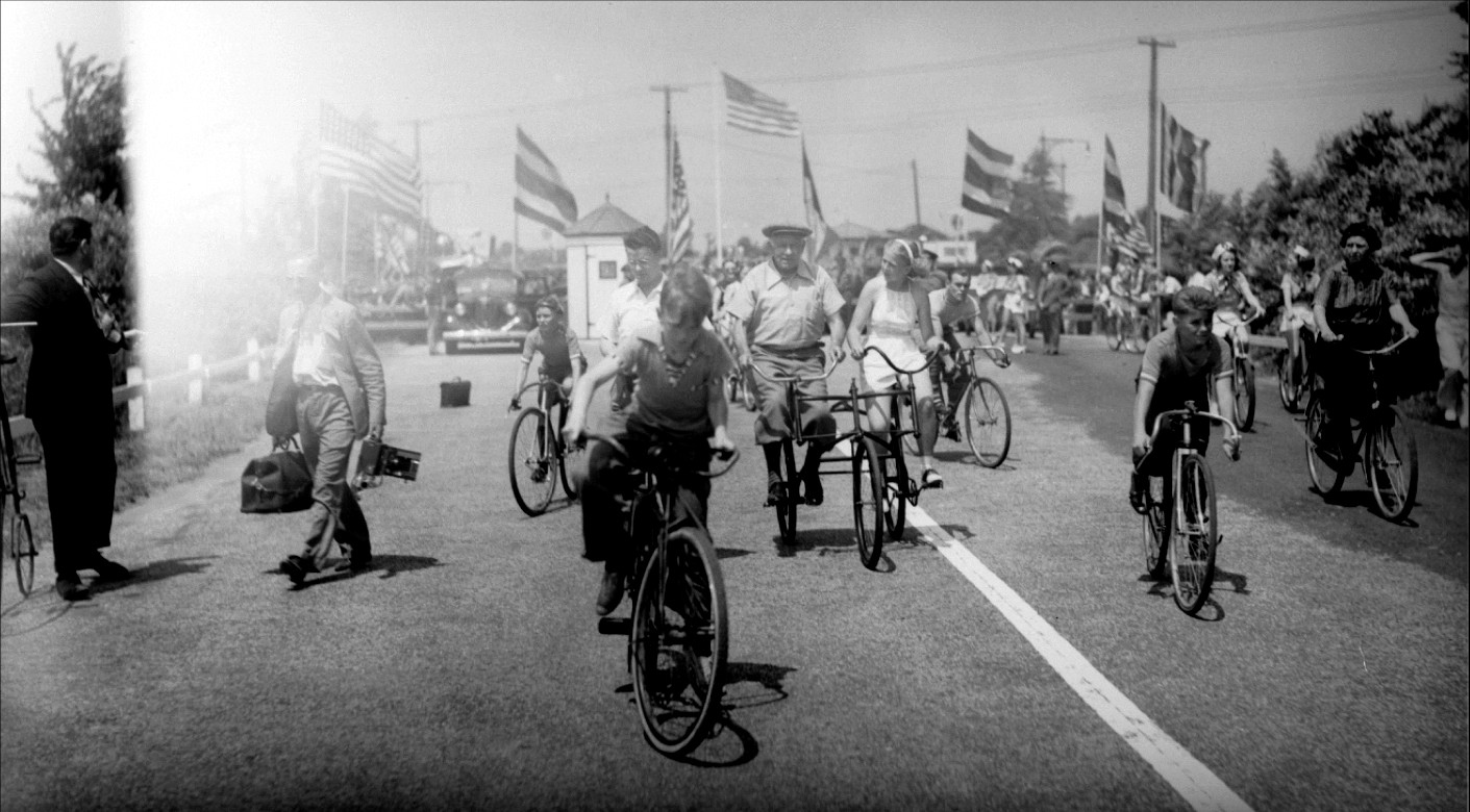
The location of the Motor Parkway western terminus at Nassau Boulevard as seen on July 9, 1938- the opening of Queens bike path after the parkway was closed.
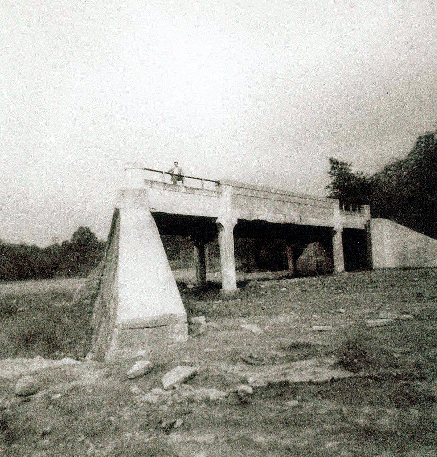
The Motor Parkway bridge that went over North Hempstead Turnpike as seen in the early 1950s.
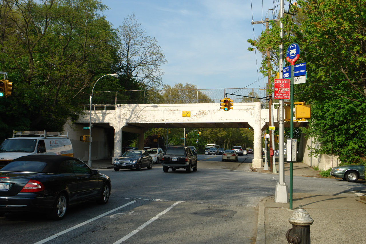
The Motor Parkway bridge over 73rd Avenue was built in 1926 and is still standing.
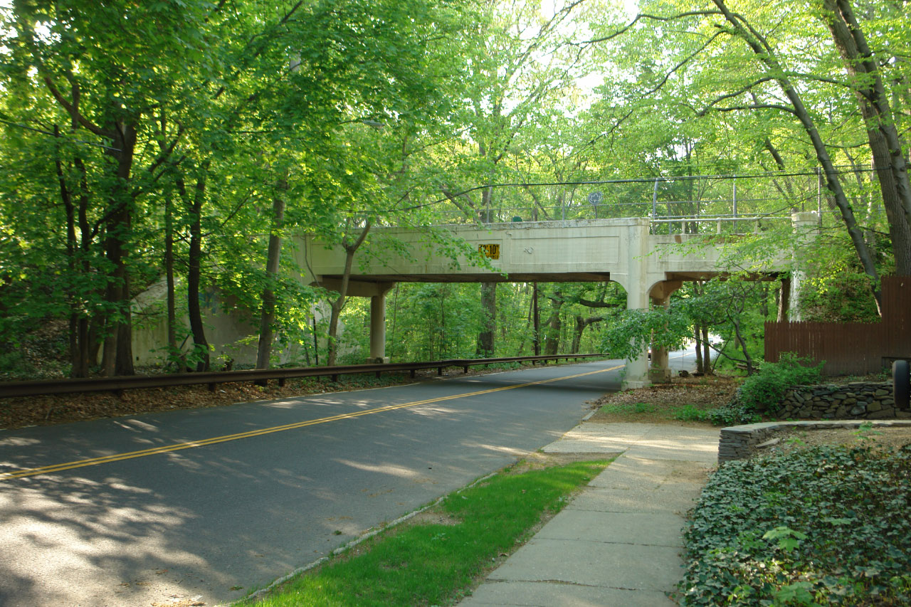
The beautiful Motor Parkway bridge over Hollis Hills Terrace in 2008. It is the second of three identical Motor Parkway bridges still standing in Queens.


Comments