Favorite Website: MyNassauProperty.com- 1926 and 1950 Aerials of Nassau County
The MyNassauProperty.com is a valuable resource on every residence in Nassau County. Last October, Brian McCarthy discovered that 1926 and 1950 aerials are embedded into the website.
Below is a guide to using this website and a help guide to finding the aerials with Lake Success as an example.
Enjoy,
Howard Kroplick
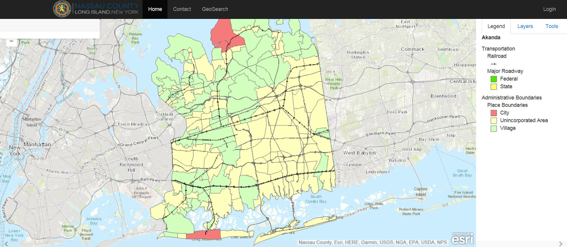
Click on map section of the MyNassauProperty.com website.
Place the mouse on the desired location and click

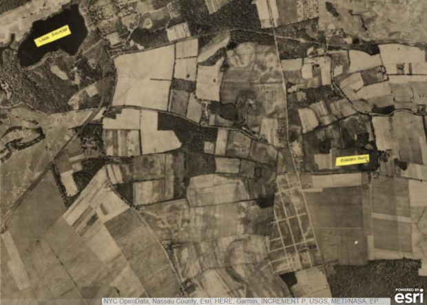
Zoom in by clicking or using the +/- . Example: The location of the Great Neck Lodge in Lake Success.
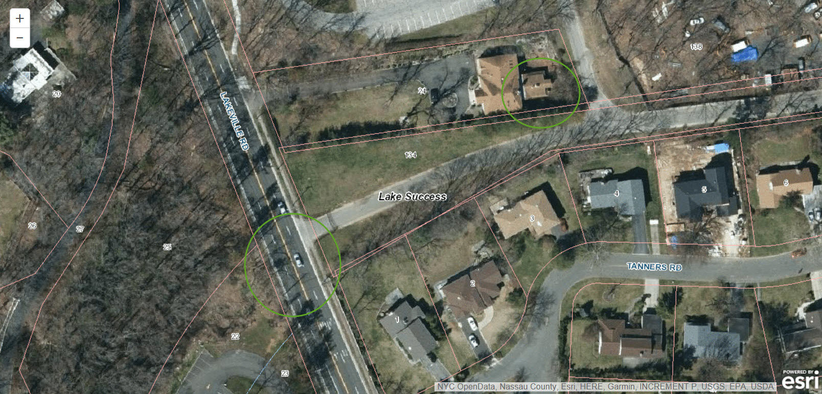
Keep zooming until the current aerial appears. Example: Sites of the Great Success Lodge and the Lakeville Avenue Motor Parkway Bridge.
Note: You may need to click on the corner to move the pseky address insert.
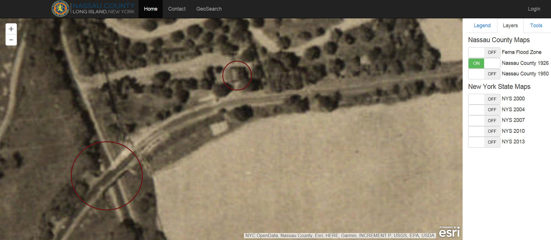
Click on the Layer tab and select Nassau County 1926. Example: Great Neck Lodge and the Lakeville Avenue Motor Parkway Bridge
Click on the Layer tab and select Nassau County 1950. Example: Great Neck Lodge and the site of Lakeville Avenue Motor Parkway Bridge
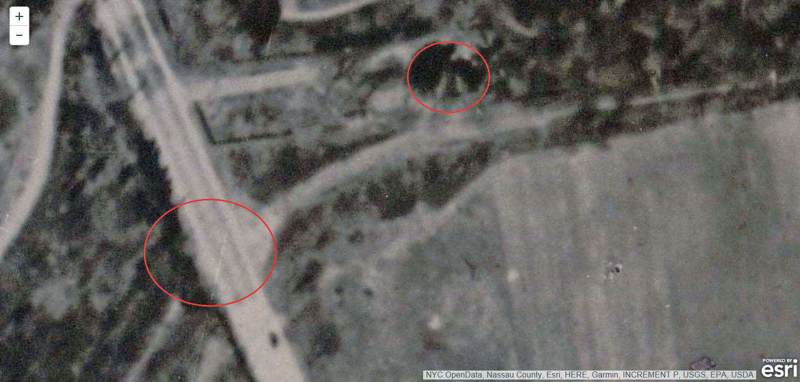
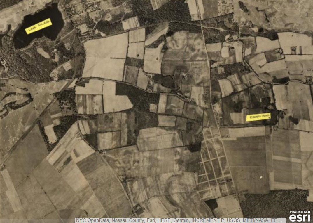
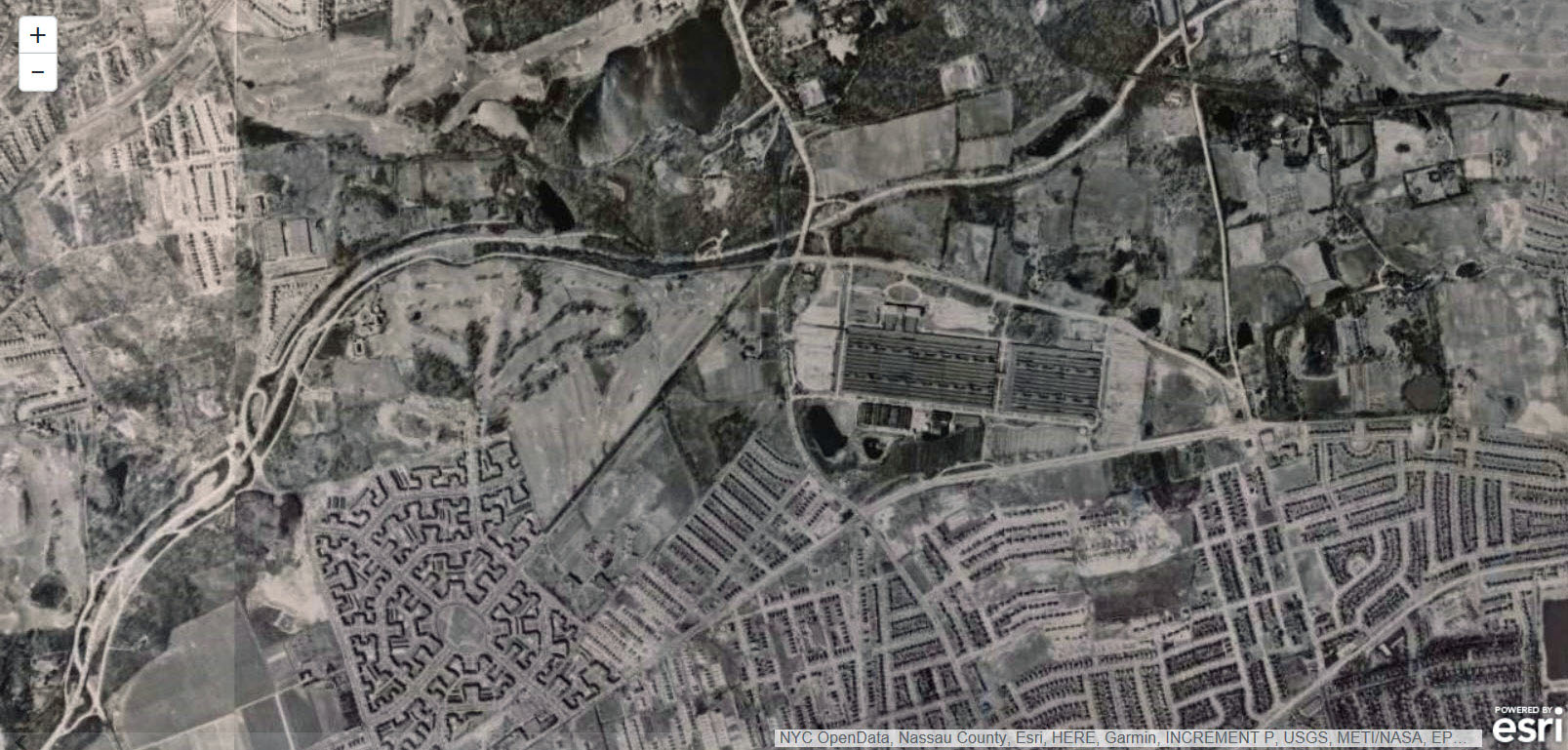
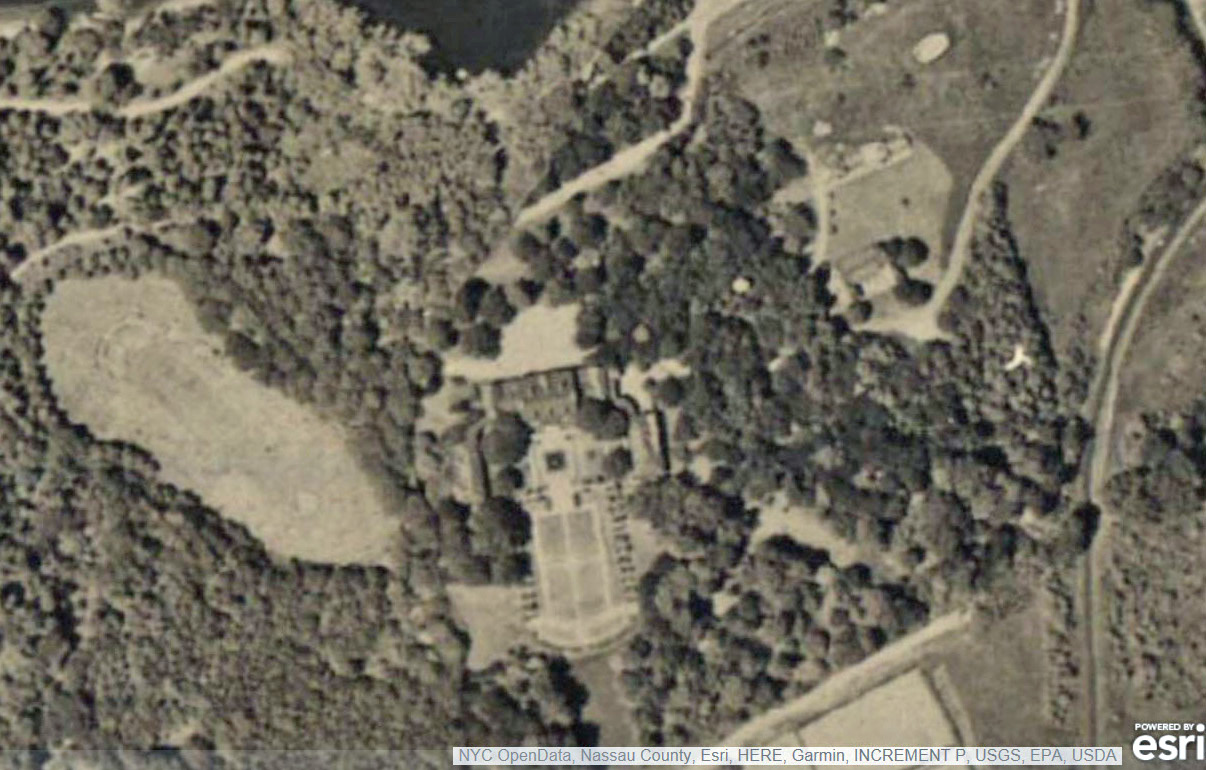
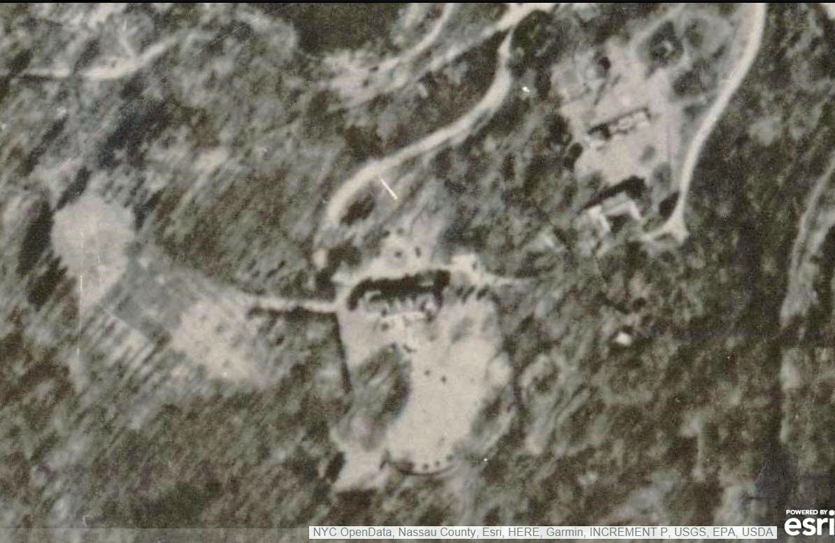
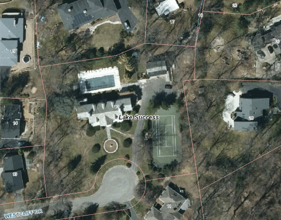
Lake Success: Then & Now
Then: 1926
Then: 1950
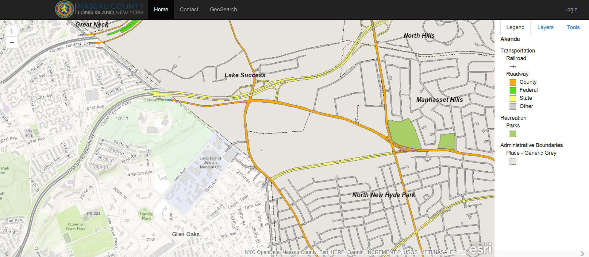
Now: Map
Deepdale Estate
Then: 1926
Then: 1950
Now
Lake Success Area- Northern State Parkway to Old Courthouse Road
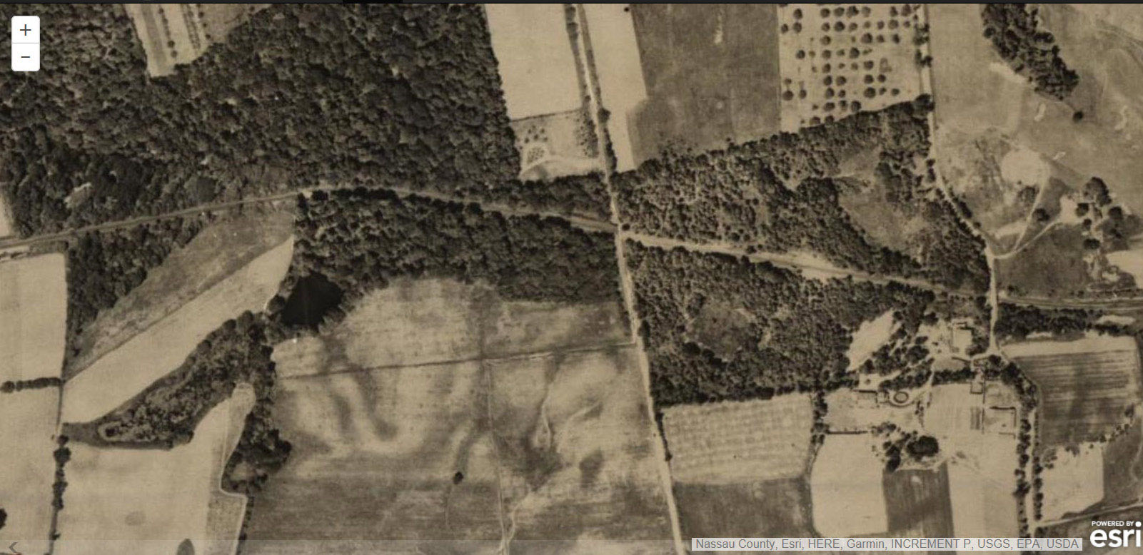
Then: 1926 Northern State Parkway had not been built.
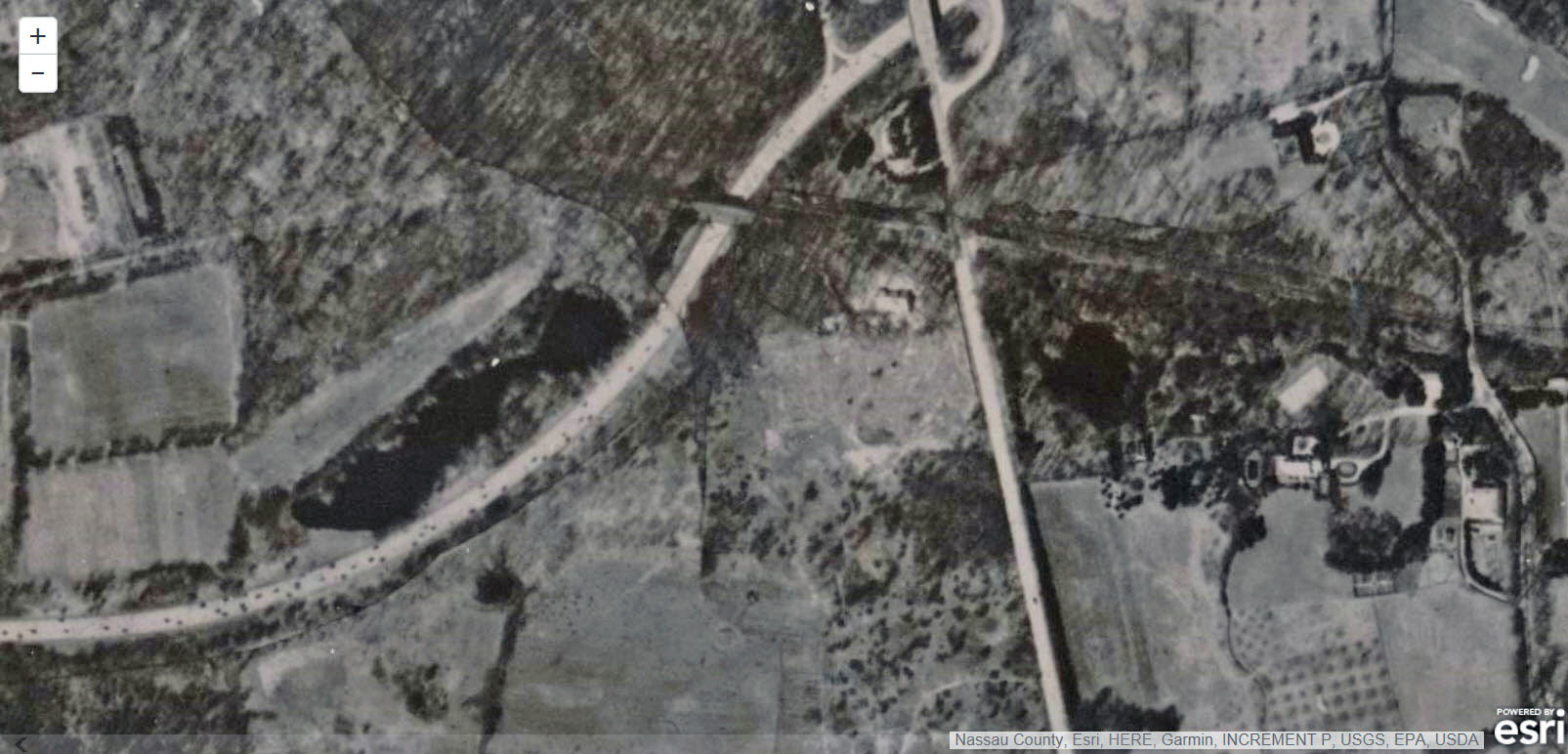
Then: 1950
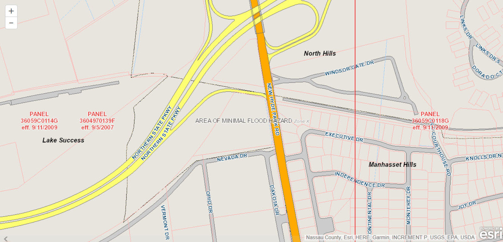
Now: Map


Comments
My original MP Panel idea was to extract an overlay of all the pix and maps relating to the LIMP and post it with a key to (or copy of) the current Hagstrom’s. Langenschweidt was amenable to some such arrangement. A later finesse (when such became available - my, how OLD is all this?) was to have added GPS points. Is there any interest in continuing with this notion? Sam, III
_____________________________________________________________
Howard Kroplick I
Sam , I believe Wayne Consolla’s Google Map of the Motor Parkway provides one type of overlay:
https://www.google.com/maps/d/viewer?ll=40.77848579025074%2C-73.45081299999998&spn=0.11244%2C0.264187&dg=feature&msa=0&mid=1b9GM_MA5G3EiZ7GyUDHjSTmwffM&z=12
Looks promising. I’ll try it when I have a chance! Thanx!
May have mentioned this before, but I came across this site without intention. The 1926 aerials are amazingly clear. Suffolk County has a similar website, but I think your already aware of this; Howard. From what I noticed, other subscribers here are enjoying the site!