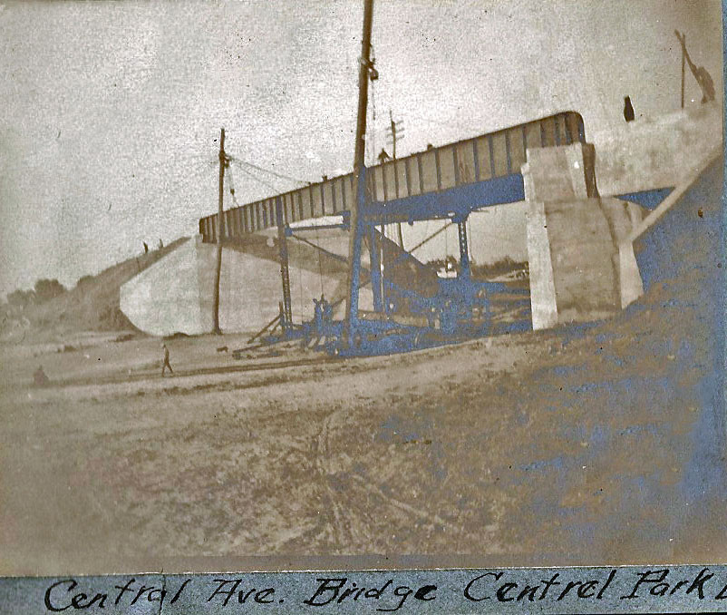
Updated: Clinton Robertson Photo Album: Central Park Avenue/LIRR Motor Parkway Bridge in Bethpage
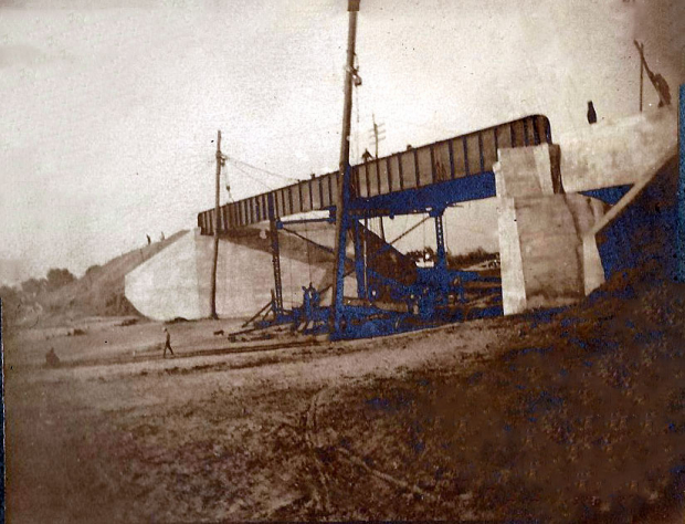
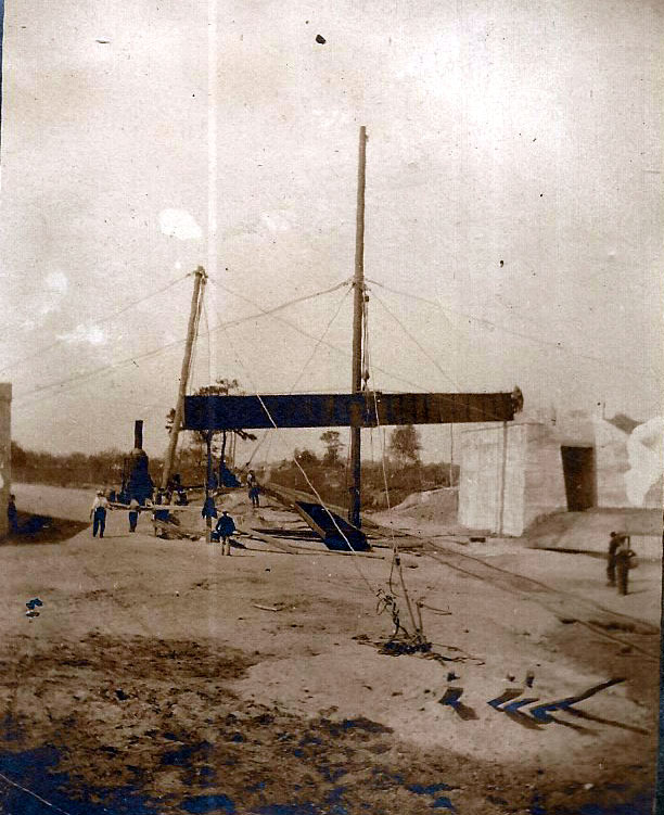
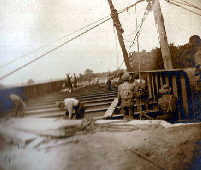
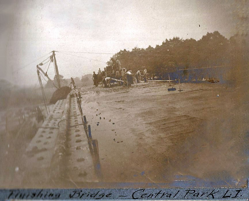
In the second of the new series of photos from surveyor Clinton A. Robertson's recently discovered construction album, the construction of the largest Motor Parkway bridge located In Central Park (Bethpage) is featured.
Clinton A. Robertson's Long Island Motor Parkway Construction Photo Album
While working as a surveyor on the Long Island Motor Parkway in 1908 and 1909, Clinton A. Robertson (above) documented the Motor Parkway construction and his fellow workers with his trusty camera. Lost for 109 years, Robertson's photo scrapbook with 84 amazing images of the Motor Parkway was recently purchased for $20 in a New Jersey flea market and resold on Ebay.
Enjoy,
Howard Kroplick
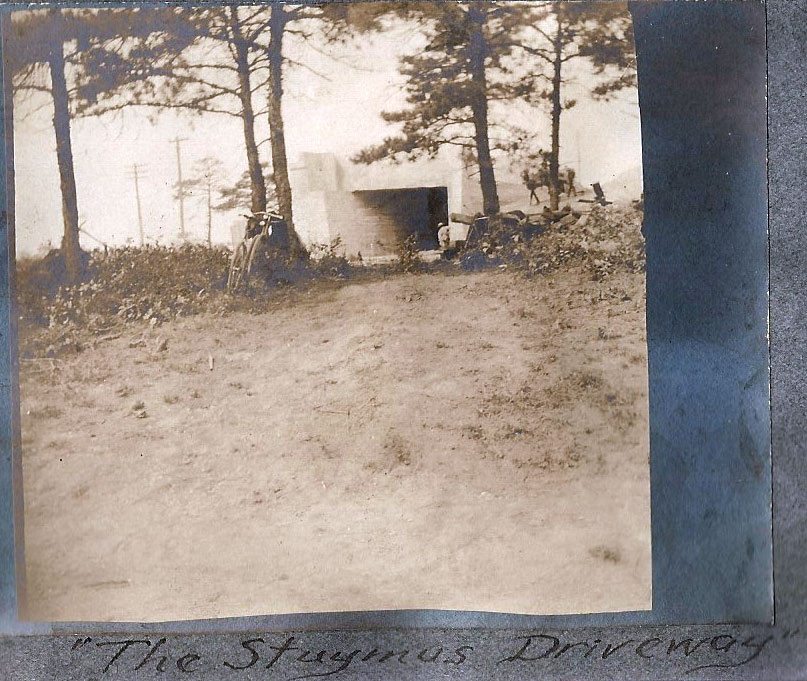
The concrete tunnel on the northside was referenced as "The Stymus Driveway".
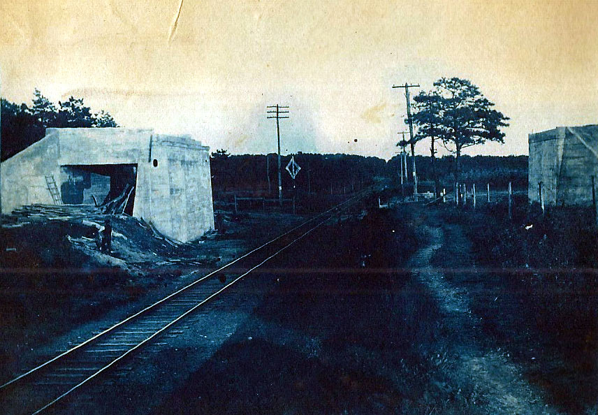
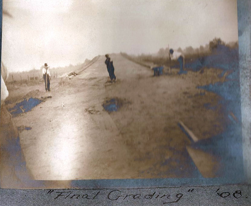
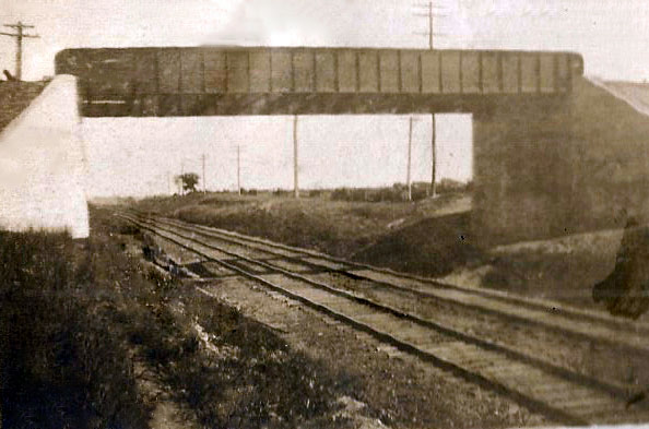
Correction (As commented by Brian McCarthy): Likely the Oyster Bay Branch LIRR Bridge in East Williston or Mineola


Comments
Thank you Clinton Robertson for documenting and thank you Howard Kroplick for preserving these great photos.
Near “Dead Man’s Curve” right?
________________________
Howard Kroplick
Near both Deadman’s Curve #1 and #2
This is like building a bridge 101! So glad this scrapbook was discovered!
Hope you don’t mind me pointing this out, Howard. I don’t believe the last image is the overpass for Central LIRR. There’s no bridge support like the Central had ( support between the tracks and Central Ave ). And there’s no road seen ( Central Ave was routed south of the RR after the overpass was removed. The RR became double track afterwards as well, but this image appears dated. ) Believe the last image could be the Mineola or Oyster Bay LIRR Pkwy Bridge.
_____________________________________________________
Howard Kroplick
Brian, good catch!
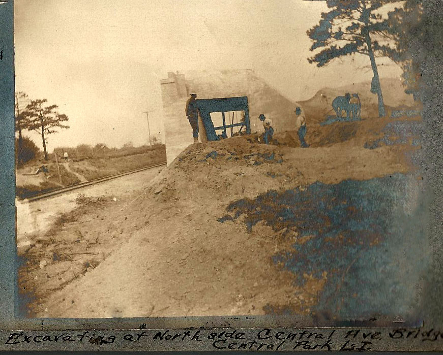
More rare first-photos, great stuff Howard! The third photo reveals the Central Ave dirt roadway without the overhead girder in place. It will soon be covered in darkness for the next 30+ years.
The last photo is mysterious; is it Mineola or Williston? Both locations had double tracks. Calling all RR experts for help.
I look forward for your rare photos—keep up the good work.
That last looks like the Main Line in Mineola; the Oyster Bay Branch bridge, between Albertson north of the LIMP RoW and Williston Park to the south west of the tracks and Roslyn to the east, is in a cut. It’s probably facing east, towards Carle Place and Westbury, or you’d see the Mineola Junction appurtenances (Mineola Road bridge, station, village, etc.). Sam, III
Wow! Barely related and purely coincidental, here’s a site with the most amazing and detailed railroad maps:
https://www.openrailwaymap.org/
You can zoom in on the LIMP/LIRR rights of way. Where geopolitical boundaries coincide with the LIMP RoW, it’s all there - William Street to South Street, and out around Islandia, just for example.
The level of detailed captioning is simply staggering! Sam, III
Sam - WOW! Nice find.
Great site Sam III, thanks!