Amazing Aerial Views of the Hempstead Plains/Levittown (1924 to 2012)
The heart of the Long Island Motor Parkway and courses for the 1908, 1909 and 1910 Vanderbilt Cup Races went right through the Hempstead Plains (now Levittown). These aerials show how this area dramatically changed from 1924 to today.
Enjoy,
Howard Kroplick
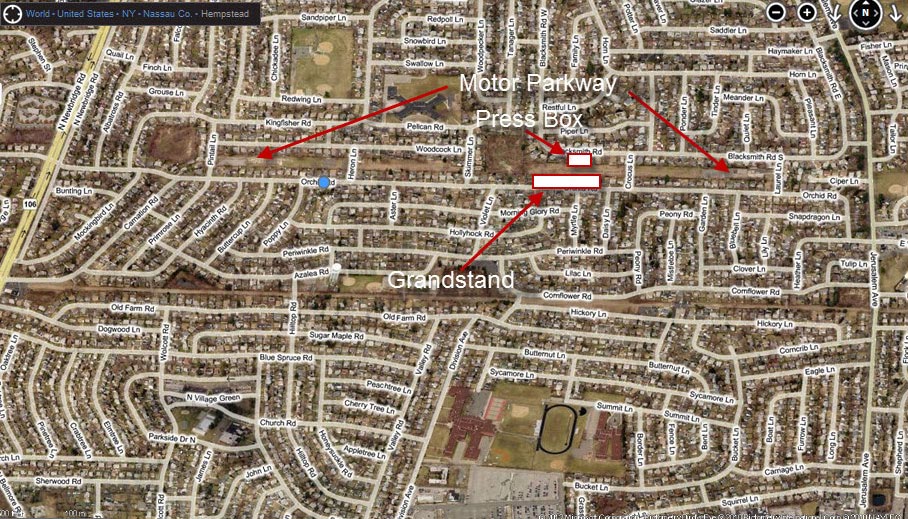
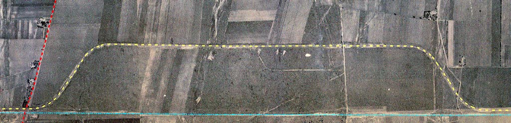 1924: The Motor Parkway is highlighted by the yellow dotted line. A road built to connect Jerusalem Avenue (on the center-right) to the former grandstand area on the Motor Parkway was still visible. Note: You can count the number of trees in this aerial.
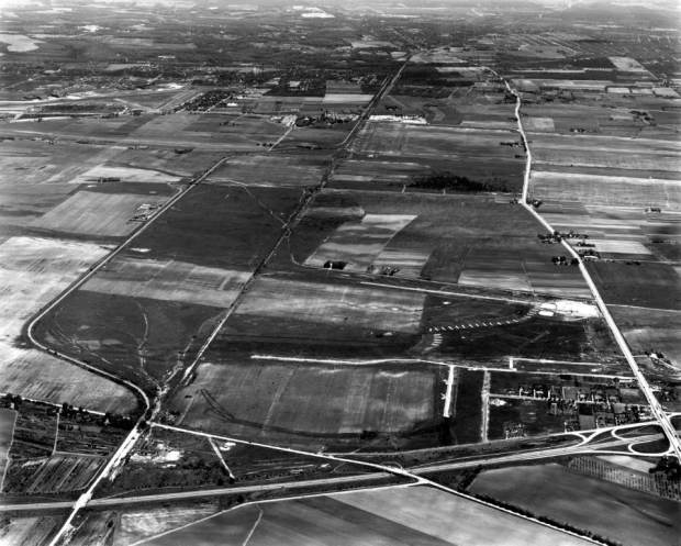
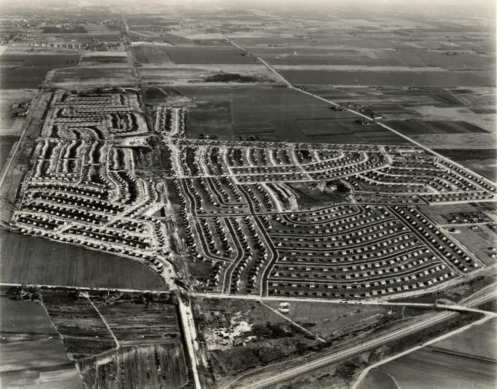
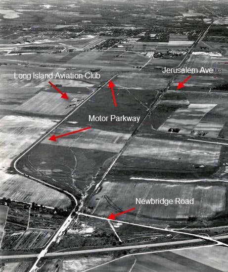 May 27, 1947: View looking east just prior to the building of houses by Levitt & Sons. The Long Island Aviation Club, one of the first private country club airfields in the US, can be seen adjoining the Motor Parkway.
 November 13, 1947: Only six months later, hundreds of houses had already been constructed. The Motor Parkway can still be seen in the backyards of houses located on Orchid Road.
 November 13, 1947: Another view looking east. The hangar and clubhouse of the Long Island Aviation Club were still standing on the far left.
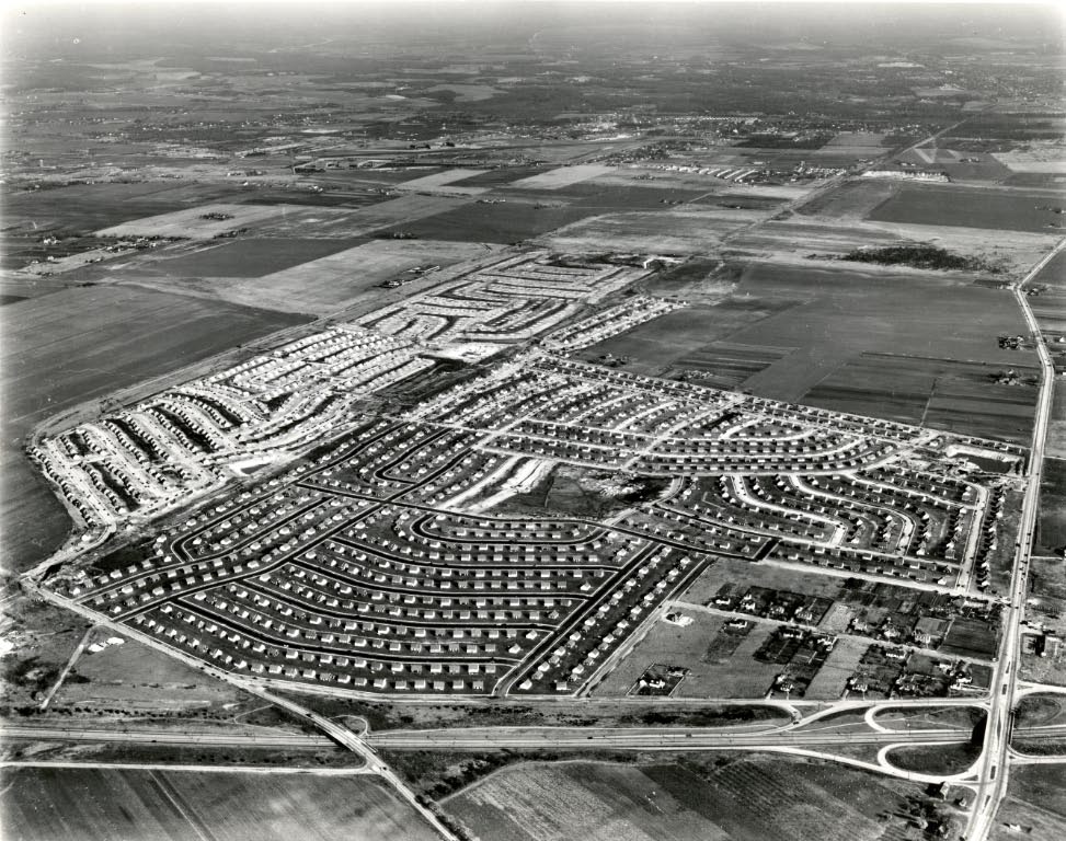
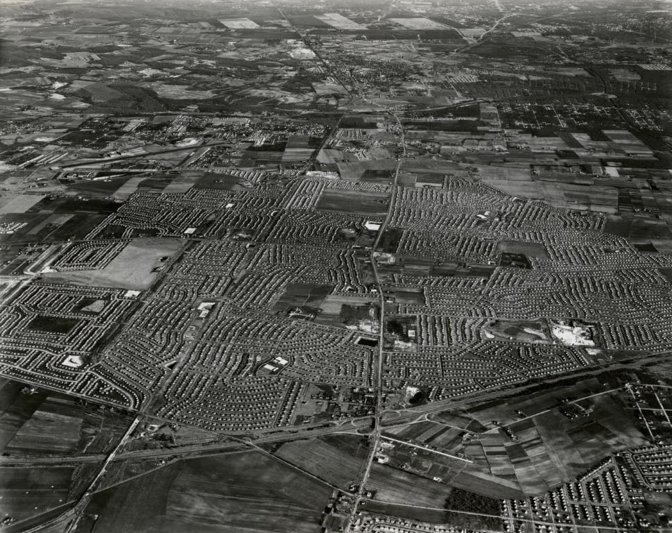 December 24, 1949: An amazing aerial showing many of the 17,447 houses built in Levittown and surrounding areas. No part of the Motor Parkway's right-of-way in this area was incorporated into the local road system.
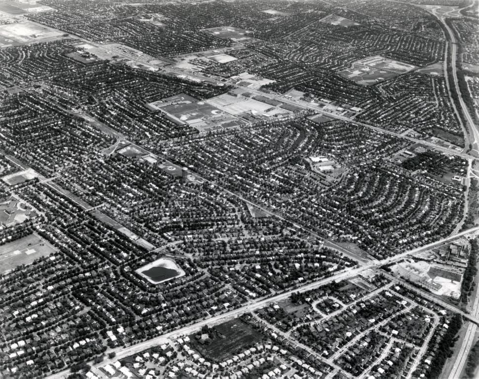 1967: View looking south-east. Wantagh Parkway can be seen across the bottom of the aerial.
 2012: This Bing "bird's eye" view matches the 1924 aerial.


Comments
Wow, great photos and also shows the destruction or perhaps the over built way most if not all of Long Island has become.
Really enjoyed the pictures both as an auto enthusiast and as an owner of a Levitt house.