Update: Pilgrim State Hospital Complex and the Motor Parkway in 1938
Responding to a comment from a former Brentwood resident, Frank Femenias and Brian McCarthy have provided new insight and aerials concerning the Pilgrim State Hospital section of the Motor Parkway (see Comments). The original post was the Mystery Foto #50 posted on December 18, 2018.
Enjoy,
Howard
Author Richard Panchyk challenged you once again to discover the Motor Parkway near this Long Island "landmark".
Answers to the Mystery Foto questions:
- Identify the location and orientation of the photographer
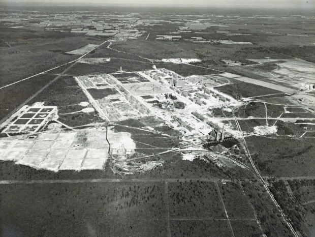
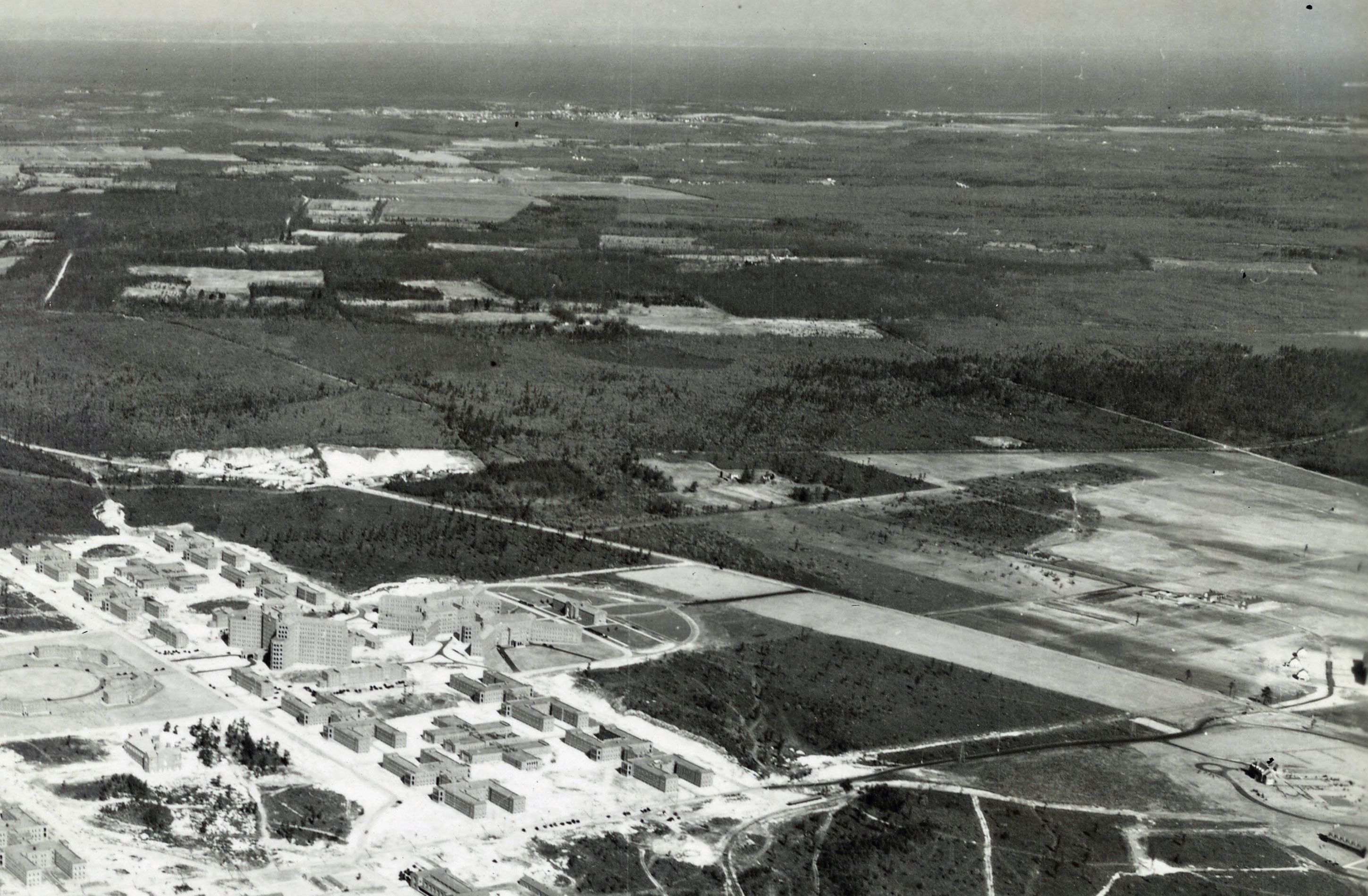
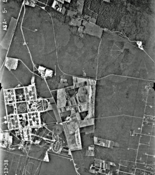
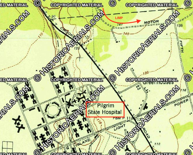
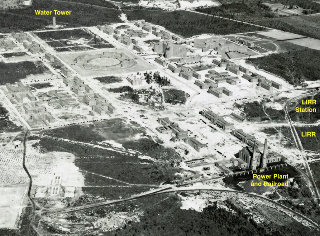
Brentwood looking north and northeast
- What is the building complex in the Mystery Foto and when was it built?
Pilgrim State Hospital built in 1929 to 1930 and opened on October 1, 1931. As a child, I considered these buildings the ugliest structures on Long Island.
- What is located on the complex today and the property on the far right?
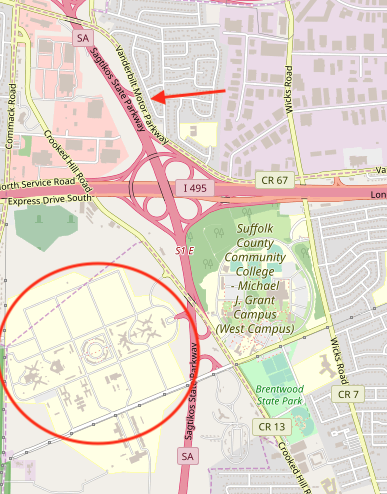
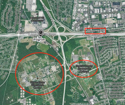
Pilgram Psychiatric Center. The eastern section, the former farm for the state hospital, became the western campus for Suffolk County Community College in 1974.
- Identify the roads that are not the Motor Parkway.
Left: Comack Road
Center Top: Crooked Hill Road
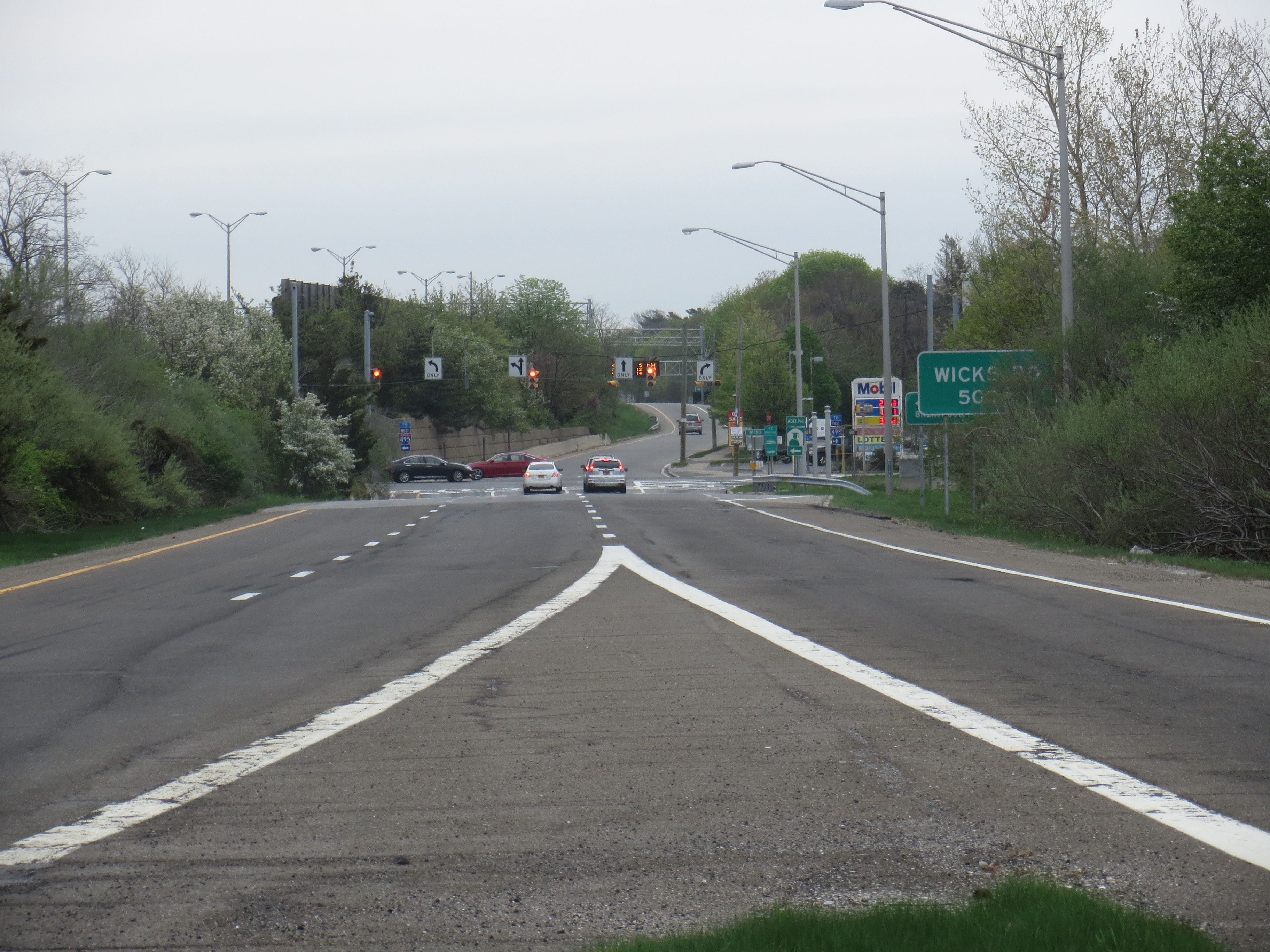
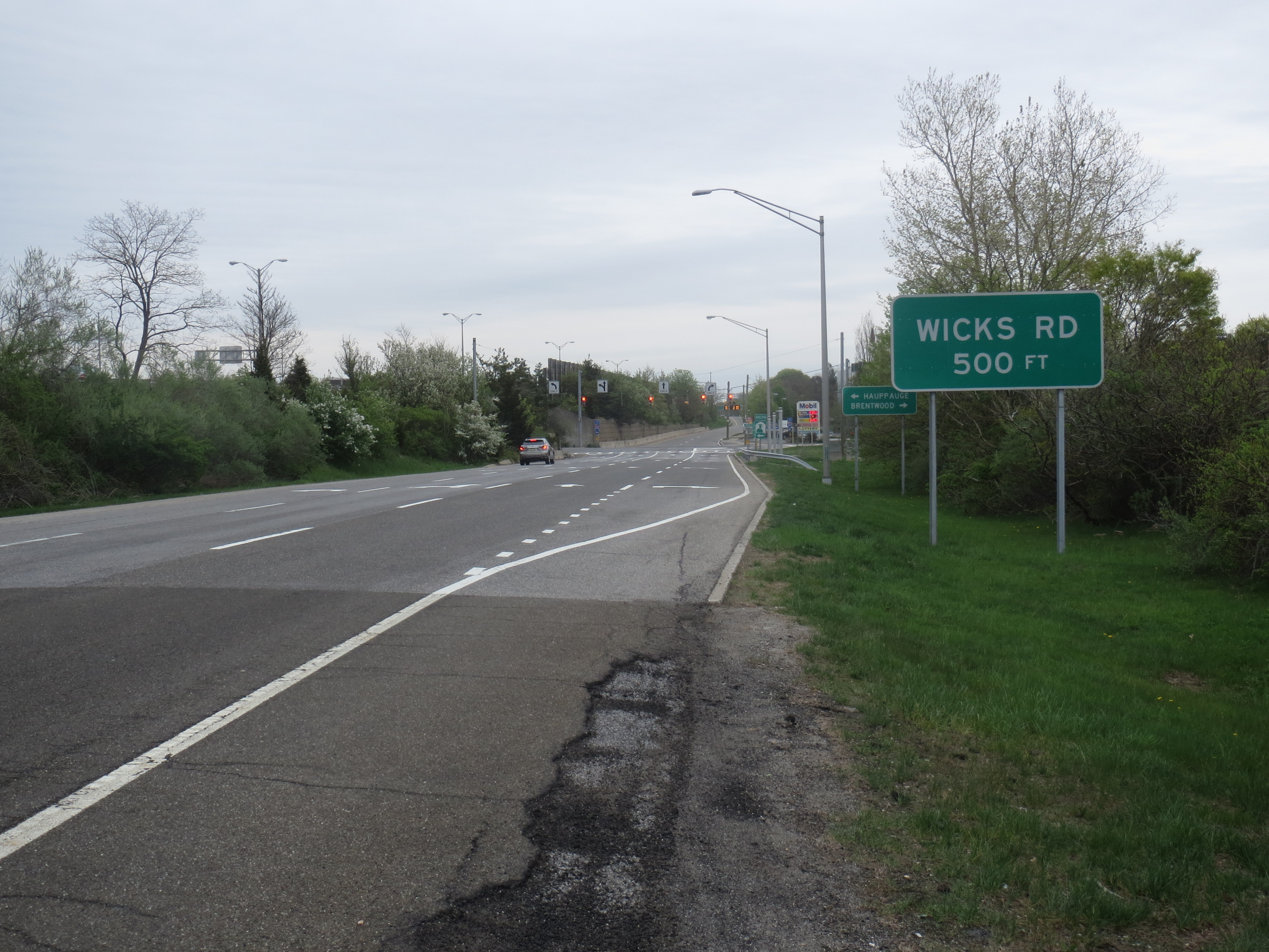
Far Right: Wicks Road
- Where is the Moto Parkway?
- Where is the Long Island Railroad?
See below comments and additional aerials.
- Kudos question: What is the date of the Mystery Foto? Provide a rationale.
February 13, 1938. The level of construction at Pilgrim State Hospital. The LIRR Spur was first used in 1934. The absence of Edgewood State Hospital buildings.
Comments (12)
Congrats to Denis Byrne, Greg O., Art Kleiner (see Kleiner's Korner), Eric Shaffer, Len Williams, Anthony Guardino, Brian McCarthy (see Brian's Bonus), Steve Lucas, Michael Kaplow and Frank Mendyk (see Mendyk's Discoveries).
Kudos to Greg O., Brian McCarthy, and Frank Mendyk for identifying the date of the aerial as 1938.
Enjoy,
Howard Kroplick
Close-Ups
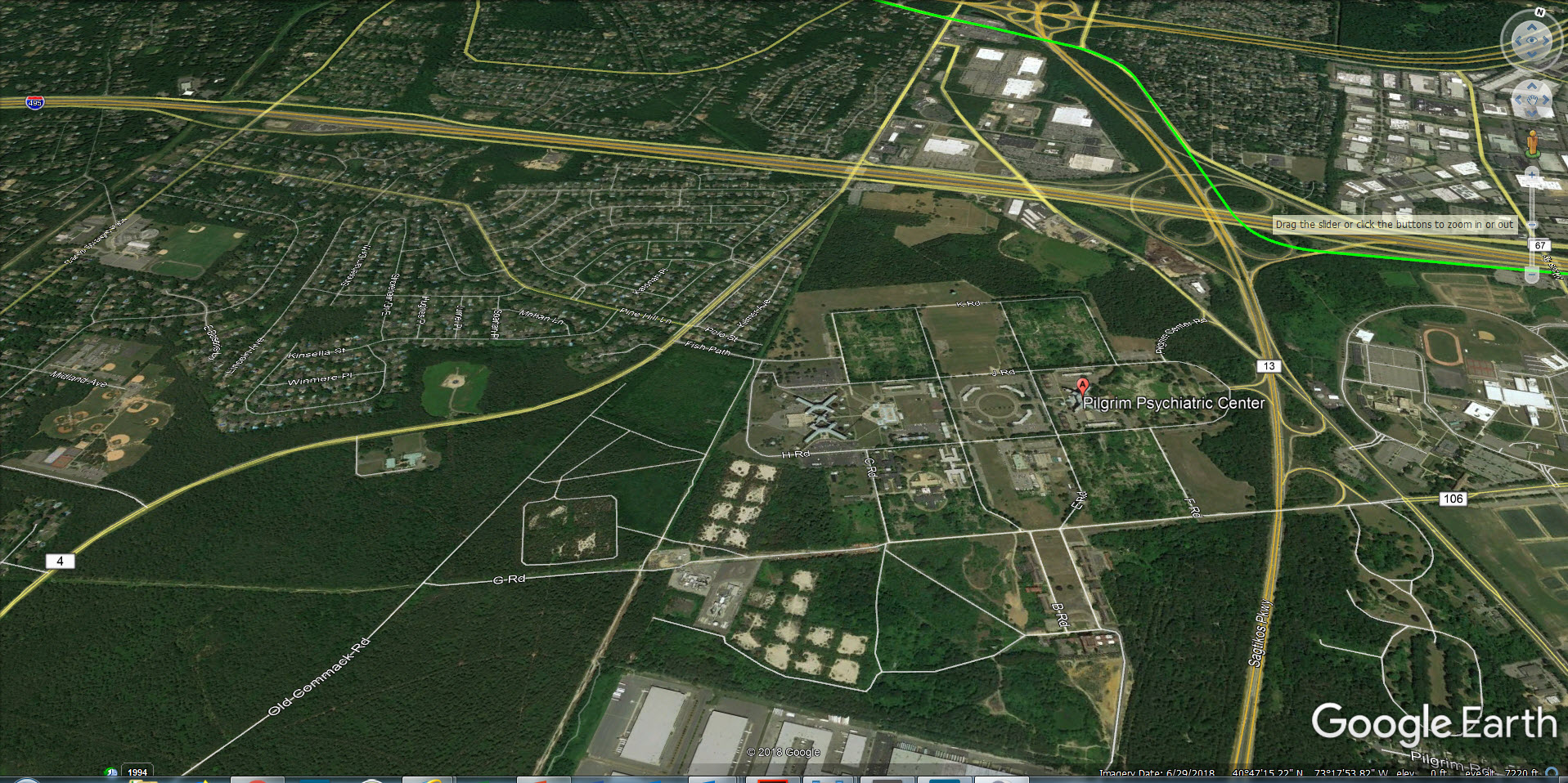
Current Google Earth View.
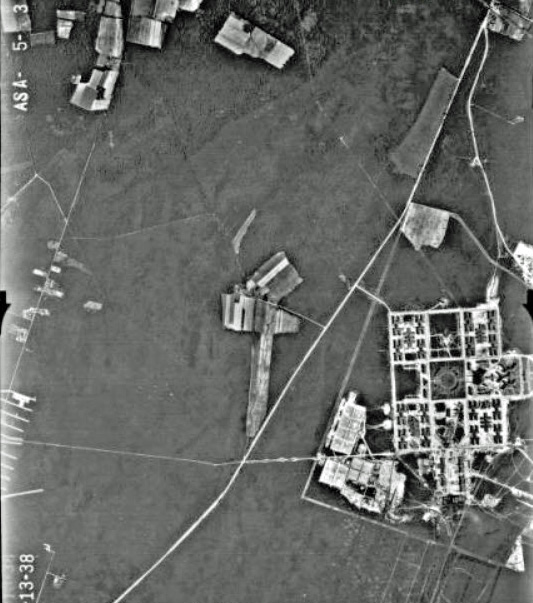
Brian's Bonus (Submitted by Brian McCarthy)
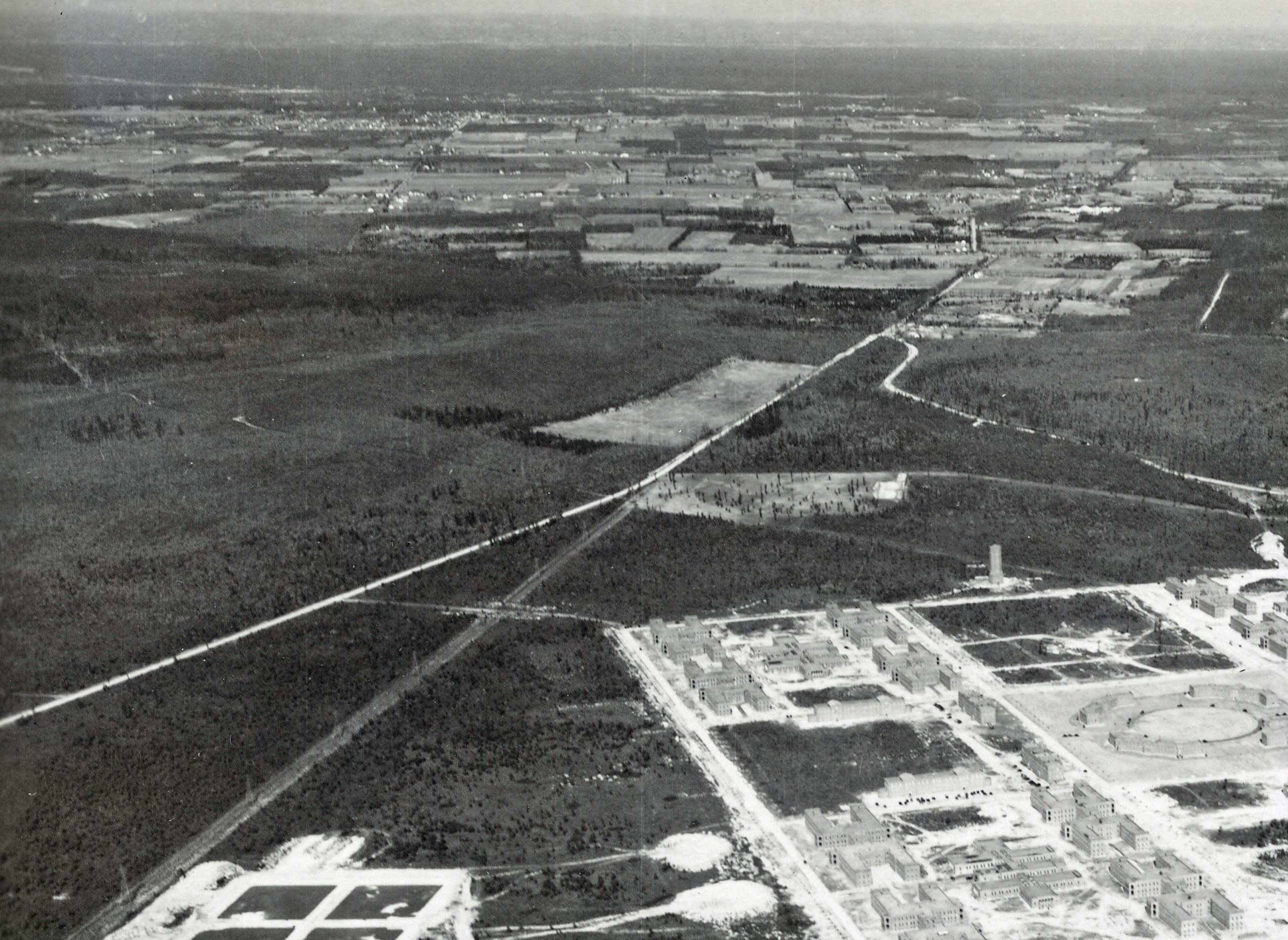
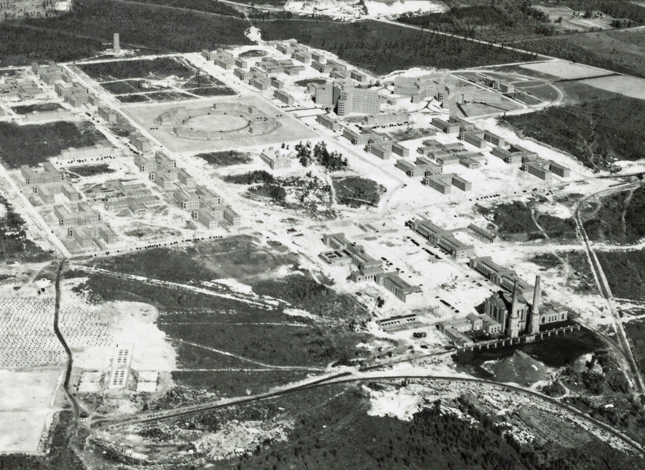
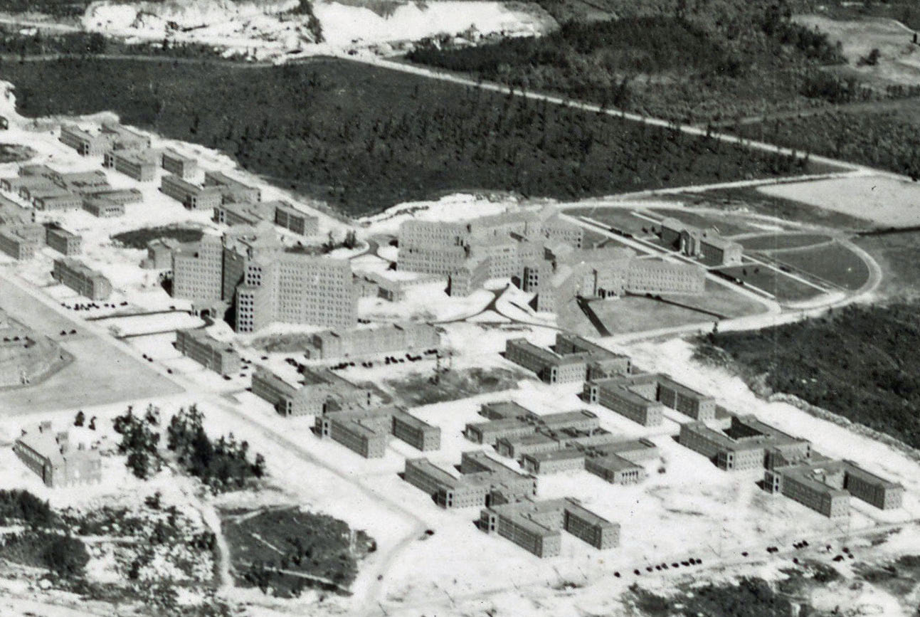
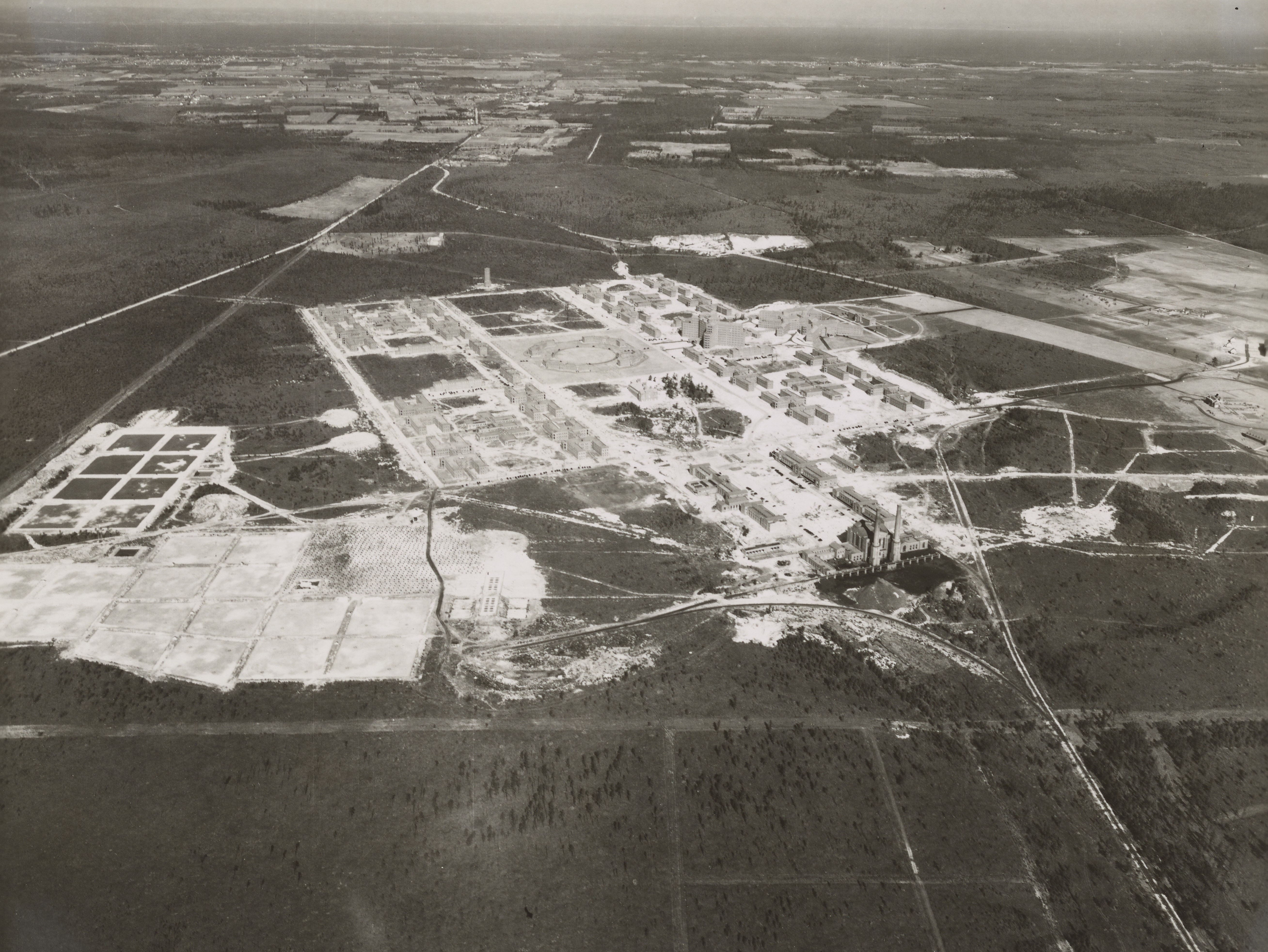
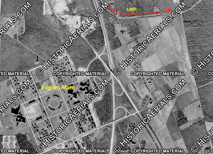
Aerial dated 7/13/1938 that matches the Mystery Foto. It's set with north on the top.
Here's a couple of 1938 aerials displaying Pilgrim State Hospital, LIMP and surrounding area. I think these aerials match the year of the Mystery Foto.
Kleiner's Korner (Submitted by Art Kleiner)
1947
1953
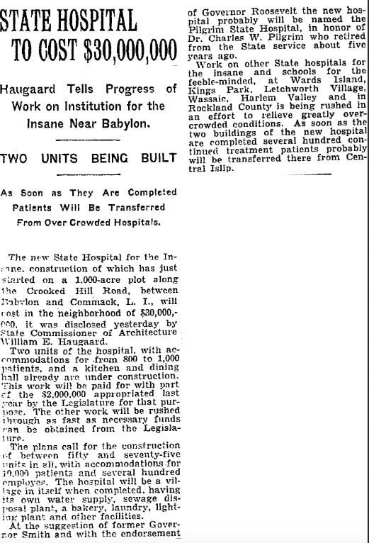
The New York Times, March 19, 1929
Suffolk County News, March 22, 1929
Brooklym Daily Eagle, April 1, 1929
Brooklyn Daily Eagle, April 1, 1929
Brooklyn Daily Eagle, March 14, 1930
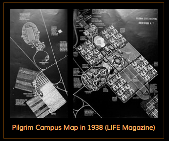
Life, 1938
From trainsarefun.com.
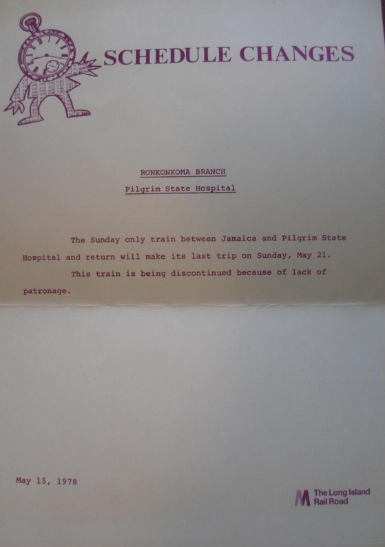
LIRR May 15, 1978
Mendyk's Discoveries (Submitted by Frank Mendyk)
LIRR Pilgrim State Hospital
Long Island Motor Parkway Right-Of-Way along LIE Service Road along Pilgrim State Center's old farm complex near Wicks Road.


Comments
Pilgrim State Hospital. Circa perhaps 1931 to 1934. Motor Parkway is evident along northeastern edge of Pilgrim farmland just East of what appears to be Crooked Hill Road. Sand mining evident already at Crooked Hill Road, an area we used to ride dirt bike motorcycles in the mid 1970’s and called the “Commack Pits”. View is facing North. Massive Buildings 81, 82, and 83 construction still has not begun in the photo although 25 is complete. Original Commack Road is visible on west side, as is possibly old route known as Fish Path. This also means Edgewood hospital construction had not yet commmenced. No sign of Sagtikos Parkway construction yet (mid 1950’s) or LIE (early to mid 1960’s )
-Identify the location and orientation of the photographer
Looking North over Deer Park/Brentwood
-What is the building complex in the Mystery Foto and when was it built?
Pilgrim State (Psychiatric) Hospital -opened on October 1, 1931
-What is located on the complex today and the property on the far right?
A much smaller Pilgrim Psychiatric Center still stands. The farm that was on the right was sold, the land developed, and it became the Suffolk County Community College in 1974.
-Identify the roads that are not the Motor Parkway,
The 2 standouts are Crooked Hill Rd, and Commack Rd.
-Where is the Motor Parkway?
Tough to describe without circles and arrows, but the section between Just before Commack Rd to just after Colonial Springs Rd can easily be seen.
-Kudos question: What is the date of the Mystery Foto? Provide a rationale.
1938-The buildings look freshly built, and there seem to be many aerials from that time period.
Where is the Long Island Railroad?
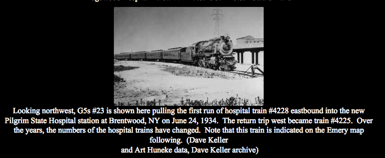
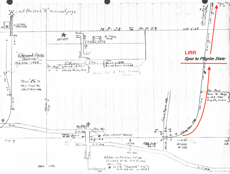
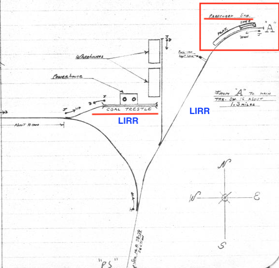
Coming up from the bottom right corner, tracks lead to a passenger train station that served the Pilgrim Psychiatric Center via the Pilgrim rail spur branching off of the Ronkonkoma branch. The station closed May 21, 1978 and currently sits abandoned in the thick brush.
Identify the location and orientation of the photographer:
Brentwood, looking northeast
What is the building complex in the Mystery Foto and when was it built?
Pilgrim State Hospital built in 1929/1930, opened Oct. 1, 1931.
What is located on the complex today and the property on the far right?
Pilgrim Psychiatric Center. The eastern side of the property was sold and became the Western Campus of Suffolk Community College in 1974.
Identify the roads that are not the Motor Parkway:
Commack Road, Crooked Hill Road, Wicks Road (far right)
Where is the Motor Parkway? Upper right portion of photo.
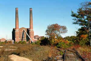
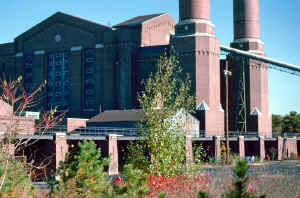
Where is the Long Island Railroad? Traveling from the bottom of the photo on the right to half way up and curving to the right (where the passenger station was until 1978). Another spur went left to right where the Power Plant is located, lower part of the picture.
Kudos question: What is the date of the Mystery Foto? Provide a rationale. 1934 - Around the early years of operation but after the LIRR passenger station was first used in 1934 Also, lack of development.
This is the Pilgrim State Phycariatic Center in Brentwood circa 1940? The view is looking North in which the Motor Parkway is running from east to west in the top half of the photo. This is exactly where the LIE runs today. On the right will be Suffolk County Community College and the not built yet Sagtikcos Parkway. Most of these structures have been demolished but their remains still lie about with a few building still in use.I have tried to find remains of the Motor Parkway in the vicinity but the creation of the LIE cleared out anything to be seen.
Pilgrim. State hospital ln the late 1920’s or early 1930’s. Photo was taken looking north east. I believe the Motor parkway is running northwest on the right side of the photo close to the power plant.
Anthony Guardino
Howard. Thanks again for your great work in promoting the history of Long Island Motor Parkway. Here are my responses to questions relating to Mystery Friday Foto #50. - Anthony Guardino
Mystery Foto questions:
• Identify the location and orientation of the photographer.
• The photo is of Brentwood looking north.
• What is the building complex in the Mystery Foto and when was it built?
• The building complex is the Pilgrim State Hospital, which began construction in 1929 and opened in 1931.
• What is located on the complex today and the property on the far right?
• Today, the New York State Office of Mental Health operates the Pilgrim Psychiatric Center from a small portion of the former State Hospital site, and a large portion has been sold to Gerald Wolkoff, who plans a major mixed-use development on it. The property on the far right is now the Suffolk Community College, Michael J. Grant Campus.
• Identify the roads that are not the Motor Parkway,
• Crooked Hill Road, Commack Road and Wicks Road
• Where is the Motor Parkway?
• It is located at the far north end of the State Hospital complex. The Commack Spur is also plainly visible at the top of the photograph.
• Where is the Long Island Railroad?
• The main line of the LIRR is located south of the photo, but a spur from the main line to the Pilgrim State Hospital station is visible along the right side of the photo. A elevated portion of the rail spur is located in front of the power plant building at the southeast part of the complex.
• Kudos question: What is the date of the Mystery Foto? Provide a rationale.
• The photo was taken between 1931 and 1941. Rationale: The State Hospital opened in 1931, but Buildings 81, 82 and 83 (three large buildings constructed some time prior to 1941 to the west of the circular feature in the center of the campus) are not shown in the photo.
*Location & Orientation: Brentwood, NY viewing north.
*Building Complex & Year Est: Pilgrim State Hospital, opened 10/1/1931. Hospital community that’s entirely self contained. Property extended into 4 towns: Babylon, Huntington, Islip and Smithtown.
*Complex buildings on both sides of Crooked Hill Rd: Pilgrim Psychiatric Center W/O Crooked Hill, and Suffolk Community College E/O Crooked Hill, est. 1974 on former Pilgrim farm land.
*Roads: Commack, Crooked Hill, and Wicks Rd. LIRR spur north from main line. Right branch towards Pilgrim Passenger Platform, and left branch towards Pilgrim Power Plant.
*LIMP: Upper half of image. West across Wicks Rd., then N/W towards Jericho Tpke spur. Continues west across Commack Rd.
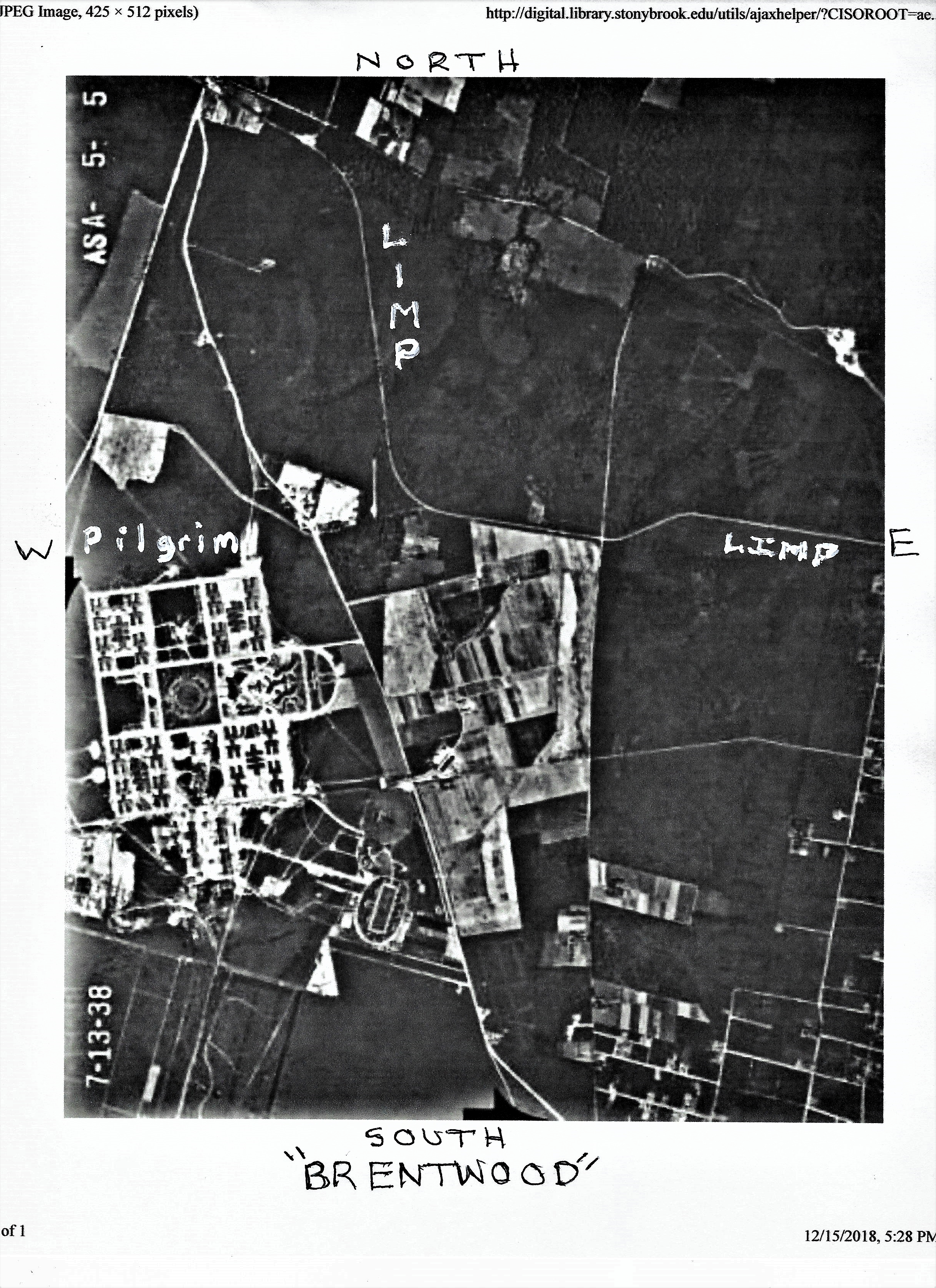
*Kudo, image date & rationale: I’ll say 1938 due to an aerial dated the same ( 7/13/1938 ) within the Stony Brook University Digital Collections ( ASA_5_5 or 5_3 ). Images are much alike.
I believe the photo is over Brentwood looking north with Pilgrim State Hospital being the main complex in the center. It opened in 1931 and the current smaller version is now known as Pilgrim Psychiatric Center. To the right is the current site of Suffolk County Community College. In addition to the LIMP, we can see Commack Road, Crooked Hill Road, Wicks Road, and with a little imagination, Jericho Turnpike ( state route 25), with its connector road to the LIMP, later to become Harned Road. The LIMP enters near the upper left corner, proceeds east, then curves south and east again where it intersects Wicks Road. The LIRR is a spur heading north from the lower right corner (having branched off the main line) before forking into two tracks on the hospital grounds. Not sure about the date but I’ll say around 1939-1940 because I don’t think there’s any evidence yet of construction starting for Edgewood State Hospital.
Nothing here looks familiar. I believe orientation is NE and LIRR is at bottom right. The RR spur terminating on a bridge over water - strange! I’m stumped. Great mystery Richard, ya got me this time!
Location - NYS pilgrim State Psychiatric Center Brentwood
Photo facing to the north over Deer Park ,Brentwood looking towards
the LIMP at Commack and Hauppauge
Building Complex - Pilgrim State Hospital built in 1929, opened in 10/01/31
Property today- Pilgrim State Hospital and associated psych centers,
lower section of photo, Heartland Industrial Park
section to the right was the center’s farm, now Suffolk
County Community College, SCPD police academy
Roads- Commack Rd, Crooked Hill Rd, Wicks Rd and G Rd (entrance to the center)
Location of the LIMP - The LIMP is on the top 3rd of the photo and runs from left
to right. The parkway is just above the intersection of
Commack and Crooked Hill and then curves down and
around to the intersection of Wicks Rd which can be seen
in the photo. LIMP runs along top of the farms to Wicks
Location of LIRR - The LIRR can be seen on the lower right coming up past
the power house and curving up to G Rd and ending at the
LIRR Pilgrim State Station. The Pilgrim Spur also splits at a wye
just below the power house and goes to the coal ramp next to
and below the power house.
Date of Photo- the date should be late 30’s early 40’s, I would say maybe 37-39
the LIRR started train service on 6/24/34 (station in photo)
Comparing the SC GIS aerial of 1947, the complex is much more
built up and developed as to mystery photo. It appears that the
parkway could possibly be still open.
Michael I. LKaplow
Howard, Richard, and all the super detectives,
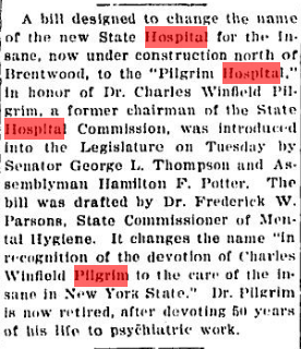
Today has been one of those rainy-can’t-walk-any-of-my-Siberians Sundays. This map mystery intrigued me! The main photo looked much like other vintage photos I have seen of Pilgrim State and other NYS Psych Centers, so I started with Pilgrim. Incidentally Pilgrim has nothing to do with New England settlers or John Wayne. The facility was named for Dr. Charles W. Pilgrim, Commissioner of Mental Health in the early 1900s. With some help from Google Maps and other sites cited, I think I have solved Mystery #50, or at least parts of it. I am not sure that the source links are live. I’d’ve left this on the web response location but the map images do not show there. BTW, the LIRR History folks are as enthusiastic as the VMP folks. Great that all this is all preserved and available!!
Identify the location and orientation of the photographer.
Brentwood (Pilgrim State) looking +/- N/E based on this RR Map
This vintage map shows the wye and the spur/sidings that serviced the then new hospital. They are shown in the lower right of the main photo. Anything that is left of the tracks now is all overgrown. This map also serves to orient the Mystery Photo. http://www.lirrhistory.com/july2000/pilmap2.JPG
What is the building complex in the Mystery Foto and when was it built?
The complex is Pilgrim State Hospital c.1930 “Pilgrim State Hospital was created by the Legislature in 1929 and … officially opened for the care and treatment of patients on 825 acres … on October 1, 1931.” https://www.omh.ny.gov/omhweb/facilities/pgpc/#history
What is located on the complex today and the property on the far right?
Pilgrim State Hospital is now the Pilgrim Psychiatric Center and hasn’t gone anywhere in 88 years! Across the future Sagtikos is now SCCC and LIU Brentwood Campus as well as Brentwood State Park just to the south of G Rd (College Rd).
Identify the roads that are not the Motor Parkway.
Crooked Hill Rd is to the right (East) and Commack Rd (old and/or new) to the left (West). Wicks Rd is to the far right (East) of the cleared land (future colleges). The Sagtikos Pkwy (opened in 1952) which runs between the two locations did not exist and neither did the LIE nor the NSP, both of which would be built to the north of the property. Within the facility the streets had letter names. G Rd is the most visible and is still around today. It cuts across the photo about mid-way up. The eastern most part of it is now known as College Rd and it ends at Wicks Rd.
Where is the Motor Parkway?
I believe that the VMP is hidden by the trees in the area just to the north of the open field that would someday be the College Campuses and is intersected by Wicks Rd on the far right (East) right where the LIE crosses Wicks now.
Where is the Long Island Railroad?
The LIRR (Ronkonkoma Branch) is and was well to the south of the Hospital. The tracks shown in the photo were a spur to the hospital and the power station and also served the State’s Edgewood facility.
http://www.lirrhistory.com/july2000/pilmap2.JPG
Kudos question: What is the date of the Mystery Foto? Provide a rationale.
Photo date: c.1930 ::: In the image, the hospital looks like it is still under construction. Can’t be sure of a more exact date but there do not appear to be significant shadows from the buildings so I’d venture not Winter on a less than sunny day!
Mike and the SnowDogs
Howard,
With the answers in, that last photo of the service road was taken directly on the RoW (on the dead grass), and shows exposed concrete similar to what Brian and I found recently in Wheatley Heights. Another visit here in order Brian?
The Suffolk County News article posted here brings to mind my stay at The Hospital for Special Surgery in NYC. The original title of this facility was “The Hospital for the Crippled and Lame”. No confusion back in the old days I guess.
After looking at your new LIMP map, Frank; I now realize there’s the original Pkwy just south and perhaps beneath the eastbound service rd.of LIE for a short stretch to Wicks Rd. Don’t think we’ll be needing Sam’s magnetometer to locate 😊
I explored the ROW west from Wicks Rd along the LIE south service roads. I continued thru the LIE cloverleaves up to the area around the Motor Parkway and Shinbone lane, all with negative results. I did not find any signs of remnants of the LIMP. I plan to return to the area and explore further for any remnants. I believe that they removed most of remnants when they built the Sagtikos Parkway and later the LIE. I hope that there are some remnants there which I originally did not find.
Excellent coverage of the area Frank. I find sometimes remnant debris left behind after highway construction in the inactive areas. Was hoping for original LIMP concrete in the photo that is located along the outskirts of the highway construction site. Planning on visiting this area on Sunday after the rain. The more eyes the better
Frank, that sounds great. What time are you going meet? I’ll see if I can make it.
Aw shucks Frank, Brian and I went today instead (Sat). Something came up for Sunday. We avoided the cloverleaves and concentrated the woods south of the LIE service road and west of Shinbone. All we found was one small chunk of limp concrete on the south. They pretty much wiped the slate clean during hwy construction. We also completed the Bagatelle tour and found more posts. Will send Howard all findings and their locations once I gather it all together. More tours coming up in the near future….
No problem, I see that you had a great exploration. Catch you guys next time. I explored Bagatelle this past May. I found the posts ant the curved embankment as you guys found. It was brutal with all of the thorns and sticker bushes. It is definitely a real nice find. I will be waiting for your findings.
As I grew up in Brentwood and spent a Lot of my childhood exploring Pilgrim State and riding Mini bikes / Dirt bikes throughout, I find this type of stuff fascinating. As I read this blog, I was reminded of a very old road that used to continue back alongside the L.I.E. behind where the parking ride is. Could this road been part of LIMP? It’s long gone since the building of the ramps and the parking ride but, possibly could still be in the overgrown area. I recall it ending in a lot of sand as you approached east towards Wicks Road.
Hi Tony - I believe you had found the LIMP while biking back then! It was once located just south of the LIE service road eastbound (see photo below). About what year were you biking there and in what condition was the roadway concrete in? Last year (2018) Brian McCarthy, Frank Mendyk, and I set out to explore the area south of the service road but found just one small piece of LIMP roadway containing trap rock. There was also a large collection of concrete dumping that I believe was unrelated. The cloverleaf interchange just to the west was also examined with no findings of the LIMP there.
Here is a link to the full map.
https://www.google.com/maps/d/viewer?mid=1396j0_672hYkvbcNFJInbc1mXNJspD9f&usp=sharing
Hi Tony, I grew in Brentwood too. The few maps below shows the changing of the area after the LIE was built. The road you remember was the original LIMP. You won’t see the maps via ‘more recent comments’, only on this blog. You’ll see what I mean.
Great maps Brian! I’ve overlooked the 1962, actually revealing the “before and after” effect DURING construction. Love all the cross-referencing. Can we get something similar for Rt 135 in Bethpage? I think we’ve all tried that already. There’s always something new to learn here.
Thanks Frank. Suffolk County LRV has several years of old aerials compared to Nassau County’s few. You’ll enjoy the latest blog here ( Art’s Foil Request ).
Thanks. Great info The road was asphalt with a lot of holes. I remember also a lot of sand. In the holes and along the road. In fact, I got my first road rash on this road, heading east on a friend’s Honda Trail 70. As I approached the end, the sand became deeper and binded the front wheel I spilled onto a mix of road and sand. The other end, I believe ended with woods. I’d guess this was around 1978-9. I also explored the slaughterhouse and church and of course, Drac’s Castle on Commack road.
ANY CONSTRUCTION PHOTOS OF EDGEWOOD STATE HOSPITAL ?
1939—1942??
IT WAS ON COMMACK ROAF