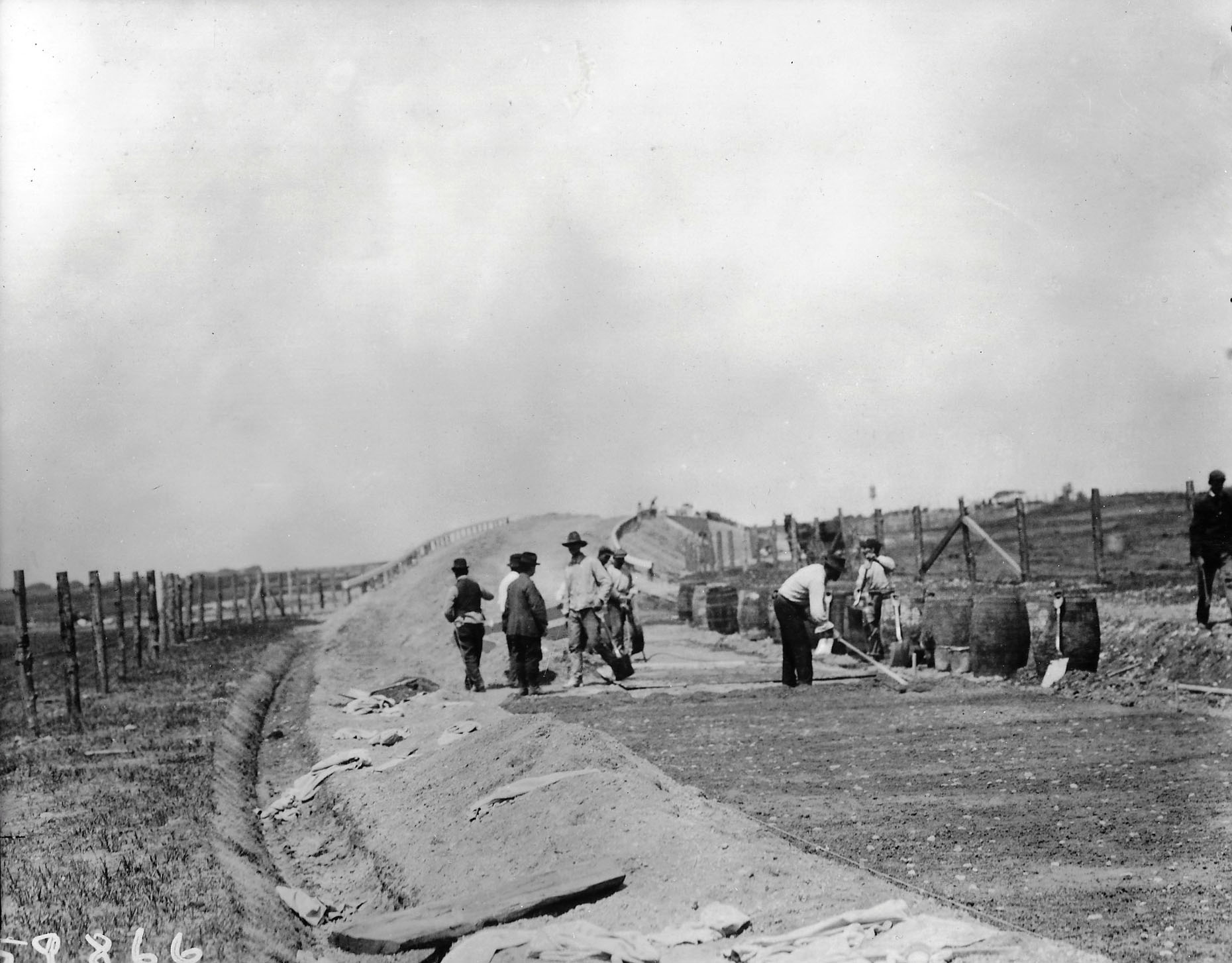
Mystery Friday Foto #45 Still Open for Discussion: A Motor Parkway Bridge Built on a Curve

My favorite co-author Al Velocci challenged you to identify this Long Island Motor Parkway Bridge that was built between 1908 to 1910.
No consensus yet, so this Mystery Foto remains open for discussion.
Mystery Foto questions:
-Identify the bridge and the orientation of the photographer. Provide a rationale.
Hint: Seven possible candidates are below. One new candidate-The Bloomingdale Road Motor Parkway Bridge- was added by me tonight.
Comments (9)
Based on the below comments, please vote on which bridge is shown in the Mystery Foto.
Here is the current count:
Westbury Avenue Bridge (4): Steve Lucas, Greg O., Tim Ivers, Frank Mendyk
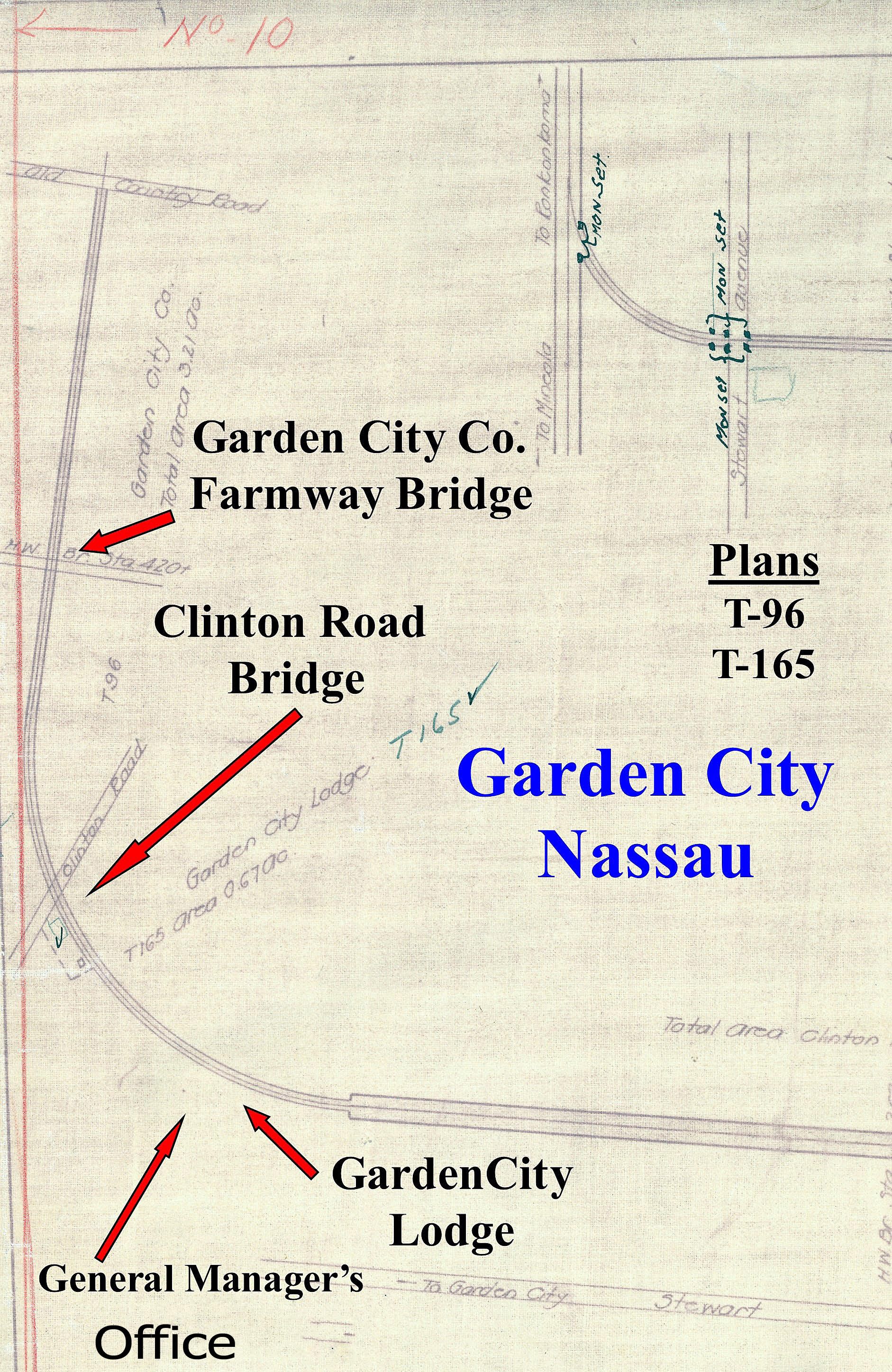
Clinton Road Bridge (2): Brian McCarthy, Al Velocci
Meadowbrook (Newbridge Avenue) Bridge (1): Frank Femenias
Central Avenue/LIRR Bridge (1): Sam Berliner III
Bloomingdale Road Bridge (1): Howard Kroplick
Comments are still open.
Enjoy,
Howard Kroplick
Close-Ups
Seven Long Island Motor Parkway Bridges Built on a Curve
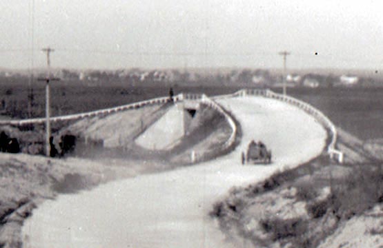
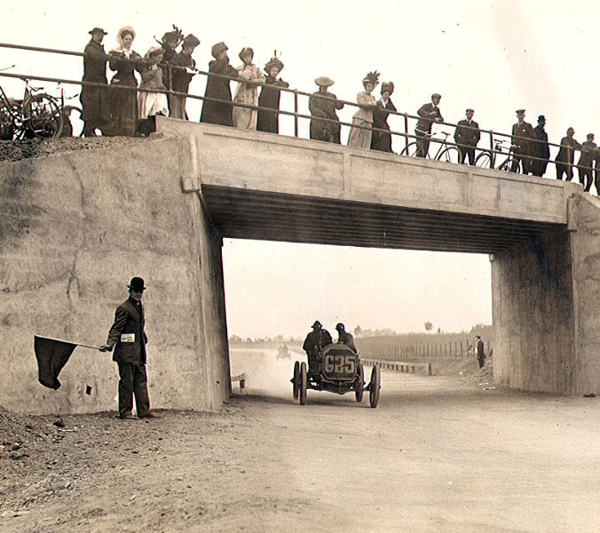
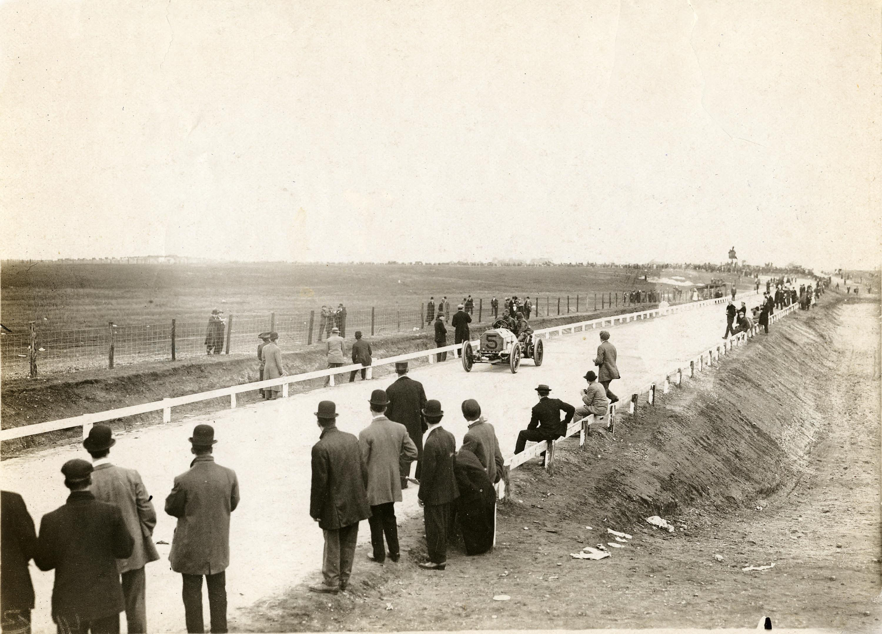
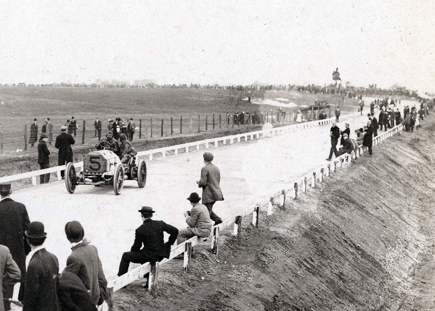
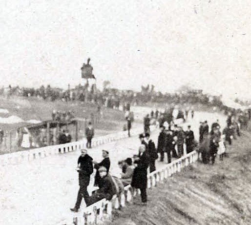
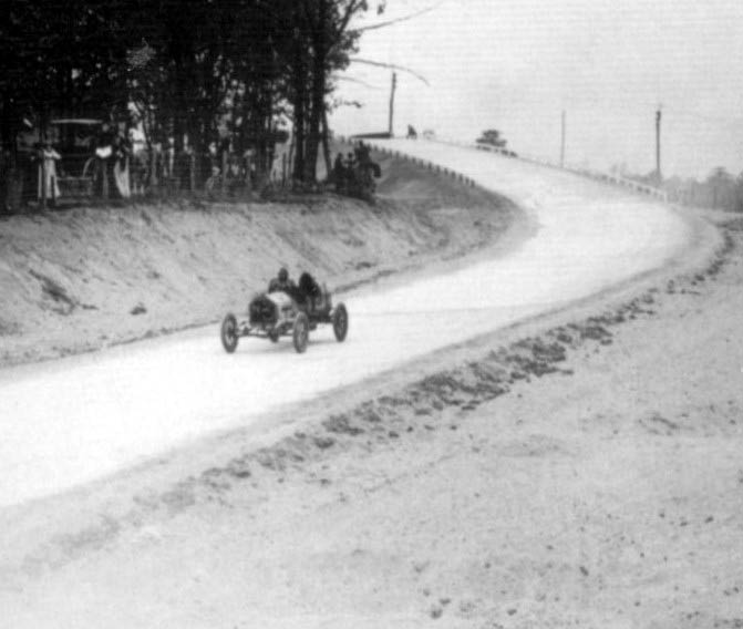
Westbury Avenue Motor Parkway/Trolley Bridge, Mineola/Carle Place
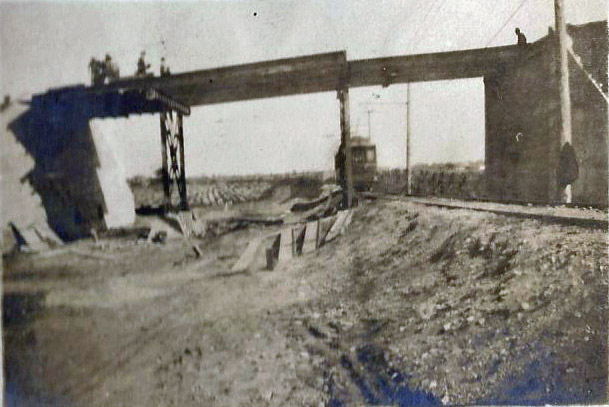
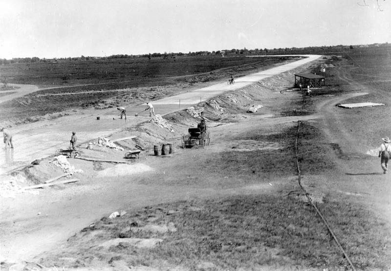
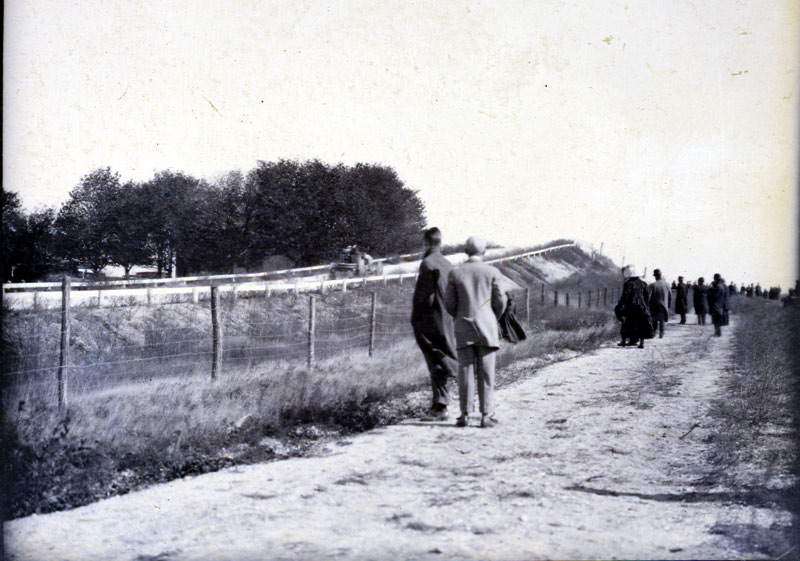
Bloomingdale Road Motor Parkway Bridge, Hempstead Plains
View looking north-1908.
Note: It is a highway bridge since the Motor Parkway went underneath the bridge.
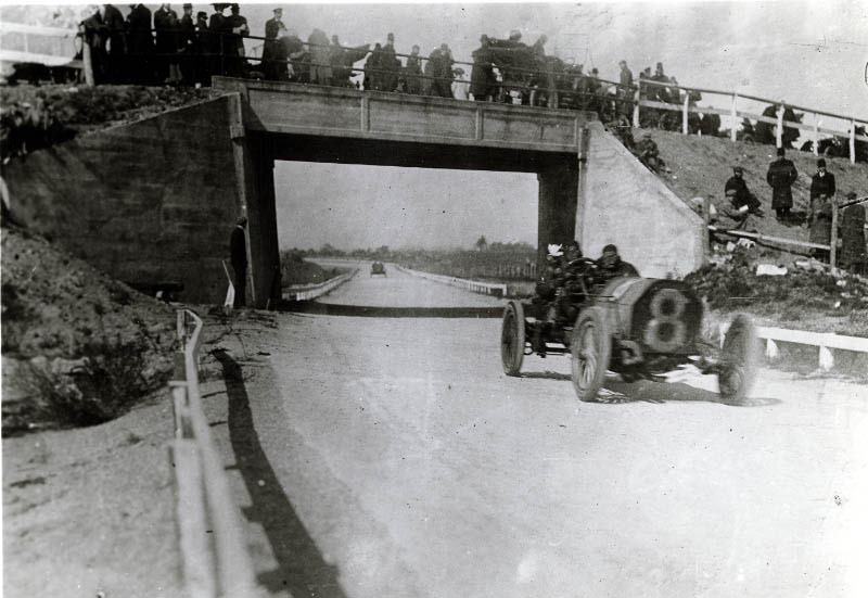
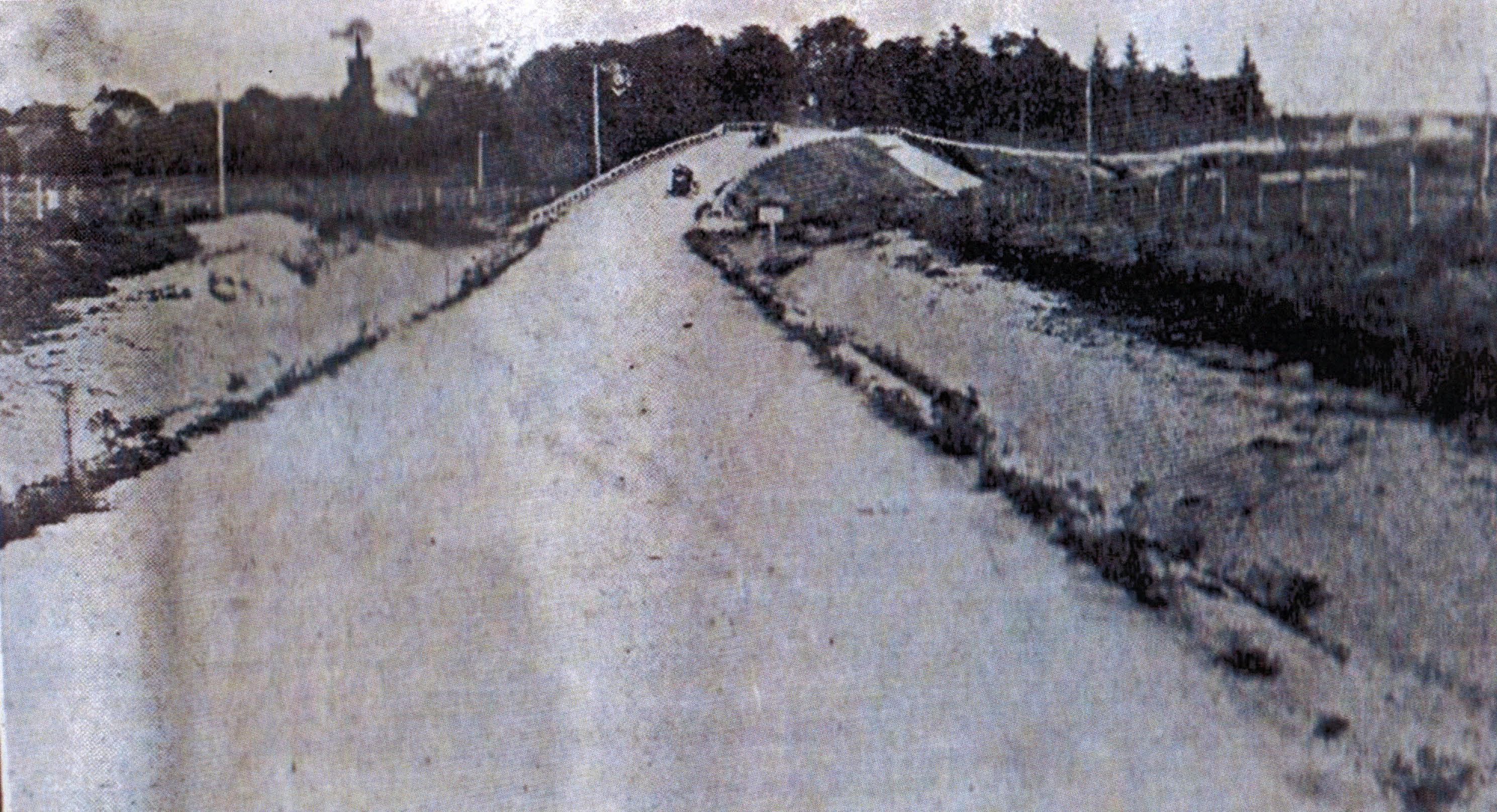
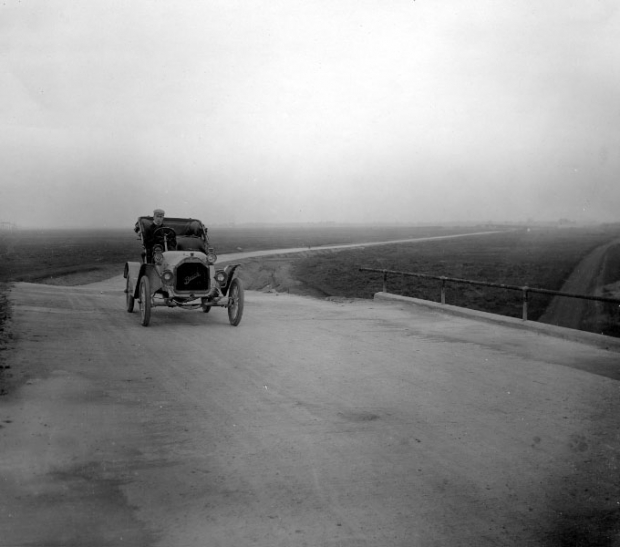
View looking north-1909 Alco Black Beast!
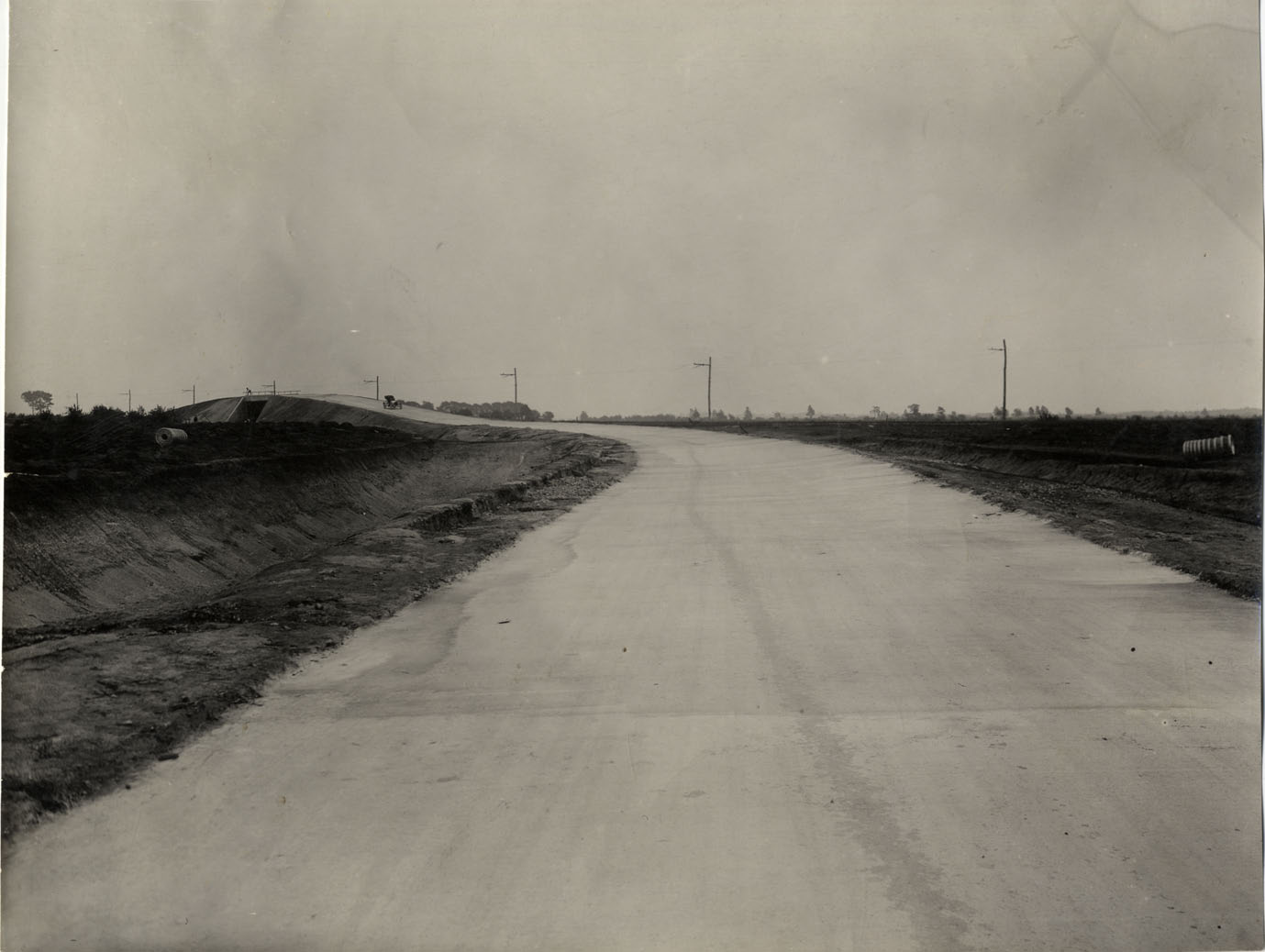
View looking north in 1908 from the Bloomingdale Road Bridge.
Note the water tower in the background and outline of homes.
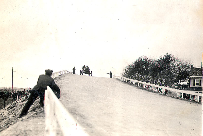
View looking south in the summer of 1908 taken from the top of the above water tower.
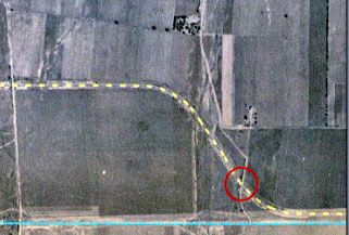
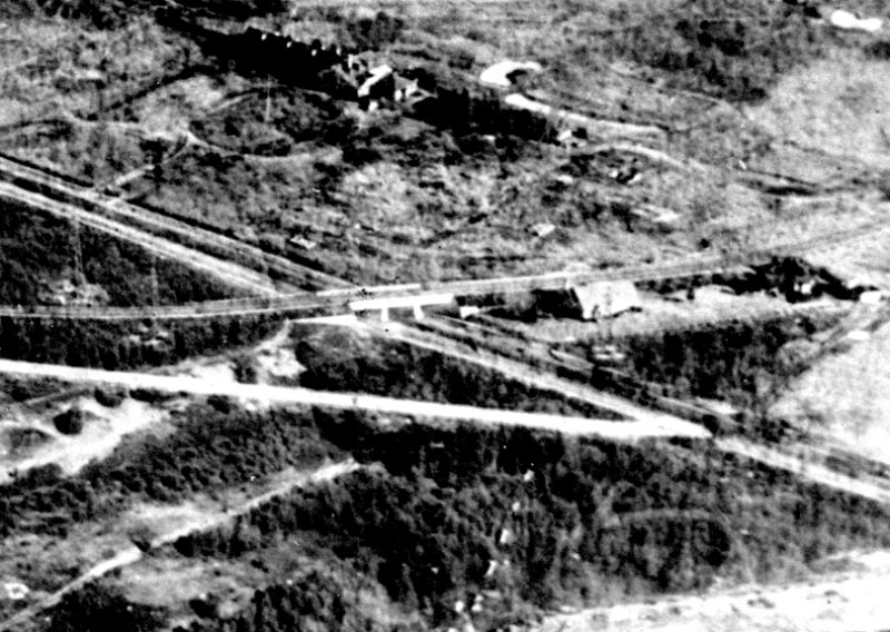
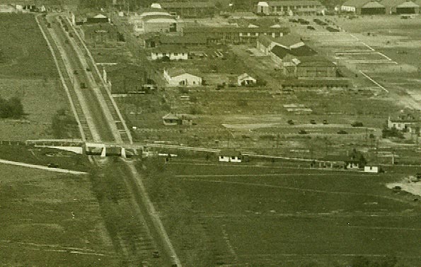
1926 Aerial of the Bloomingdale Road Motor Parkway Bridge.
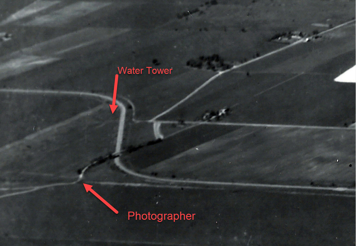
1936 Aerial of the Bloomingdale Road Motor Parkway Bridge with possible position of the photographer.


Comments
Great image, Al!
I’ll have to say this is Clinton Rd bridge during construction. The view is broadly west and north. I recall this bridge needed to be wider than originally planned due to the future widening of Clinton Rd, so maybe that’s why Clinton Rd isn’t noticeable. I also see a steam engine westbound on the LIRR - Mineola Line.
Thought maybe that this could be the Westbury Ave Bridge viewing south, with the train eastbound on the LIRR. But I don’t see a any utility poles or wire above for the trolley line.
So my answer is the Clinton Rd location.
Another great mystery photo, thank you Al. I think I see the Long Island Aviation Country Club hangars in the distance. If correct, the only LIMP bridge configuration to match is the Newbridge Ave Parkway Bridge (Bellmore Rd), once located in Eisenhower Park. Newbridge Ave once traveled through the park and proceeded north into what is today’s Salisbury Park Dr. What’s funny is how the LIMP Stewart Ave Highway Bridge, just beyond the mystery photo is not visible, but it’s there. Also, the iconic Ladenburg wind mill is just to the left of the photo, and also can’t be seen. Photographer was looking East. Great stuff guys! Keep it going!
Meadow Brook bridge (Newbridge Ave/Bellmore Rd), and Long Island Aviation Country Club hangars
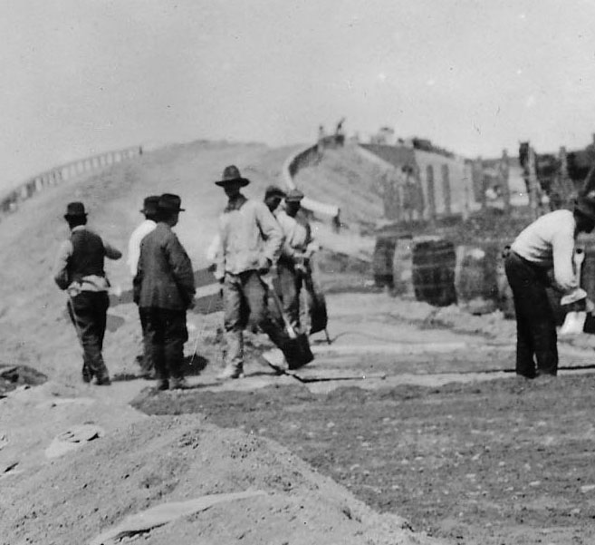
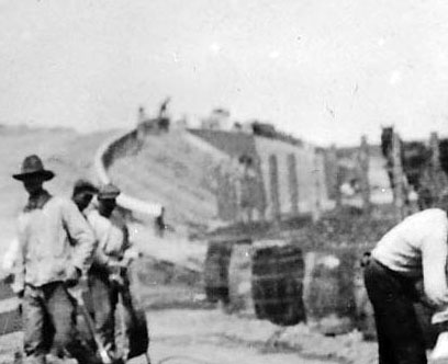
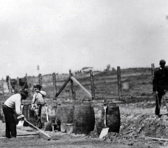
I dunno and am not about to do the research to find out but my gut feeling is Central Avenue looking west. ??? I do want to point out, though, the terrific detail of how the gravel was dumped (probably by wheelbarrow) in piles on the graded subsurface and then spread out and leveled by hand, prior to pouring the cement slurry. Now, Al or somebody, do we know how they kept the slurry from running out laterally? Board forms? How I wish that missing photo album, <http://sbiii.com/limpkwy0.html#limpbklt>, would turn up! It documented all such work. Sam, III
just a somewhat educated guess but I think we’re looking north at the Westbury Avenue bridge because it looks like there’s no road under the bridge yet and that could be the water tower on East Williston Avenue off in the distance.
Just guessing here…The surrounding area looks to be the Westbury Road Motor Parkway bridge, but I have some reservations about the guardrails.
I’m guessing it’s the Westbury Road East Meadow bridge looking west.
Might be Mrs. Ladenburg’ windmill in the distant right.
Location - LIMP Carle Place, Westbury Ave bridge -eastbound (LIMP direction).
The photo is facing south towards the LIRR main line and Mineola.
Comparing the photo with the other locations, the Westbury Ave Bridge
location best matches the landscape features seen in the photo. Several
features missing in the photo are trees,buildins or roads.
On the right side of the photo just above the ground, I observed what
could be possibly a smoke plume from a LIRR steam engine. If this is
correct in would match up to where the LIRR main line would be
located in the photo.
Howard, I believe we are looking at the bridge being built over Clinton Rd. in Garden City and we are looking west. We know at this point the Parkway ROW is only 50 feet wide which would account for the perimeter fencing being so close to the roadway. Also, going over Clinton Rd. it appears that the frame work for the bridge itself has multiple openings. And. it appears that the roadway is only 16 feet wide which means it must be west of Merrick Ave. or east of Round Swamp Rd. Lastly. the top right part of the part of the photo shows the terrain at a higher level which fits in that part of Garden City. Al.
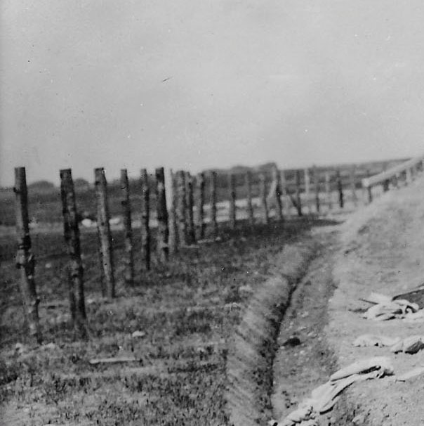
Howard, something I missed earlier. The enlargement photo of the cedar fence posts on the left side , beyond the posts are several similar looking buildings in the distance. Could they be the barracks of Camp Black?
That there actually was (may still be) such: <http://sbiii.com/lirr2etc.html#lirrmisc>, 3rd para., “Just as good is the rumor - - - “. This thread sure is a good one; all us “experts” disagreeing. I “don’t see no” water tower or it’s the weirdest water tower ever (we’ve been through this before, no?). The water tower in Frank F.‘s pic is quite different - see attached. People see such odd things in these blurry blog photos - sure wish the blowups from thumbnailed images were bigger/sharper (PLEASE). Sam, III
_________________________________
Howard Kroplick
As shown in the other images, there was a water tower there for the construction. During the 1908 races, a spectator climbed to the top resulting in a strange shape.
It would appear that the bridge being built in the mystery photo is a Parkway bridge, but the Bloomingdale Road Bridge was a highway bridge?
______________________________________________
Howard Kroplick
Correct, I believe that the Motor Parkway goes under the bridge.
“Under”? No way, Hose A! Sorry. Maître, but the LIMP goes OVER; they wouldn’t be putting down gravel for the world’s first reinforced concrete highway on a local road, let alone fencing it IN. Sam, III
Wow, great answers. Though it resembles the LIACC hangars in the distance, I now doubt they were built this early during aviation’s infancy. LIACC officially opened in 1929 but the hangars may already have existed on the site. Al’s 50ft RoW at the Clinton bridge makes sense, and this photo likely the original bridge before expansion for the roadway/trolley. The structures on the left can be either Camp Mills or Mineola Fairgrounds. The RR tracks in the distance (if that’s a plume of smoke) from the Clinton Br would be approx 0.8 miles. From the Westbury bridge only 0.25mi. This is tougher than I thought. Great mystery!
Also Vanderbilt Court remains hidden, but the Manager’s Office wasn’t built until 1914.
Interesting, I always assume most roads being built in these photos is the LIMP, and I would have thought the road being constructed in this mystery photo WAS the LIMP, but your speculation is that Bloomingdale road being resurfaced to continue over the bridge. I think I agree with you on this one as that finally makes a little more sense of this particular photo.
Think I set a record for the amount of times for agreeing & disagreeing with myself over this classic photo. Strongly feel this is a parkway bridge, not highway. Definitely a true right curve. Think we all see the steam engine w/plume . Fairly certain that’s a water tower in the further distance of the train. Are we seeing the full size of this image, or was it cropped somewhat?
Do notice the row of structures to the left that Al points out. Camp Black was bordered by Clinton Rd to the west, Old Country Rd to the north, and the Central RR. Hazelhurst Field was here afterwards. So they were north & east of the LIMP. Clinton Rd Bridge would have to be curving to the left, to make sense in my mind anyway.
Photos from the Clinton Robinson Scrapbook clearly show the poles for the trolley feed on either side of Westbury Ave, with a pole in close proximity of the bridge. Just don’t see evidence of this in the image.
The Meadowbrook Pkwy Bridge design is very convincing viewing East. The train would be eastbound on the Central line. But there should be in view the trees and windmill on the Ladenburgh property to the center & left.
Brian, no, the photo has not been cropped, its all there. also, regarding my comments about the Camp Black barracks, Bill Belmer. the Garden City historian tells me there were no barracks, only tents.
Bloomingdale road looking north is another great guess. This photo could be looking north due to subject brightness. If so, the object in the distance at right cannot be the LIACC hangars. Those hangars belong more west and on the left of photo, 3/4 miles away from the bridge. If said hangars are really a plume of train smoke, that places the LIRR mainline about 1.5 mi. north from the bridge, very close to what’s seen in the photo. But why are they fencing in Bloomingdale Road, they should be fencing in the LIMP below the bridge. And the bridge railings don’t match the 1908 race photo below looking NW. Great post, my baldness progresses with much a-head scratchin’. Can’t get enuf!
Possibility of Bloomingdale Rd - maybe not so unlikely that the photographer was positioned south of this Hwy Bridge during construction. The boundary fencing on both sides of the Bloomingdale south of the LIMP could have extended to the ROW fencing east & west. Being that the parkway built the bridge, doing SOME road paving on both sides seems like a good idea, but certainly not the ENTIRE roadway.
Since we don’t know the bridge, we don’t know the year, by we DO know that the entire Hempstead Plains section was built between 1908 and 1911, so no possible 1929 LIACC or its hangars, nor Camp Mills. I have good recipes for crow (and have eaten my share) but I can all but guarantee this is a PARKWAY bridge! In my not-at-all humble opinion, some of you are wasting your time looking for matches to highway bridges. Selah! I have spoken (yes, I live dangerously). :·) Also, look at the precision with which the left-hand ditch was cut; amazing - and unlikely for just a country road. C’mon, guys. Fu’ther, what IS that thing on the right horizon, just above the fence crossbucks? I spotted it instantly as Westbury Station but the present two-story building wasn’t built until 1914. ??? Sam, III
All great guesses, but Al and Brian’s stands out furthest in my opinion. Clinton Ave parkway bridge (1909) in Garden City looking NW, with its 50ft RoW being fenced in. The flat roadway in the photo appears about 16ft. width, and less than 22ft. As Al noted, the only LIMP section to get the 22ft roadway this early was between Merrick Rd in Salisbury and Round Swamp Rd in Bethpage. The structures in the distance on left could belong to Mineola Fairgrounds (1866-1950). They had eight buildings standing inline on the south side by Washington Ave and 11 Street. As Brian suggests, the object in the distance at right could be a smoke plume from a westbound steam engine on the LIRR mainline, measured approx 0.8 miles from this bridge, a distance close to what’s seen in the photo. Vanderbilt Court roadway (lodge entrance) would’ve been off this photo to the left, after measuring the distance 100 ft between it and the LIMP, center to center.
The Westbury Ave parkway bridge (1909) with its 16ft width also an excellent guess, but the south view against the sun I believe, would’ve back-lit all the workers, making them appear darker in the photo. The only shadows are under the hats. There are no photos of this bridge’s railings but I suspect they too were low, as its sister Mineola RR bridge just to the south.
The Bloomingdale Rd highway bridge (1908) with water tower is a great guess too, but the high railings don’t match. I guess these were placed to help keep farm equipment from spilling onto the roadway below.
That’s my two cents. Feel free to comment, I’m sure I’ve missed several things on this tricky mystery
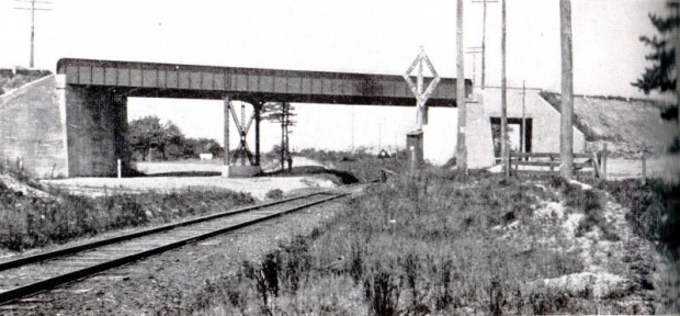
These 1909 photos of the Old Country Road highway bridge in Mineola/Garden City by surveyor Clinton Robertson demonstrate the difference between north and south views. The top photo of the bridge is looking north and well lit. The bottom photo is looking south and darker. These were taken at the same time, sometime in the afternoon.
I’m not second guessing anyone this time, just curious. Reading Al’s comments, I imagine not even he actually knows, so we are ALL guessing! How are to find out (if ever)? Sam. III
Another rambling - re Frank F.‘s OCR bridge pix - I lived in Mineola for many years and, back then, potatoes kept sprouting out of my lawn. The whole area was once dead flat, the vast Mott potato farms. So just think of what a massive operation it was to raise the grade of E-W OCR and lower the N-S RoW for the LIMP (mostly by hand, at that)! Sam, III
Frank, Regarding the two views of the Old Country Rd. bridge, I believe the views are the other way around. The descending heights of the remaining cement posts on the north side of Old Country Rd. clearly define the angle of the Parkway going under Old Country Rd. Photos of the Parkway ROW south of Old Country Rd. show it to be level with no elevating of the roadway, the height consistent with the early photos of the “Mayan Ruins"area. Not generally known is that the Vanderbilt originally petitioned to have the Parkway go over Old Country Rd. He tries to avoid the scenario of going southward, over the LIRR (24 feet clearance), which let to a steep descent in a short distance to the underpass at Old country Rd. That section must have been a favorite of the motorists. I’m sure some of the early autos had a difficult time going up that grade.
Al - That’s hidden history few or none know about, thank you for sharing this. If Vanderbilt had his way, those two parkway bridges would’ve been only 1000 ft apart. I believe it worked out better the way it did - Over LIRR first, then under OCR (southbound). Those cars definitely were struggling up those grades. What a sight it must’ve been! Wish I was there.
Hate to disagree but most cars that ran the LIMP probably had little trouble on those grades. Cars back then went up and down the Roslyn and Spinney Hill grades, as well as in and out of Port Jeff., routinely. Ditto the climb from the Hudson up to Broadway in northern Manhattan and similarly in Yonkers and Croton and across the river in Nyack. There was a hill on today’s Rte. 17 over the Catskills where Model Ts had to back up to summit but nothing near like that on LI. Any documentation to prove either thesis? Sam, III
Sam, Your mention of the Roslyn grade, I assume your referring to Northern Blvd on the east side of the Roslyn Viaduct. If so, I recall at least one newspaper article describing how some early Fords could only make the grade by backing up the hill. Today the grade elevation is much lower than it was originally, we now go under the railroad crossing, at one time that section of Northern Blvd had a steeper angle and was a level grade crossing with the railroad.
Al - I noticed in the first photo Robertson positioned the camera at ground level, attempting to include the horizon under the OCR bridge on the other side. I had a similar issue recently when photographing a RR trestle that also had a dip underneath. Robertson barely cleared it, and fortunately was able to include most of the Mineola RR bridge with its steep incline to the north. In the second photo the camera was held normally and cleared the horizon without a hitch, likely indicating a higher elevation on the south side than in the north.
Sam - Interesting how the Model T was a better hill climber in reverse gear. Guessing it was due to the gear ratio.
Frank, Note that in the top photo the embankment walls are extended and angled outward. The Parkway could not do that on the south side of OCR because the overall width or the Parkway ROW was only 50 feet wide.
Al - I meant both sides of the climb on the North Hempstead Turnpike (HA!) up out of Roslyn. Seems to me the west side is steeper but I’m not about the check my topo maps. Ditto Spinney Hill. From my Automotive page <http://sbiii.com/automotv.html>, “A Dr. Doehm, a veterinarian in Roslyn, Long Island, drove a Franklin as his every-day car well into the ‘60s or ‘70s; his favorite trick was to start the car cold and drive it directly up the Northern Boulevard (25A) hill (very long and steep) in top gear without even warming it up or shifting down, which the car did without even hesitating!” Dr. D.‘s place was at the base of the hill on Bryant Ave. (#55?) opposite the westbound on/off ramp from 25A. He drove ONLY air-cooled Franklins. Of course, his later cars were from the 20’s and 30’s. We really should have an indexed archive for all this stuff! Sam, III
Hmm not sure Al. On the top photo there are boundary posts that appear close to 50ft width if the roadway is only 16. The bottom shows no posts indicating a wider RoW width. I’m assuming the LIMP RoW was more than 50ft north of OCR.
Sam III - I too was hoping that this image was a known, you know it’s going to be tough when NO ONE has the unequivocal answer.
The 2 images of The Old Country Rd Hwy Bridge that Frank posted above - The northbound image must have been photographed from uprise of the parkway that’s seen in the southbound image, Clinton positioned himself at the uprise to obtain a ‘level’ full on photo. This also made the ROW appear wider than it was. Viewed closely, the southbound image shows the extended abutment walls rather straight than flared out.
Frank, There are other instances where the fencing is close to the over and under passes where the ROW is 100 feet wide, primarily for safety reasons. Some of the photos of the VCR races posted by Howard clearly show this. The primary purpose of the fencing was to keep cheaters and farmers and their live stock off the Parkway. Not every section was fenced. Where it was deemed very difficult to gain access to the Parkway roadway, such as in the bottom photo, fencing of certain areas did not come until the concrete posts replaced the original cedar posts. To the best of my recollection, the Parkway ROW east of Route 110 wasn’t fenced until the advent of the cement posts in the 1930’s
I was hoping to get some Model T (1925) reverse action in the video link below. No dice, but also interesting is how to start and drive it. This would take some time to get used to.
https://www.youtube.com/watch?v=QxfHMtgg2d8
Those 1909 photos make you feel like your right there!