Mystery Foto #2 Solved: The New Hyde Park Road Motor Parkway Bridge Abutment
My favorite co-author Al Velocci needed your assistance identifying this currently unknown Motor Parkway bridge abutment. It came from the same folder that held a 1956 view of Levittown (Mystery Foto #43).
Answers to the Mystery Foto questions:
- Identify the location of the Mystery Foto and the orientation of the photographer. Provide a rationale.
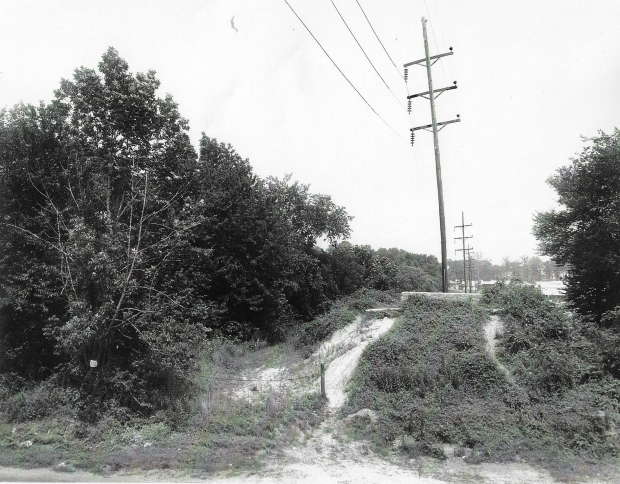
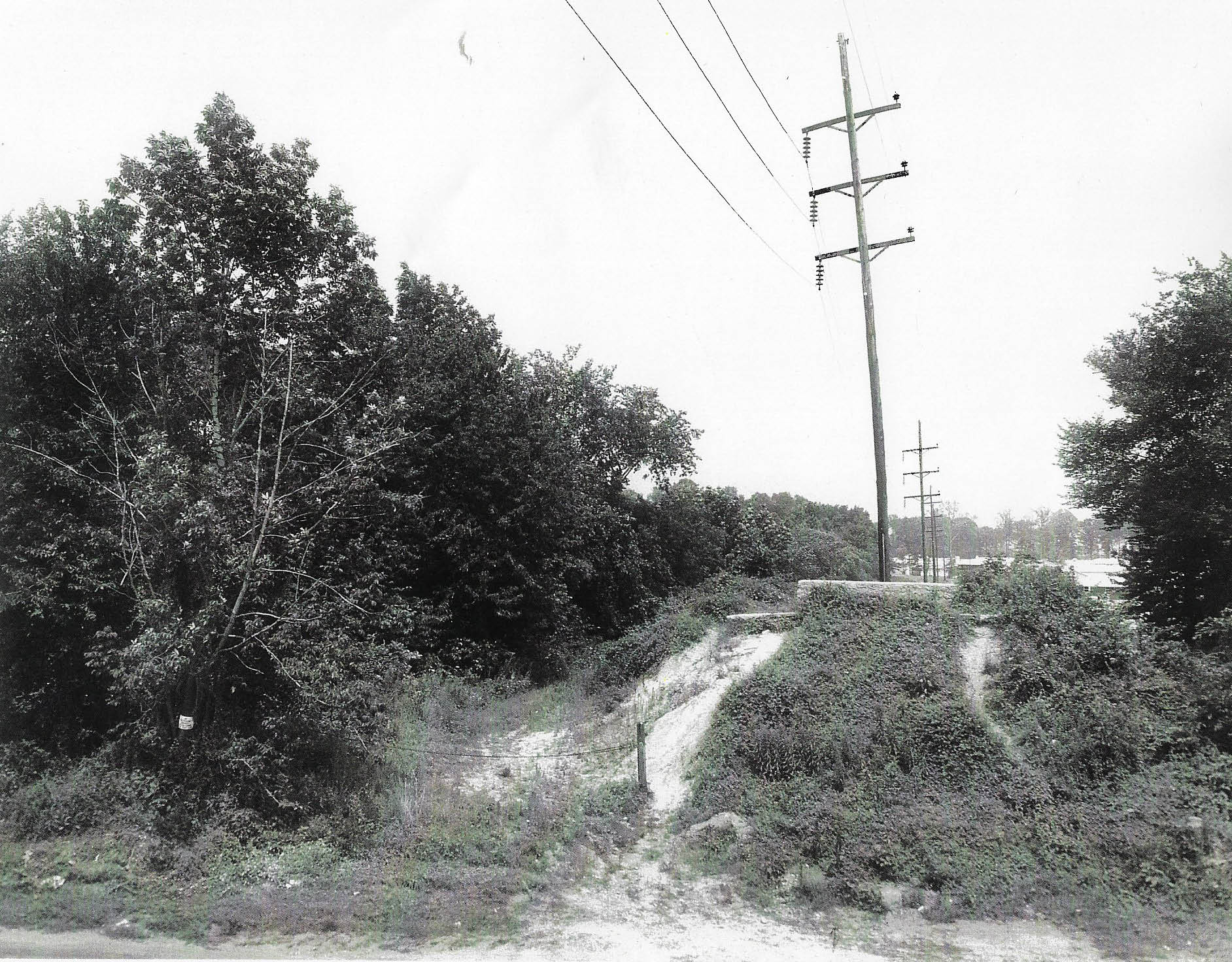
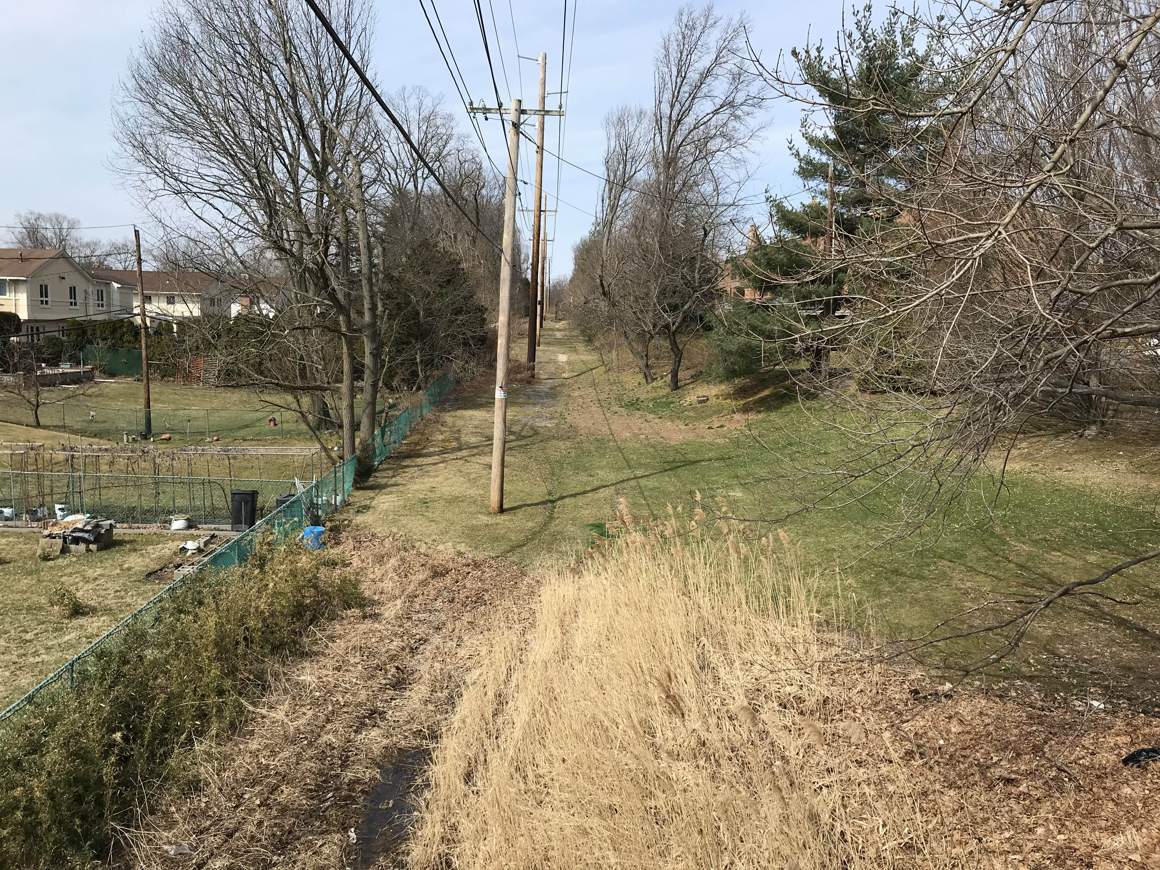
Looking east, the Mystery Foto is the bridge abutment of the New Hyde Park Road Motor Parkway Bridge. Rationale: The matching image from Henry Austin Clark, Jr. Collection, the house on the right, the electric poles in the middle of the Motor Parkway and the matching electric poles in this area from the Ron Ridolph Collection. A close second possibility was the nearby Shelter Rock Road Bridge abutment -eliminated for the houses on the right and the absence of the concrete wall.
What was the purpose of the structure on top of the abutment?
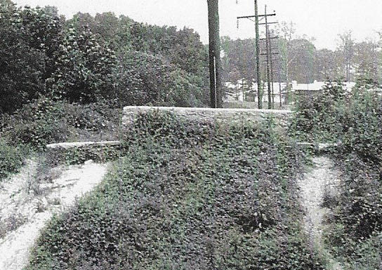
After the bridge was removed from New Hyde Park Road, the concrete wall was built to stop automobiles from going over the abutment.
Comments (6)
Congrats to Brian McCarthy and Steve Lucas for identifying the correct area in Manhasset Hills.
Special kudos to Brian McCarthy who solved and documented this very difficult Mystery Foto.
Do you have a Mystery Foto? Please email it to [email protected]
Enjoy,
Howard Kroplick
Close-Ups
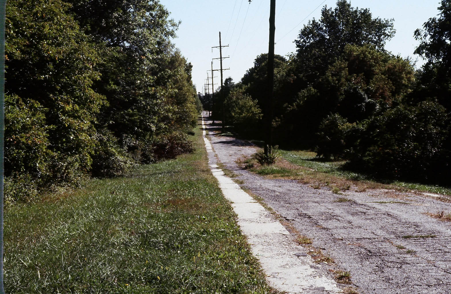
New Hyde Park Road Bridge Abutment (Circa 1960) Source Henry Austin Clark, Jr. Collection at The Henry Ford Museum Provided by Al Velocci
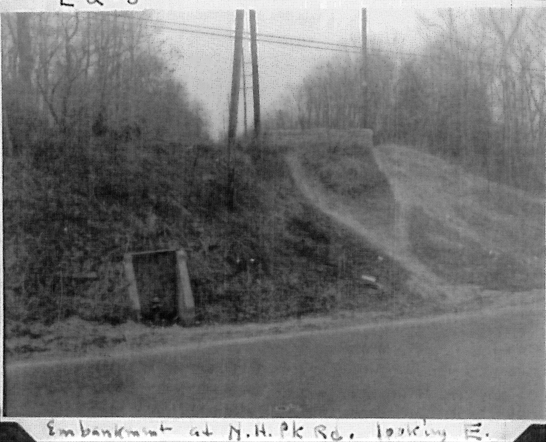
Caption: Embankment at N.H.Park Rd., looking E.
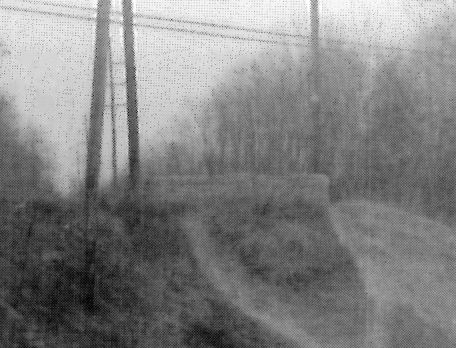
The slope and path match the Mystery Foto.
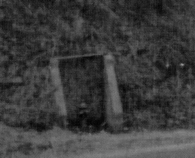
Definitely a fire hydrant.
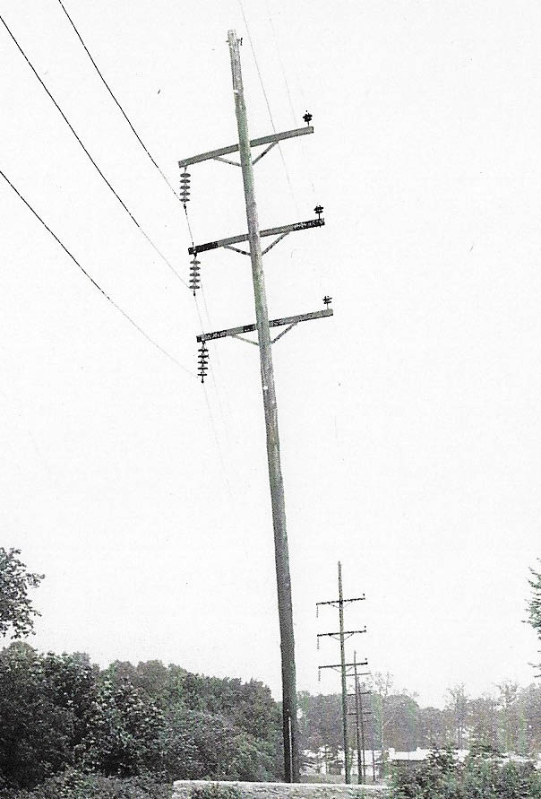
Long Island Motor Parkway East of Old Courthouse Road, Manhasset Hills (1981) Courtesy of Ron Ridolph
In 1981, Ron Ridolph documented this section of the Motor Parkway-east of New Hyde Park Road and Old Courthouse Road Motor Parkway Bridge.
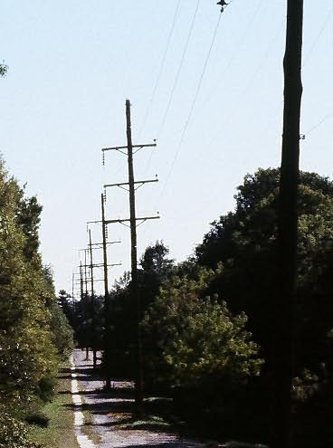
The design of the electric poles match the Mystery Foto.
New Hyde Park Road to Old Courthouse Road Bridge (2019) Courtesy of Sammy & Dave Russo
As documented by the dynamic father and son team of Sammy and Dave Russo, the concrete wall is still there.
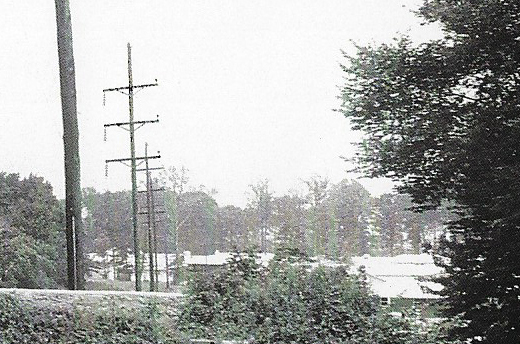
View looking east to the Old Courthouse Road Bridge, a landmark of the Town of North Hempstead. Note: The electric pole are in the middle of the Parkway.
View looking west from atop the bridge.


Comments
Along sals. Park drive near pseg plant, behind the county jail. The parkway curved to run along the rail road tracks that were once there.
I’m thinking way outside the Levittown folder, so here goes:
He or she was positioned on the west side of New Hyde Park Rd, viewing east capturing the LIMP abutment and LILCO ROW. To the right are side views of homes along Executive Dr. A 1966 aerial shows these homes. Blurry to the ROW’s east, but Old Courthouse Hwy bridge may be visible? Wall was erected to close of the parkway post 1938. Also see a chain barrier to the left which may have been a entrance for LILCO ( there’s a gate here now for PSEG ). 4 images you’ll see below, 1 is a 1960’s view of this abutment. Thinking the mystery is later in the 1960’s than the bridge series image. Pretty sure that’s a hydrant in the bridge series image, there’s no hydrant there now. There is a hydrant across on the west side of New Hyde Park Rd.
One more, bridge series image.
Looks more like the North Hills-Williston-Roslyn stretch to me, perhaps the #26 Robbins Lane farmway bridge? Sam, III
possibly stewart ave in Bethpage looking west
I think this photo could be looking west from Shelter Rock Road. Growing up in North New Hyde Park, it sure looks like what I remember of that location in the 1950’s. The flat, open area to the right of the LIMP could be the old Links Golf Course. The structure on top of the abutment was a barricade built to deter automobile usage after abandonment in 1938.
Outstanding work, Brian! Well, at least I was in the right general area; I KNEW it wasn’t Salisbury or Levittown. Structure? WHAT structure? Never even occurred to me that the barrier wall was a “structure”. These Mystery Fotos are such grand fun; thanks, Al and Howard. Sam, III
Thanks Sam III, feels good to hit a home run once a while. : )
Brian, Great deducing,. My guess was looking east from Jerusalem Ave. If I had kept an open mind would have realized that there weren’t many trees of that size in that area at the time. Good work.
Thanks Al. Took me a while to figure what was to the right. Then I was able to see the windows on the side of the home. Hope you don’t run out of these unknown photos : )
The photo captioned “View looking east from atop the bridge.” is actually looking west; Executive Drive back yards appear at left, Windsor Gate Drive property is at right.
___________________________________
Howard Kroplick
Correct! Thanks!
I took shots of that in 1969. You can still see it when you leave eastbound exit off Northern State for New Hyde Park Road south. Exit straight part is using LIMP right of way on west side of NHP Road.
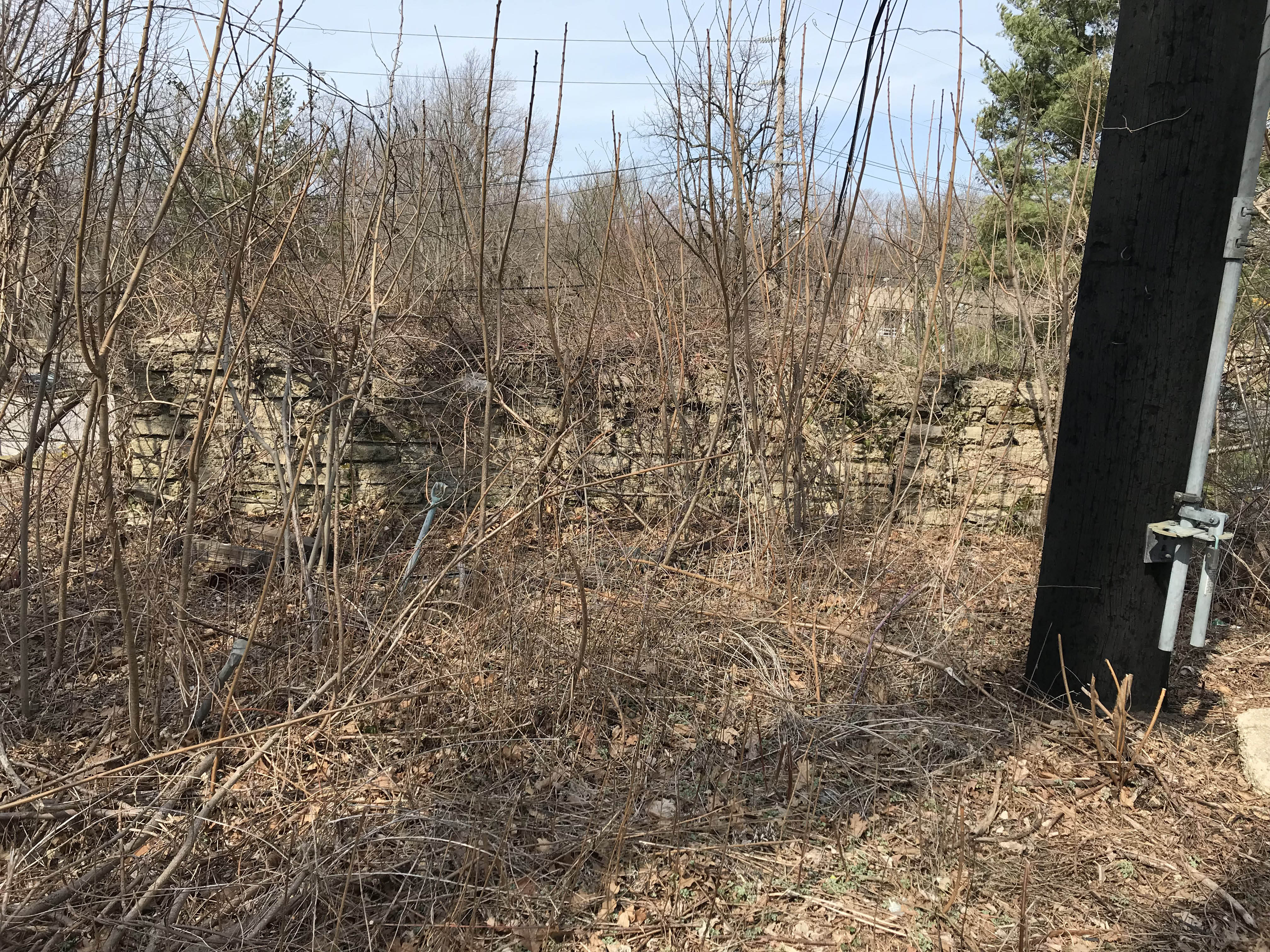
This is so bitterly frustrating, I could cry; my LIMP page 10 covered this in detail and ALL the pix, from 06 Jun 2001, are lost so there’s nothing to post - GAHHH! However, here’s a glimmer. I was able to recover two blurry thumbnails captioned as follows: “Then, crossing the NSP on LR S/B and swinging L onto Marcus Avenue and entering NSP E/B and getting off at the very next exit for New Hyde Park Road S/B but stopping about half way up the ramp on the N side just past the guard rail (you can easily see where; there isn’t much choice where to pull off), I did what I could to document the remanent abutment (it really is more like a wing wall than an abutment); the first two photos show it under all the trees and poison ivy (lots of that!), and where it peters out into the ground at the far right center, just beyond the last branch” (first pic.) and “Here’s a close-up of the last bit under that branch and another view of the top of the wall” (second pic.) . It ain’t much but all I could extract (so far). As far as I know, all that remanent structure should still be there, under the brush on the north side of the north guard rail on the S/B off ramp to New Hyde Park Road (red line on third pic). Sam, III
Thanks Sam III, that’ll be a location to check out in early spring.
Brian, better make it late winter or VERY early spring; that brush “springs” up quite quickly. How I wish I could join you. Sam, III
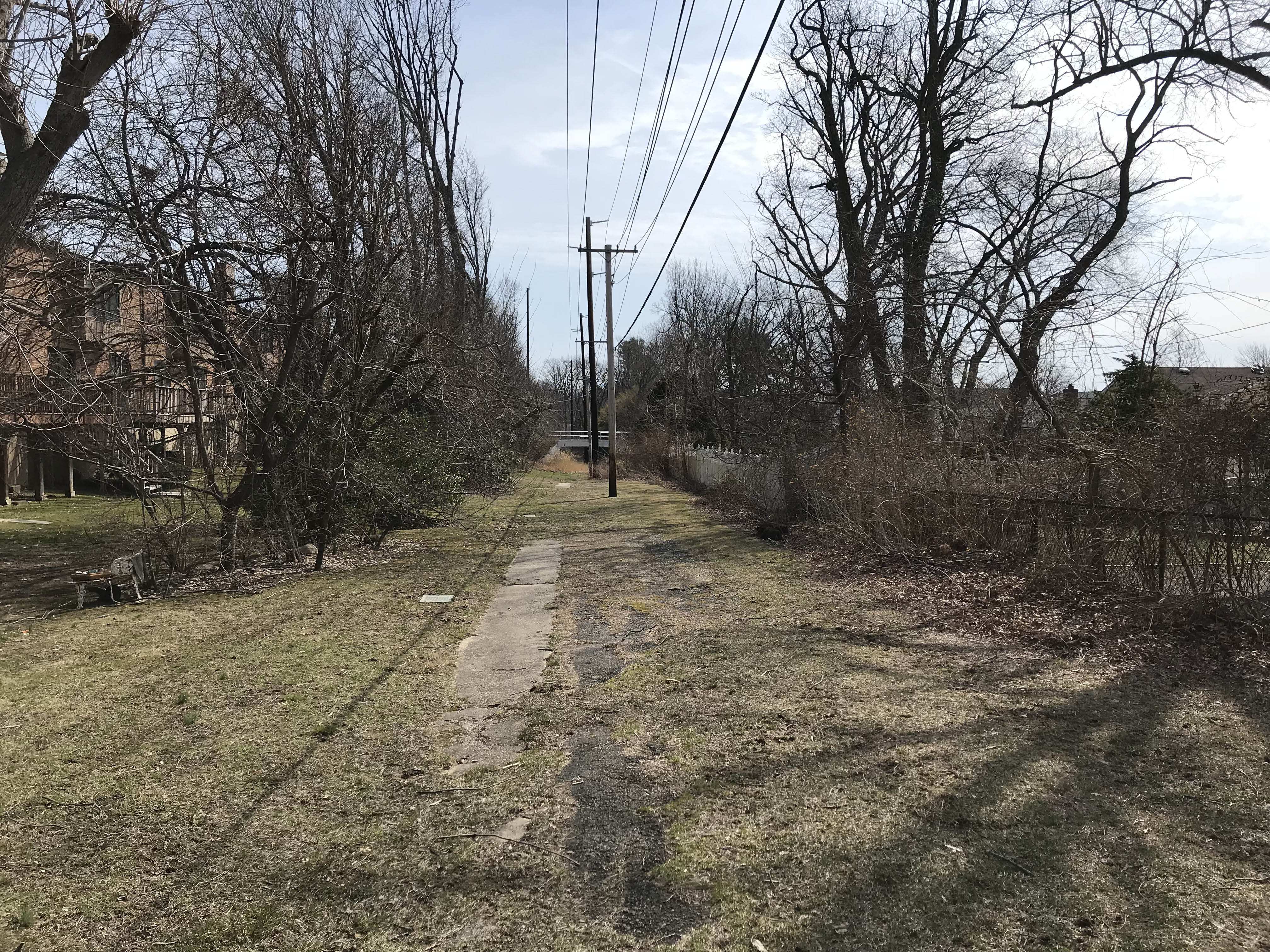
I took Sam’s advice and visited the area he highlighted. Found a curved wall of bricks on the northern side of the southbound New Hyde Park Rd. exit (were you referring to this, Sam?) along with some auto-related relics from a more recent age.
Here’s a view across the Northern State looking west from the area explored and a piece of rock with rebar.
No, Art; I refer to the straight top of a concrete abutment or wing wall appearing just above the ground, much as the Transverse Road “Mayan Ruins” do. It is/was solid, not broken, perhaps 10-15’ long, more or less parallel to the guard rail, and behind you in your view to the west, further S/E, closer to NHP Road. That “brick” (block) wall seems to be protection for the tree; nothing to do with the LIMP, and far more recent (there’s nothing growing in the crevices). Sam, III
I walked along where the red line on your photo is and didn’t notice anything. Your pictures were taken in 2001 I’m assuming so might have been more work done on the exit there since then. See these pics that should mirror your photo with the red line. Am I getting close? The guard rail in my last picture doesn’t go further east towards NHP Road.
Art, gettin’ old; I can’t tell where the guard rail began back then but, clearly, what I saw was only to the left in your last pic or behind your left shoulder. I was on the Island only two-three years ago and the guard rail hadn’t changed in the curve, so I assume the artifacts haven’t either; they are most likely buried deeply under vegetation by now. Let’s also assume my red line is too far in and the site is to the left of the overhanging tree or between that and the gap south of the two white cars in the upper lot. I don’t recall the rail being particularly curved and note that the object is in full sunlight. Gotta retrieve those photos somehow! Happy hunting. Sam, III
That’s my doctor’s office on the left at 3003 NHP Rd. I once overlaid the LIMP here and located it as a straight line, east of the exit curve on the straight- a- way towards NHP Rd, and directly on the guardrail. Have yet explored this section but occasionally passing it
Art, I ‘m familiar to what Sam is referring to. I came across the same about 20 years ago. I was told at the time that it was part of the embankment of the Motor Parkway bridge that Moses built over the Northern State. Even then we had to remove about 2 feet of brush to uncover it. Never gave it much thought since it wasn’t part of the original.
If we move my red line westerly, then, and overlay the LIMP in white, the item in question makes sense as a wing wall or abutment for the Moses NSP/LIMP bridge. Funny, though, how if you even sneeze limply, it now is far more significant than it might have been 20-30 years ago. Explorers; forward march! Sam, III
Thanks Al, I went back on Thursday and found what u and Sam and Robert are referring to.
See attached. Very accessible. In fact this morning I found some pics on the blog I had put up in 2015 showing it. Don’t remember having found it before but I had.
Yee-hah; tol’ you so! Was I closer on my last aerial, Art? Shovel brigade? Sam, III
Sam, Al - makes absolute sense in terms of its location.