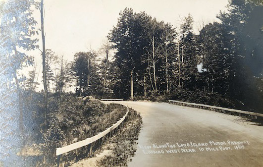
Mystery Foto #12 Solved: A View Along the 10-Mile Curve in Dix Hills & the “View” Postcard Series

To promote the restaurant/inn Petit Trianon and the Motor Parkway in 1912, Long Island Motor Parkway, Inc. hired a photographer to develop the "View Along the Long Island Motor Parkway" series. These postcards were sold at Petit Trianon. My favorite co-author Al Velocci challenged you to identify this postcard, one of the "View Along the Long Island Motor Parkway" series.
Answers to the Mystery Foto questions:
- Identify the exact location of the Mystery Foto. Provide a rationale. Hint: Check out the post on the 1910 Motor Parkway Survey Atlas.
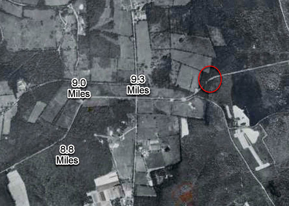
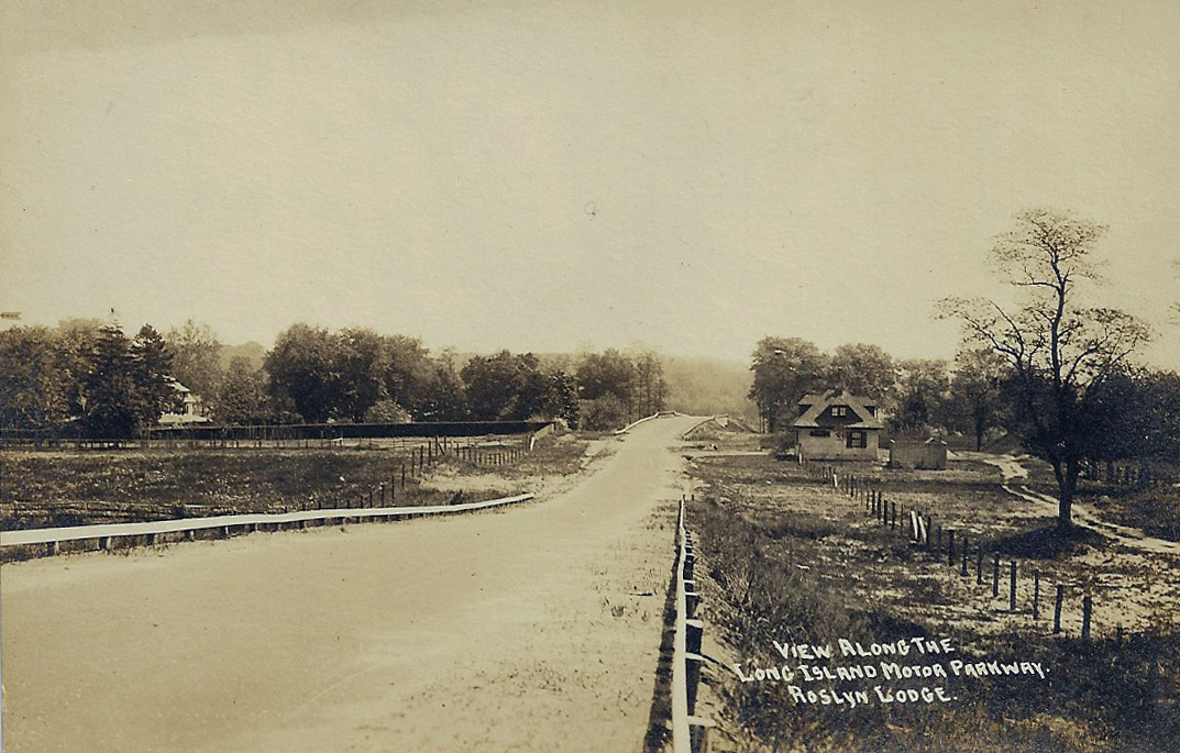
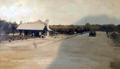
The location is a Motor Parkway curve 0.7 miles east of Deer Park Avenue and near Candlewood Path. Rationale: The woods indicates Suffolk County, the unpaved Motor Parkway and the 10-mile post caption.
- What was the 10 Mile Post?
As indicated by the Motor Parkway Survey Bookmap, it was likely the 10-mile mark from the Bethpage Lodge, which was the eastern terminus in 1908.
- What materials were used for the parkway in this section in 1912?
Macadam and gravel, this section was not paved in 1912.
- Is there a logical pattern for the ID # on some of the postcards?
The numbers appear to go higher west to east. It may be a code by the postcard company based on the original photo. Brian has a theory in his below Comment.
- Shout-Out question: Post additional "View Along the Long Island Motor Parkway" postcards?Kudos
Shout-Out to Greg O. for adding another "View Along the Long Island Motor Parkway" postcard.
Comments (6)
Congrats and kudos to Brian McCarthy and Frank Femenias to identifying this challenging Mystery Foto.
Howard Kroplick
Close-Ups
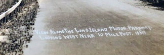
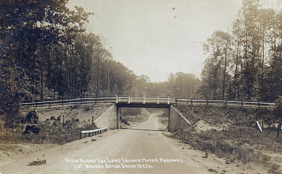
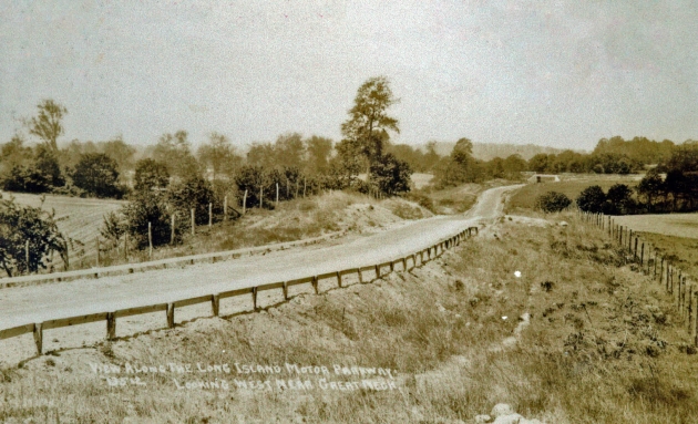
Caption: View Along the Long Island Motor Parkway Looking West Near 10 Mile Post, 13519
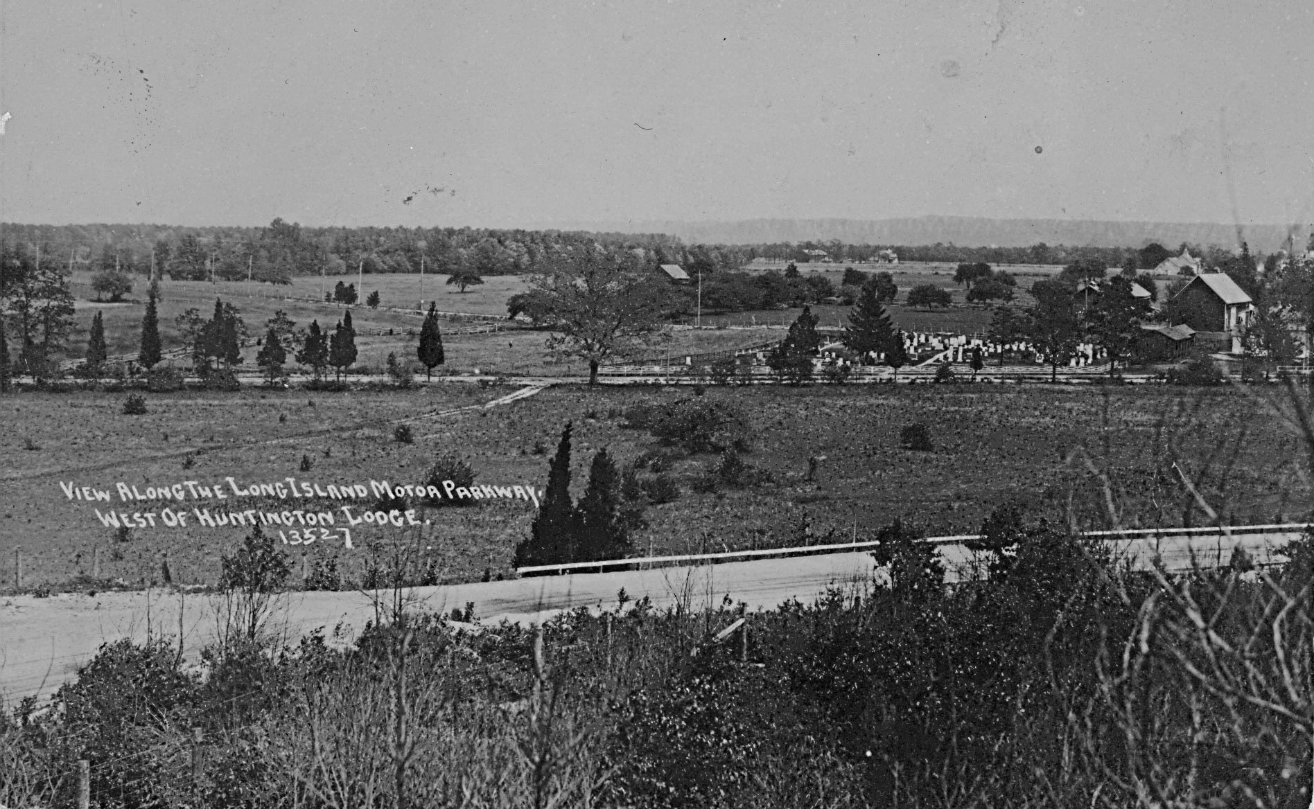
1910 Motor Parkway Survey Atlas
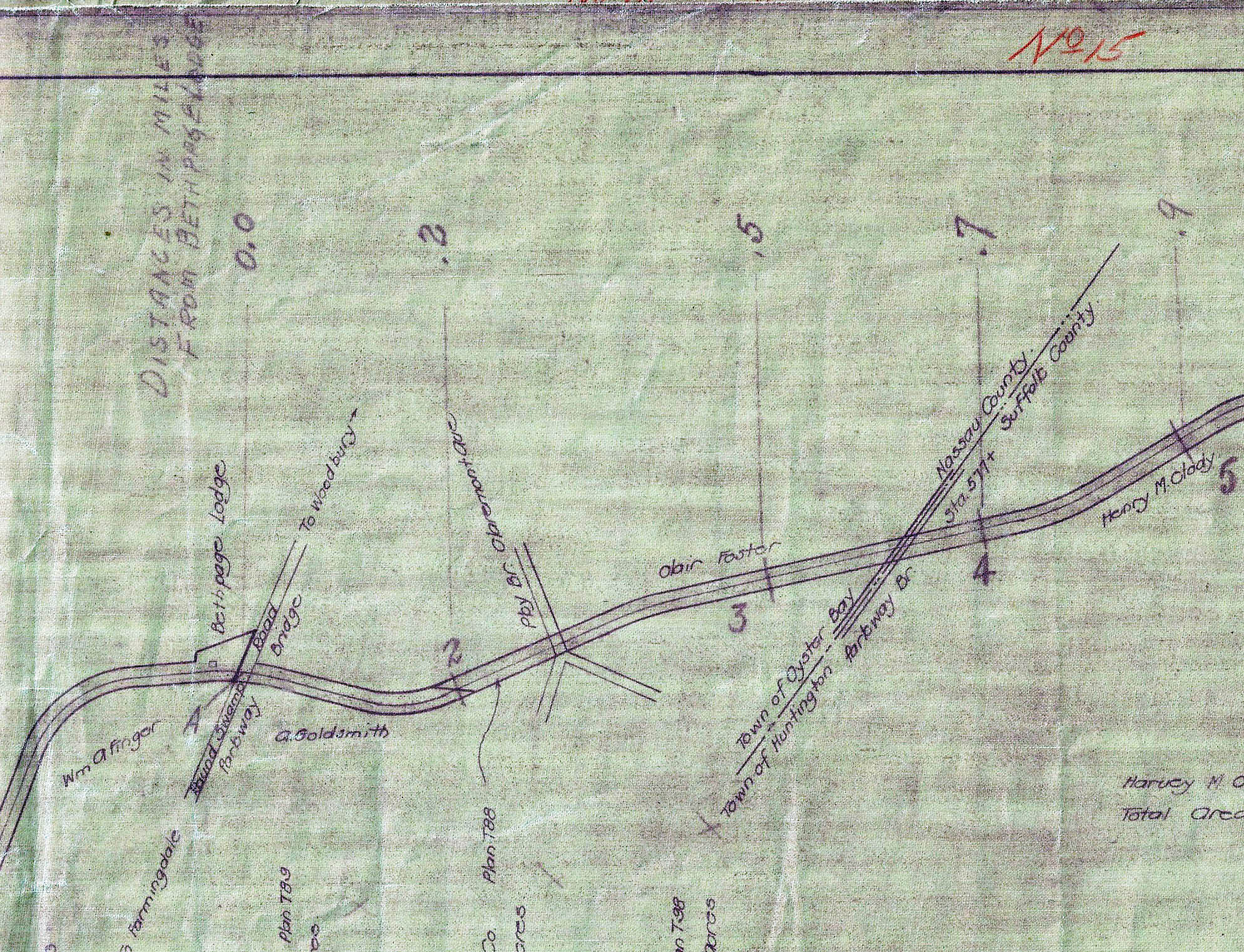
The Motor Parkway Survey Bookmap noted the mileage from the Bethpage Lodge.
1910 Motor Parkway Survey Atlas
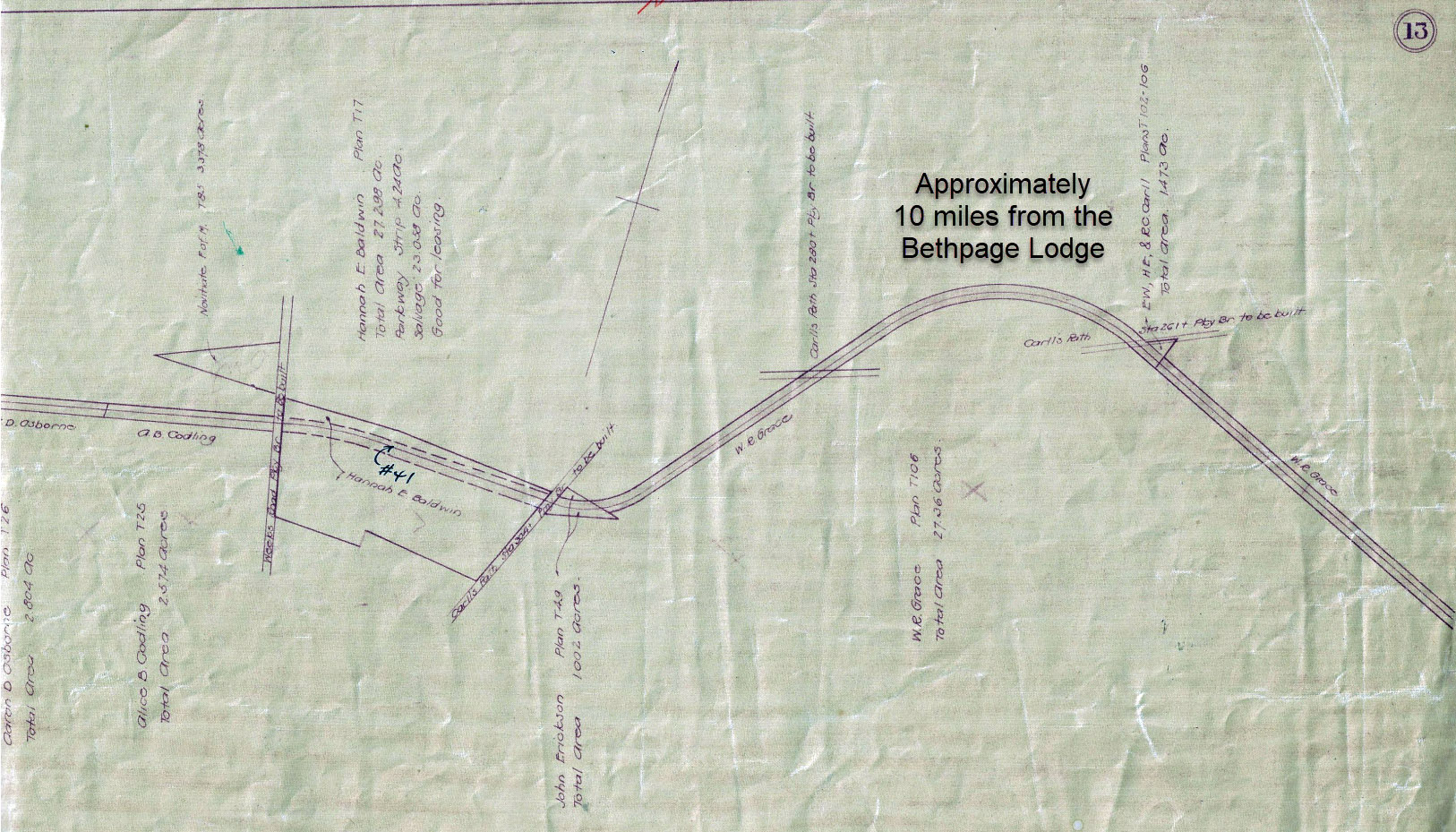
This curve was located approximately 10 miles from the Bethpage Lodge
1928-1930 Suffolk County Aerial-- Dix Hills
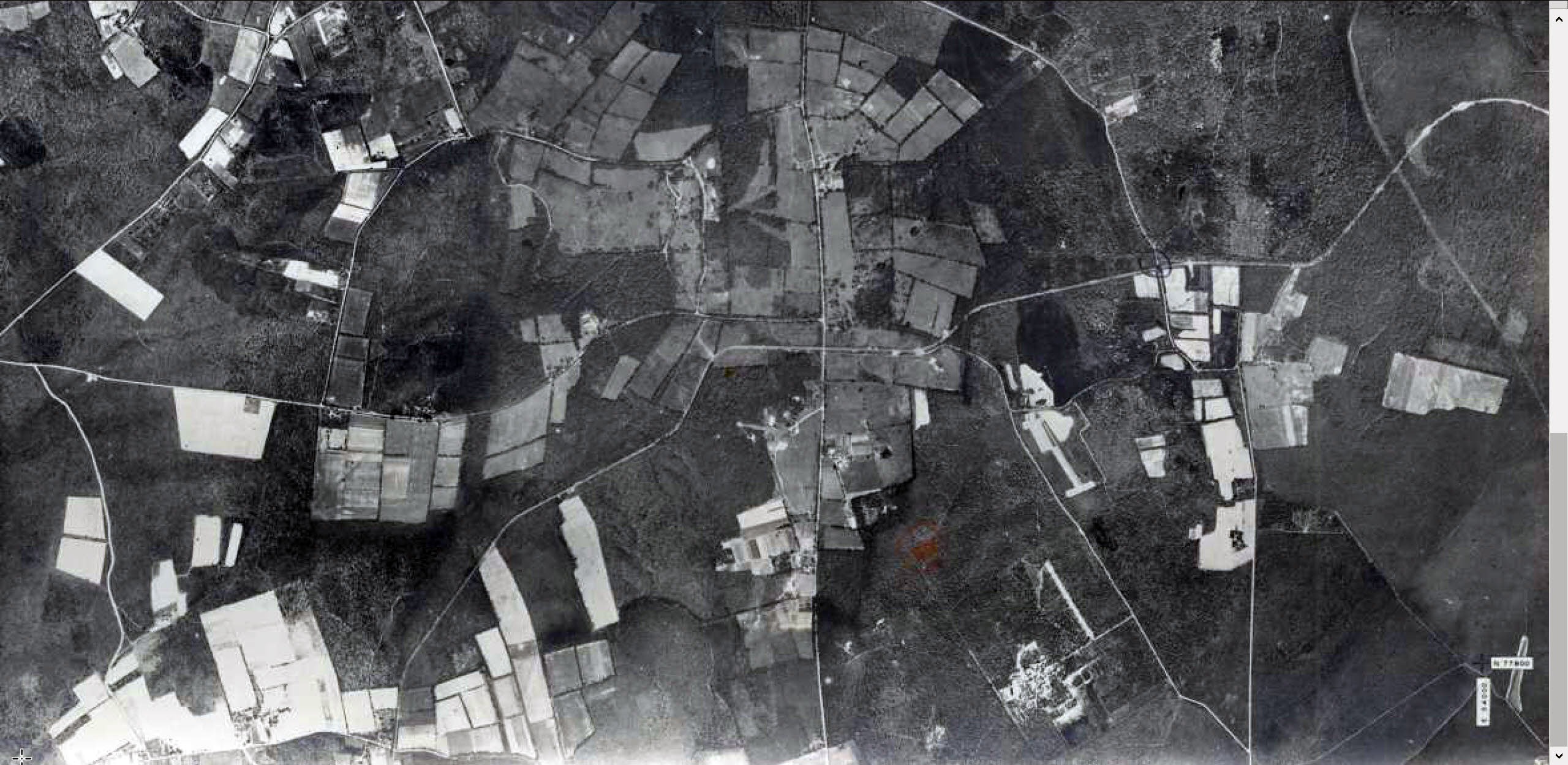
Suffolk County Aerials- Stony Brook University
Deer Park Road is in the middle of the aerial
"View Along the Long Island Motor Parkway" Postcard Series
Characteristics of the "View Along" Postcard Series
- Captions usually start: "View Along the Long Island Motor Parkway"
-Hand-written font
-Several have a five digit ID #
-Current # postcards: 17 March 23, 2020
Looking west near Great Neck Submitted by Greg O.
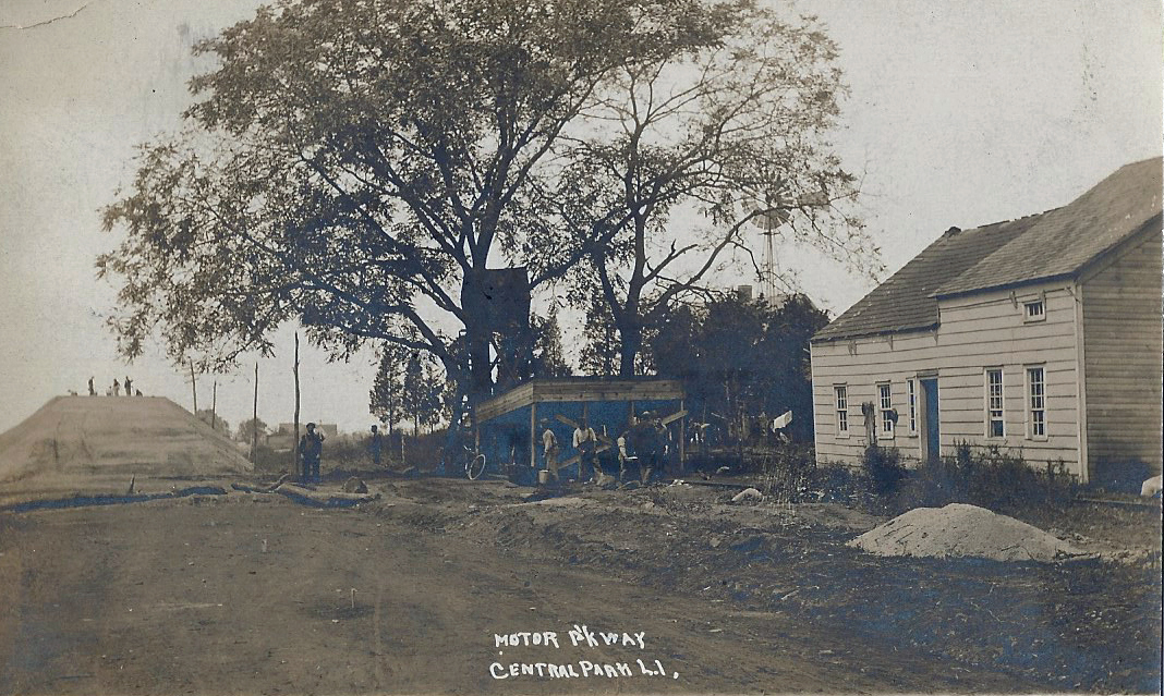
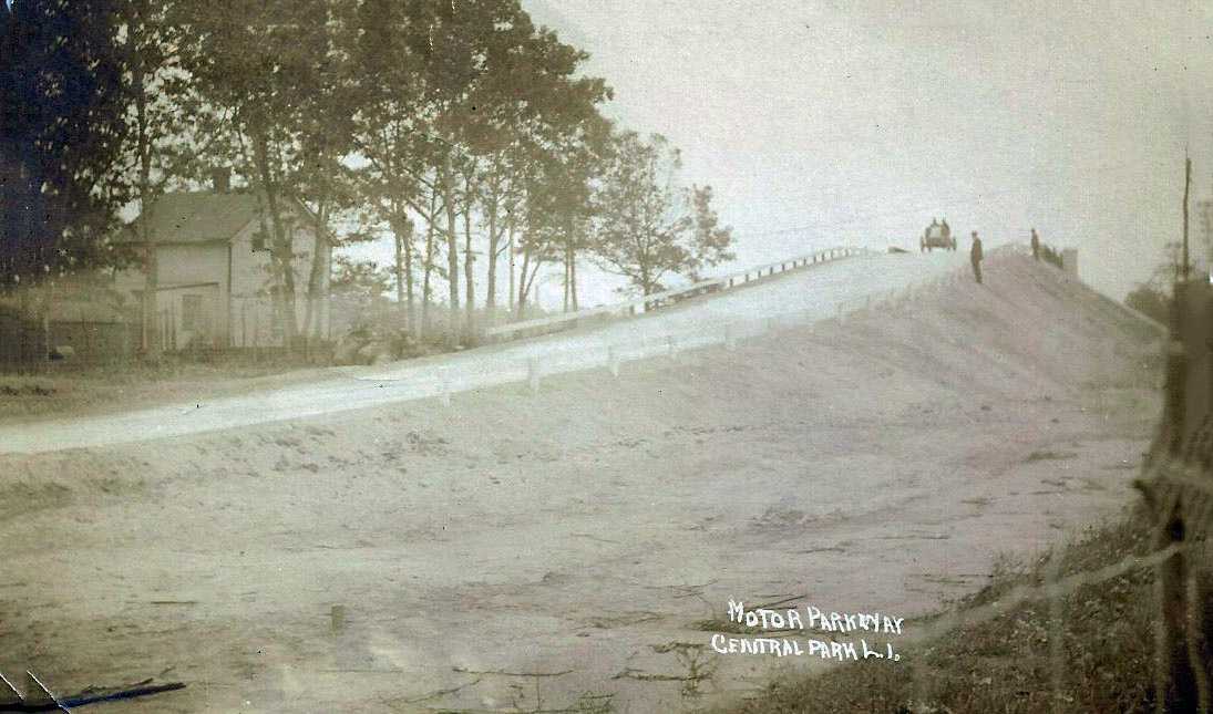
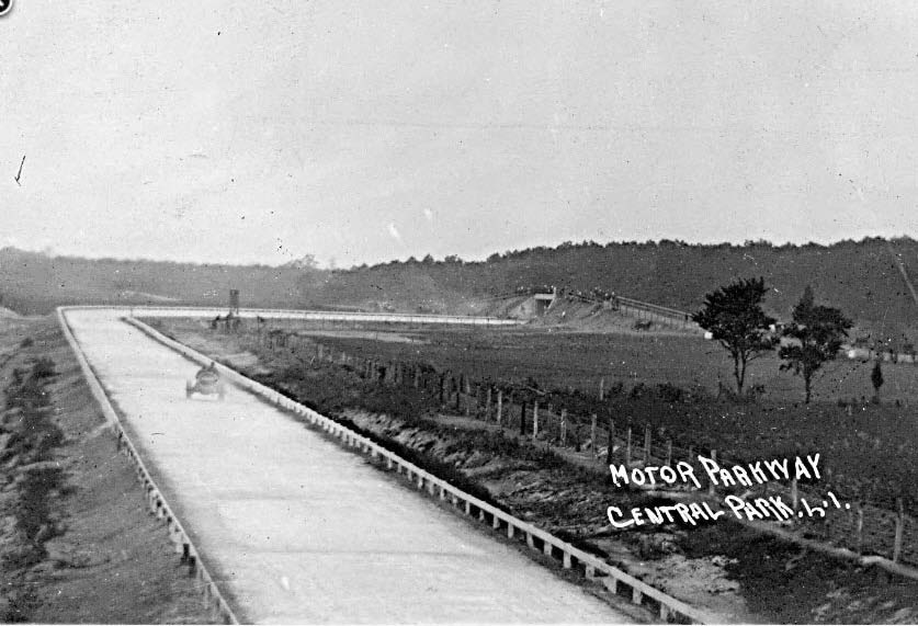
Central Park, L.I.
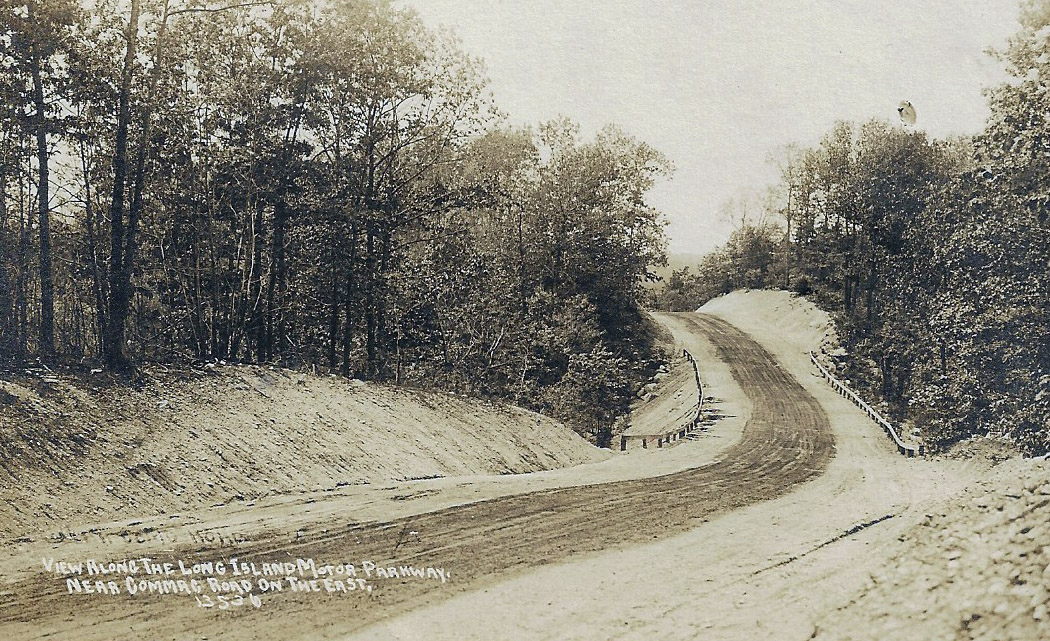
Near Commack Road on the East 13536
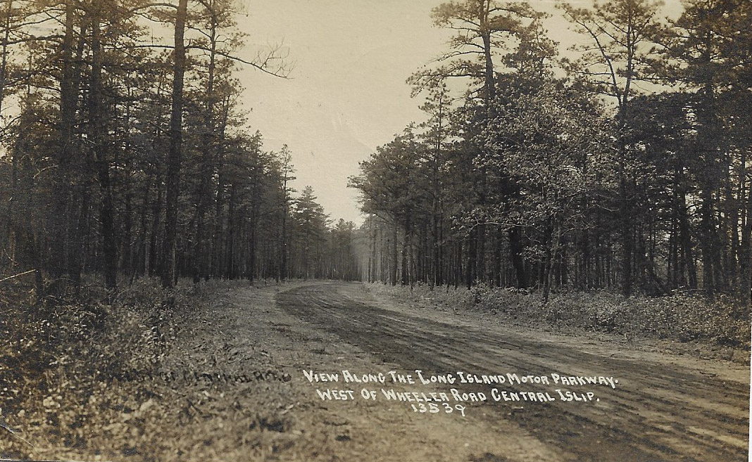
West of Wheeler Road Central Islip 13539
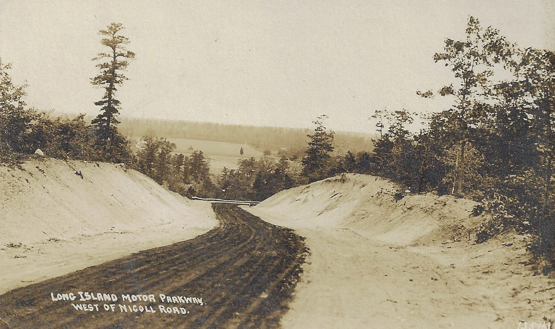
West of Nicoll Road
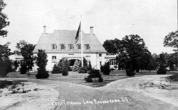
Petit Trianon
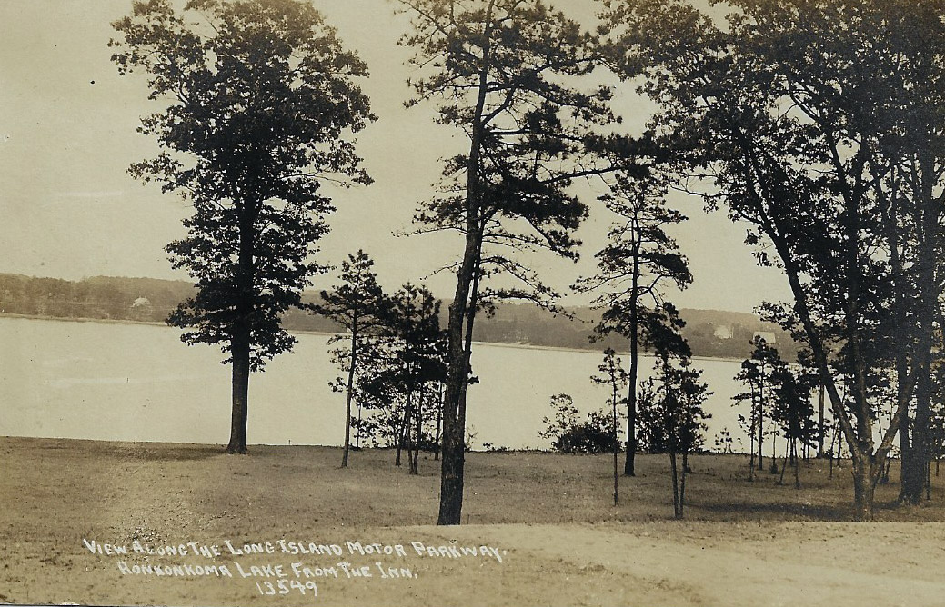
Ronkonkoma Lake from the Inn 13549
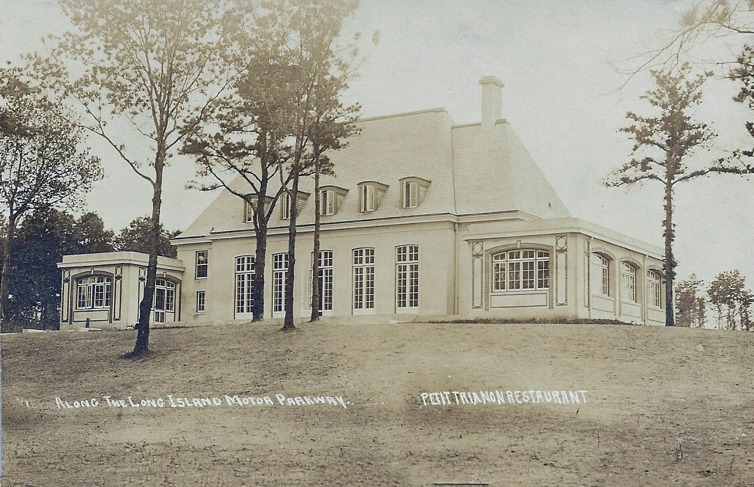
Petit Trianon Restaurant
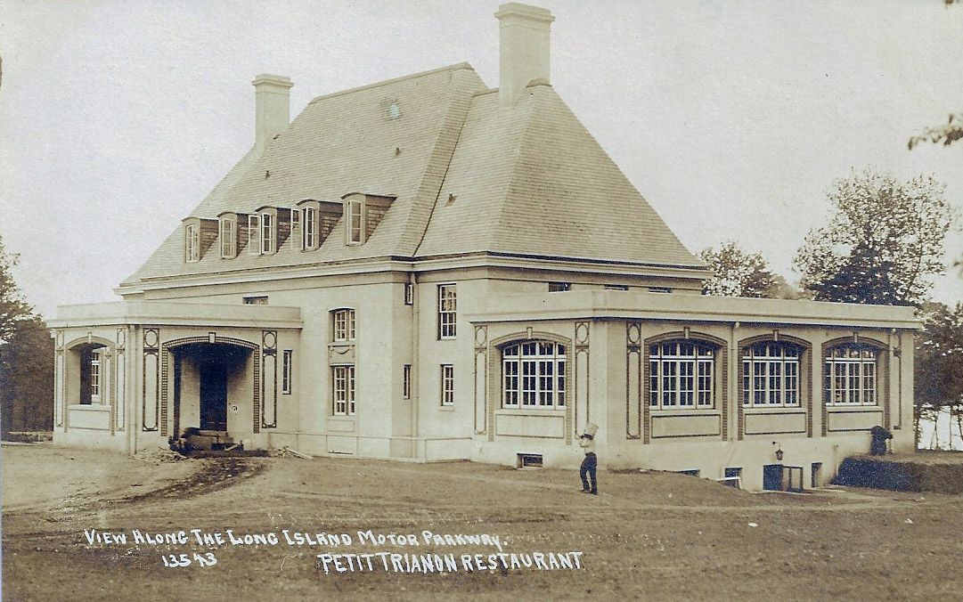
Petit Trianon 13543
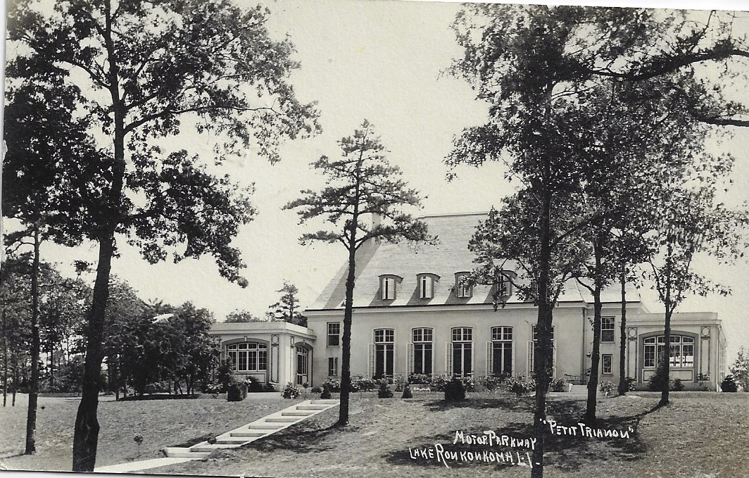
Petit Trianon
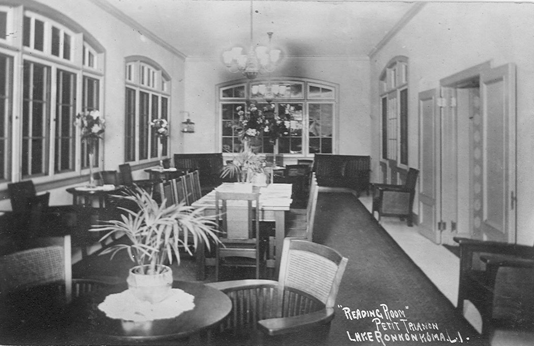
"Reading Room" Petit Trianon Lake Ronkonkoma, L.I.


Comments
Since we are looking west, I’m going to assume that the ten mile post is a point on the LIMP approximately 10 miles west of the Petit Trianon. Using an old map and rough calculations, along with the road curving to the left, this should place the photo slightly east of the place where the extension to Jericho Turnpike (today’s Harned Road) would be built in 1927. This unpaved section was probably compacted dirt, possibly oiled to limit dust. The numbers might have been an index system used by the photographer/publisher to locate the image for re-orders. Could not find any other postcard images.
Note: West of Wheeler Road Central Islip is 13539 ( not 13529 )
Couldn’t tell you anything about the Mystery question but I sure did enjoy seeing the pictures…
I’m guessing the Motor Parkway Atlas was measuring in miles from the Bethpage Lodge for the newly completed section of Motor Parkway. The mile 10 curve (9.8) east of the lodge is in Dix Hills, just east of the LIMP’s last bridge over Deer Park Ave by Candlewood Path. If correct, I believe the photo below is near (west of) the mystery photo but facing in the opposite direction.
Also noticed in the mystery photo a section of guardrail missing on the curve, the location of Parkway Br #10314 that was yet to be built. Guardrails at this time were made of wood. And the atlas east of the Bethpage Lodge was drawn in three sections, with each section ending with a “49” designation. The last postcard of the lake behind the Inn has a 49 designation as well, while the front of the Inn postcard has a 43. The postcards and the atlas seem to be connected
http://www.vanderbiltcupraces.com/blog/article/csi_report_identification_of_a_rare_photo_of_the_motor_parkway_in_suffolk_c
*Mystery Foto Location - my best guess is a gentle curve between Candlewood Path N & Deer Park Ave. Dix Hills.
*10 mile post - should be at the intersection of Candlewood Path N and Vanderbilt Pkwy. The distance from the Bethpage Lodge.
*Pavement in Suffolk County - I remember Al Velocci saying that most of the LIMP in Suffolk wasn’t paved or open to traffic prior to 1915? Anyway, the road was constructed with a concrete base, and then paved with asphalt.
*Postcard #‘s - There is some pattern of the numbers/distance : W/O Huntington Lodge 13527 towards W/O Commack Rd 13536 is a difference of 9 ( about 9 miles between ). Some are less precise ( but the images are great ). I’m thinking the difference between the Lake 13549 and the Inn 13543 is 6 yards ( 18 to 20 ft ). I found an identical Bethpage Lodge image as above numbered 13525. Difference of 2 with Huntington 13527 ( really about 1.7 miles between ).
It’s curious that the Mystery Image is numbered 13519, lower than the other numbers; so it should be 6 miles, yards etc into Nassau County? Wait and discover, this was a thinker : ) !
Image matching Bethpage Lodge above.
This one has had me head scratching all weekend and I hate being stumped…
I’ve run out of time, so I’m just going with guess and say the ten mile post was seen traveling West from Ronkonkoma at just about where the Brentwood lodge was located. I think the curve in the mystery photo is the curve just after Harned Rd spur.
I am unsure as to the rationale for the ID # pattern.
I’m attaching another photo from ‘along the motor parkway’ series taken of the section that is now on the northern portion of Manhasset Hills showing the Old Courthouse Rd bridge.
Brian, Re: The paving of the roadway in Suffolk County. In 1910 it was paved from Round Swamp Rd. to Bagatelle Rd. In 1912 paved from Bagatelle to Wheeler Road. In 1913 Wheeler to Rosevale Ave. All the pavement consisted of a 4 inch concrete base and a 2 inch “Bituminous Macadam”. The delay in paving was due to a combination of bad weather, money, and soil settling that had to rolled . In early 1911 the Parkway paid the Andrew Bros. Construction Co. of Mineola $1513.04 to spread 75,652 gallons of road oil on the unpaved portions of the roadway.
While out running some errands, I found myself heading home on Deer Park Ave and decided to see the location in person for a ‘then and now’ perspective.
Love the unpaved photos!
13536 - Looks like the entrance to Harned Rd is at the top of the hill. Photographer is looking westbound.