Kleiner’s Kolumn: Suffolk County Acquisition of the Long Island Motor Parkway
In 1938, The Long Island Motor Parkway, Inc. deeded the roadway to Queens, Nassau and Suffolk Counties to use as they each saw fit. Recently obtained documents from the Suffolk County Dept. of Public Works (SCDPW) detail the agreement between William K.Vanderbilt, Jr. as President of the Corporation and the County of Suffolk.
Discover new information about the Motor Parkway from Dr. Steve Gittelman, trustee of the Suffolk County Vanderbilt Museum, this Tuesday at 7:00 pm at the Bryant Library in Roslyn.
Art Kleiner
Board of Supervisor's Resolution
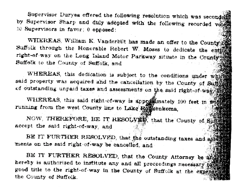
The Suffolk Board of Supervisors made its formal resolution to take ownership of the Motor Parkway on Oct. 25, 1937; note the property was viewed as dedicated by Willie K. through Robert Moses in exchange for cancellation of taxes owed.
The Deed
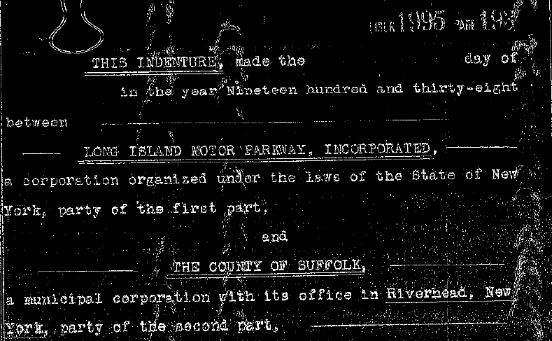
A 136 page deed containing 69 parcels was recorded on July 26, 1938 with The Long Island Motor Parkway, Inc. as the "party of the first part" and the County of Suffolk as the "party of the second part". A second deed was also recorded the same day with The Lakeville Holding and Develoment Co. which included 8 parcels on the Commack Spur (Harned Road).
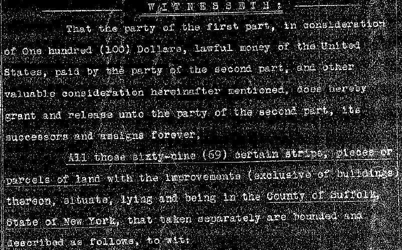
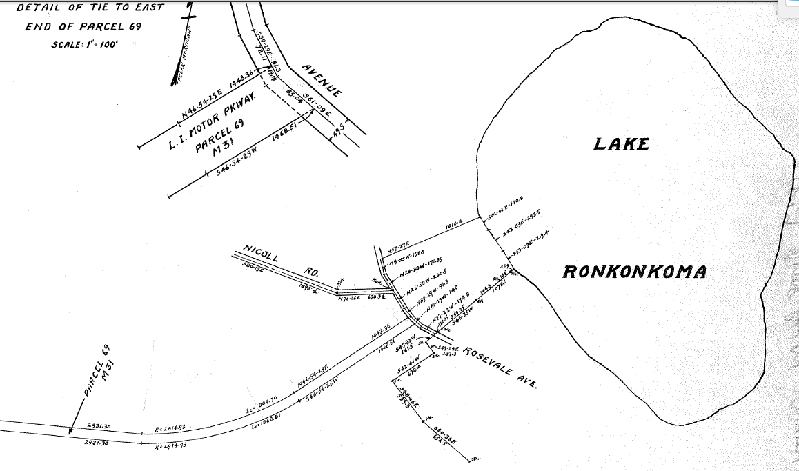
$100 plus "other valuable consideration" was offered by The County of Suffolk in exchange for the 69 parcels. Parcel 1 comprised the property beginning at Broad Hollow Road and Parcel 69 was the eastern terminus at Lake Ronkonkoma.
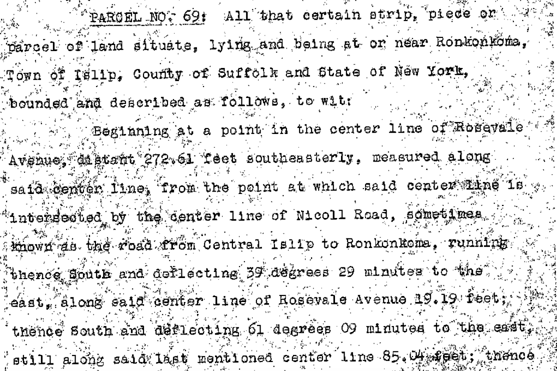
Each parcel was detailed in terms of location, previous owner(s), stone monuments, etc. and often reverted back to the original deeds between the Ridgefield Land Co. (The Motor Parkway's Real Estate company) and each property owner.
Exchange Conditions
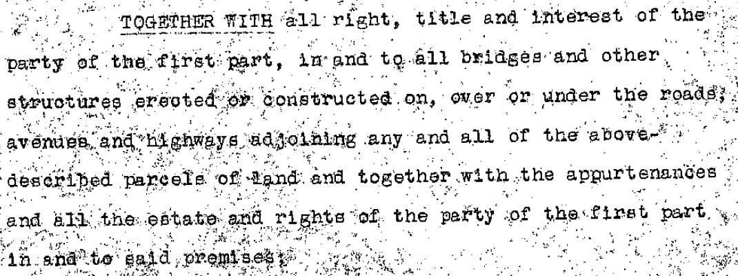
Various conditions of the deed were detailed including the "right, title and interest in and to all bridges and other structures erected or constructed on . . ."
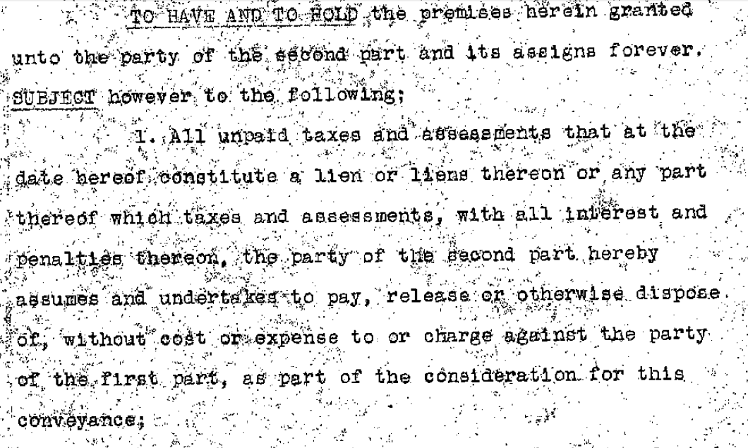
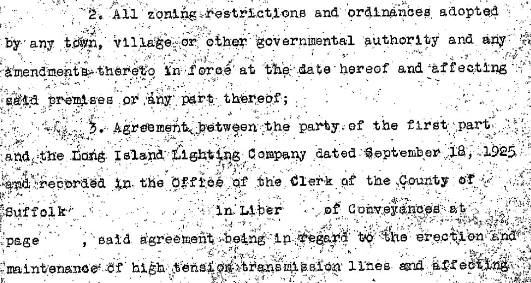
A 1925 deed between The Motor Parkway Corporation and The Long Island Lighting Company pertaining to high tension wires was addressed . . .
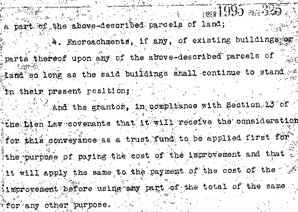
as were buildings still standing.
Signatures
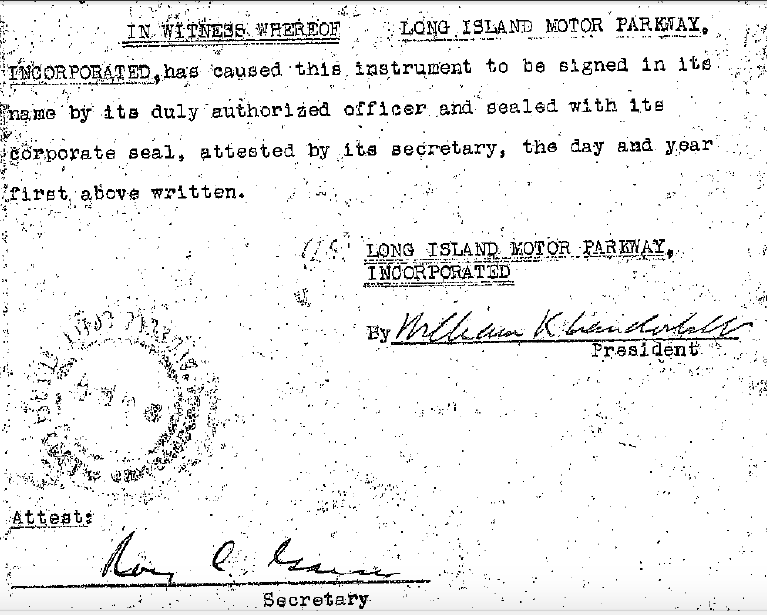
Willie K. signed the document as President, as did the corporation's secretary (anyone know who this might be?). The official logo had to be affixed.
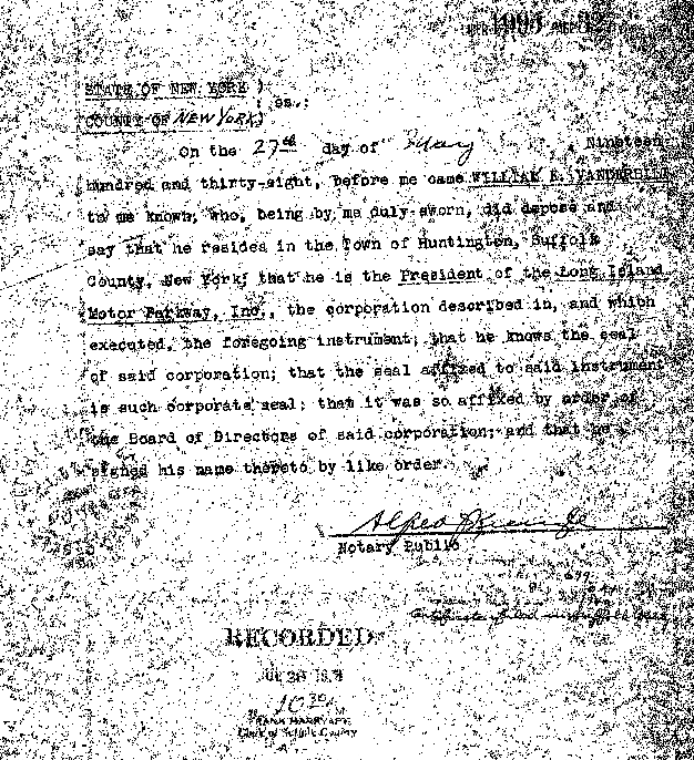
The actual document was most likely signed on May 27, 1938 as Willie K.'s notarization attesting to his title was signed that day by Alfred Kienzle, a Motor Parkway official and General Manager from 1911 through 1938.
Incorporation into the County Road System.
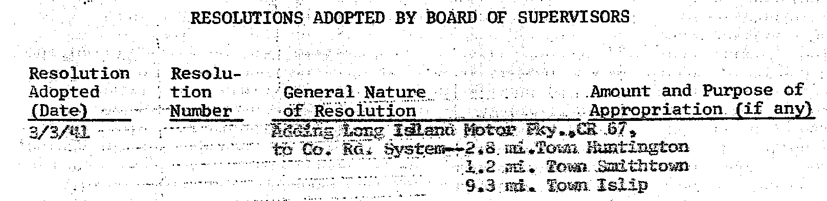
Suffolk County formally incorporated 13.3 miles of the Motor Parkway into its road system but not until 1941.
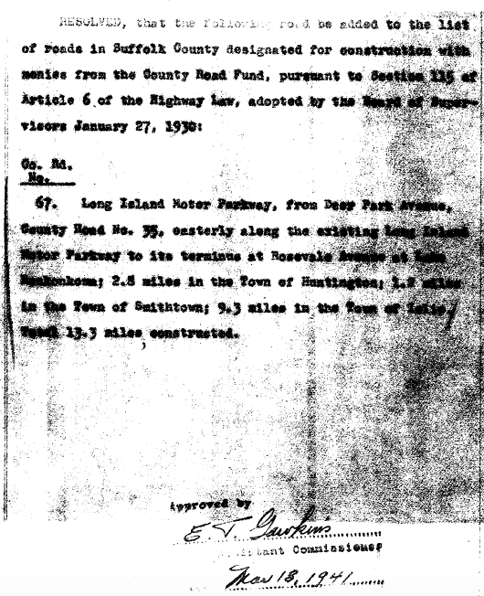
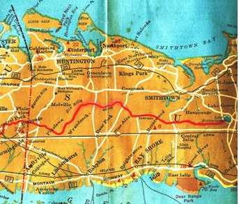
1941 Suffolk County Motor Parkway Map
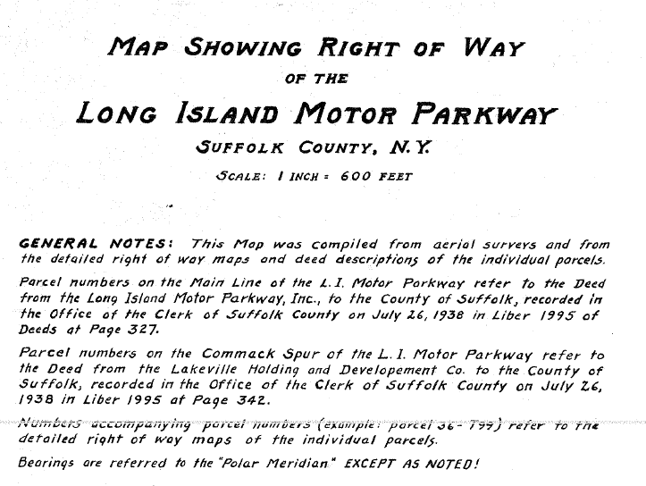
The County's 1941 map of the Motor Parkway reflected the parcel numbers. The map is to large to show here, so I've included some examples.
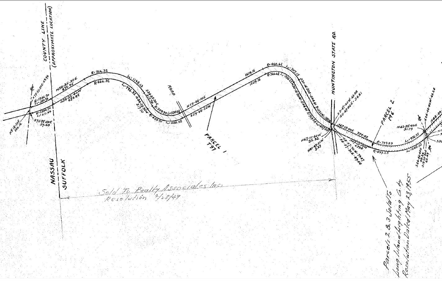
Often times the map was used to show property no longer needed as part of the road system and which were sold to individuals or the Long Island Lighting Company.
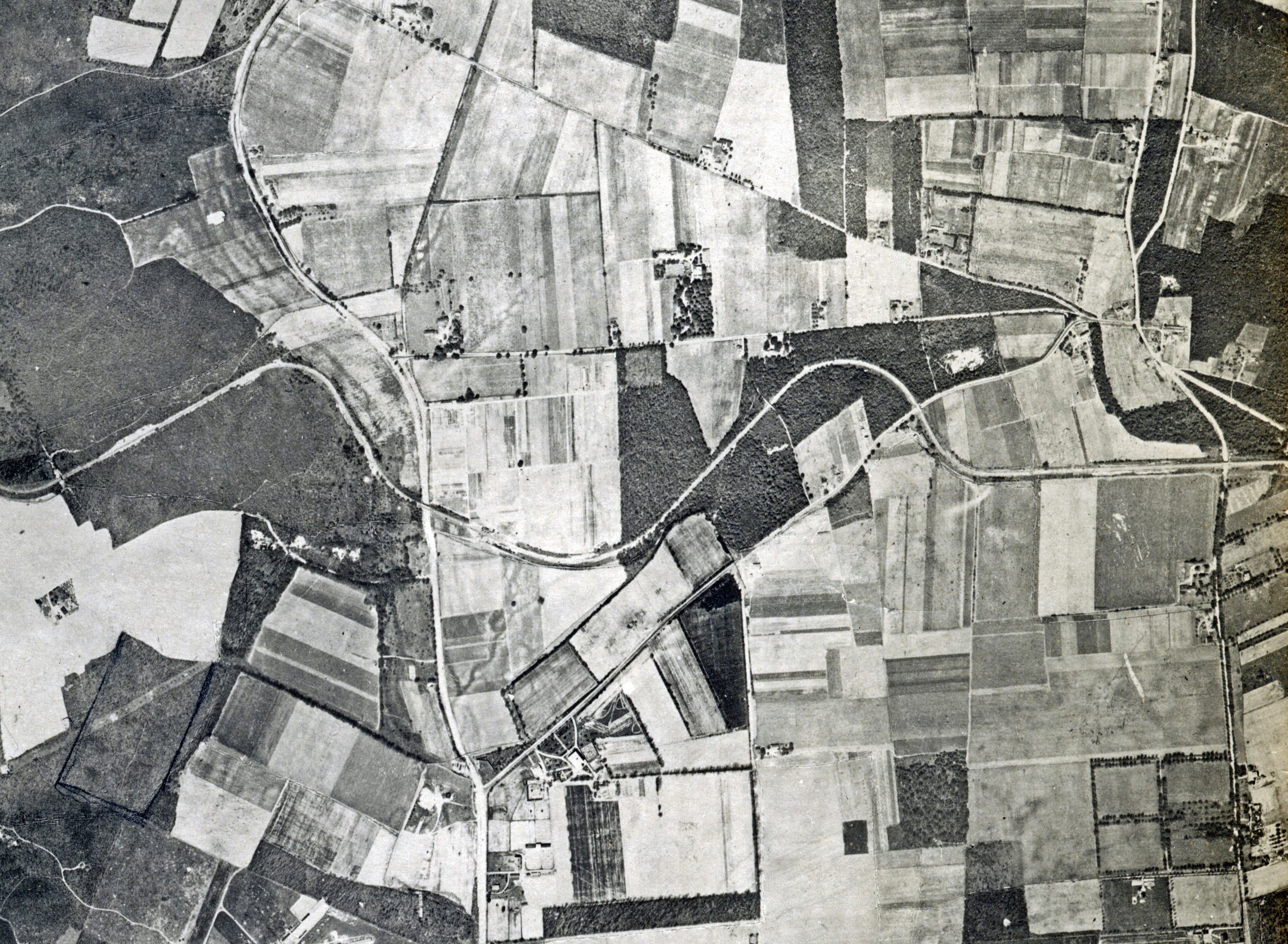
1928 Aerial
Board of Supervisor resolutions were made through the years pertaining to Motor Parkway property no longer needed.
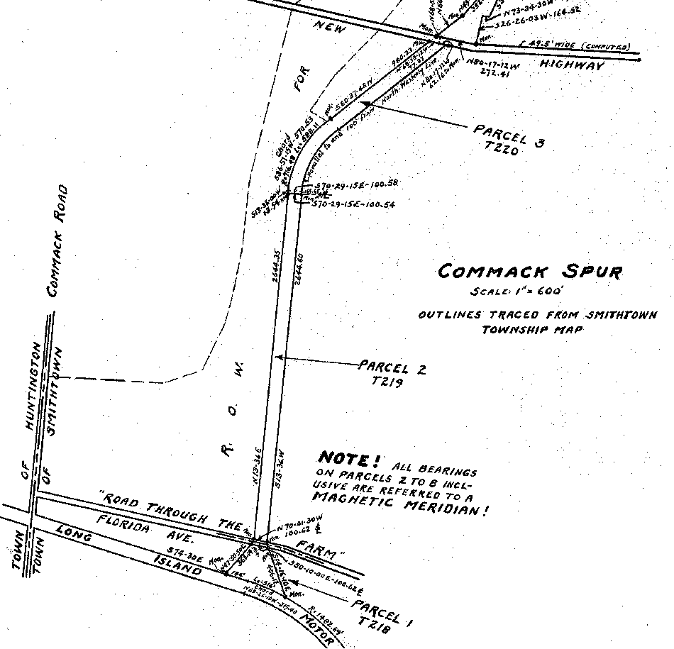
Commack Spur
If you are interested in viewing additional details about a particular piece of Motor Parkway property in either the deed or the map, let me know and I'll see what is available. About half of the deed is illegible; I'm trying to see if its the original document or the scanned image provided by the County that is the problem.


Comments
This is excellent Art, thank you!
An area of interest right off the top of my head is today’s Maxess Rd towards the end of today’s Vanderbilt Pkwy at Half Hollow Rd. Large area but I guess it can be posted here in segments. Details and notes on these maps can be interesting and helpful.
Also near Commack Rd being that 2 of the Brentwood Lodges were here on either side of the LIMP.
I, for one, would love to see the whole map, in sections, of course. I recognize that that’s asking a lot but so was posting the WWI LI map, the 2005 LIMP Nomination Maps, the ‘42-‘43 LIMP Topo Maps. and the whole Nassau County aerial photo series of 1926, 1950, and 2000. Ditto for Frank F.‘s and Wayne’s work and Art’s other maps. It would be great to have the whole thing accessible to our members and readers before it vanishes back into the recesses of the Suffolk files. Thanks so much for all your detective work, Art! Sam, III
From Art: Thanks Brian and Sam - I’m working on splitting the entire map into sections (probably 20 or so) and will create an entirely new post with a link between this post and the new one. In addition, anyone wanting me to e-mail you the entire map please send along your e-mail address. Thanks.
PS: Sam, I haven’t forgotten your request a few months back concerning doing some follow-up for you. Continues to be on my to-do list which is tending to grow in retirement!
Art, The parkway’s secretary at the tine of the sale to Suffolk County was Roy C. Gasser. I’m trying to tie him to Gasser Ave./Old Westbury Rd.
From Art: Thanks Al. I know Gasser Avenue was named in honor of the Gasser family that owned a nearby farm. Roy C. Gasser was a founder of Plandome, where he and his wife lived.
On Shore road.
Gasser was quite deep with Willie; see <https://books.google.com/books?id=mp2Fp31d1oAC&pg=RA5-PA15&lpg=RA5-PA15&dq=Roy+C.+Gasser&source=bl&ots=KWY7cI_SUQ&sig=ACfU3U3Kfuv0Ohx_OrCI8SRrcaFzdcqyvQ&hl=en&sa=X&ved=2ahUKEwiHk976i4HnAhXBx1kKHeaHBE0Q6AEwC3oECAUQAQ#v=onepage&q=Roy C. Gasser&f=false> re Muriel and Consuelo. [No, that’s NOT the Great American Novel, just a novel URL] Sam, III
Oh, this gets better and better: <https://books.google.com/books?id=qeZYAAAAYAAJ&pg=PA91&lpg=PA91&dq;=“roy+c.+gasser”+plandome&source=bl&ots=6v2nA76xzi&sig=ACfU3U1kGLefBJySczjc7VnIGIv46M0y_A&hl=en&sa=X&ved=2ahUKEwiznbvdtIHnAhXDwFkKHdA8CMMQ6AEwEXoECAkQAQ#v=onepage&q=“roy c. gasser” plandome&f=false>! There’s the LIMP and Willie and Roy and Batchelder and Thompson and Fullerton, etc.! Al - 18 Shore DRIVE; Shore ROAD is a completely different street some ¼-mile to the south. Sam, III