Femenias Findings: A New Interactive Online Map of the Long Island Motor Parkway
Inspired by Wayne Consolla's online Motor Parkway map, our master mapper Frank Femenias has created a new interactive online map of the Long Island Motor Parkway.
Here is Frank's description of the map:
The Long Island Motor Parkway Online Map
By Frank Femenias
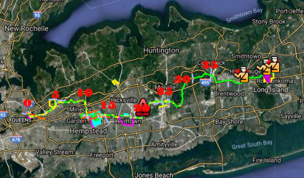
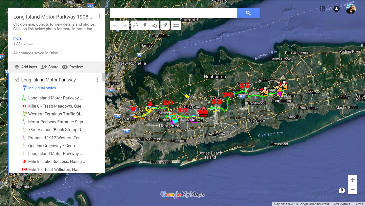
The map is an alternate view of Wayne Consolla’s wonderful online map. Anyone with internet service can access it. All map photos and links re-route back to the wonderful website VanderbiltCupRaces.com.
The views are accumulations of Google Earth files over the years, revealing locations of the Motor Parkway, its structures, and main attractions along its route. Many of these locations were obtained by overlaying aerial photos for accuracy. All the files are now neatly assembled together on one map.
There are two ways to access the map contents.
- My favorite is to go directly into the map on the right side, and double clicking to zoom into the desired location(s).
- The other way is to scroll through the lists on the left side pane. These lists are categorized into four groups:
-Motor Parkway
-Extras
-Bridges and Underpasses
-Lodges and Toll Booths
The contents of these lists are in location order from the Western Terminus (Mile 0), to the Eastern Terminus (Mile 45). Mile markers were also put into place to help with the search.
Thanks again Howard and great job with an awesome website!
Any suggestions and recommendations are gladly welcome in the below Comments section.
Enjoy,
Howard Kroplick
Examples of the Femenias Long Island Motor Online Parkway Map
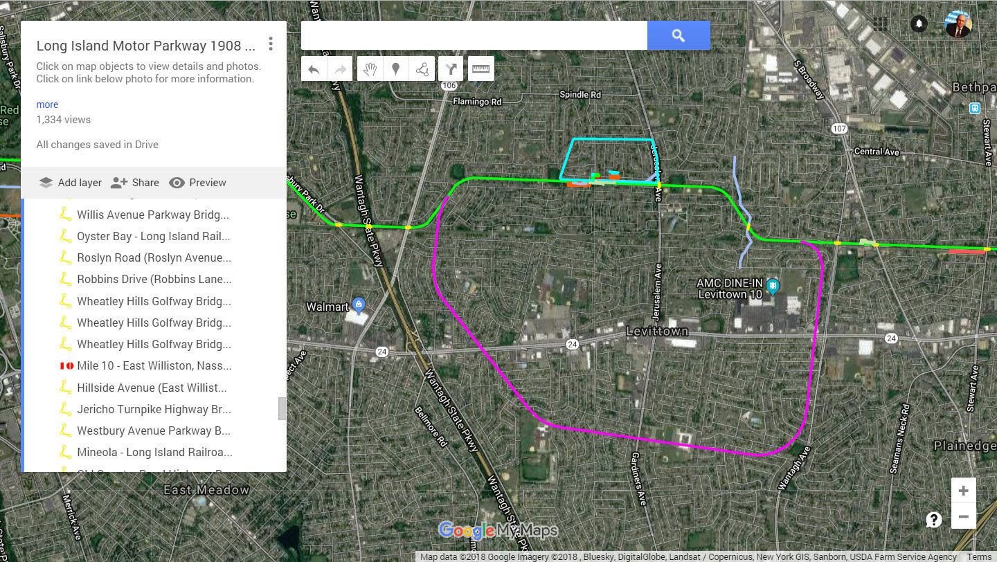
The Motor Parkway
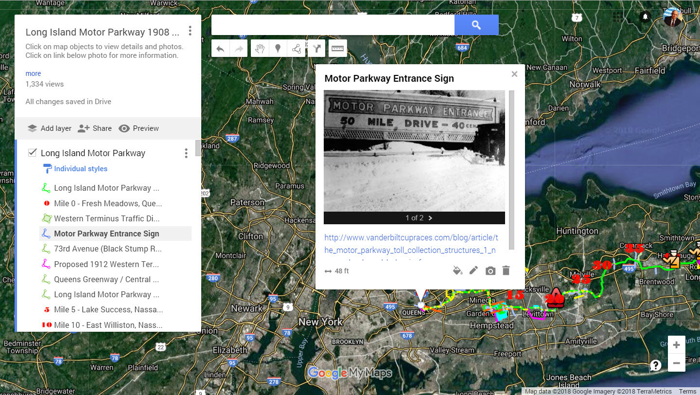
The Western Terminus
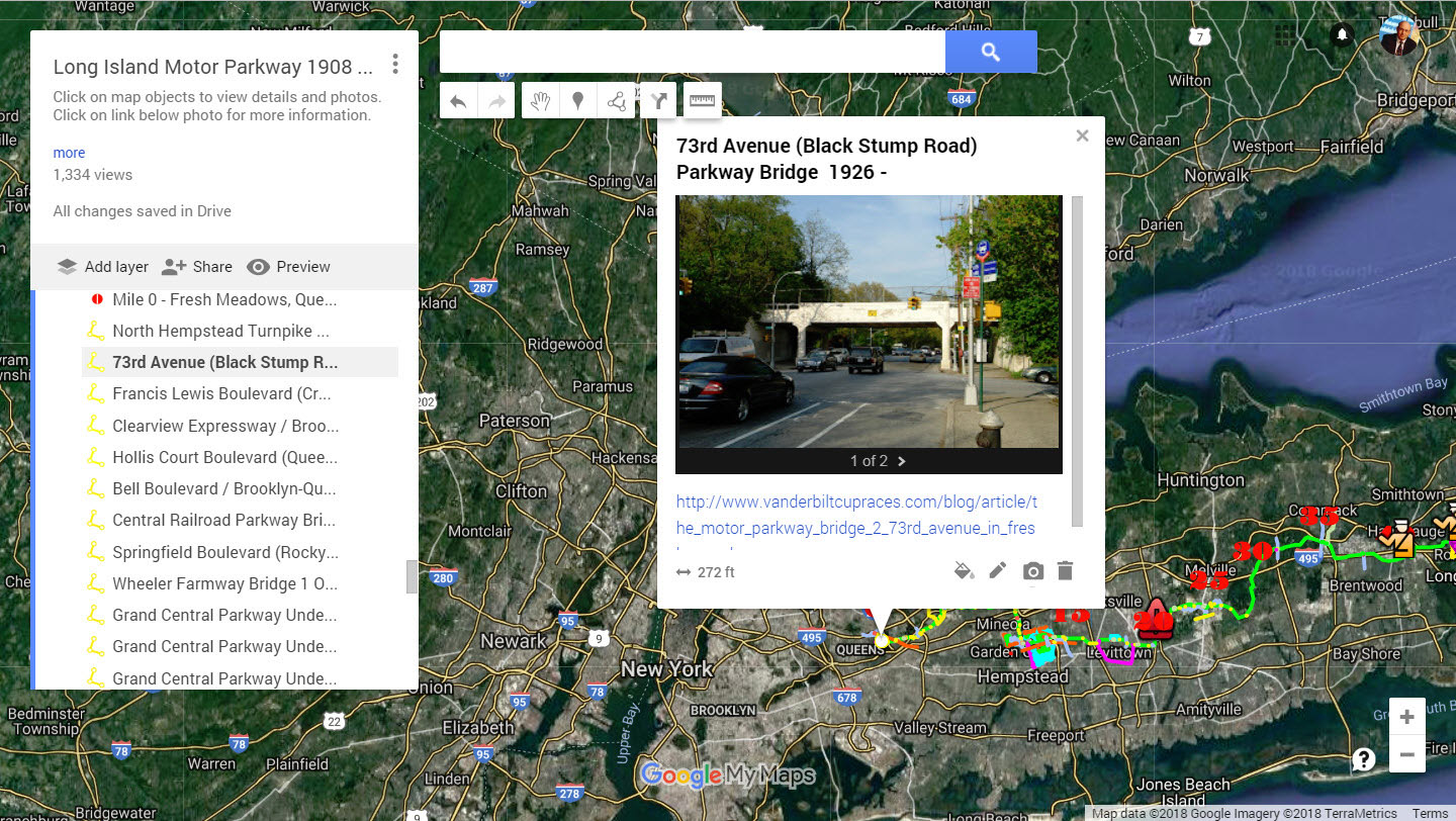
73rd Avenue Motor Parkway Bridge
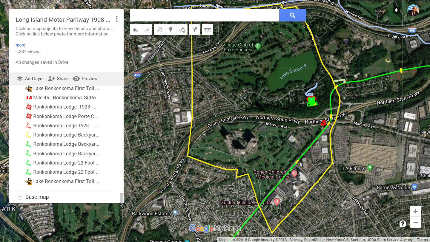
The outline of William K. Vanderbilt, Jr.'s Deepdale Estate in Lake Success
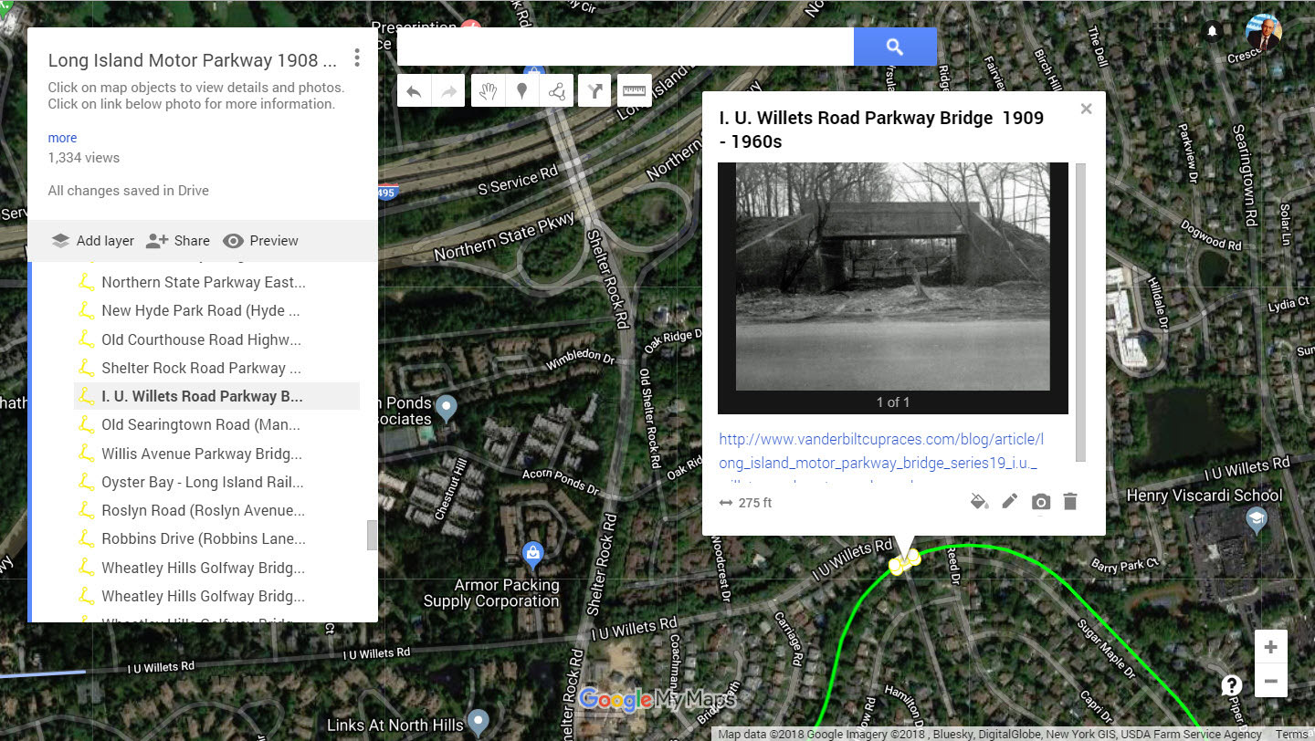
I.U. Willets Motor Parkway Bridge
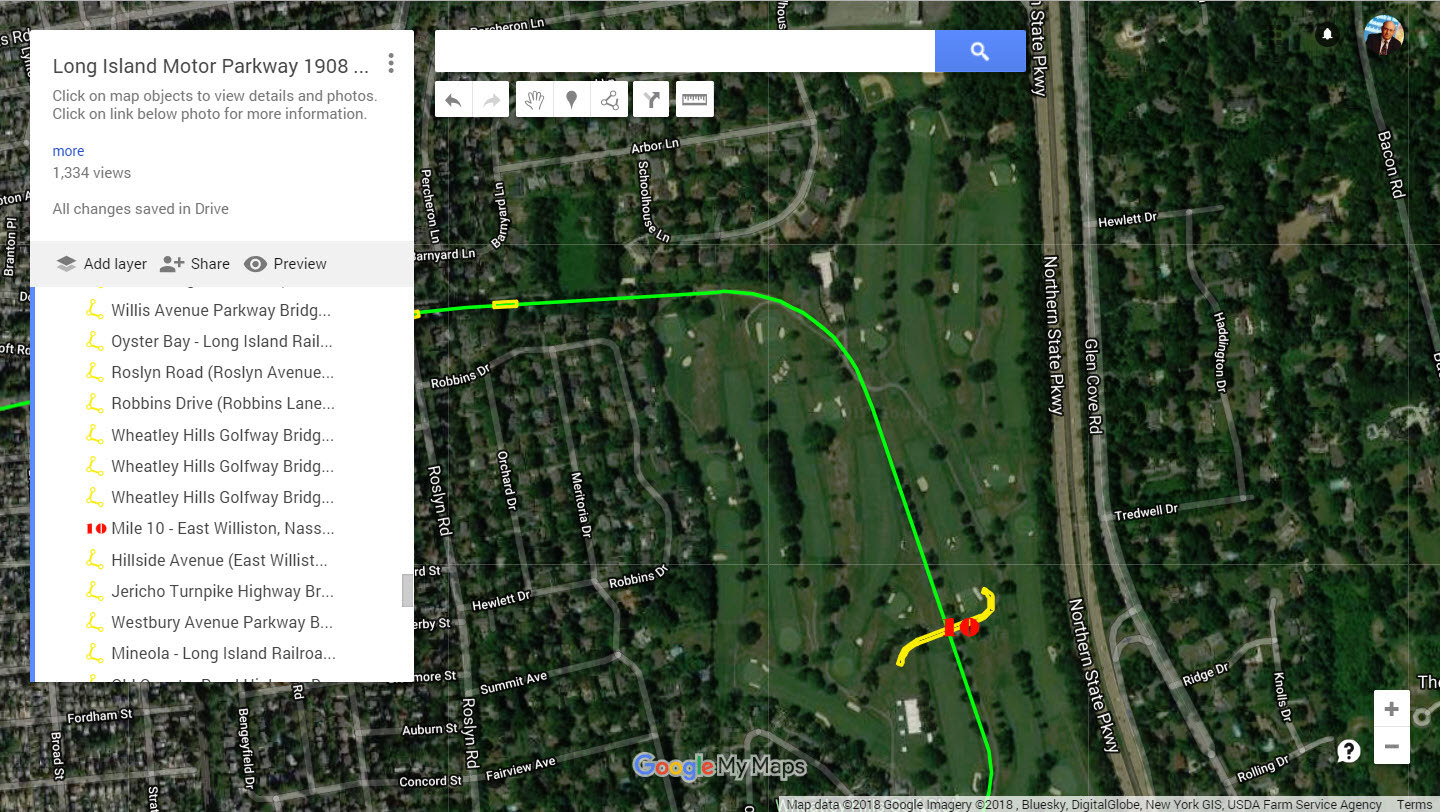
Wheatley Hills Golfway Bridge
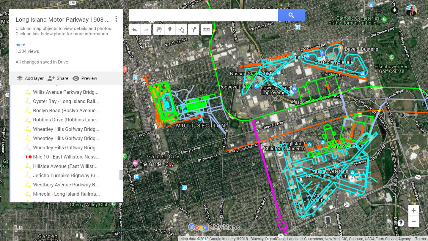
Mapping of Camp Mills, Roosevelt Field, Roosevelt Raceway, the Hempstead Spur and Mitchel Field.
The Vanderbilt Cup Race grandstands, the Long Island Aviation Country Club and the proposed Hempstead Plains Race Track.
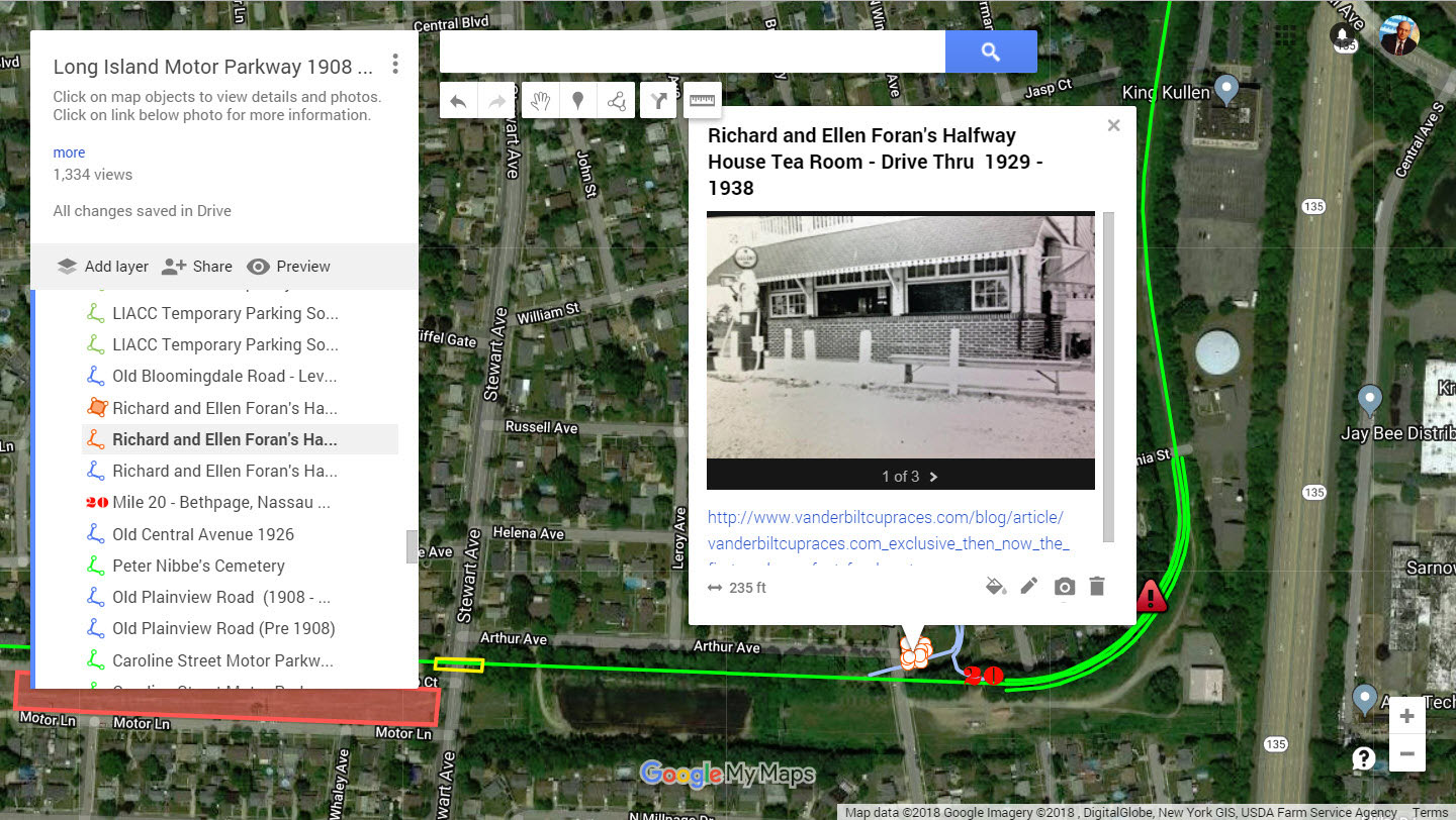
Richard and Ellen Foran's Halfway House Tea Room
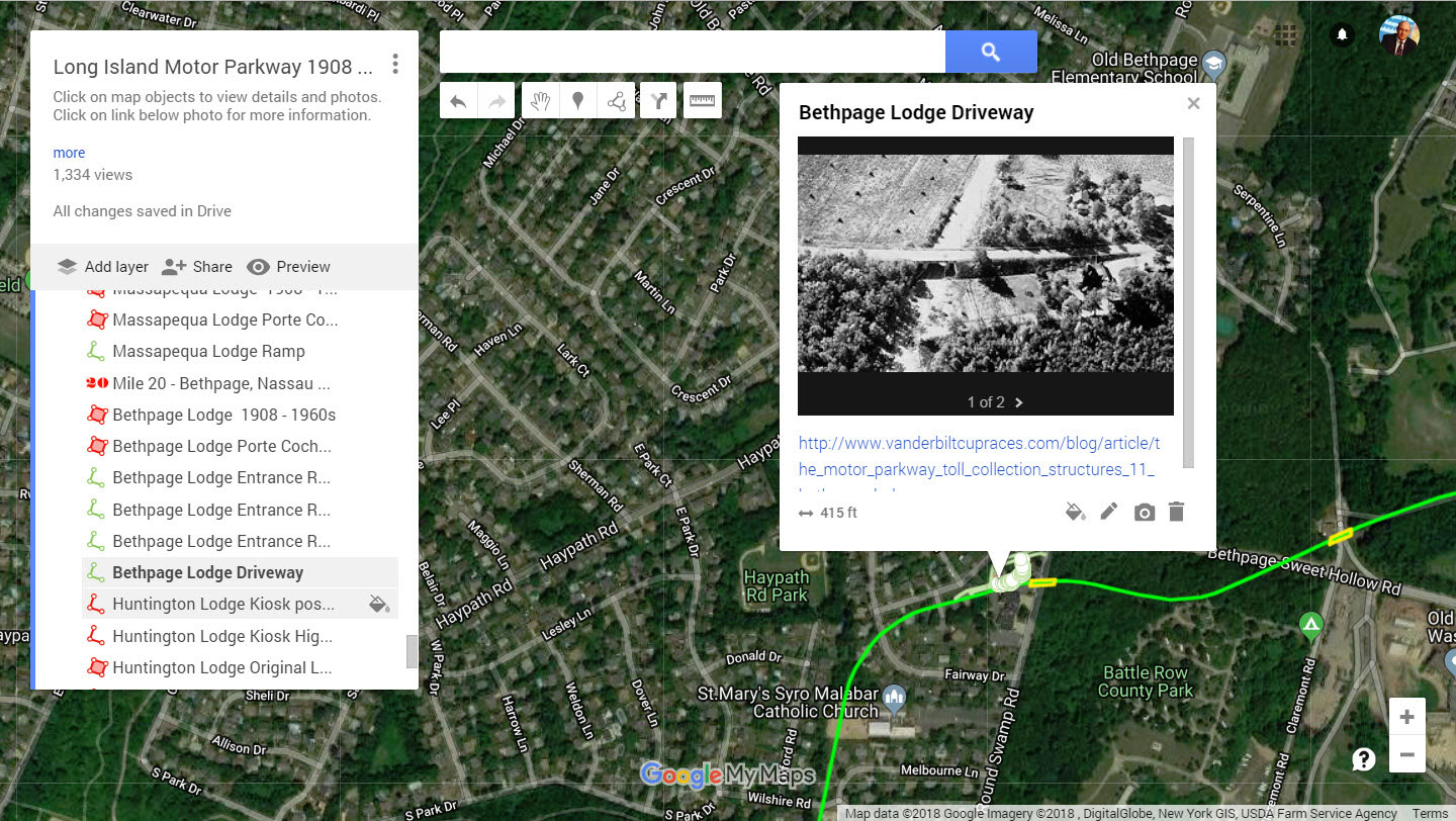
Bethpage Lodge Driveway
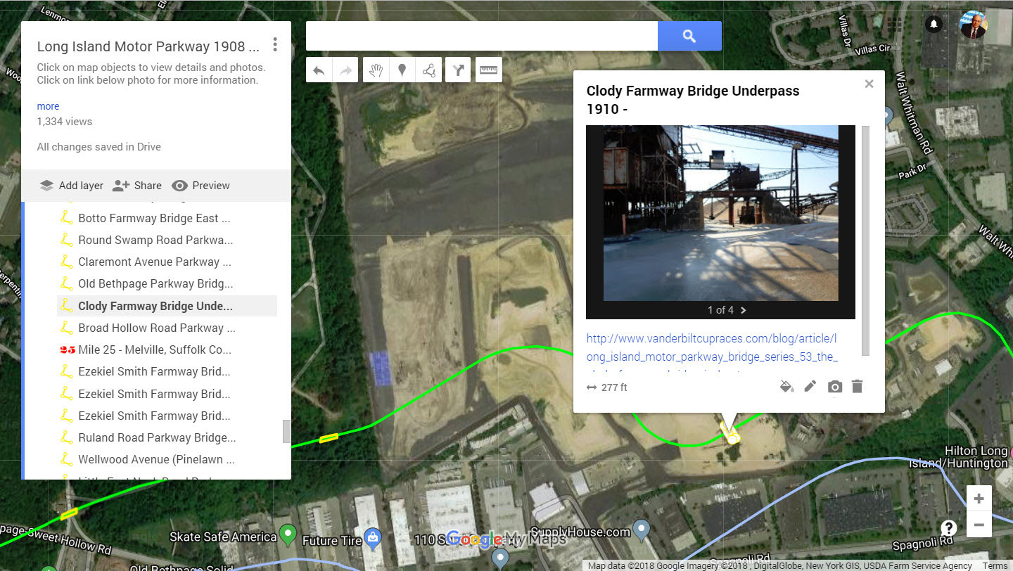
Clody Farmway Bridge
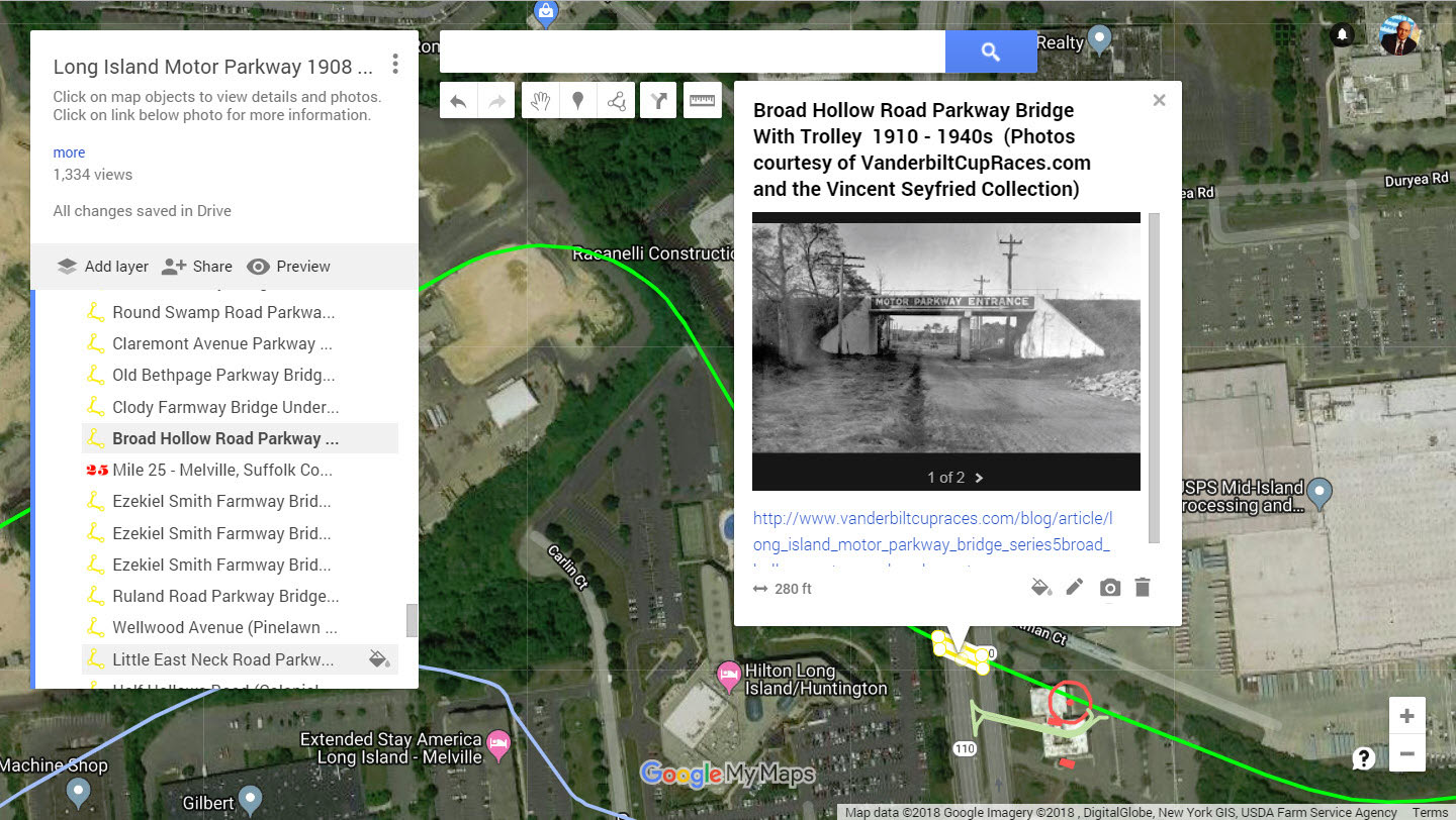
Broad Hollow Motor Parkway Bridge
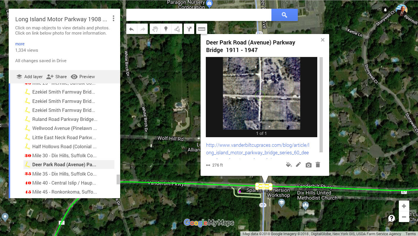
Deer Park Road (Avenue)
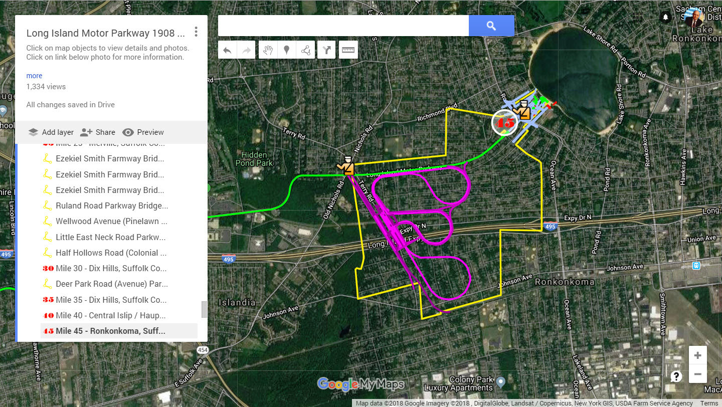
The proposed Ronkonkoma Speedway
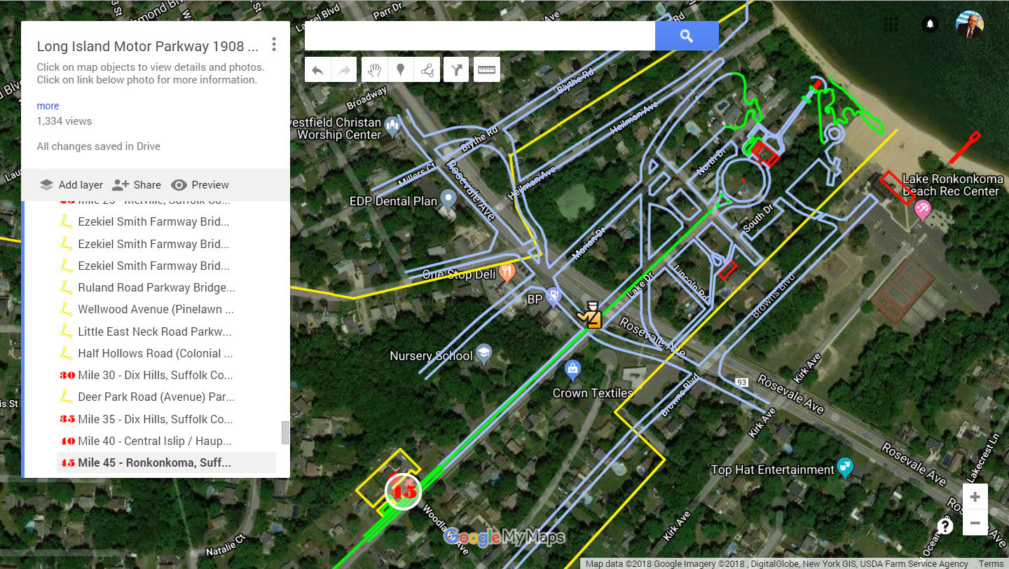
Ronkonkoma Lodge and Petit Trianon


Comments
This is a fantastic map! Great job - thanks.
Frank - great job! Thanks for the time and effort you put in.
Excellant Frank! Great virtual drive of our favorite road!
Awesome job Frank! Can I make some suggestions for markings and links for Grave’s Garage and Krug’s Corner as well?
What took you so long Frank??? You are the map king! Wayne’s map is awesome and it’s pretty cool that he was first to congratulate you on this new map.
I have to explore it more thoroughly, I haven’t been on top of the LIMP as I would like. Busy lately.
Question: Did you do your own research in terms of laying out the LIMP ROW? Or did you piggy back off of Wayne’s map for that? Did you have any points where you disagreed with Wayne’s map? I’m very curious.
Thanks everyone, enjoy the map!
Dave - both maps were created independently and have exact results along the LIMP RoW, even through the tricky Queens and Suffolk segments. Deadman’s Curve #2 over Route 135 appears exact on both. This finding is from two independent sources.
Greg - Great suggestions. Both were added to the map. I can envision an occasional train whizzing by. :D
The Grave’s Garage site appears to be under development in 2017. Does anyone have updates of this location?
Also updated is the multiple locations of the Mineola Lodge and Kiosk locations. Thanks to Al’s detailed description, their locations have been located in a 1926 aerial.
Great job making the race come alive! These are such great historic landmarks along the racetrack. I’m wondering if there were designated pit stops or were these arbitrary depending on the race?
_______________________________________________
Howard Kroplick
Sheri, there were “tire” stations throughout the courses. The locations changed every year.
Nice looking maps, but none of them worked. Every time I tried to interact with them, they closed.
Dave, there was one minor point I disagreed with Wayne’s map, but I won’t entertain it here. Check out both maps when you have the time